Hogtrough Shaw

Wood, Forest in Kent Maidstone

England

Hogtrough Shaw

Greensand Steps These steps are on the Greensand Way long distance footpath
Greensand Steps Credit: Glyn Baker

Hogtrough Shaw, located in Kent, England, is a serene and picturesque wood situated in the heart of the Forest of Blean. Covering an area of approximately 200 acres, this enchanting woodland is renowned for its natural beauty, diverse wildlife, and rich history.

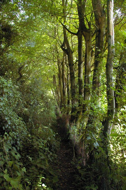
The wood is predominantly composed of native broadleaf trees, including oak, beech, and birch, which create a dense canopy and provide a vital habitat for various species of birds, mammals, and insects. It is a popular destination for nature enthusiasts, walkers, and birdwatchers who can enjoy the tranquility of the woodland while admiring the breathtaking flora and fauna.

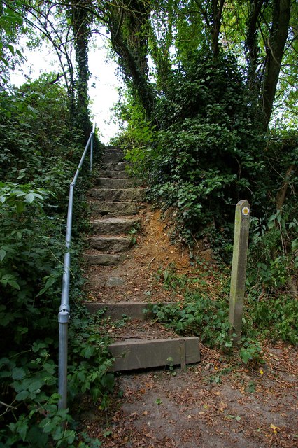
Hogtrough Shaw also offers a network of well-maintained walking trails, allowing visitors to explore its many hidden gems. The paths wind through the trees, occasionally opening up to reveal charming clearings or meandering streams. Alongside the trails, there are informative signposts that guide visitors and provide interesting facts about the area's wildlife and history.

Historically, Hogtrough Shaw has been used for various purposes, including timber production and charcoal burning. Evidence of these activities can still be seen in the form of old coppice stools and charcoal platforms that dot the woodland. Additionally, remnants of ancient earthworks, believed to be from the Iron Age, can be found within the wood, adding an extra layer of historical intrigue.

Overall, Hogtrough Shaw is a captivating woodland retreat that offers a tranquil escape from the bustling modern world. Its natural beauty, diverse wildlife, and intriguing history make it a must-visit destination for both locals and tourists alike.

If you have any feedback on the listing, please let us know in the comments section below.

Hogtrough Shaw Images

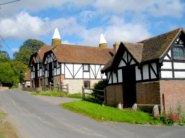
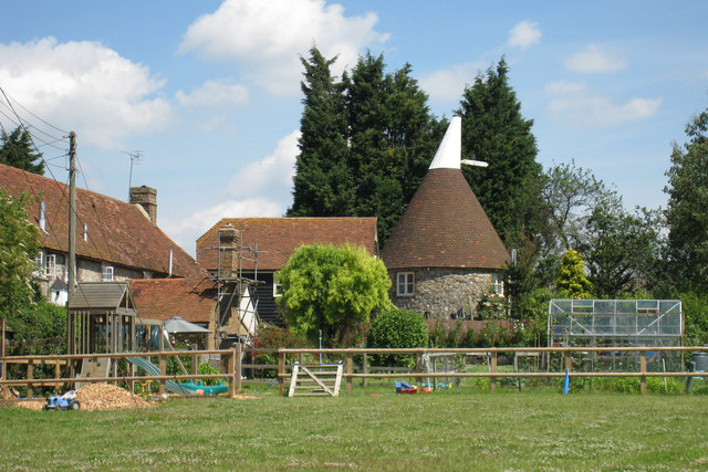
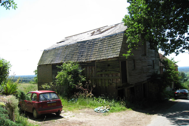
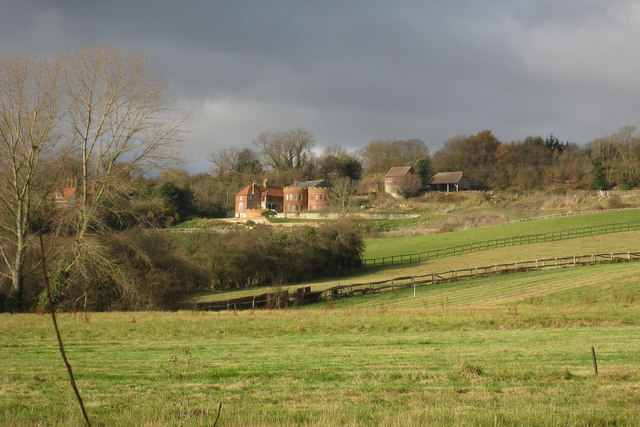
Images are sourced within 2km of 51.234285/0.55425561 or Grid Reference TQ7851. Thanks to Geograph Open Source API. All images are credited.

Greensand Steps These steps are on the Greensand Way long distance footpath
Greensand Steps
These steps are on the Greensand Way long distance footpath
Greensand Way This is the Greensand Way long distance footpath in the section between Wierton and Hill Rd
Greensand Way
This is the Greensand Way long distance footpath in the section between Wierton and Hill Rd
Buttercups Sanctuary for Goats, Boughton Monchelsea More information can be obtained about the above from   <span class="nowrap"><a title="http://www.buttercups.org.uk" rel="nofollow ugc noopener" href="http://www.buttercups.org.uk">Link</a><img style="margin-left:2px;" alt="External link" title="External link - shift click to open in new window" src="https://s1.geograph.org.uk/img/external.png" width="10" height="10"/></span>.
Buttercups Sanctuary for Goats, Boughton Monchelsea
More information can be obtained about the above from LinkExternal link.
Wierton Hill Farm B&B, near Chart Sutton
Wierton Oast, Wierton Hill, Boughton Monchelsea, Kent Two internal kilned oast house.
Wierton Oast, Wierton Hill, Boughton Monchelsea, Kent
Two internal kilned oast house.
The Oast, East Hall Hill, Boughton Monchelsea, Kent Single round kiln oast house. Stone walls.
The Oast, East Hall Hill, Boughton Monchelsea, Kent
Single round kiln oast house. Stone walls.
East Hall Oast, East Hall Hill, Wierton, Boughton Monchelsea, Kent Once a six round kiln oast house. Only two remain, with the roundel roofs replaced with a flat roof with battlements, giving a castle like impression on the hill.
East Hall Oast, East Hall Hill, Wierton, Boughton Monchelsea, Kent
Once a six round kiln oast house. Only two remain, with the roundel roofs replaced with a flat roof with battlements, giving a castle like impression on the hill.
Orchards by the Greensand Way, west of Chart Hill
Orchards south of the Greensand Way, west of Chart Hill
Orchard north of the Greensand Way
Apple orchards by the Greensand Way, Wierton
Former orchard, near Wierton This field has been grubbed up & will now be used for arable crops which give a better return than fruit.
Former orchard, near Wierton
This field has been grubbed up & will now be used for arable crops which give a better return than fruit.
Grubbing up an orchard, Wierton Unfortunately this is becoming a common sight as orchards become less profitable.
Grubbing up an orchard, Wierton
Unfortunately this is becoming a common sight as orchards become less profitable.
Wierton Hall Farm
Wierton Hall Farm
Wierton Hall
Wierton Hall
Greensand Way leaves Wierton Rd
Show me another place!

Hogtrough Shaw is located at Grid Ref: TQ7851 (Lat: 51.234285, Lng: 0.55425561)

Administrative County: Kent

District: Maidstone

Police Authority: Kent

What 3 Words

///starter.shark.lordship. Near Maidstone, Kent

Related Wikis

Park Wood, Maidstone

Park Wood is a suburb of Maidstone, Kent. == History == Before the Second World War most of the area around the village of Park Wood was mainly woodland...

Senacre Technology College

Senacre Technology College was a secondary school in Maidstone, Kent. The school became a Technology College in September 1994.The school closed in 2008...

Chart Sutton

Chart Sutton is a civil parish and small village on the edge of the Weald of Kent, England. It lies approximately 5 miles (8 km) to the south of Maidstone...

Bearsted F.C.

Bearsted Football Club is a football club located in Bearsted, near Maidstone, in Kent, England. The club are currently members of the Southern Counties...

Boughton Monchelsea

Boughton Monchelsea is a village and civil parish in the borough of Maidstone in Kent, England. The civil parish lies on a ragstone ridge situated between...

Willington, Kent

Willington is a suburb of Maidstone, in the Maidstone district, in the county of Kent, England. == References == The geographic coordinates are from the...

St Peter's Church, Boughton Monchelsea

St Peter's Church is a parish church in Boughton Monchelsea, Kent. It is a Grade II* listed building. == Building == The church is mostly built of ragstone...

Langley, Kent

Langley is a village and civil parish in the Maidstone District of Kent, England. The parish is located on the A274 road leading south from Maidstone to...

Nearby Amenities

Located within 500m of 51.234285,0.55425561
Bus Stop
Holy Family School
Bus: yes
Flag: no
Naptan AtcoCode: 2400A001100A
Naptan Bearing: S
Naptan BusStopType: CUS
Naptan CommonName: Holy Family School
Naptan Indicator: o/s
Naptan Landmark: Opp Heather House
Naptan NaptanCode: kntadpmg
Naptan PlusbusZoneRef: MSTONEB
Naptan Street: Longshaw Road
Naptan Verified: no
Public Transport: platform
Source: naptan_import
Lat/Long: 51.2378591/0.5552632
Bus Stop
Highcroft Green Balmoral House
Bus: yes
Naptan AtcoCode: 2400A001110A
Naptan Bearing: E
Naptan CommonName: Highcroft Green Balmoral House
Naptan Indicator: adj
Naptan Landmark: Highcroft Green
Naptan NaptanCode: kntadpmj
Naptan PlusbusZoneRef: MSTONEB
Naptan Street: Longshaw Road
Naptan Verified: no
Public Transport: platform
Source: naptan_import
Lat/Long: 51.2360695/0.5564395
Turning Circle
Lat/Long: 51.2344738/0.5594742
Power: pole
Lat/Long: 51.2316988/0.5536755
Power: pole
Lat/Long: 51.2354177/0.5550658
Power: pole
Lat/Long: 51.2325955/0.5536271
Power: pole
Lat/Long: 51.2345682/0.5543731
Power: pole
Lat/Long: 51.2335893/0.5535975
Power: pole
Lat/Long: 51.2307867/0.5537412
Power: pole
Lat/Long: 51.2298812/0.5538089
Turning Circle
Lat/Long: 51.2364674/0.5591218
Post Box
Operator: Royal Mail
Operator Type: private
Operator Wikidata: Q638098
Post Box Type: lamp
Ref: ME15 112D
Lat/Long: 51.236065/0.5571692
United Cars Taxi Service
Lat/Long: 51.236276/0.5601648
Generator Method: photovoltaic
Generator Output Electricity: yes
Generator Source: solar
Generator Type: solar_photovoltaic_panel
Location: roof
Power: generator
Lat/Long: 51.2377409/0.5576795
Barrier: bollard
Lat/Long: 51.2371847/0.5522324
The data included in this document is from www.openstreetmap.org. The data is made available under ODbL.

Have you been to Hogtrough Shaw?

Leave your review of Hogtrough Shaw below (or comments, questions and feedback).