Black Wood

Wood, Forest in Suffolk West Suffolk

England

Black Wood

Broomagefield Wood Walking a footpath near Rede.
Broomagefield Wood Credit: steven ruffles

Black Wood is a picturesque forest located in Suffolk, England. Situated amidst the stunning countryside, this woodland is renowned for its beauty and tranquility. Covering an area of approximately 100 hectares, it offers a diverse range of flora and fauna, making it a haven for nature enthusiasts and wildlife lovers alike.

The forest is primarily composed of deciduous trees, including oak, beech, and birch, which provide a vibrant display of colors during the autumn months. The dense canopy formed by these trees creates a sheltered and serene environment within the woodland. The forest floor is carpeted with an array of wildflowers, including bluebells and primroses, adding to the natural charm of the area.

Black Wood is home to a variety of wildlife species, making it an ideal spot for birdwatching and animal spotting. Visitors may catch a glimpse of woodpeckers, jays, and nuthatches, among many other bird species that inhabit the forest. The woodland also provides a habitat for mammals such as deer, foxes, and squirrels, enhancing the overall biodiversity of the area.

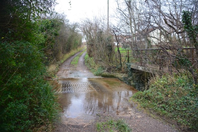
The forest offers a network of well-maintained trails, allowing visitors to explore its beauty on foot or by bike. These paths wind through the ancient trees, providing opportunities to discover hidden clearings and tranquil ponds. Black Wood also features picnic areas and benches, allowing visitors to relax and admire the stunning surroundings.

With its natural beauty, abundant wildlife, and peaceful ambiance, Black Wood in Suffolk is a destination that offers a welcome escape from the hustle and bustle of everyday life.

If you have any feedback on the listing, please let us know in the comments section below.
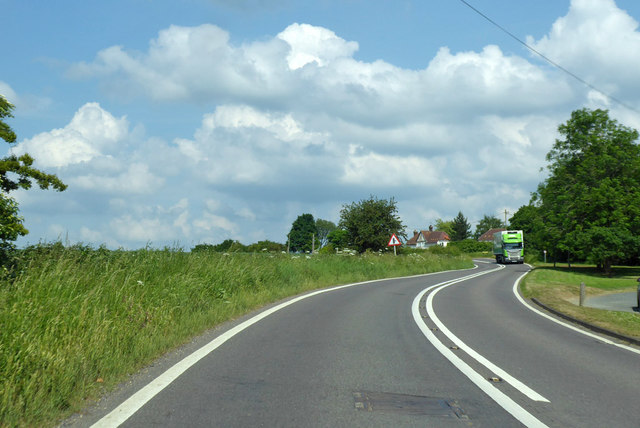
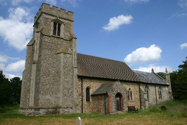
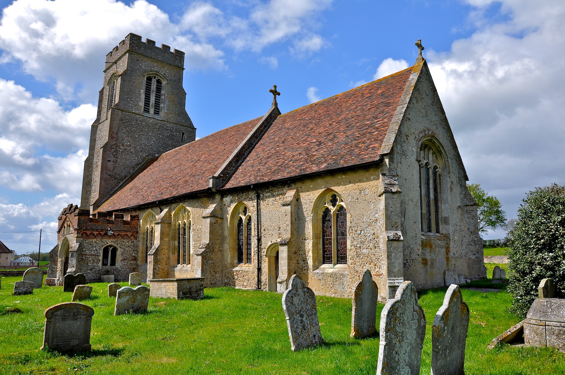
Black Wood Images

Images are sourced within 2km of 52.162232/0.60281418 or Grid Reference TL7854. Thanks to Geograph Open Source API. All images are credited.

Broomagefield Wood Walking a footpath near Rede.
Broomagefield Wood
Walking a footpath near Rede.
Purton Green Ford This ford is found on the approach to Purton Green Farm near Stansfield.
Purton Green Ford
This ford is found on the approach to Purton Green Farm near Stansfield.
Farm track with public footpath at field edge The route is entering a small field to the west of Purton Green.
Farm track with public footpath at field edge
The route is entering a small field to the west of Purton Green.
Path beside ponds Two of the six ponds - artificially created of course - on the slope descending towards Cordell Hall.
Path beside ponds
Two of the six ponds - artificially created of course - on the slope descending towards Cordell Hall.
Road leading to mast The location at the camera position is reckoned to be the Suffolk county top.
Road leading to mast
The location at the camera position is reckoned to be the Suffolk county top.
Walkers along bridleway between fields The pair are heading south-west between fields close to Gatesbury's Farm.
Walkers along bridleway between fields
The pair are heading south-west between fields close to Gatesbury's Farm.
Bare earth south of Cresslands Farm There is actually an emerging crop coming through the gently sloping field. It's seen from a restricted byway which, some way to the north, past the farm, seems to lose that status, becoming simply a bridleway.
Bare earth south of Cresslands Farm
There is actually an emerging crop coming through the gently sloping field. It's seen from a restricted byway which, some way to the north, past the farm, seems to lose that status, becoming simply a bridleway.
A143 at Clopton Green Heading for Bury St Edmunds.
A143 at Clopton Green
Heading for Bury St Edmunds.
A143 towards Bury St Edmunds The village sign for Depden is ahead, but little sign of the actual village yet. Most of the small village is off the main road anyway.
A143 towards Bury St Edmunds
The village sign for Depden is ahead, but little sign of the actual village yet. Most of the small village is off the main road anyway.
A143 towards Bury St Edmunds In the parish of Depden.
A143 towards Bury St Edmunds
In the parish of Depden.
A143 towards Bury St Edmunds In the parish of Depden.
A143 towards Bury St Edmunds
In the parish of Depden.
A143 towards Bury St Edmunds Passing through Depden, although  not much to see on the main road.
A143 towards Bury St Edmunds
Passing through Depden, although not much to see on the main road.
Depden WW1 War Memorial The memorial bears nine names of men lost in the Great War.
Depden WW1 War Memorial
The memorial bears nine names of men lost in the Great War.
Depden Church St Mary's at Depden is probably Suffolk's most remote church.  Access is by footpath only and it is a brisk ten-minute walk from the nearest vehicle access point.  Predictably, the church is situated close to the Hall, (but a long way from the village).  Services are held once a month, on the third Sunday.
Depden Church
St Mary's at Depden is probably Suffolk's most remote church. Access is by footpath only and it is a brisk ten-minute walk from the nearest vehicle access point. Predictably, the church is situated close to the Hall, (but a long way from the village). Services are held once a month, on the third Sunday.
Suffolk's county top This mast, at Elms Farm, sits astride Suffolk's highest point, at 420 feet.
Suffolk's county top
This mast, at Elms Farm, sits astride Suffolk's highest point, at 420 feet.
Elms Farm, Depden This farm is situated some 200 metres from Suffolk's highest point.
Elms Farm, Depden
This farm is situated some 200 metres from Suffolk's highest point.
Big Al's caff off the A143 A large bend in the road, now by-passed, serves as a lay-by, where 'Big Al' does a roaring trade.
Big Al's caff off the A143
A large bend in the road, now by-passed, serves as a lay-by, where 'Big Al' does a roaring trade.
Entrance to Coblands Farm Antiques are sold and furniture repaired at this farm.
Entrance to Coblands Farm
Antiques are sold and furniture repaired at this farm.
Show me another place!

Black Wood is located at Grid Ref: TL7854 (Lat: 52.162232, Lng: 0.60281418)

Administrative County: Suffolk

District: West Suffolk

Police Authority: Suffolk

What 3 Words

///melon.dearest.operation. Near Glemsford, Suffolk

Nearby Locations

Link Field Wood Black Wood

Related Wikis

Great Wood Hill

At 128 metres (420 ft), Great Wood Hill, near Chedburgh, is the highest point in the English county of Suffolk. It is the highest part of the Newmarket...

Newmarket Ridge

The Newmarket Ridge or East Anglian Ridge is a ridge starting north-west of Hertford, Hertfordshire near the Chiltern Hills and ending near Sudbury, Suffolk...

Gifford's Hall, Wickhambrook

Gifford's Hall is a manor house in the civil parish of Wickhambrook, in the West Suffolk district, in the county of Suffolk, England. It is Grade I listed...

Depden

Depden is a village and civil parish in the West Suffolk district of Suffolk in eastern England. Located on the A143 around five miles south-west of Bury...

Stansfield Windmill

Stansfield Mill is a Grade II listed tower mill at Stansfield, Suffolk, England which is derelict. == History == Stansfield Mill was built in 1840, replacing...

RAF Chedburgh

Royal Air Force Chedburgh or more simply RAF Chedburgh is a former Royal Air Force satellite station located near Bury St Edmunds, Suffolk, UK. The Bury...

Hawkedon

Hawkedon is a village and civil parish in the West Suffolk district of Suffolk in eastern England. Located around 7 miles (11 km) south-south-west of Bury...

Denston

Denston is a village and civil parish in the West Suffolk district of Suffolk in eastern England. Located around eight miles south-west of Bury St Edmunds...

Have you been to Black Wood?

Leave your review of Black Wood below (or comments, questions and feedback).