Anderson's Shaw

Wood, Forest in Sussex Rother

England

Anderson's Shaw

Barnes Wood A forest track leading into the wood where it was a busy day for foresters. A few sections of track were rendered nearly impassable by the deep ruts in the mud.
Barnes Wood Credit: Colin Smith

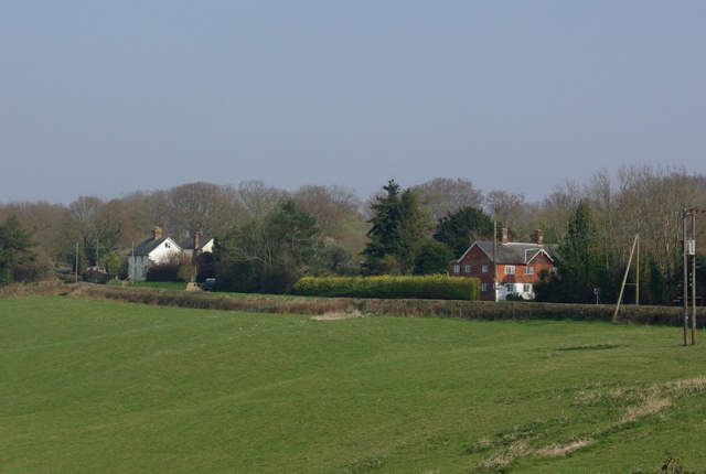
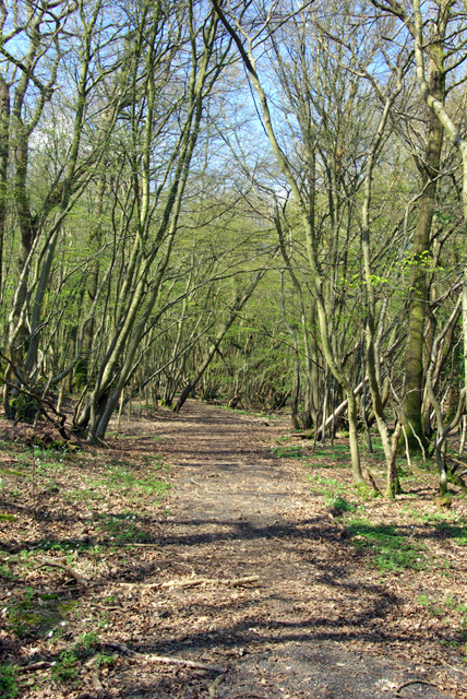
Anderson's Shaw is a picturesque woodland area located in the county of Sussex, England. Situated near the village of Shaw, this natural haven is known for its lush greenery, diverse flora and fauna, and peaceful atmosphere.

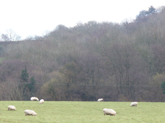
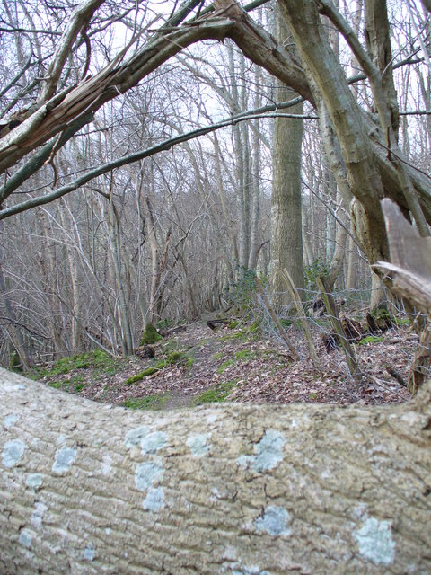
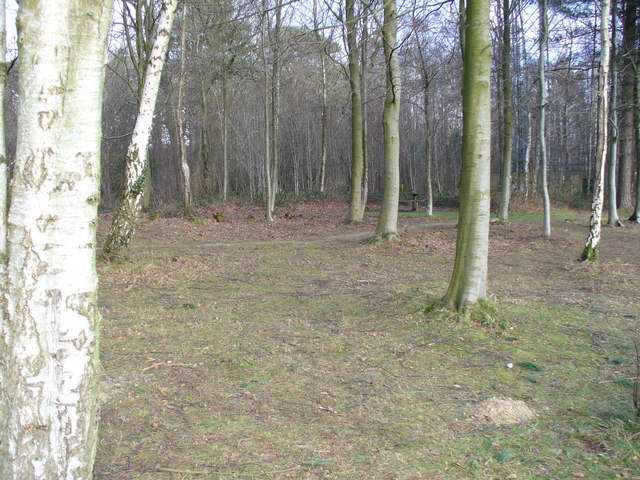
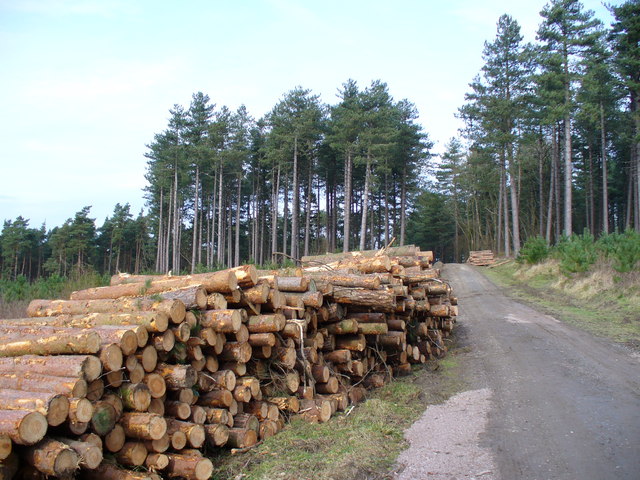
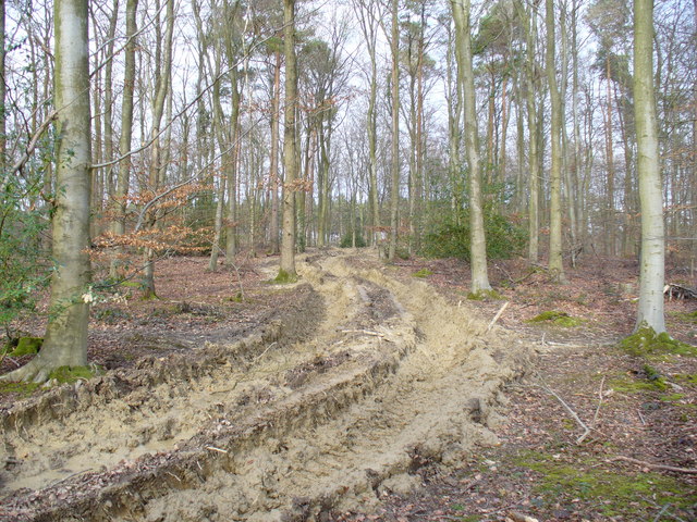
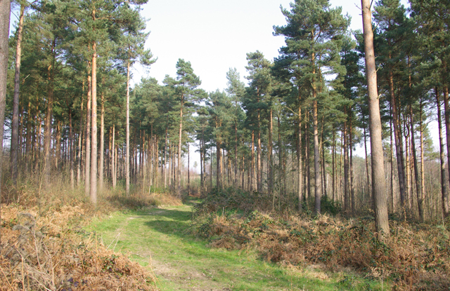
Covering an area of approximately 200 acres, Anderson's Shaw boasts a mix of deciduous and coniferous trees, including oak, beech, ash, and pine, creating a stunning mosaic of colors throughout the year. The woodland is also home to a variety of wildflowers, ferns, and mosses, adding to its natural beauty.

The forest provides a habitat for numerous species of wildlife, making it a popular spot for nature enthusiasts and birdwatchers. Visitors may catch a glimpse of deer, foxes, badgers, and a wide range of bird species, including woodpeckers, owls, and thrushes.

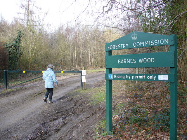
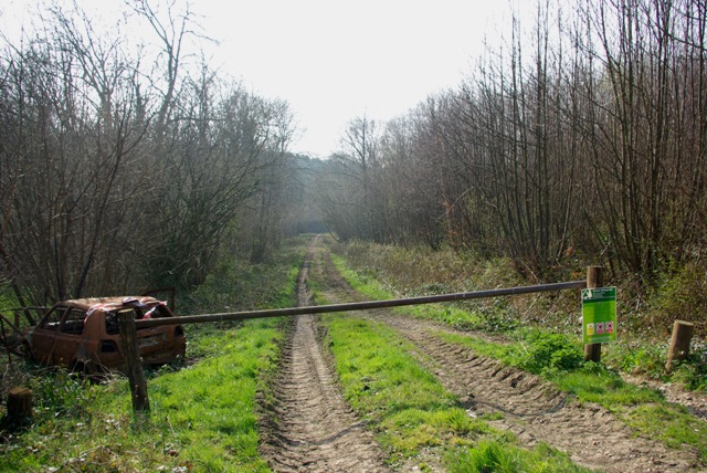
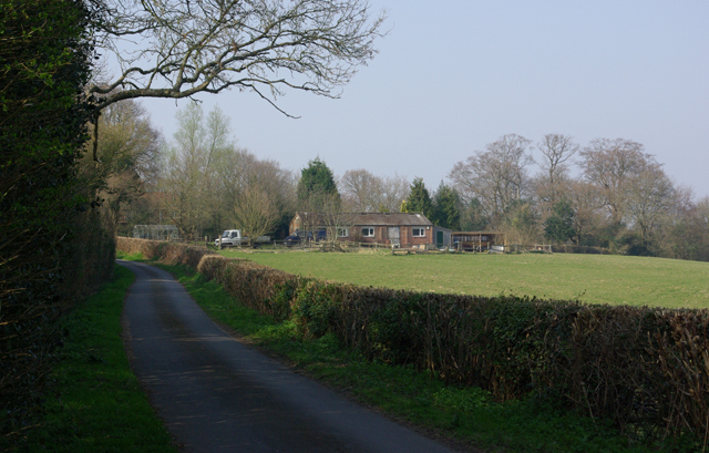
There are several well-maintained walking trails that wind through Anderson's Shaw, allowing visitors to explore the woodland at their own pace. These paths offer breathtaking views of the surrounding countryside and provide an opportunity for a peaceful and rejuvenating nature walk. The forest also features picnic areas and benches, allowing visitors to relax and enjoy the tranquility of the surroundings.

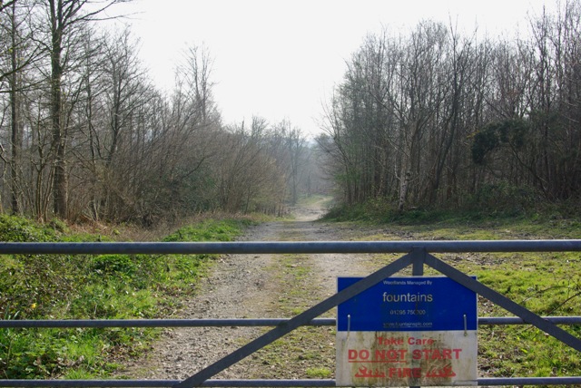
Anderson's Shaw is easily accessible by car and is located within close proximity to the village of Shaw. The woodland is open to the public year-round and is managed by the local conservation authority, ensuring its preservation for future generations to enjoy.

If you have any feedback on the listing, please let us know in the comments section below.

Anderson's Shaw Images

Images are sourced within 2km of 50.965239/0.5290823 or Grid Reference TQ7721. Thanks to Geograph Open Source API. All images are credited.

Barnes Wood A forest track leading into the wood where it was a busy day for foresters. A few sections of track were rendered nearly impassable by the deep ruts in the mud.
Barnes Wood
A forest track leading into the wood where it was a busy day for foresters. A few sections of track were rendered nearly impassable by the deep ruts in the mud.
Grazing Sheep at Footland The wet grassland provides sustenance for many sheep as they enter the lambing season. Beyond the fields, the valleysides are clothed by deciduous trees.
Grazing Sheep at Footland
The wet grassland provides sustenance for many sheep as they enter the lambing season. Beyond the fields, the valleysides are clothed by deciduous trees.
Blocked Path near Beech Farm This trunk, mottled with light turquoise growth, lies across the path through a small beech wood.
Blocked Path near Beech Farm
This trunk, mottled with light turquoise growth, lies across the path through a small beech wood.
Picnic Site, Footland Wood Benches sit benow the birches by the large car park. This area is popular with dog-walkers and walkers.
Picnic Site, Footland Wood
Benches sit benow the birches by the large car park. This area is popular with dog-walkers and walkers.
Log Stack, Barnes Wood The output of winter forestry activity line a track in this Wealden wood.
Log Stack, Barnes Wood
The output of winter forestry activity line a track in this Wealden wood.
Forest Track, Footland Wood The footpath here has been turned into a forest road and badly disfigured by the deep ruts, up to two feet deep. Recent heavy rain has left much clarty dubs to hinder walkers in the woods.
Forest Track, Footland Wood
The footpath here has been turned into a forest road and badly disfigured by the deep ruts, up to two feet deep. Recent heavy rain has left much clarty dubs to hinder walkers in the woods.
Staplecross War Memorial War Memorial commemorating the fallen from both world wars at Staplecross.
Staplecross War Memorial
War Memorial commemorating the fallen from both world wars at Staplecross.
Entrance, Vinehall Forest Forestry Commission with public access. A pity about the car.
Entrance, Vinehall Forest
Forestry Commission with public access. A pity about the car.
Swailes Green On the B2089 with Cripps Corner to the left.
Swailes Green
On the B2089 with Cripps Corner to the left.
Wattlehill Wattlehill is the name of the house. The lane is Beacon Lane.
Wattlehill
Wattlehill is the name of the house. The lane is Beacon Lane.
Streetfield Wood An entrance gate from the B2089.
Streetfield Wood
An entrance gate from the B2089.
Brede High Wood A track a little way into the wood roughly paralleling the B2089.
Brede High Wood
A track a little way into the wood roughly paralleling the B2089.
Ellenwhorne Lane Whorne Wood is on the right. The buildings on the skyline are Stockwood Farm.
Ellenwhorne Lane
Whorne Wood is on the right. The buildings on the skyline are Stockwood Farm.
First house in Staplecross That is if the approach is from the west along the bridleway shown. The bridleway evidently is a bit of a mess, but has actually been improved recently with scrub clearance and ditching on the left for what must have been a waterlogged section.
First house in Staplecross
That is if the approach is from the west along the bridleway shown. The bridleway evidently is a bit of a mess, but has actually been improved recently with scrub clearance and ditching on the left for what must have been a waterlogged section.
Bridleway, Staplecross The fourth way giving Staplecross its name, this bridleway has recently been cleared of overgrowth and ditched on the right, so should improve with time from its present state.
Bridleway, Staplecross
The fourth way giving Staplecross its name, this bridleway has recently been cleared of overgrowth and ditched on the right, so should improve with time from its present state.
Bridleway, Wellhead Wood West Wellhead Woods, West and East, are parts of Lordship Wood as a whole.
Bridleway, Wellhead Wood West
Wellhead Woods, West and East, are parts of Lordship Wood as a whole.
Exotic Bird Deep in Wellhead Wood lurks a peacock. There was no sight or sound of any others, there or nearby. It warily kept its distance, this was the best view.
Exotic Bird
Deep in Wellhead Wood lurks a peacock. There was no sight or sound of any others, there or nearby. It warily kept its distance, this was the best view.
Orchard windbreak hedge Orchards on either side on this rather exposed hill.
Orchard windbreak hedge
Orchards on either side on this rather exposed hill.
Show me another place!

Anderson's Shaw is located at Grid Ref: TQ7721 (Lat: 50.965239, Lng: 0.5290823)

Administrative County: East Sussex

District: Rother

Police Authority: Sussex

What 3 Words

///everyone.youngest.sprayer. Near Robertsbridge, East Sussex

Related Wikis

Cripps Corner

Cripps Corner is a village in the civil parish of Ewhurst and the Rother district of East Sussex, England. It is in the High Weald Area of Outstanding...

Sedlescombe vineyard

Sedlescombe organic vineyard is an English vineyard located in Robertsbridge, just outside Sedlescombe in East Sussex.It is one of the few British vineyards...
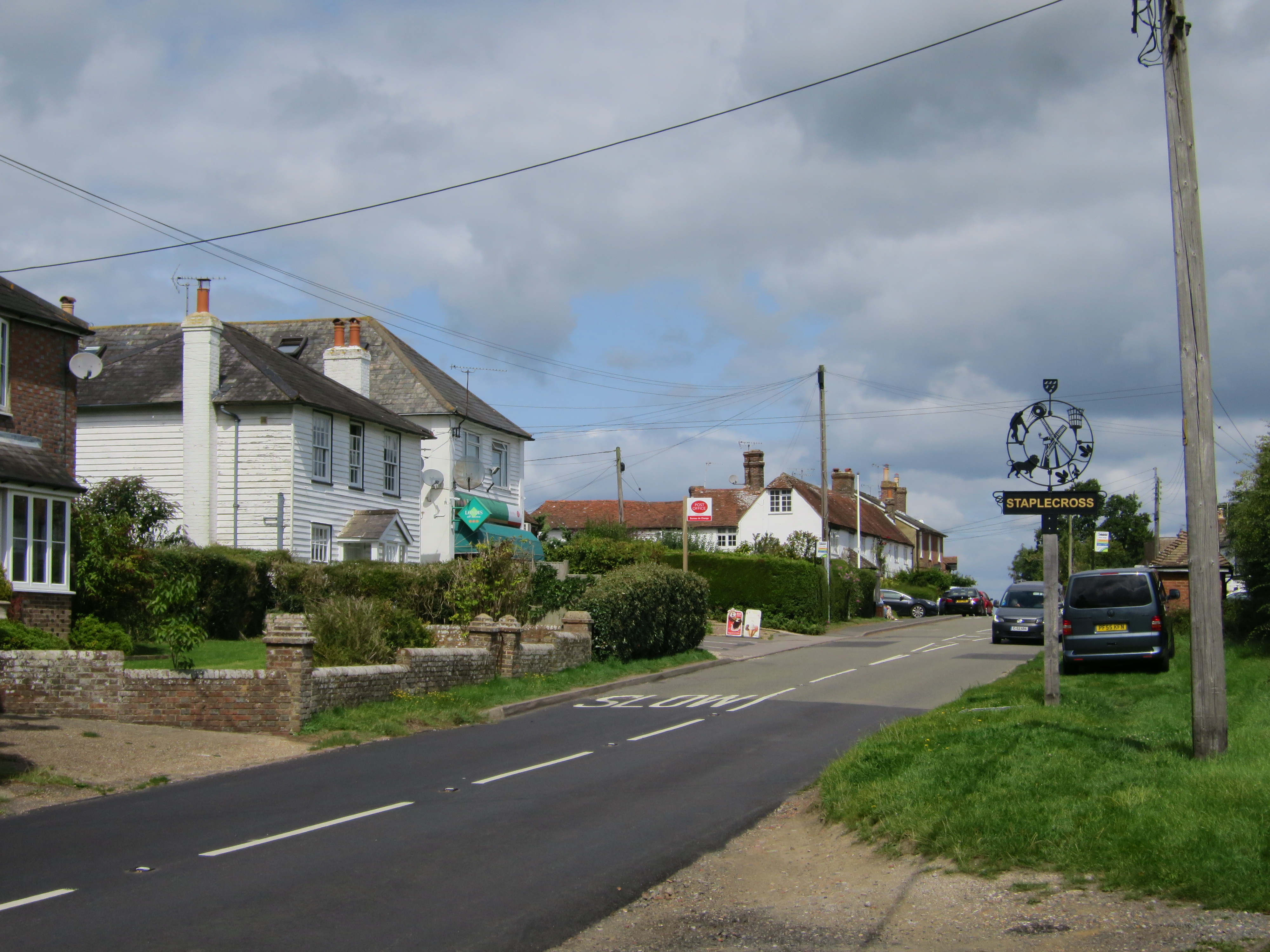
Staplecross

Staplecross is a village in the civil parish of Ewhurst and the Rother district of East Sussex, England. Staplecross is the largest settlement in Ewhurst...

Ewhurst, East Sussex

Ewhurst is a civil parish in the Rother district of East Sussex, England. The parish is on the southern ridge of the River Rother valley, and much of the...

Vinehall Street

Vinehall Street (or Vinehall), is a linear settlement in the civil parishes of Mountfield and Whatlington, and the Rother district of East Sussex, England...

Durhamford Manor

Durhamford Manor is a Grade II* listed country house in the parish of Sedlescombe, East Sussex, England. The timber-framed, close-studded house dates to...

Vinehall School

Vinehall School is a co-educational day, boarding school and nursery located at Vinehall Street, near the town of Robertsbridge, East Sussex. It takes...

Junction Road Halt railway station

Junction Road Halt, also known as Junction Road (for Hawkhurst), was a halt station on the Kent and East Sussex Railway. It was located on the eastern...

Nearby Amenities

Located within 500m of 50.965239,0.5290823
Cripps Corner
Place: village
Wikidata: Q61636954
Wikipedia: en:Cripps Corner
Lat/Long: 50.962818/0.5302872
Stop
Direction: backward
Stop: minor
Lat/Long: 50.9625559/0.5301093
Give Way
Direction: forward
Lat/Long: 50.9625442/0.5303241
Give Way
Direction: forward
Lat/Long: 50.9624491/0.5298206
Bus Stop
White Hart
Bench: yes
Bin: yes
Bus: yes
Check Date Shelter: 2023-03-28
Naptan AtcoCode: 1400RR0360
Naptan NaptanCode: esuatgjg
Public Transport: platform
Shelter: yes
Lat/Long: 50.9621846/0.5294785
Post Box
Operator: Royal Mail
Operator Wikidata: Q638098
Post Box Type: lamp
Ref: TN32 259
Royal Cypher: EIIR
Royal Cypher Wikidata: Q33102113
Lat/Long: 50.9622125/0.5295411
Give Way
Direction: forward
Lat/Long: 50.9614806/0.5285096
Give Way
Direction: backward
Lat/Long: 50.9617791/0.528645
Turning Loop
Lat/Long: 50.9617351/0.5332125
Give Way
Direction: backward
Lat/Long: 50.9625851/0.5297801
Give Way
Direction: forward
Lat/Long: 50.961777/0.5284763
Cafe
The Staplecross Express Cafe
Addr City: Robertsbridge
Addr Postcode: TN32 5QA
Addr Street: Cripps Corner Road, Staplecross
Cuisine: brunch
Outdoor Seating: yes
Phone: +44 1580 830008
Lat/Long: 50.9668253/0.5355319
The data included in this document is from www.openstreetmap.org. The data is made available under ODbL.

Have you been to Anderson's Shaw?

Leave your review of Anderson's Shaw below (or comments, questions and feedback).