Godfreys Wood

Wood, Forest in Norfolk King's Lynn and West Norfolk

England

Godfreys Wood

Peddars Way near Anmer
Peddars Way near Anmer Credit: Jonathan Thacker

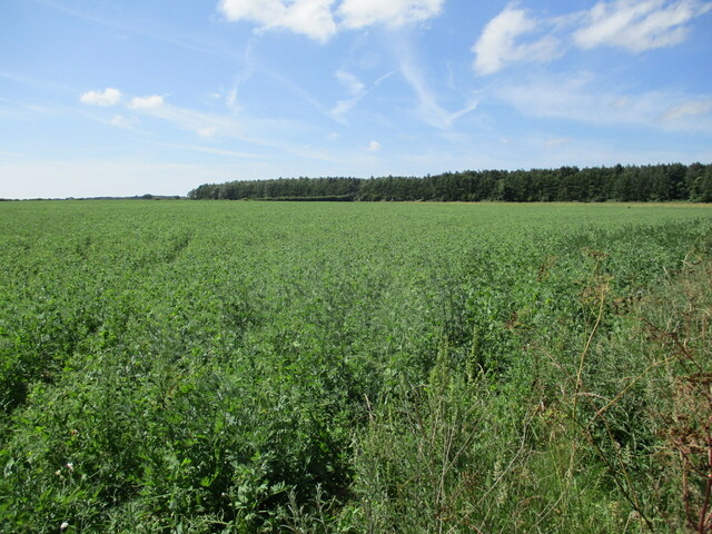
Godfreys Wood is a picturesque woodland located in Norfolk, England. Nestled within the beautiful Norfolk countryside, this enchanting forest covers an area of approximately 50 acres. The wood is named after the nearby village of Godfreys, and it has a rich history dating back centuries.

Characterized by its diverse flora and fauna, Godfreys Wood offers a haven for nature lovers. The woodland is primarily composed of deciduous trees, including oak, beech, and ash, which create a stunning display of colors during the autumn months. In addition to the trees, the forest floor is adorned with a carpet of wildflowers, providing a vibrant and colorful setting.

The wood is home to a variety of wildlife, making it a popular destination for birdwatchers and wildlife enthusiasts. Visitors may catch a glimpse of native species such as deer, squirrels, foxes, and a wide range of bird species, including woodpeckers and owls. The peaceful atmosphere and tranquil surroundings make it an ideal spot for those seeking a quiet retreat.

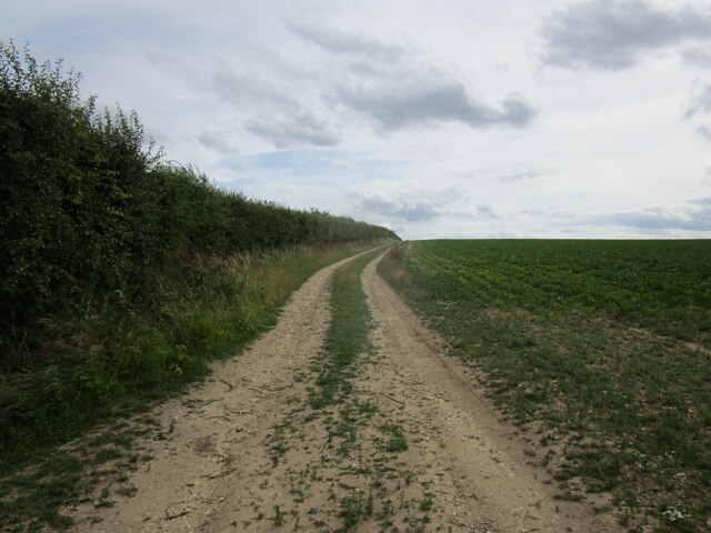
Godfreys Wood offers several walking trails, allowing visitors to explore the woodland and discover its hidden treasures. The paths wind through ancient trees and provide breathtaking views of the surrounding countryside. Nature lovers can also enjoy picnics in designated areas or simply relax in the peaceful surroundings.

With its natural beauty and serene ambiance, Godfreys Wood is a must-visit destination for those seeking a peaceful escape in the heart of Norfolk. Whether you are a nature enthusiast, an avid walker, or simply looking for a tranquil spot to unwind, this enchanting woodland will not disappoint.

If you have any feedback on the listing, please let us know in the comments section below.

Godfreys Wood Images

Images are sourced within 2km of 52.856316/0.60347914 or Grid Reference TF7531. Thanks to Geograph Open Source API. All images are credited.

Peddars Way near Anmer
Grass track to Anmer
Field of peas and Pentonville
Barley field near Great Bircham
Houses on Fring Road, Great Bircham
Farm track near Fring
Great Bircham: The Cross of Sacrifice For more, see <span class="nowrap"><a title="https://www.warmemorialsonline.org.uk/memorial/268237/" rel="nofollow ugc noopener" href="https://www.warmemorialsonline.org.uk/memorial/268237/">Link</a><img style="margin-left:2px;" alt="External link" title="External link - shift click to open in new window" src="https://s1.geograph.org.uk/img/external.png" width="10" height="10"/></span>
Great Bircham: The Cross of Sacrifice
For more, see LinkExternal link
Doggone it, she's still going Trixie has been accompanying us on our walks for many years <a title="https://www.geograph.org.uk/photo/4418815" href="https://www.geograph.org.uk/photo/4418815">Link</a> Here she is on the Peddars Way between the B1153 and Pentonville
Doggone it, she's still going
Trixie has been accompanying us on our walks for many years Link Here she is on the Peddars Way between the B1153 and Pentonville
The path divides on the Peddars Way Straight on for Fring; to the right for Great Bircham
The path divides on the Peddars Way
Straight on for Fring; to the right for Great Bircham
Glimpse of a field through a hedge gap on the Peddars Way The Peddars Way is a long distance footpath in Norfolk. It is 46 miles long and follows the route of a Roman road. It has been suggested by more than one writer that it was not created by the Romans but was an ancient trackway, a branch or extension of the Icknield Way, used and remodelled by the Romans. The name is said to be derived from the Latin pedester – on foot.  It starts at Knettishall Heath in Suffolk (near the Norfolk-Suffolk border, about 4 miles east of Thetford), and it links with the Norfolk Coast Path at Holme-next-the-Sea.
Combined with the Norfolk Coast Path, it forms the Peddars Way & Norfolk Coast Path National Trail, one of 15 National Trails in England and Wales, and the two paths together run for 97 miles.
Wikipedia: <span class="nowrap"><a title="http://en.wikipedia.org/wiki/Peddars_Way" rel="nofollow ugc noopener" href="http://en.wikipedia.org/wiki/Peddars_Way">Link</a><img style="margin-left:2px;" alt="External link" title="External link - shift click to open in new window" src="https://s1.geograph.org.uk/img/external.png" width="10" height="10"/></span>
Glimpse of a field through a hedge gap on the Peddars Way
The Peddars Way is a long distance footpath in Norfolk. It is 46 miles long and follows the route of a Roman road. It has been suggested by more than one writer that it was not created by the Romans but was an ancient trackway, a branch or extension of the Icknield Way, used and remodelled by the Romans. The name is said to be derived from the Latin pedester – on foot. It starts at Knettishall Heath in Suffolk (near the Norfolk-Suffolk border, about 4 miles east of Thetford), and it links with the Norfolk Coast Path at Holme-next-the-Sea. Combined with the Norfolk Coast Path, it forms the Peddars Way & Norfolk Coast Path National Trail, one of 15 National Trails in England and Wales, and the two paths together run for 97 miles. Wikipedia: LinkExternal link
As Thomas Hardy put it..... The Roman Road runs straight and bare  The Roman Road runs straight and bare
(as seen here on the Peddars Way)
As Thomas Hardy put it.....
The Roman Road runs straight and bare The Roman Road runs straight and bare (as seen here on the Peddars Way)
Road and path junction near Bircham The Peddars Way meets a road. One way in a vehicle would take you past Bircham Plantation; the other towards the historic windmill <span class="nowrap"><a title="https://www.birchamwindmill.co.uk/" rel="nofollow ugc noopener" href="https://www.birchamwindmill.co.uk/">Link</a><img style="margin-left:2px;" alt="External link" title="External link - shift click to open in new window" src="https://s1.geograph.org.uk/img/external.png" width="10" height="10"/></span>
Road and path junction near Bircham
The Peddars Way meets a road. One way in a vehicle would take you past Bircham Plantation; the other towards the historic windmill LinkExternal link
Great Bircham: inscription on the Cross of Sacrifice
St Mary, Great Bircham: font The font in a Christian church is that place where new members are inducted in a ceremony known as a christening. Fonts are often symbolically placed at or near the entrance. Typically, the font is between 90 and 130 centimetres tall and sculpted in stone- although wood and metal are sometimes used.  During the ceremony, a priest traces the sign of the cross on the new member’s forehead.  If an infant, several adults will be asked to be godparents. They will then pledge at the font to guide the child on their Christian journey.
St Mary, Great Bircham: font
The font in a Christian church is that place where new members are inducted in a ceremony known as a christening. Fonts are often symbolically placed at or near the entrance. Typically, the font is between 90 and 130 centimetres tall and sculpted in stone- although wood and metal are sometimes used. During the ceremony, a priest traces the sign of the cross on the new member’s forehead. If an infant, several adults will be asked to be godparents. They will then pledge at the font to guide the child on their Christian journey.
Inside St Mary, Great Bircham (A)
Inside St Mary, Great Bircham (B)
Inside St Mary, Great Bircham (C)
Inside St Mary, Great Bircham (D) A shield commemorating the life of Sidney Wharton <span class="nowrap"><a title="http://whartonfamilyhistory.weebly.com/sidney-alfred-wharton-1895-1916.html" rel="nofollow ugc noopener" href="http://whartonfamilyhistory.weebly.com/sidney-alfred-wharton-1895-1916.html">Link</a><img style="margin-left:2px;" alt="External link" title="External link - shift click to open in new window" src="https://s1.geograph.org.uk/img/external.png" width="10" height="10"/></span>
Inside St Mary, Great Bircham (D)
A shield commemorating the life of Sidney Wharton LinkExternal link
Show me another place!

Godfreys Wood is located at Grid Ref: TF7531 (Lat: 52.856316, Lng: 0.60347914)

Administrative County: Norfolk

District: King's Lynn and West Norfolk

Police Authority: Norfolk

What 3 Words

///widget.sprinkler.somewhere. Near Dersingham, Norfolk

Nearby Locations

Godfreys Wood Dodds Belt

Related Wikis

Great Bircham Windmill

Great Bircham Windmill is a Grade II listed tower mill in Great Bircham, Norfolk, England. == History == The earliest record of a windmill in Great Bircham...
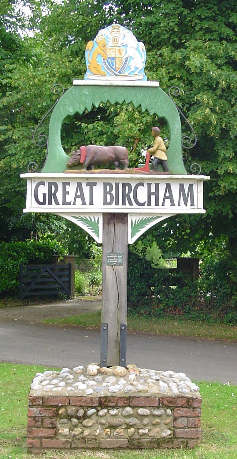
Great Bircham

Great Bircham is the largest of the three villages that make up the civil parish of Bircham, in the west of the English county of Norfolk. The village...

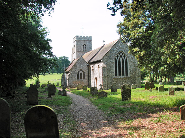
St Mary the Virgin's Church, Great Bircham

St Mary's Church, Great Bircham dates from the 12th-century, and is a Grade I listed parish church in the Church of England Diocese of Norwich in Great...

Bircham

Bircham is a civil parish in the English county of Norfolk. It includes the three villages of Great Bircham, Bircham Newton and Bircham Tofts. The parish...

Bircham Newton

Bircham Newton is the smallest of the three villages that make up the civil parish of Bircham, in the west of the English county of Norfolk. The village...

Bircham Tofts

Bircham Tofts is one of the three villages that make up the civil parish of Bircham, in the west of the English county of Norfolk. The village is located...

Anmer

Anmer is a small village and civil parish in the English county of Norfolk. It is around 12 miles (19 km) north-east of the town of King's Lynn and 35...

Anmer Hall

Anmer Hall is a Georgian country house in the village of Anmer in Norfolk, England. Built in the 19th century, it was acquired by the Sandringham Estate...

Related Videos

Bircham Windmill, North Norfolk, England

Our day trip to Bircham Windmill while on holiday in North Norfolk, England.

Merry Christmas! Prince William, Duchess Kate and Kids Went to Country Home Anmer Hall

Royal Insider News The Duke and Duchess of Cambridge took Prince George, Princess Charlotte, and Prince Louis to their ...

Nearby Amenities

Located within 500m of 52.856316,0.60347914
Fieldbarn Farm
Place: farm
Lat/Long: 52.858659/0.5998462
The data included in this document is from www.openstreetmap.org. The data is made available under ODbL.

Have you been to Godfreys Wood?

Leave your review of Godfreys Wood below (or comments, questions and feedback).