Garden Plantation

Wood, Forest in Norfolk King's Lynn and West Norfolk

England

Garden Plantation

Chalk Quarry near Hillington Operated by West Norfolk Super Lime Co. Ltd.
Chalk Quarry near Hillington Credit: Stephen McKay

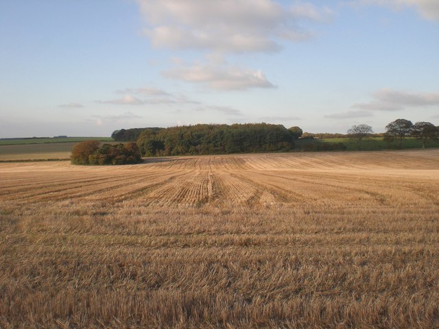
Garden Plantation, located in Norfolk, is a magnificent woodland area known for its pristine natural beauty and vast variety of plant species. Spread across a sprawling expanse, this plantation is a haven for nature enthusiasts and those seeking solace amidst lush greenery.

The plantation is predominantly composed of woodlands and forests, offering a diverse range of flora and fauna. Towering trees, including oak, beech, and pine, dominate the landscape, creating a dense canopy that provides shade and shelter for numerous plant and animal species. The forest floor is adorned with a rich carpet of mosses, ferns, and wildflowers, adding to the enchanting ambiance of the area.

Garden Plantation is a haven for bird watchers, as it attracts a wide array of avian species. The melodious songs of warblers, the majestic flights of birds of prey, and the occasional sighting of rare species make it a paradise for ornithologists and bird lovers alike.

Visitors to the plantation can explore a network of well-maintained trails that wind through the woods, offering picturesque views of the surrounding landscape. Nature walks and guided tours are available, led by knowledgeable experts who provide insight into the unique ecosystem and the importance of conservation efforts.

Additionally, Garden Plantation boasts a small visitor center, where visitors can learn more about the flora and fauna that call the plantation home. The center also offers educational programs and workshops, aimed at promoting awareness and understanding of the natural world.

In summary, Garden Plantation in Norfolk is a captivating woodland area, teeming with an abundance of plant and animal life. Its serene ambiance, diverse vegetation, and educational facilities make it a must-visit destination for nature enthusiasts and those seeking a tranquil retreat in the heart of nature.

If you have any feedback on the listing, please let us know in the comments section below.

Garden Plantation Images

Images are sourced within 2km of 52.785562/0.57945218 or Grid Reference TF7424. Thanks to Geograph Open Source API. All images are credited.

Chalk Quarry near Hillington Operated by West Norfolk Super Lime Co. Ltd.
Chalk Quarry near Hillington
Operated by West Norfolk Super Lime Co. Ltd.
Open Field Boundary south of the A148 Somewhere just in front of the photographer ran the former Fakenham -King's Lynn railway line - but no signs on the ground remain here. The wood in the background is The Belmont Ring.
Open Field Boundary south of the A148
Somewhere just in front of the photographer ran the former Fakenham -King's Lynn railway line - but no signs on the ground remain here. The wood in the background is The Belmont Ring.
Field Boundary Looking towards Hillington The busy A148 is just to the right of the hedge. The former King's Lynn-Fakenham railway line was probably that side too.
See <a title="https://www.geograph.org.uk/photo/566133" href="https://www.geograph.org.uk/photo/566133">Link</a> for an old photo of this same shot with the field full of poppies.
Field Boundary Looking towards Hillington
The busy A148 is just to the right of the hedge. The former King's Lynn-Fakenham railway line was probably that side too. See Link for an old photo of this same shot with the field full of poppies.
Small Barn east of Grimston (Looking west)
Small Barn east of Grimston
(Looking west)
Track East of Grimston This track heads north to the A148. The repair markings on the road suggests that in the recent past, the trackway has been utilised for underground services of some kind.
Track East of Grimston
This track heads north to the A148. The repair markings on the road suggests that in the recent past, the trackway has been utilised for underground services of some kind.
Field Boundary (2) looking towards Hillington Same view as the first photo <a title="https://www.geograph.org.uk/photo/549838" href="https://www.geograph.org.uk/photo/549838">Link</a> - but probably some 18 years earlier.
Field Boundary (2) looking towards Hillington
Same view as the first photo Link - but probably some 18 years earlier.
Road & Track at Stonepit Hills Looking east, early morning.
Road & Track at Stonepit Hills
Looking east, early morning.
Walkers' map, Congham Heath Wood Owned by UPM Tilhill <span class="nowrap"><a title="http://www.upm-tilhill.com/" rel="nofollow ugc noopener" href="http://www.upm-tilhill.com/">Link</a><img style="margin-left:2px;" alt="External link" title="External link - shift click to open in new window" src="https://s1.geograph.org.uk/img/external.png" width="10" height="10"/></span> this woodland has a good network of permissive paths for walkers which are not marked on the OS maps.

As an aside Tilhill's company description as 'the leader for tree solutions' must be worthy of entry in Private Eye's solutions series.
Walkers' map, Congham Heath Wood
Owned by UPM Tilhill LinkExternal link this woodland has a good network of permissive paths for walkers which are not marked on the OS maps. As an aside Tilhill's company description as 'the leader for tree solutions' must be worthy of entry in Private Eye's solutions series.
Track east through Grimston Carr This conglomeration of woods (Grimston Carr, Crimea Plantation, Old Scotch Wood, Avenue Plantation, Congham Heath, Alexandra Plantation, Snipe Covert and Broom Covert) is owned by UPM Tithill <span class="nowrap"><a title="http://www.upm-tilhill.com/" rel="nofollow ugc noopener" href="http://www.upm-tilhill.com/">Link</a><img style="margin-left:2px;" alt="External link" title="External link - shift click to open in new window" src="https://s1.geograph.org.uk/img/external.png" width="10" height="10"/></span> and managed under the umbrella name of Congham Heath Wood.  A well kept and signposted network of permissive paths, not marked on the OS maps, provides good woodland walking, see <a href="https://www.geograph.org.uk/photo/583731">TF7222 : Walkers' map, Congham Heath Wood</a>.
Track east through Grimston Carr
This conglomeration of woods (Grimston Carr, Crimea Plantation, Old Scotch Wood, Avenue Plantation, Congham Heath, Alexandra Plantation, Snipe Covert and Broom Covert) is owned by UPM Tithill LinkExternal link and managed under the umbrella name of Congham Heath Wood. A well kept and signposted network of permissive paths, not marked on the OS maps, provides good woodland walking, see TF7222 : Walkers' map, Congham Heath Wood.
Across stubble towards eastern end of Broom Covert
North across arable land from eastern end of Congham Heath
Barns and disused stockyard On the road from Grimston to Massingham at the south eastern edge of Broom Covert, these buildings were, until fairly recently, used for cattle.  The steel feeders line the side facing the road.
Barns and disused stockyard
On the road from Grimston to Massingham at the south eastern edge of Broom Covert, these buildings were, until fairly recently, used for cattle. The steel feeders line the side facing the road.
North west across beet from northern end of Old Belt
East towards plantation south of Fox Covert Back along the footpath that runs along this ridge.  A beautiful October afternoon for a solitary walk - in 10 1/2 miles, mainly on footpaths and tracks, I met no-one.
East towards plantation south of Fox Covert
Back along the footpath that runs along this ridge. A beautiful October afternoon for a solitary walk - in 10 1/2 miles, mainly on footpaths and tracks, I met no-one.
North across stubble Forty Acre Plantation in the foreground and Belmont Ring beyond.
North across stubble
Forty Acre Plantation in the foreground and Belmont Ring beyond.
North along western edge of Beech Plantation
Track north through Grimston Carr
Permissive path, Congham Heath
Show me another place!

Garden Plantation is located at Grid Ref: TF7424 (Lat: 52.785562, Lng: 0.57945218)

Administrative County: Norfolk

District: King's Lynn and West Norfolk

Police Authority: Norfolk

What 3 Words

///foremost.bulldozer.hobby. Near Grimston, Norfolk

Related Wikis

Hillington railway station

Hillington railway station was a station in Hillington, Norfolk on the now closed Midland and Great Northern Joint Railway line between South Lynn and...

Grimston, Norfolk

Grimston is a village and civil parish in the English county of Norfolk, approximately 6 miles north-east of King's Lynn. It covers an area of 18.08 km2...

Congham

Congham is a village and civil parish in the English county of Norfolk. It is situated some 6 miles (10 km) east of the town of King's Lynn and 34 miles...

Hillington, Norfolk

Hillington is a village and civil parish in the English county of Norfolk. It covers an area of 10.27 km2 (3.97 sq mi) and had a population of 287 in 123...

Flitcham, Norfolk

Flitcham is a village and civil parish in the English county of Norfolk. The village is located 7.1 miles (11.4 km) north-east of King's Lynn and 33 miles...

River Cong (Norfolk)

The River Cong is a stream in the west of the county of Norfolk, only 1.5 miles (2.4 km) in length. It is a tributary of the River Babingley. The spring...

Flitcham with Appleton

Flitcham with Appleton is a civil parish in the English county of Norfolk. It covers an area of 17.08 km2 (6.59 sq mi) and had a population of 236 in 96...

Roydon, King's Lynn and West Norfolk

Roydon is a small village, civil parish and electoral ward east of King's Lynn in the English county of Norfolk. It covers an area of 4.62 km2 (1.78 sq...

Nearby Amenities

Located within 500m of 52.785562,0.57945218
Power: pole
Lat/Long: 52.7870862/0.5855262
Power: pole
Lat/Long: 52.7870505/0.5840242
Power: pole
Lat/Long: 52.7869986/0.5825275
Power: pole
Lat/Long: 52.7869565/0.5810603
Power: pole
Lat/Long: 52.7869256/0.5795637
Power: pole
Lat/Long: 52.7868818/0.5780482
Power: pole
Lat/Long: 52.7868478/0.5766481
Power: pole
Lat/Long: 52.7867245/0.5751783
Power: pole
Lat/Long: 52.7865915/0.5737084
Power: pole
Lat/Long: 52.7864698/0.5722976
The data included in this document is from www.openstreetmap.org. The data is made available under ODbL.

Have you been to Garden Plantation?

Leave your review of Garden Plantation below (or comments, questions and feedback).