Fifehead Magdalen

Settlement in Dorset

England

Fifehead Magdalen

Path to Stour Provost The stile ahead carries footpath N71 60 towards the village.
Path to Stour Provost Credit: Derek Harper

Fifehead Magdalen is a small village located in the county of Dorset, England. Situated approximately 6 miles south of the town of Gillingham and 5 miles north of Shaftesbury, it is nestled in the picturesque Blackmore Vale.

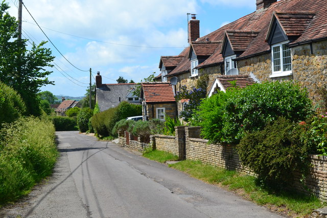
The village is known for its quaint charm and rural beauty. It is surrounded by rolling hills and fields, creating a stunning backdrop for residents and visitors alike. Fifehead Magdalen is characterized by its traditional thatched cottages, which add to its idyllic atmosphere.

The village is home to a small but tight-knit community. The residents take pride in preserving the village's heritage, and this is evident in the well-maintained buildings and gardens. Despite its small size, Fifehead Magdalen has a strong sense of community spirit, with local events and gatherings often taking place.

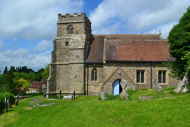
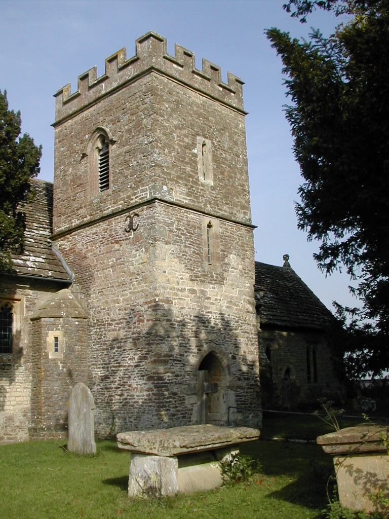
One of the notable landmarks in Fifehead Magdalen is the Church of St. Mary Magdalene, a beautiful medieval church with a tower that dominates the village skyline. The church has a rich history, dating back to the 12th century, and is a focal point for religious and community activities.

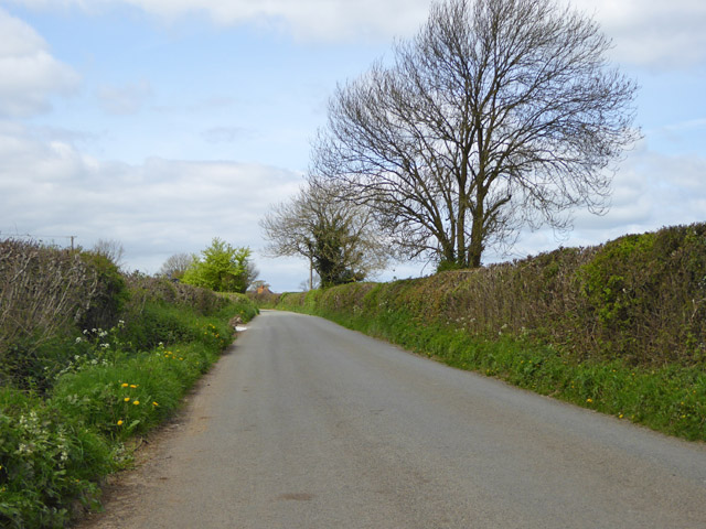
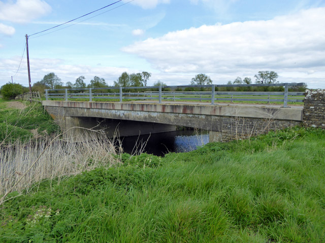
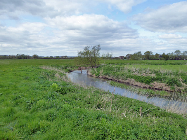
Surrounded by the Dorset countryside, Fifehead Magdalen offers plenty of opportunities for outdoor pursuits such as walking, cycling, and horse riding. The village is also conveniently located near several nature reserves and country parks, providing further options for exploring the surrounding natural beauty.

In summary, Fifehead Magdalen is a charming and picturesque village in Dorset, known for its rural beauty, traditional architecture, and strong sense of community. It offers residents and visitors a peaceful and idyllic setting to enjoy the best of the English countryside.

If you have any feedback on the listing, please let us know in the comments section below.

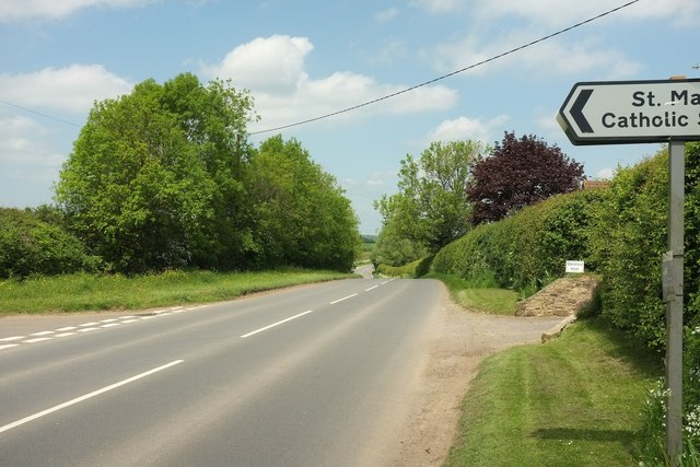
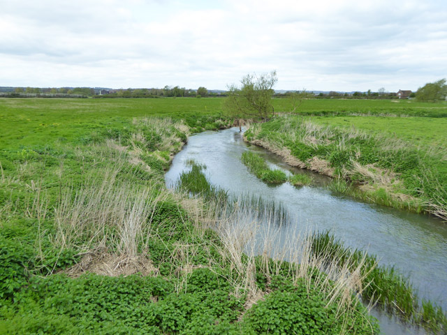
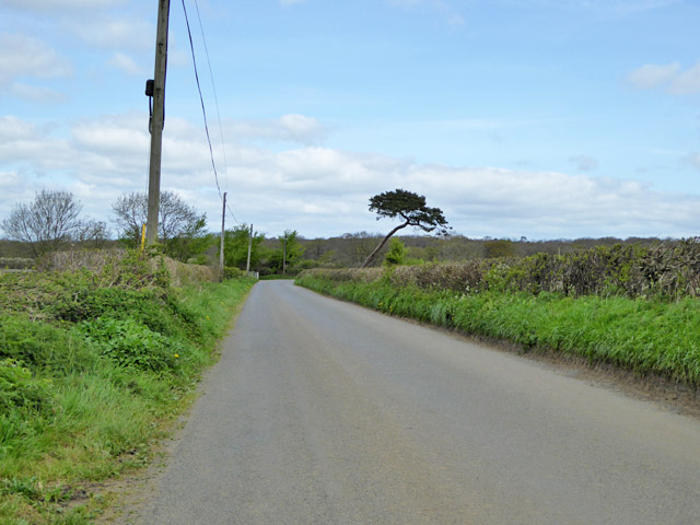
Fifehead Magdalen Images

Images are sourced within 2km of 50.992362/-2.3155949 or Grid Reference ST7721. Thanks to Geograph Open Source API. All images are credited.

Path to Stour Provost The stile ahead carries footpath N71 60 towards the village.
Path to Stour Provost
The stile ahead carries footpath N71 60 towards the village.
Field boundaries near Stour Provost From the same spot as <a href="https://www.geograph.org.uk/photo/5115131">ST7921 : Path to Stour Provost</a>, looking left. Two hedges at right angles to each other, seen from footpath N71 60.
Field boundaries near Stour Provost
From the same spot as ST7921 : Path to Stour Provost, looking left. Two hedges at right angles to each other, seen from footpath N71 60.
B3092 at Todber At the junction with Great Down Lane (left). The road sign is for St Mary's Catholic Primary School.
B3092 at Todber
At the junction with Great Down Lane (left). The road sign is for St Mary's Catholic Primary School.
Great Down Lane From the junction with the B3092 where <a href="https://www.geograph.org.uk/photo/5117508">ST7920 : B3092 at Todber</a> was taken. The lane leads to Marnhull.
Great Down Lane
From the junction with the B3092 where ST7920 : B3092 at Todber was taken. The lane leads to Marnhull.
Field near Todber #4 Looking to the right from the same spot as <a href="https://www.geograph.org.uk/photo/5117632">ST7920 : Field near Todber #3</a>, with a little overlap. On the right is Provost Farm. The distant houses are at Fifehead Magdalen.
Field near Todber #4
Looking to the right from the same spot as ST7920 : Field near Todber #3, with a little overlap. On the right is Provost Farm. The distant houses are at Fifehead Magdalen.
Field near Todber #5 Looking to the right from the same spot as <a href="https://www.geograph.org.uk/photo/5117637">ST7920 : Field near Todber #4</a>, with a little overlap; the tree on the left obscures part of Provost Farm. The houses are at Stour Provost.
Field near Todber #5
Looking to the right from the same spot as ST7920 : Field near Todber #4, with a little overlap; the tree on the left obscures part of Provost Farm. The houses are at Stour Provost.
Field boundary near Northfield House I'm searching for the exit from the field for footpath N73 5, but it emerges later that I've already missed it, and it can't have been where the map shows it. However, I decide to head for the obvious fence near the oak tree and end up in someone's garden.
Field boundary near Northfield House
I'm searching for the exit from the field for footpath N73 5, but it emerges later that I've already missed it, and it can't have been where the map shows it. However, I decide to head for the obvious fence near the oak tree and end up in someone's garden.
Edge of field near Todber From beneath the oak seen in <a href="https://www.geograph.org.uk/photo/5117654">ST7920 : Field boundary near Northfield House</a>, looking towards the northwestern panhandle of the large field shown in <a href="https://www.geograph.org.uk/photo/5117632">ST7920 : Field near Todber #3</a>.
Edge of field near Todber
From beneath the oak seen in ST7920 : Field boundary near Northfield House, looking towards the northwestern panhandle of the large field shown in ST7920 : Field near Todber #3.
River Stour below Mill Lane bridge Looking downstream.
River Stour below Mill Lane bridge
Looking downstream.
Road to Fifehead Magdalen The hedgerow conifer seems to have suffered some trauma in the past.
Road to Fifehead Magdalen
The hedgerow conifer seems to have suffered some trauma in the past.
Entering Fifehead Magdalen from the south-west
Chapel Hill, Kington Magna
All Saints' Church, Kington Magna
Road north from Fifehead Magdalen
River Stour above Mill Lane bridge Looking upstream.
River Stour above Mill Lane bridge
Looking upstream.
Bridge on Mill Lane Over the River Stour.
Bridge on Mill Lane
Over the River Stour.
River Stour Looking downstream below Mill Lane bridge.
River Stour
Looking downstream below Mill Lane bridge.
The Riverside Cafe, West Stour
Show me another place!

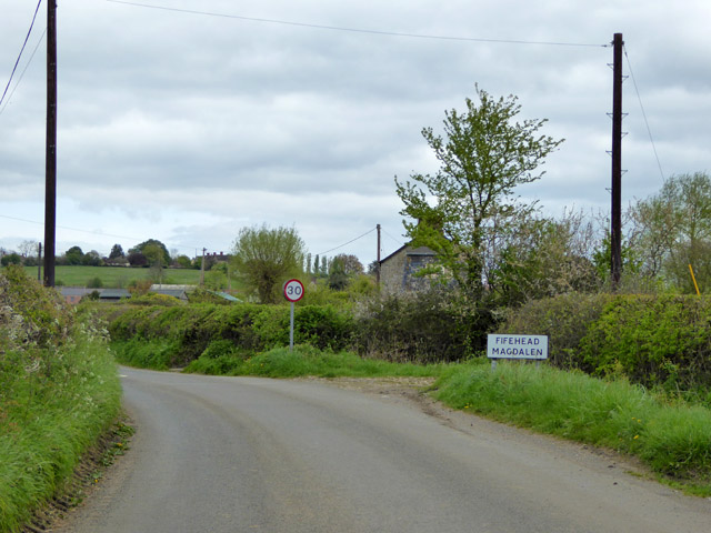
Fifehead Magdalen is located at Grid Ref: ST7721 (Lat: 50.992362, Lng: -2.3155949)

Unitary Authority: Dorset

Police Authority: Dorset

What 3 Words

///loosens.proves.unhelpful. Near Marnhull, Dorset

Related Wikis

Fifehead Magdalen

Fifehead Magdalen is a small village and civil parish in the county of Dorset in southern England. It lies within the Blackmore Vale, about three miles...

Fifehead Wood

Fifehead Wood is a woodland in Dorset, England, near the village of Fifehead Magdalen. Owned and maintained by the Woodland Trust, Fifehead Wood covers...

West Stour, Dorset

West Stour is a village and civil parish situated in the Blackmore Vale area of North Dorset, England. It is one of a group of villages known as The Stours...

Stour Provost

Stour Provost is a village and civil parish in the Blackmore Vale area of north Dorset, England, situated on the River Stour between Sturminster Newton...

Nearby Amenities

Located within 500m of 50.992362,-2.3155949
Barrier: stile
Foot: yes
Lat/Long: 50.9923158/-2.3226348
Barrier: stile
Foot: yes
Lat/Long: 50.9942211/-2.3135457
Barrier: stile
Foot: yes
Lat/Long: 50.9924474/-2.3147195
Barrier: kissing_gate
Foot: yes
Lat/Long: 50.9949052/-2.3129276
Barrier: stile
Foot: yes
Lat/Long: 50.9936303/-2.3141909
Barrier: kissing_gate
Foot: yes
Lat/Long: 50.9947702/-2.3129943
Barrier: stile
Foot: yes
Lat/Long: 50.9943519/-2.3165181
Fifehead Magdalen
Place: village
Lat/Long: 50.9927377/-2.3151326
Parking
Lat/Long: 50.9934172/-2.3155363
Barrier: stile
Lat/Long: 50.9927962/-2.3103888
Power: pole
Lat/Long: 50.9952057/-2.3186731
Power: pole
Lat/Long: 50.9960227/-2.3187831
Power: pole
Lat/Long: 50.9922159/-2.3189601
Power: pole
Lat/Long: 50.9922125/-2.3175627
Power: pole
Lat/Long: 50.9939412/-2.3164925
Power: pole
Lat/Long: 50.9937657/-2.3175198
Power: pole
Lat/Long: 50.993607/-2.3184183
Power: pole
Lat/Long: 50.9882137/-2.3135624
Power: pole
Lat/Long: 50.9889442/-2.3137648
Power: pole
Lat/Long: 50.9895514/-2.3139248
Power: pole
Lat/Long: 50.9900157/-2.3145969
Power: pole
Lat/Long: 50.9904638/-2.3152592
Public Bookcase
Defibrillator
Booth: K6
Defibrillator Location: inside old red phone box (that is now used as book exchange) in Fifehead Magdalen
Disused Amenity: telephone
Emergency: defibrillator
Man Made: telephone_box
Public Bookcase Type: phone_box
Lat/Long: 50.9925568/-2.3135355
Post Box
Post Box Type: lamp
Ref GB Uprn: 10015338734
Royal Cypher: EIIR
Royal Cypher Wikidata: Q33102113
Lat/Long: 50.9925512/-2.3135999
Entrance: main
Lat/Long: 50.9932832/-2.3108762
The data included in this document is from www.openstreetmap.org. The data is made available under ODbL.

Have you been to Fifehead Magdalen?

Leave your review of Fifehead Magdalen below (or comments, questions and feedback).