Lordswell Belt

Wood, Forest in Suffolk West Suffolk

England

Lordswell Belt

Fields south of Lakenheath: aerial 2022
Fields south of Lakenheath: aerial 2022 Credit: Simon Tomson

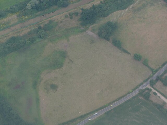
Lordswell Belt is a picturesque woodland area located in Suffolk, England. Situated near the village of Wood, it is often referred to as Lordswell Belt Forest due to its dense, lush vegetation and rich biodiversity. Spanning over several acres, this enchanting forest offers a tranquil escape from the hustle and bustle of everyday life.

The woodland is predominantly composed of deciduous trees, such as oaks, beeches, and birches, which create a beautiful canopy that provides shade during the summer months. The forest floor is covered in a thick carpet of moss, ferns, and wildflowers, adding to the area's natural charm.

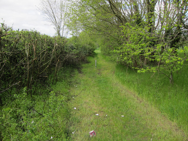
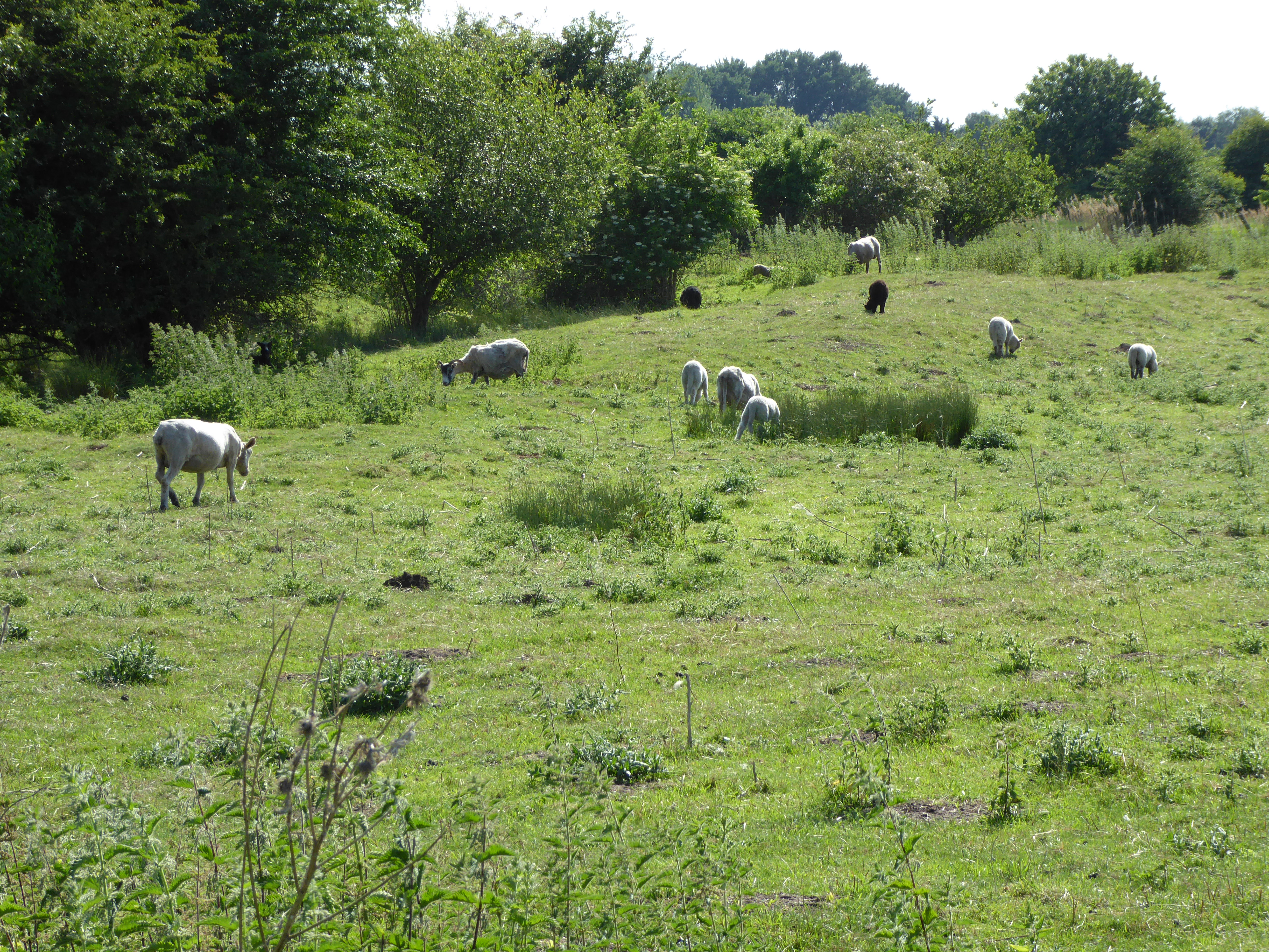
Lordswell Belt is home to a diverse range of wildlife, including various bird species, small mammals, and insects. Birdwatchers can spot species like woodpeckers, owls, and thrushes, while lucky visitors might catch a glimpse of elusive deer or foxes roaming through the trees. The forest also features a small stream that meanders through the woodland, providing a source of water for the wildlife and adding to the overall tranquility of the area.

The forest is a popular destination for nature enthusiasts, hikers, and photographers who appreciate the beauty of the great outdoors. Several well-marked trails crisscross the woodland, allowing visitors to explore its hidden gems and experience the peacefulness that only nature can provide.

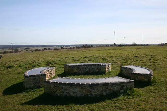
Overall, Lordswell Belt in Suffolk is a stunning forest that showcases the natural beauty of the English countryside. With its diverse flora and fauna, it offers a unique and peaceful experience for those seeking to immerse themselves in nature.

If you have any feedback on the listing, please let us know in the comments section below.

Lordswell Belt Images

Images are sourced within 2km of 52.393125/0.53543632 or Grid Reference TL7280. Thanks to Geograph Open Source API. All images are credited.

Fields south of Lakenheath: aerial 2022
R.A.F. Lakenheath: aerial 2022 (1) ...where the Air Traffic Controller always calls me Ma'am"!
R.A.F. Lakenheath: aerial 2022 (1)
...where the Air Traffic Controller always calls me Ma'am"!
R.A.F. Lakenheath: aerial 2022 (2) ...where the Air Traffic Controller always calls me Ma'am"!
R.A.F. Lakenheath: aerial 2022 (2)
...where the Air Traffic Controller always calls me Ma'am"!
Common Lane Bridleway to the Cut-off Channel.
Common Lane
Bridleway to the Cut-off Channel.
B1112 to Lakenheath Between Lakenheath Airfield and Lakenheath village.
B1112 to Lakenheath
Between Lakenheath Airfield and Lakenheath village.
Common Lane Bridleway to the Cut-off Channel, through some damp woodland.
Common Lane
Bridleway to the Cut-off Channel, through some damp woodland.
Footbridge over the Cut-off Channel
Footpath along Cut-off Channel The Cut-off channel is a drainage channel around the edge of the Fens.
Footpath along Cut-off Channel
The Cut-off channel is a drainage channel around the edge of the Fens.
Footpath along Cut-off Channel The Cut-off channel is a drainage channel around the edge of the Fens.
Footpath along Cut-off Channel
The Cut-off channel is a drainage channel around the edge of the Fens.
Cut-off Channel From the footbridge.
Cut-off Channel
From the footbridge.
Sika Deer in a ride Near the Cut-off Channel.
Sika Deer in a ride
Near the Cut-off Channel.
Bridleway near Cut-off Channel
High Fen Grassland by the Cut-off Channel, close to the edge of the Fens.
High Fen
Grassland by the Cut-off Channel, close to the edge of the Fens.
Eriswell Hall Originally a 15th century manor house but with many later modifications and additions. See <span class="nowrap"><a title="http://www.britishlistedbuildings.co.uk/en-275830-eriswell-hall-eriswell-suffolk" rel="nofollow ugc noopener" href="http://www.britishlistedbuildings.co.uk/en-275830-eriswell-hall-eriswell-suffolk">Link</a><img style="margin-left:2px;" alt="External link" title="External link - shift click to open in new window" src="https://s1.geograph.org.uk/img/external.png" width="10" height="10"/></span>
Eriswell Hall
Originally a 15th century manor house but with many later modifications and additions. See LinkExternal link
Footpath Junction Footpath junction near to Lakenheath, Suffolk.
Footpath Junction
Footpath junction near to Lakenheath, Suffolk.
Footbridge Footbridge across the cut off channel near to Lakenheath, Suffolk.
Footbridge
Footbridge across the cut off channel near to Lakenheath, Suffolk.
Cut Off Channel Looking north along the Cut off channel near to Lakenheath, Suffolk.
Cut Off Channel
Looking north along the Cut off channel near to Lakenheath, Suffolk.
Footpath Looking north along the footpath next to the Cut off channel near to Lakenheath, Suffolk.
Footpath
Looking north along the footpath next to the Cut off channel near to Lakenheath, Suffolk.
Show me another place!

Lordswell Belt is located at Grid Ref: TL7280 (Lat: 52.393125, Lng: 0.53543632)

Administrative County: Suffolk

District: West Suffolk

Police Authority: Suffolk

What 3 Words

///pancakes.spurned.porridge. Near Lakenheath, Suffolk

Related Wikis

Lordswell Field

Lordswell Field or Lord's Well Field is a 3.2-hectare (7.9-acre) biological Site of Special Scientific Interest in Eriswell in Suffolk. It is a Nature...

Eriswell Low Warren

Eriswell Low Warren is a 7.4-hectare (18-acre) biological Site of Special Scientific Interest north-east of Eriswell in Suffolk. It is a Nature Conservation...

Maidscross Hill

Maidscross Hill is a 44.8-hectare (111-acre) biological Site of Special Scientific Interest on the eastern outskirts of Lakenheath in Suffolk. It is a...

Wilde Street Meadow

Wilde Street Meadow is an 11.6-hectare (29-acre) biological Site of Special Scientific Interest between Lakenheath and Mildenhall in Suffolk, England.This...

RAF Lakenheath

Royal Air Force Lakenheath or RAF Lakenheath (IATA: LKZ, ICAO: EGUL) is a Royal Air Force station near the village of Lakenheath in Suffolk, England, UK...

Lakenheath

Lakenheath is a village and civil parish in the West Suffolk district of Suffolk in eastern England. It has a population of 4,691 according to the 2011...

RAF Lakenheath SSSI

RAF Lakenheath is a 111 hectare biological Site of Special Scientific Interest covering parts of RAF Lakenheath Royal Air Force base, east of Lakenheath...

Lackford Hundred

Lackford was a hundred of Suffolk, consisting of 83,712 acres (338.77 km2).The hundred fills the north western corner of Suffolk and is triangular in shape...

Nearby Amenities

Located within 500m of 52.393125,0.53543632
Power: pole
Lat/Long: 52.3908869/0.5304683
Power: pole
Lat/Long: 52.3961378/0.5317801
Power: pole
Lat/Long: 52.3915303/0.5321449
Power: pole
Lat/Long: 52.3923019/0.5318416
Power: pole
Lat/Long: 52.3932948/0.5315762
Power: pole
Lat/Long: 52.3910679/0.5305744
Crossing
Crossing: uncontrolled
Crossing Ref: zebra
Lat/Long: 52.3895676/0.5340651
Power: pole
Lat/Long: 52.3917922/0.5320161
Power: pole
Lat/Long: 52.3915383/0.5320146
Power: pole
Lat/Long: 52.3961345/0.5318659
Power: pole
Lat/Long: 52.3918789/0.5320175
Power: pole
Lat/Long: 52.3917881/0.5321314
Power: pole
Lat/Long: 52.3932932/0.531485
Power: pole
Lat/Long: 52.3923731/0.5319664
Power: pole
Lat/Long: 52.3918551/0.532185
Power: pole
Lat/Long: 52.3916612/0.5319236
Post Box
Collection Times: Mo-Fr 16:15; Sa 09:00
Post Box Mounting: pier
Post Box Type: lamp
Ref: IP27 3356
Royal Cypher: EIIR
Royal Cypher Wikidata: Q33102113
Lat/Long: 52.3897923/0.5305286
School
Lat/Long: 52.3929541/0.5369068
The data included in this document is from www.openstreetmap.org. The data is made available under ODbL.

Have you been to Lordswell Belt?

Leave your review of Lordswell Belt below (or comments, questions and feedback).