Winch Gorse

Wood, Forest in Norfolk King's Lynn and West Norfolk

England

Winch Gorse

Well Hall Lane, Ashwicken near King's Lynn
Well Hall Lane, Ashwicken near King's Lynn Credit: Richard Humphrey

Winch Gorse is a small but picturesque woodland located in Norfolk, England. Covering an area of approximately 20 acres, it is a notable site for nature enthusiasts and those seeking a peaceful retreat in the midst of nature. The woodland is predominantly composed of gorse bushes, which give it its distinctive name.

As visitors wander through the woodland, they are greeted by a diverse array of flora and fauna. The gorse bushes, with their vibrant yellow flowers, create a stunning sight during the spring and summer months. The woodland floor is adorned with a carpet of bluebells, adding a touch of color to the scene.

Winch Gorse is also home to a variety of wildlife. Birdwatchers will be delighted by the presence of numerous species, including woodpeckers, thrushes, and warblers. The woodland is also a haven for small mammals such as squirrels and voles, which can often be spotted scurrying through the undergrowth.

For those seeking an active outdoor experience, Winch Gorse offers several walking trails that wind through the woodland. These trails provide an opportunity to explore the natural beauty of the area while enjoying the tranquility of the surroundings. The peaceful atmosphere of Winch Gorse makes it an ideal location for those looking to escape the hustle and bustle of everyday life.

Overall, Winch Gorse is a charming woodland in Norfolk that offers visitors the chance to immerse themselves in nature. With its vibrant flora, diverse wildlife, and scenic trails, it is a destination that should not be missed by nature enthusiasts and anyone seeking a peaceful retreat.

If you have any feedback on the listing, please let us know in the comments section below.
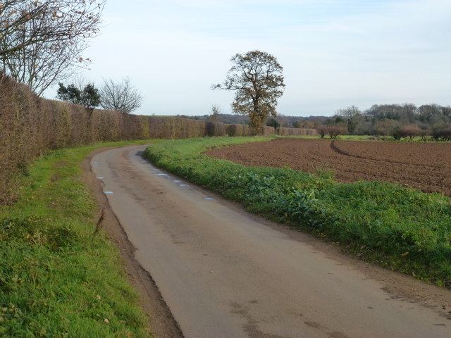
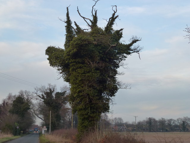
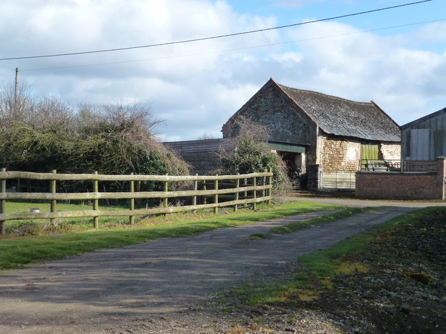
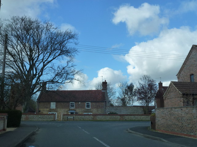
Winch Gorse Images

Images are sourced within 2km of 52.736723/0.55053772 or Grid Reference TF7218. Thanks to Geograph Open Source API. All images are credited.

Well Hall Lane, Ashwicken near King's Lynn
Narrow lane near Gayton in Norfolk
Gayton Hall Norfolk - southern boundary
Life after death in Gayton, Norfolk This dead tree on Winch Road south of the village forms a perfect framework for prolific ivy growth.
Life after death in Gayton, Norfolk
This dead tree on Winch Road south of the village forms a perfect framework for prolific ivy growth.
Entrance to Raes Farm south of Gayton
Wizard Cottage south of Gayton Is this Harry Potter's Norfolk holiday home?
Wizard Cottage south of Gayton
Is this Harry Potter's Norfolk holiday home?
House on Lynn Road, Gayton Opposite the junction with Winch Road
House on Lynn Road, Gayton
Opposite the junction with Winch Road
Inquisitive horse near Gayton Thorpe
Three shiny silos in the Norfolk sunshine Possibly something to do with free range pig farming. On the road between East Winch and East Walton
Three shiny silos in the Norfolk sunshine
Possibly something to do with free range pig farming. On the road between East Winch and East Walton
Straw stack near Walton Common, Norfolk
Gayton St. Nicholas' church The height of the tower is accentuated by the short buttresses, conical cap and the figures at each corner. On the north side is a blocked Tudor doorway. On the east face of the tower the line of the old thatched roof can be clearly seen and inside is yet another much lower line from before the clerestory was added. In the nave is a simple 14th c. octagonal font with quatrefoil designs on the bowl and shaft and close by is an old four wheeled bier. Tall 14th c. octagonal piers support the tie-beam and arch-braced roof and form the arcades of north and south aisles. Above the chancel arch is a blocked east window. Large painted panels of glass form the lovely 19th c. east window, above in the apex of the roof is a shield surmounted by a dove. Below is a piscina and sedilia beneath arches and square hood.
Gayton St. Nicholas' church
The height of the tower is accentuated by the short buttresses, conical cap and the figures at each corner. On the north side is a blocked Tudor doorway. On the east face of the tower the line of the old thatched roof can be clearly seen and inside is yet another much lower line from before the clerestory was added. In the nave is a simple 14th c. octagonal font with quatrefoil designs on the bowl and shaft and close by is an old four wheeled bier. Tall 14th c. octagonal piers support the tie-beam and arch-braced roof and form the arcades of north and south aisles. Above the chancel arch is a blocked east window. Large painted panels of glass form the lovely 19th c. east window, above in the apex of the roof is a shield surmounted by a dove. Below is a piscina and sedilia beneath arches and square hood.
The Rampant Horse pub (closed), Gayton The pub closed in 2012 and there are plans to convert the building into housing. There is currently a campaign by residents of Gayton to block this and to reopen it as a community pub. See <span class="nowrap"><a title="http://www.lynnnews.co.uk/news/local/latest-local-news/residents-launch-campaign-to-save-gayton-pub-from-housing-plan-1-6117504" rel="nofollow ugc noopener" href="http://www.lynnnews.co.uk/news/local/latest-local-news/residents-launch-campaign-to-save-gayton-pub-from-housing-plan-1-6117504">Link</a><img style="margin-left:2px;" alt="External link" title="External link - shift click to open in new window" src="https://s1.geograph.org.uk/img/external.png" width="10" height="10"/></span>
The Rampant Horse pub (closed), Gayton
The pub closed in 2012 and there are plans to convert the building into housing. There is currently a campaign by residents of Gayton to block this and to reopen it as a community pub. See LinkExternal link
Former chapel, Gayton The plaque on the gable reads "Primitive Methodist Chapel 1870". It is now converted to residential use and appears to be for sale at the moment.
Former chapel, Gayton
The plaque on the gable reads "Primitive Methodist Chapel 1870". It is now converted to residential use and appears to be for sale at the moment.
St Nicholas' church, Gayton (1) A C14 church, restored in 1850. The lower portions of the tower probably belong to an earlier structure.

The roof is currently undergoing repairs.
St Nicholas' church, Gayton (1)
A C14 church, restored in 1850. The lower portions of the tower probably belong to an earlier structure. The roof is currently undergoing repairs.
St Nicholas' church, Gayton (2) A C14 church, restored in 1850. The lower portions of the tower probably belong to an earlier structure.

The roof is currently undergoing repairs.
St Nicholas' church, Gayton (2)
A C14 church, restored in 1850. The lower portions of the tower probably belong to an earlier structure. The roof is currently undergoing repairs.
The Crown Inn, Gayton A brick and flint building dating from C18. See <span class="nowrap"><a title="http://www.britishlistedbuildings.co.uk/en-221957-the-crown-inn-gayton-norfolk" rel="nofollow ugc noopener" href="http://www.britishlistedbuildings.co.uk/en-221957-the-crown-inn-gayton-norfolk">Link</a><img style="margin-left:2px;" alt="External link" title="External link - shift click to open in new window" src="https://s1.geograph.org.uk/img/external.png" width="10" height="10"/></span>
The Crown Inn, Gayton
A brick and flint building dating from C18. See LinkExternal link
Gayton Mill Its British Listed Building entry describes it as "Mill with attached granary and bakehouse". See <span class="nowrap"><a title="http://www.britishlistedbuildings.co.uk/en-221955-the-mill-with-attached-granary-and-bakeh" rel="nofollow ugc noopener" href="http://www.britishlistedbuildings.co.uk/en-221955-the-mill-with-attached-granary-and-bakeh">Link</a><img style="margin-left:2px;" alt="External link" title="External link - shift click to open in new window" src="https://s1.geograph.org.uk/img/external.png" width="10" height="10"/></span>.

The earliest record showing a mill present on this site is Faden's Map of Norfolk (1797). This tower mill had been built by 1824 when  the first O.S. map was published.

The sails were removed in 1925 but it continued to operate as a mill until 1937. It was derelict until 1980 when it was sold and converted to residential use.
Gayton Mill
Its British Listed Building entry describes it as "Mill with attached granary and bakehouse". See LinkExternal link. The earliest record showing a mill present on this site is Faden's Map of Norfolk (1797). This tower mill had been built by 1824 when the first O.S. map was published. The sails were removed in 1925 but it continued to operate as a mill until 1937. It was derelict until 1980 when it was sold and converted to residential use.
Gayton Thorpe Common: aerial 2015
Show me another place!

Winch Gorse is located at Grid Ref: TF7218 (Lat: 52.736723, Lng: 0.55053772)

Administrative County: Norfolk

District: King's Lynn and West Norfolk

Police Authority: Norfolk

What 3 Words

///stag.response.revolting. Near Grimston, Norfolk

Nearby Locations

Winch Gorse

Related Wikis

Gayton, Norfolk

Gayton is a village and civil parish in the English county of Norfolk. The village is located 6 miles (9.7 km) east of King's Lynn and 32 miles (51 km...

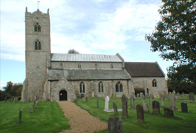
St Nicholas Church, Gayton

St Nicholas Church is a Church of England church located in Gayton, Norfolk. == Overview == The construction of the church building was completed in 1604...

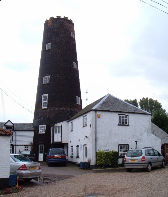
Gayton Windmill, Norfolk

For the Gayton Windmill now in Merseyside see Gayton Windmill, Cheshire Gayton Mill is a Grade II listed tower mill at Gayton, Norfolk, England which...

Gayton Thorpe Roman Villa

Gayton Thorpe Roman Villa is the site of a Roman villa, near Gayton Thorpe and about 5 miles (8 km) east of King's Lynn, in Norfolk, England. It was discovered...

Nearby Amenities

Located within 500m of 52.736723,0.55053772
Note: Way continues
Lat/Long: 52.7382059/0.5543153
Power: pole
Lat/Long: 52.73292/0.5475166
Power: pole
Lat/Long: 52.7340699/0.5478787
Power: pole
Transformer: distribution
Lat/Long: 52.7333212/0.5476454
Power: pole
Lat/Long: 52.7353676/0.5482972
Power: pole
Lat/Long: 52.7347017/0.5480853
Power: pole
Lat/Long: 52.7361926/0.5485547
Power: pole
Lat/Long: 52.7370403/0.5488363
Power: pole
Lat/Long: 52.7375357/0.5493271
Power: pole
Lat/Long: 52.7378897/0.5496624
Power: pole
Lat/Long: 52.7386123/0.5503598
Power: pole
Lat/Long: 52.7392798/0.5509981
Location Transition: yes
Power: pole
Lat/Long: 52.7401177/0.5506521
Give Way
Lat/Long: 52.740004/0.5499829
Give Way
Lat/Long: 52.7402078/0.5499762
The data included in this document is from www.openstreetmap.org. The data is made available under ODbL.

Have you been to Winch Gorse?

Leave your review of Winch Gorse below (or comments, questions and feedback).