Boughton Fen

Wood, Forest in Norfolk King's Lynn and West Norfolk

England

Boughton Fen

Bridleway close to the River Wissey, Stoke Ferry The River Wissey is marked by the trees on the right.
Bridleway close to the River Wissey, Stoke Ferry Credit: Jonathan Thacker

Boughton Fen, located in Norfolk, England, is a picturesque woodland area that boasts stunning natural beauty and rich biodiversity. Covering an area of approximately 400 acres, it is renowned for its diverse range of plant and animal species, making it a haven for nature enthusiasts and wildlife lovers.

The fen is primarily composed of wetland habitats, including marshes, reedbeds, and open water areas. These wetland environments provide a favorable breeding ground for a variety of bird species, such as reed warblers, bearded tits, and marsh harriers. The fen is also home to several rare and endangered species, including the fen orchid and the swallowtail butterfly.

The woodland within Boughton Fen is comprised of a mix of deciduous and coniferous trees, creating a diverse and vibrant ecosystem. Oak, birch, and willow trees dominate the landscape, providing shelter and food for a range of bird, mammal, and insect species. The forest floor is adorned with an array of wildflowers, including bluebells, primroses, and cowslips, adding to its enchanting allure.

In addition to its flora and fauna, Boughton Fen offers visitors a network of walking trails, allowing them to explore the area and immerse themselves in its natural splendor. The fen is also home to a visitor center, where individuals can learn more about the wildlife and conservation efforts taking place in the area.

Overall, Boughton Fen is a captivating destination that showcases the beauty of Norfolk's woodlands and wetlands. Its rich biodiversity and tranquil ambiance make it a must-visit location for nature enthusiasts seeking to reconnect with the natural world.

If you have any feedback on the listing, please let us know in the comments section below.

Boughton Fen Images

Images are sourced within 2km of 52.582343/0.53487564 or Grid Reference TF7101. Thanks to Geograph Open Source API. All images are credited.

Bridleway close to the River Wissey, Stoke Ferry The River Wissey is marked by the trees on the right.
Bridleway close to the River Wissey, Stoke Ferry
The River Wissey is marked by the trees on the right.
Cottages, High Street, Stoke Ferry
Park House, Stoke Ferry Dates from about 1770 <span class="nowrap"><a title="https://historicengland.org.uk/listing/the-list/list-entry/1170433?section=official-list-entry" rel="nofollow ugc noopener" href="https://historicengland.org.uk/listing/the-list/list-entry/1170433?section=official-list-entry">Link</a><img style="margin-left:2px;" alt="External link" title="External link - shift click to open in new window" src="https://s1.geograph.org.uk/img/external.png" width="10" height="10"/></span>
Park House, Stoke Ferry
Dates from about 1770 LinkExternal link
Former church of All Saints'. Stoke Ferry Largely dates from 1848 though of medieval origin <span class="nowrap"><a title="https://historicengland.org.uk/listing/the-list/list-entry/1077742?section=official-list-entry" rel="nofollow ugc noopener" href="https://historicengland.org.uk/listing/the-list/list-entry/1077742?section=official-list-entry">Link</a><img style="margin-left:2px;" alt="External link" title="External link - shift click to open in new window" src="https://s1.geograph.org.uk/img/external.png" width="10" height="10"/></span> Closed for worship in 2001; now in secular use.
Former church of All Saints'. Stoke Ferry
Largely dates from 1848 though of medieval origin LinkExternal link Closed for worship in 2001; now in secular use.
The Old Chemist's Shop, Stoke Ferry Dates from 1824 though the rear of the building is somewhat older <span class="nowrap"><a title="https://historicengland.org.uk/listing/the-list/list-entry/1077737?section=official-list-entry" rel="nofollow ugc noopener" href="https://historicengland.org.uk/listing/the-list/list-entry/1077737?section=official-list-entry">Link</a><img style="margin-left:2px;" alt="External link" title="External link - shift click to open in new window" src="https://s1.geograph.org.uk/img/external.png" width="10" height="10"/></span>
The Old Chemist's Shop, Stoke Ferry
Dates from 1824 though the rear of the building is somewhat older LinkExternal link
The Corner Shop, Stoke Ferry
The Old Granary, Stoke Ferry Now in domestic use <span class="nowrap"><a title="https://historicengland.org.uk/listing/the-list/list-entry/1077779?section=official-list-entry" rel="nofollow ugc noopener" href="https://historicengland.org.uk/listing/the-list/list-entry/1077779?section=official-list-entry">Link</a><img style="margin-left:2px;" alt="External link" title="External link - shift click to open in new window" src="https://s1.geograph.org.uk/img/external.png" width="10" height="10"/></span>
The Old Granary, Stoke Ferry
Now in domestic use LinkExternal link
Former miller's house, Stoke Ferry Dates to the mid eighteenth century <span class="nowrap"><a title="https://historicengland.org.uk/listing/the-list/list-entry/1077778?section=official-list-entry" rel="nofollow ugc noopener" href="https://historicengland.org.uk/listing/the-list/list-entry/1077778?section=official-list-entry">Link</a><img style="margin-left:2px;" alt="External link" title="External link - shift click to open in new window" src="https://s1.geograph.org.uk/img/external.png" width="10" height="10"/></span>
Former miller's house, Stoke Ferry
Dates to the mid eighteenth century LinkExternal link
High Street, Stoke Ferry
Cobbles, Stoke Ferry Eighteenth century house now used as offices <span class="nowrap"><a title="https://historicengland.org.uk/listing/the-list/list-entry/1077745?section=official-list-entry" rel="nofollow ugc noopener" href="https://historicengland.org.uk/listing/the-list/list-entry/1077745?section=official-list-entry">Link</a><img style="margin-left:2px;" alt="External link" title="External link - shift click to open in new window" src="https://s1.geograph.org.uk/img/external.png" width="10" height="10"/></span>
Cobbles, Stoke Ferry
Eighteenth century house now used as offices LinkExternal link
All Saints' Lodge, Stoke Ferry All Saints' Lodge dates to the sixteenth century <span class="nowrap"><a title="https://historicengland.org.uk/listing/the-list/list-entry/1077739?section=official-list-entry" rel="nofollow ugc noopener" href="https://historicengland.org.uk/listing/the-list/list-entry/1077739?section=official-list-entry">Link</a><img style="margin-left:2px;" alt="External link" title="External link - shift click to open in new window" src="https://s1.geograph.org.uk/img/external.png" width="10" height="10"/></span>
All Saints' Lodge, Stoke Ferry
All Saints' Lodge dates to the sixteenth century LinkExternal link
Crown House, Stoke Ferry Dates to the sixteenth century but with a nineteenth century facade <span class="nowrap"><a title="https://historicengland.org.uk/listing/the-list/list-entry/1077743?section=official-list-entry" rel="nofollow ugc noopener" href="https://historicengland.org.uk/listing/the-list/list-entry/1077743?section=official-list-entry">Link</a><img style="margin-left:2px;" alt="External link" title="External link - shift click to open in new window" src="https://s1.geograph.org.uk/img/external.png" width="10" height="10"/></span>
Crown House, Stoke Ferry
Dates to the sixteenth century but with a nineteenth century facade LinkExternal link
The River Wissey near Stoke Ferry
Bridleway to Stringside Drove
Boats on the River Wissey
Bridleway to Stringside Drove
Excavating a new pond
Garden by the River Wissey near Stoke Ferry
Show me another place!

Boughton Fen is located at Grid Ref: TF7101 (Lat: 52.582343, Lng: 0.53487564)

Administrative County: Norfolk

District: King's Lynn and West Norfolk

Police Authority: Norfolk

What 3 Words

///outlooks.locker.balance. Near Stoke Ferry, Norfolk

Nearby Locations

Boughton Fen

Related Wikis

Boughton Fen

Boughton Fen is a 15.7-hectare (39-acre) biological Site of Special Scientific Interest east of Downham Market in Norfolk. it is common land registered...
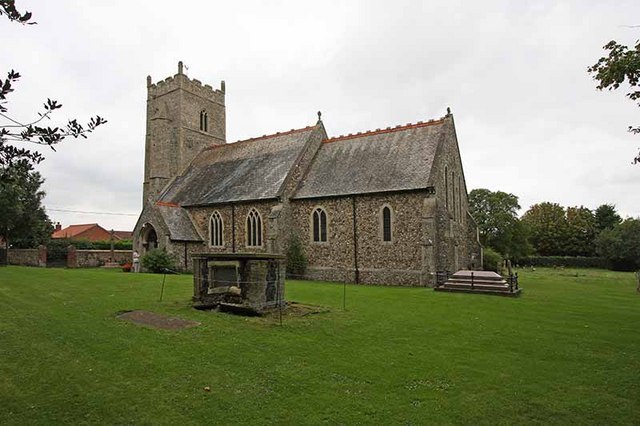
Boughton, Norfolk

Boughton is a village and a civil parish in the English county of Norfolk. The village is 44.4 miles (71.5 km) west of Norwich, 15.1 miles (24.3 km) south...

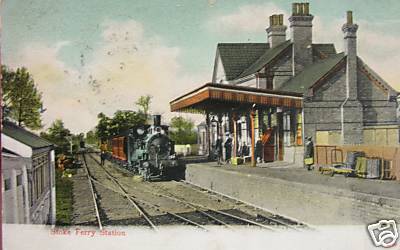
Stoke Ferry railway station

Stoke Ferry is a closed railway station in Norfolk. It was the terminus of a 7ΒΌ mile branch line from Denver which opened on 1 August 1882 and finally...
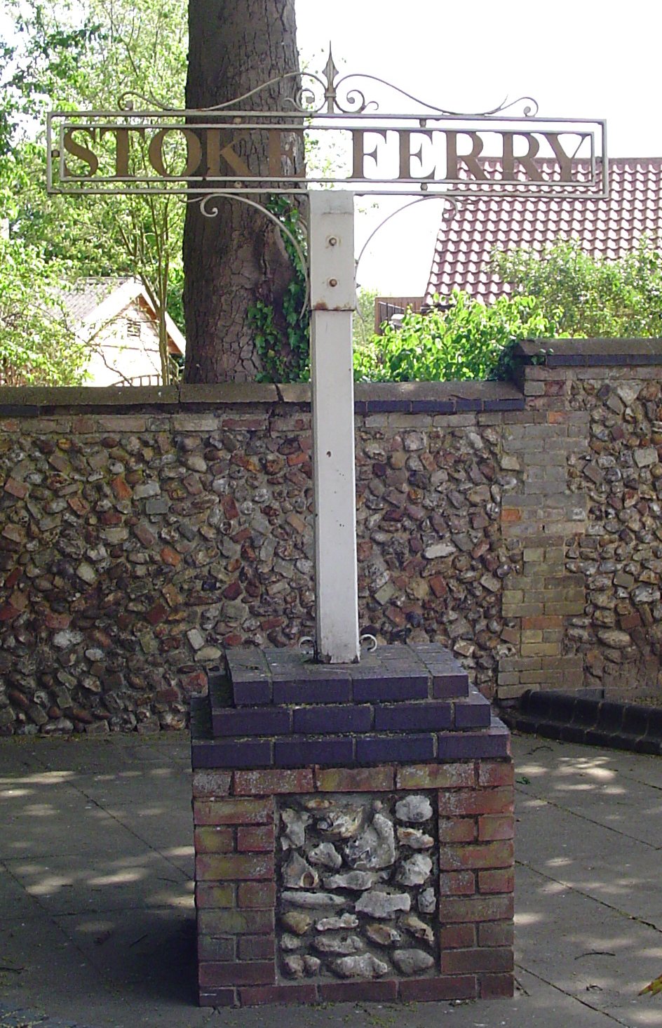
Stoke Ferry

Stoke Ferry is a village and civil parish in the English county of Norfolk, 6.5 miles southeast of Downham Market. The village lies on the River Wissey...

Nearby Amenities

Located within 500m of 52.582343,0.53487564
Fixme: incomplete
Lat/Long: 52.5808779/0.5329737
Fixme: incomplete
Lat/Long: 52.5843627/0.5372563
Fixme: incomplete
Lat/Long: 52.5806392/0.5329118
Give Way
Lat/Long: 52.5808958/0.5316866
Give Way
Lat/Long: 52.5807805/0.5315384
Give Way
Lat/Long: 52.5808217/0.531759
Power: pole
Lat/Long: 52.5838008/0.53567
Power: pole
Lat/Long: 52.5831342/0.5367335
Power: pole
Lat/Long: 52.5826066/0.5375616
Power: pole
Lat/Long: 52.5820407/0.5384501
Power: pole
Lat/Long: 52.5815363/0.539238
Power: pole
Lat/Long: 52.5809108/0.5402344
Power: pole
Lat/Long: 52.5803131/0.5411712
The data included in this document is from www.openstreetmap.org. The data is made available under ODbL.

Have you been to Boughton Fen?

Leave your review of Boughton Fen below (or comments, questions and feedback).