Fernie

Settlement in Fife

Scotland

Fernie

Pathcondie from Monimail Looking north-westwards up the hill from Monimail towards Pathcondie.
Pathcondie from Monimail Credit: Scott Cormie

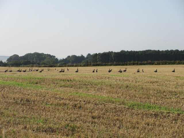
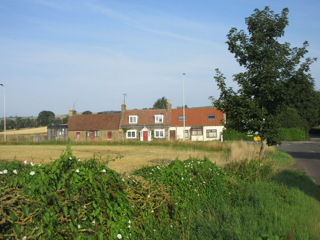
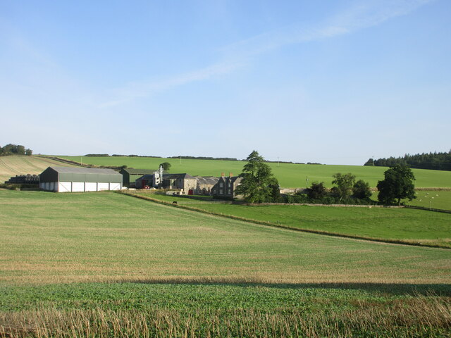
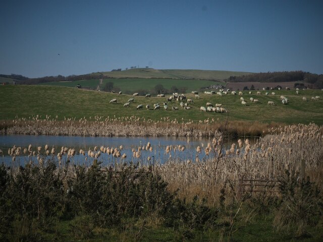
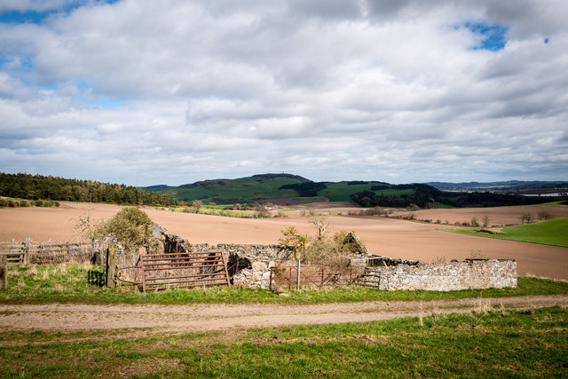
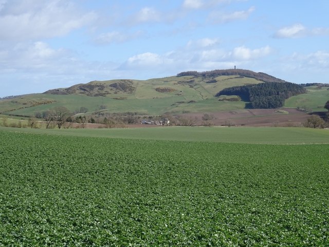
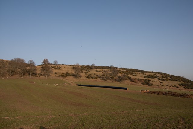
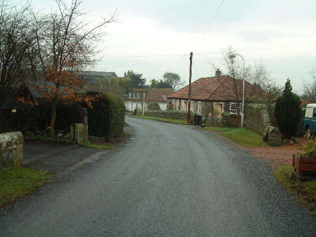
Fernie is a small village located in the historic county of Fife, Scotland. Situated about 10 miles southwest of Cupar, the village is nestled in the picturesque countryside, surrounded by green fields and rolling hills. With a population of around 200 people, Fernie exudes a tranquil and rural ambiance.

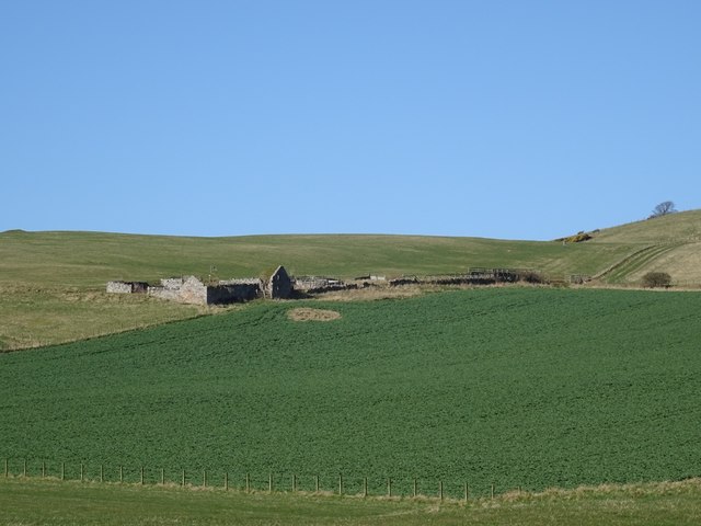
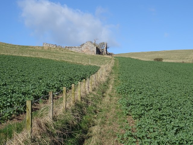
The village is known for its charming traditional architecture, with many of the houses dating back several centuries. The center of Fernie features a cluster of stone-built cottages, giving it a timeless and idyllic feel. The surrounding landscape offers breathtaking views, making it a popular destination for nature lovers and hikers.

Fernie boasts a strong sense of community, with various social events and activities bringing residents together. The village hall serves as a hub for gatherings, hosting a range of events throughout the year. Additionally, the local primary school plays a vital role in the community, providing education to children from Fernie and the surrounding areas.

While Fernie may be small in size, it benefits from its proximity to larger towns and cities. Cupar, with its wider range of amenities and services, is easily accessible, ensuring that residents have convenient access to shops, healthcare facilities, and recreational opportunities.

Overall, Fernie offers a peaceful and close-knit community, picturesque surroundings, and a convenient location for those seeking a tranquil rural lifestyle while still being within reach of urban amenities.

If you have any feedback on the listing, please let us know in the comments section below.

Fernie Images

Images are sourced within 2km of 56.322344/-3.117232 or Grid Reference NO3115. Thanks to Geograph Open Source API. All images are credited.

Pathcondie from Monimail Looking north-westwards up the hill from Monimail towards Pathcondie.
Pathcondie from Monimail
Looking north-westwards up the hill from Monimail towards Pathcondie.
Geese in a stubble field Geese in a stubble field to the south of the Letham to Bow of Fife road.
Geese in a stubble field
Geese in a stubble field to the south of the Letham to Bow of Fife road.
Letham Toll Letham Toll on the A92, viewed from the minor road to the south-east.
Letham Toll
Letham Toll on the A92, viewed from the minor road to the south-east.
Nisbetfield from the south Looking north from Monimail up the hill to Nisbetfield.
Nisbetfield from the south
Looking north from Monimail up the hill to Nisbetfield.
Small loch on site of disused Fife quarry A series of small lochs have been created on the site of Mountcastle sand and gravel quarry. Now a haven for birds, with lochans to the SW of the site in the process of being turned into Eden Springs Fishery (planning permission under appeal). This loch is closest to existing Letham Ponds - view towards Monimail.
Small loch on site of disused Fife quarry
A series of small lochs have been created on the site of Mountcastle sand and gravel quarry. Now a haven for birds, with lochans to the SW of the site in the process of being turned into Eden Springs Fishery (planning permission under appeal). This loch is closest to existing Letham Ponds - view towards Monimail.
Loch on site of disused quarry surrounded by farmland Eastern edge of one of several small lochs created on the site of Mountcastle quarry, near Letham, perfect for reed bunting and water birds.
Loch on site of disused quarry surrounded by farmland
Eastern edge of one of several small lochs created on the site of Mountcastle quarry, near Letham, perfect for reed bunting and water birds.
Abandoned farm at Gowdie Wonderful views to the south and east, with Hopetown monument just visible on the skyline
Abandoned farm at Gowdie
Wonderful views to the south and east, with Hopetown monument just visible on the skyline
Collairniehill farm ruin
Gowdie A ruined farm above Letham. The grass above is grazed by cattle in the Summer months, the dark green is oilseed rape which had just started its Spring growth spurt.
Gowdie
A ruined farm above Letham. The grass above is grazed by cattle in the Summer months, the dark green is oilseed rape which had just started its Spring growth spurt.
Gowdie A ruined farm above Letham.
Gowdie
A ruined farm above Letham.
Oilseed rape, Gowdie Arable land above Letham with a view towards Mount Hill.
Oilseed rape, Gowdie
Arable land above Letham with a view towards Mount Hill.
Ruin, Gowdie East gable end of the farmhouse. I passed by quickly, it looks like a deep breath is all that is needed to bring it down. The stonework is interesting, undressed stone, probably cleared off the fields. The igneous rock of the Ochil Hills is not far beneath the surface here.
Ruin, Gowdie
East gable end of the farmhouse. I passed by quickly, it looks like a deep breath is all that is needed to bring it down. The stonework is interesting, undressed stone, probably cleared off the fields. The igneous rock of the Ochil Hills is not far beneath the surface here.
Hill above Gowdie A 198m summit with mobile mast. I cannot find the name of the hill, but I would bet Gowdie features in it. Did not hang about, I got the headache you used to get with early mobile telephones.  There is evidence that the summit area was once wooded and there are some surviving trees here. Other than the microwaves, a rather lovely place.
Hill above Gowdie
A 198m summit with mobile mast. I cannot find the name of the hill, but I would bet Gowdie features in it. Did not hang about, I got the headache you used to get with early mobile telephones. There is evidence that the summit area was once wooded and there are some surviving trees here. Other than the microwaves, a rather lovely place.
View towards Dunbog Hill A field of sheep, the only livestock I saw today, although in Summer there are always a lot of cattle up here. The pale object in the dip is a combine. There are about seven people walking across the far slope, the sheep were not too bothered.
View towards Dunbog Hill
A field of sheep, the only livestock I saw today, although in Summer there are always a lot of cattle up here. The pale object in the dip is a combine. There are about seven people walking across the far slope, the sheep were not too bothered.
Hills behind Letham Over the back from Gowdie overlooking a mixed landscape of arable land, small woods and open grazing with a lot of whins growing, especially on Collairnie Hill, my destination. There is a big clearance cairn in the newly ploughed field. Gorse grows well on basalt uplands, especially where there snow drifts tend to form. The distant hill is Norman's Law and the scenery there is similar to here. They may not be high, but Fife's bit of the Ochils is very rewarding.
Hills behind Letham
Over the back from Gowdie overlooking a mixed landscape of arable land, small woods and open grazing with a lot of whins growing, especially on Collairnie Hill, my destination. There is a big clearance cairn in the newly ploughed field. Gorse grows well on basalt uplands, especially where there snow drifts tend to form. The distant hill is Norman's Law and the scenery there is similar to here. They may not be high, but Fife's bit of the Ochils is very rewarding.
View towards Collairniehill The ruin of Collairniehill lies beneath gorse covered Collairnie Hill. The distant view is past Norman's Law to Craigowl Hill in the Sidlaws, past Dundee.
View towards Collairniehill
The ruin of Collairniehill lies beneath gorse covered Collairnie Hill. The distant view is past Norman's Law to Craigowl Hill in the Sidlaws, past Dundee.
Cunnoquhie West Hill Wood The track runs along the northern and western end of the wood and is very useful for dodging fences and crops. A continuation carries on to the ruins at Gowdie.  There is more woodland on Cunnoquhie West Hill  than currently mapped.
Cunnoquhie West Hill Wood
The track runs along the northern and western end of the wood and is very useful for dodging fences and crops. A continuation carries on to the ruins at Gowdie. There is more woodland on Cunnoquhie West Hill than currently mapped.
Cunnoquhie West Hill Although this hill is not named on the OS map, the woodland east of it is named as Cunnoquhie West Hill Wood (confusingly, and as opposed to Cunnoquhie East Hill Wood). I have therefore chosen to call it Connoquhie West Hill, but am prepared to be corrected!
Cunnoquhie West Hill
Although this hill is not named on the OS map, the woodland east of it is named as Cunnoquhie West Hill Wood (confusingly, and as opposed to Cunnoquhie East Hill Wood). I have therefore chosen to call it Connoquhie West Hill, but am prepared to be corrected!
Show me another place!

Fernie is located at Grid Ref: NO3115 (Lat: 56.322344, Lng: -3.117232)

Unitary Authority: Fife

Police Authority: Fife

What 3 Words

///nation.crazy.breaches. Near Ladybank, Fife

Related Wikis

Secret Garden (outdoor nursery)

The Secret Garden is an outdoor nursery school in Letham, Fife, Scotland, for children aged 3–7 years. It is a forest kindergarten in which children walk...

Letham, Fife

Letham is a small village in Fife, Scotland, located just off the A92, around 5 miles from Cupar. According to the 2001 Census, Letham has 138 residents...
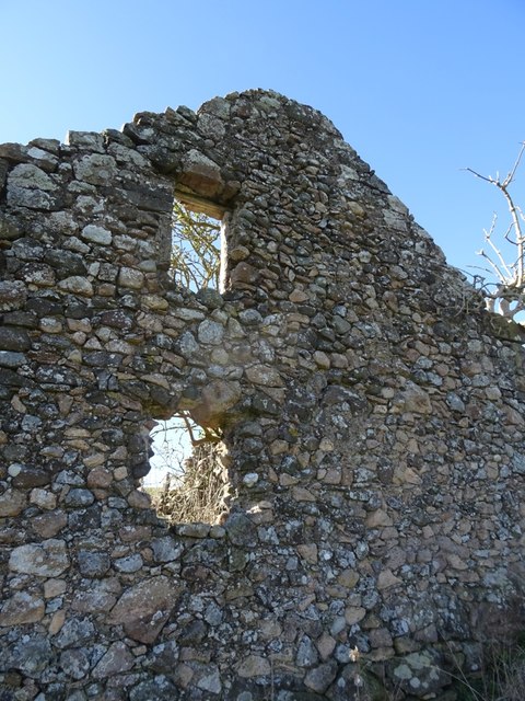
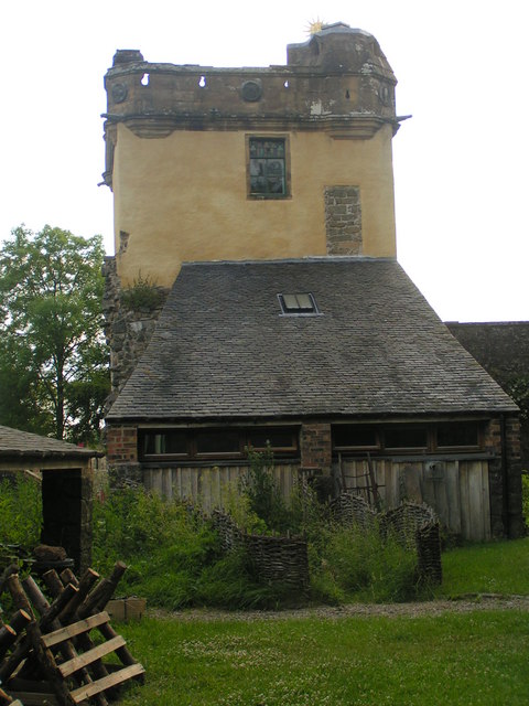
Fernie Castle

Fernie Castle is an enlarged sixteenth-century tower house in north-east Fife, Scotland. Originally built in an L-plan layout, it was later extended to...

Palace of Monimail

The Palace of Monimail, also known as Monimail Tower, was a Renaissance palace in Fife, Scotland. A residence of the Archbishops of St Andrews from the...

Melville House

Melville House is a 1697 house that lies to the south side of the Palace of Monimail near Collessie in Fife, Scotland. It has been a school and a training...

Collairnie Castle

Collairnie Castle is an L-plan castle in Dunbog, Fife, Scotland. The castle was extended in the 16th century, with a wing added of 4 storeys with an attic...

Dunbog

Dunbog is a parish in the county of Fife in Scotland which is now (since 1983) united with the neighbouring parish of Abdie, Dunbog kirk closing at that...
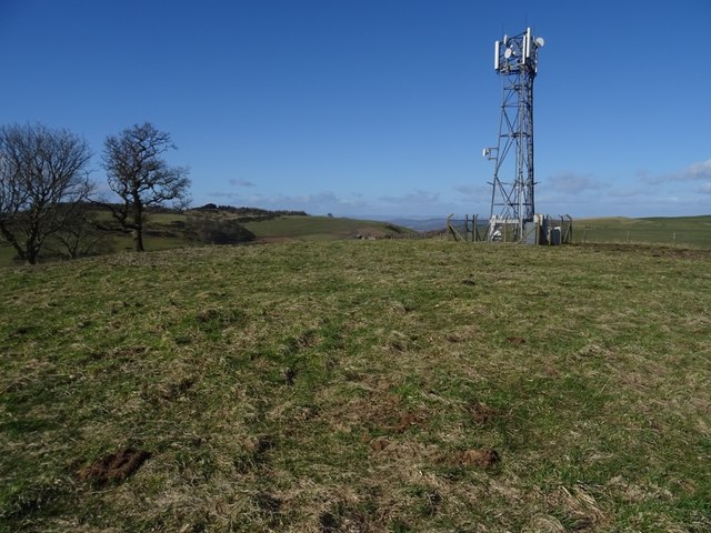
Mount Hill

Mount Hill rises from the rolling farmland about three miles north west of Cupar in North East Fife, Scotland. On its summit stands the 29-metre (95 ft...

Nearby Amenities

Located within 500m of 56.322344,-3.117232
Power: pole
Lat/Long: 56.3181743/-3.1149923
Power: pole
Lat/Long: 56.318366/-3.1160475
Power: pole
Lat/Long: 56.3186425/-3.117583
Power: pole
Lat/Long: 56.318921/-3.119064
Power: pole
Lat/Long: 56.319147/-3.1203484
Power: pole
Lat/Long: 56.3194093/-3.1217093
Power: pole
Lat/Long: 56.3196514/-3.1229865
Power: pole
Lat/Long: 56.3185435/-3.1158067
Power: pole
Lat/Long: 56.3191193/-3.1152152
Power: pole
Lat/Long: 56.3197077/-3.1146071
Power: pole
Lat/Long: 56.3205198/-3.1150063
Power: pole
Lat/Long: 56.321091/-3.1152545
Power: pole
Lat/Long: 56.3216943/-3.1155068
Power: pole
Lat/Long: 56.3221829/-3.1157281
Power: pole
Lat/Long: 56.323191/-3.1163031
Power: pole
Lat/Long: 56.3237324/-3.1165472
Power: pole
Lat/Long: 56.3242462/-3.1167685
Power: pole
Lat/Long: 56.3247978/-3.1171491
Power: pole
Lat/Long: 56.3253919/-3.1177903
Power: pole
Lat/Long: 56.3261258/-3.1184459
Power: pole
Lat/Long: 56.3197559/-3.1144375
Power: pole
Lat/Long: 56.3200449/-3.1133764
Power: pole
Lat/Long: 56.3203603/-3.112245
Power: pole
Lat/Long: 56.3206689/-3.1111219
Power: pole
Lat/Long: 56.3209946/-3.1099347
Power: pole
Lat/Long: 56.3210531/-3.1097113
Power: pole
Lat/Long: 56.3211024/-3.1095479
The data included in this document is from www.openstreetmap.org. The data is made available under ODbL.

Have you been to Fernie?

Leave your review of Fernie below (or comments, questions and feedback).