Fenton

Settlement in Lincolnshire South Kesteven

England

Fenton

Stubble field and Stanger's Plantation
Stubble field and Stanger's Plantation Credit: Jonathan Thacker

Fenton is a small village located in the county of Lincolnshire, in the East Midlands region of England. Situated approximately 7 miles west of the city of Lincoln, Fenton is a rural settlement surrounded by picturesque countryside.

The village is known for its tranquil and idyllic setting, characterized by rolling hills, green fields, and quaint cottages. It has a small population, with only a few hundred residents, adding to its peaceful atmosphere.

Fenton boasts a rich history, with evidence of human habitation in the area dating back to the Roman times. The village is home to St. Botolph's Church, a Grade II listed building that dates back to the 12th century. The church's stunning architecture and beautiful stained glass windows attract visitors from near and far.

Fenton is primarily an agricultural community, with farming playing a significant role in the local economy. The village is surrounded by farmland where crops like wheat, barley, and rapeseed are cultivated.

Despite its small size, Fenton offers a close-knit community feel, with a village hall serving as a hub for social events and gatherings. The village also has a local pub, providing a traditional meeting place for residents and visitors alike.

The peacefulness and natural beauty of Fenton make it an ideal destination for those seeking a tranquil retreat away from the hustle and bustle of urban life.

If you have any feedback on the listing, please let us know in the comments section below.

Fenton Images

Images are sourced within 2km of 53.047598/-0.68851735 or Grid Reference SK8850. Thanks to Geograph Open Source API. All images are credited.

Stubble field and Stanger's Plantation
Footpath to Stubton Gorse
Public footpath near Stubton This farm road goes to a private airstrip running left to right on the horizon. The footpath goes to Fenton.
Public footpath near Stubton
This farm road goes to a private airstrip running left to right on the horizon. The footpath goes to Fenton.
Lake at Gorse Lodge, near Stubton Gorse Lodge is actually in <a href="https://www.geograph.org.uk/gridref/SK8849">SK8849</a> but the majority of this lake, the field beyond and the woodland, Stubton Gorse are in the featured square. There is a clay pigeon shooting ground here.
Lake at Gorse Lodge, near Stubton
Gorse Lodge is actually in SK8849 but the majority of this lake, the field beyond and the woodland, Stubton Gorse are in the featured square. There is a clay pigeon shooting ground here.
Ploughed field at Gorse Lodge
Stubton Hall Stubton Hall from Brandon Road, former school, now a wedding venue <span class="nowrap"><a title="http://www.stubtonhall.co.uk/" rel="nofollow ugc noopener" href="http://www.stubtonhall.co.uk/">Link</a><img style="margin-left:2px;" alt="External link" title="External link - shift click to open in new window" src="https://s1.geograph.org.uk/img/external.png" width="10" height="10"/></span>
Stubton Hall
Stubton Hall from Brandon Road, former school, now a wedding venue LinkExternal link
Stubton Hall Country House built 1813-14 by Sir Jeffry Wyatville, later enhanced as a private school, now an hotel <span class="nowrap"><a title="http://www.stubtonhall.co.uk/" rel="nofollow ugc noopener" href="http://www.stubtonhall.co.uk/">Link</a><img style="margin-left:2px;" alt="External link" title="External link - shift click to open in new window" src="https://s1.geograph.org.uk/img/external.png" width="10" height="10"/></span>
Stubton Hall
Country House built 1813-14 by Sir Jeffry Wyatville, later enhanced as a private school, now an hotel LinkExternal link
Entrance to Stubton Hill Farm
Footpath to Stubton Gorse
Track to Stubton Gorse
View towards Stubton Gorse
Farm track near Stubton
Moor Farm Cottages
Moor Farm Cottages
Moor Farm, Stubton
Moor Farm, Stubton
Fenton Road Leaving Stubton towards Fenton, with curious different coloured spheres on the power lines
Fenton Road
Leaving Stubton towards Fenton, with curious different coloured spheres on the power lines
Stubble field and Stanger's Plantation
Sown field near Stubton Fenton Boundary Plantation on the right.
Sown field near Stubton
Fenton Boundary Plantation on the right.
Bridleway to Stubton Gorse
Show me another place!

Fenton is located at Grid Ref: SK8850 (Lat: 53.047598, Lng: -0.68851735)

Division: Parts of Kesteven

Administrative County: Lincolnshire

District: South Kesteven

Police Authority: Lincolnshire

What 3 Words

///elevator.irony.educates. Near Claypole, Lincolnshire

Nearby Locations

Fenton

Related Wikis

Fenton, South Kesteven

Fenton is a village in the South Kesteven district of Lincolnshire, England. It is situated 14 miles (23 km) south-west from the city and county town of...
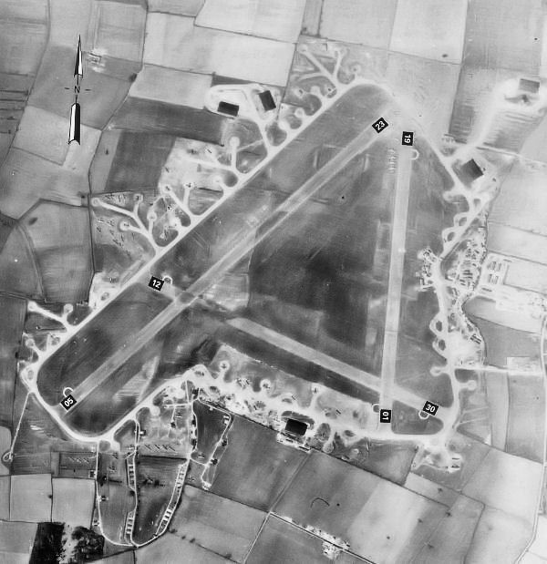
RAF Fulbeck

Royal Air Force Fulbeck or more simply RAF Fulbeck is a former Royal Air Force station located 6.3 miles (10.1 km) east of Newark-on-Trent, Nottinghamshire...

Stubton

Stubton is a small village and civil parish in the South Kesteven district of Lincolnshire, England. The population of the civil parish (including Fenton...

All Saints' Church, Barnby in the Willows

All Saints' Church, Barnby in the Willows, is a Grade I listed parish church in the Church of England in Barnby in the Willows. == History == The church...

Nearby Amenities

Located within 500m of 53.047598,-0.68851735
Fenton
Is In: Lincolnshire, England, UK
Place: hamlet
Source: Survey
Lat/Long: 53.0472768/-0.689016
Bus Stop
Telephone Box
Naptan AtcoCode: 270002700442
Naptan Bearing: NE
Naptan CommonName: Telephone Box
Naptan Indicator: adj
Naptan Landmark: Telephone Box
Naptan NaptanCode: linagpta
Naptan Street: Main Street
Naptan Verified: no
Source: naptan_import
Lat/Long: 53.0472531/-0.6892626
Bus Stop
Telephone Box
Naptan AtcoCode: 2700LFTB0559
Naptan Bearing: SW
Naptan CommonName: Telephone Box
Naptan Indicator: opp
Naptan Landmark: Telephone Box
Naptan NaptanCode: linadwga
Naptan Street: Main Street
Naptan Verified: no
Source: naptan_import
Lat/Long: 53.0471983/-0.6891897
Post Box
Ele: 17.9
Post Box Mounting: pier
Post Box Type: lamp
Ref: NG23 39
Royal Cypher: EIIR
Lat/Long: 53.0472254/-0.6891225
Booth: K6
Ele: 17.9101563
Removed Amenity: telephone
Lat/Long: 53.0472295/-0.6891111
Ele: 17.9101563
Information: board
Tourism: information
Lat/Long: 53.047244/-0.689095
The Grange
Place: farm
Source: Bing
Lat/Long: 53.0455989/-0.6906479
Generator Method: photovoltaic
Generator Output Electricity: yes
Generator Source: solar
Generator Type: solar_photovoltaic_panel
Location: roof
Power: generator
Lat/Long: 53.0485028/-0.687347
Generator Method: photovoltaic
Generator Output Electricity: yes
Generator Source: solar
Generator Type: solar_photovoltaic_panel
Location: roof
Power: generator
Lat/Long: 53.0489465/-0.6889872
Generator Method: photovoltaic
Generator Output Electricity: yes
Generator Source: solar
Generator Type: solar_photovoltaic_panel
Location: roof
Power: generator
Lat/Long: 53.0474163/-0.6876246
Generator Method: photovoltaic
Generator Output Electricity: yes
Generator Source: solar
Generator Type: solar_photovoltaic_panel
Location: roof
Power: generator
Lat/Long: 53.0468004/-0.6898857
Generator Method: photovoltaic
Generator Output Electricity: yes
Generator Source: solar
Generator Type: solar_photovoltaic_panel
Location: roof
Power: generator
Lat/Long: 53.0456233/-0.6909452
Generator Method: photovoltaic
Generator Output Electricity: yes
Generator Source: solar
Generator Type: solar_photovoltaic_panel
Location: roof
Power: generator
Lat/Long: 53.0463424/-0.6888236
Generator Method: photovoltaic
Generator Output Electricity: yes
Generator Source: solar
Generator Type: solar_photovoltaic_panel
Location: roof
Power: generator
Lat/Long: 53.046128/-0.6881047
Generator Method: photovoltaic
Generator Output Electricity: yes
Generator Source: solar
Generator Type: solar_photovoltaic_panel
Location: roof
Power: generator
Lat/Long: 53.0460957/-0.6882254
Generator Method: photovoltaic
Generator Output Electricity: yes
Generator Source: solar
Generator Type: solar_photovoltaic_panel
Location: roof
Power: generator
Lat/Long: 53.047476/-0.6868012
Generator Method: photovoltaic
Generator Output Electricity: yes
Generator Source: solar
Generator Type: solar_photovoltaic_panel
Location: roof
Power: generator
Lat/Long: 53.0477275/-0.6866939
The data included in this document is from www.openstreetmap.org. The data is made available under ODbL.

Have you been to Fenton?

Leave your review of Fenton below (or comments, questions and feedback).