Ladymeads Wood

Wood, Forest in Sussex Wealden

England

Ladymeads Wood

Foxhole Barn Oast, Foxhole Lane, Wadhurst, East Sussex Three round kiln oast house.
Foxhole Barn Oast, Foxhole Lane, Wadhurst, East Sussex Credit: Oast House Archive

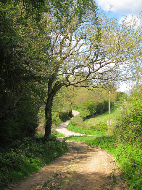
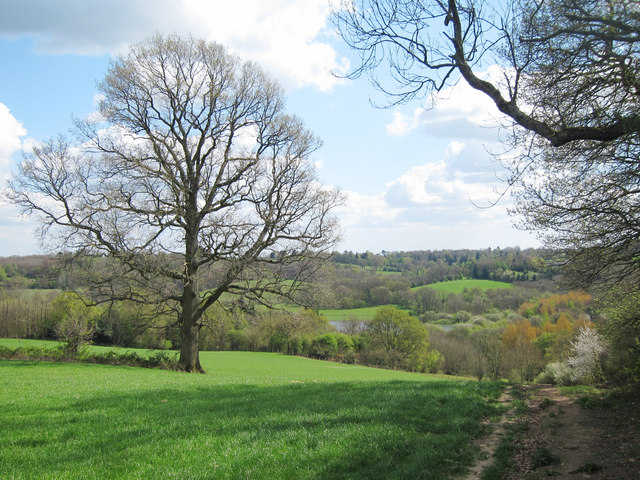
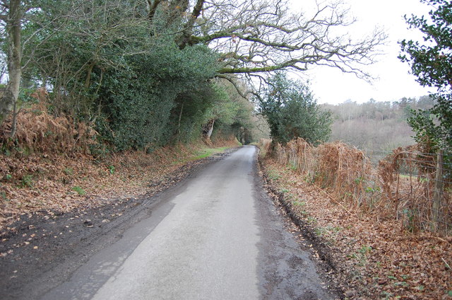
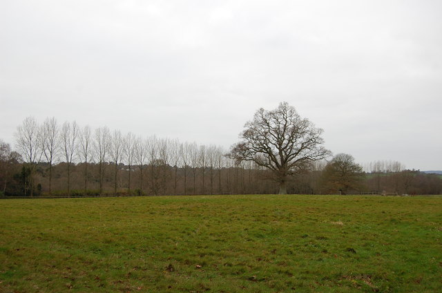
Ladymeads Wood, located in Sussex, England, is a picturesque woodland area that covers approximately 50 acres. The wood is a designated Site of Special Scientific Interest due to its rich biodiversity and historical significance. It is managed by a local conservation organization in collaboration with the Forestry Commission.

The wood is predominantly composed of broadleaf trees, including oak, beech, and birch, which create a dense canopy that provides a habitat for a diverse range of flora and fauna. Bluebells, wood anemones, and wild garlic carpet the forest floor during spring, creating a vibrant and enchanting atmosphere.

Ladymeads Wood is home to a variety of wildlife, including several species of birds such as woodpeckers and tawny owls. It also supports a population of small mammals like squirrels, badgers, and foxes. The wood's diverse ecosystem attracts many nature enthusiasts, birdwatchers, and photographers who visit the area to observe the wildlife and capture its natural beauty.

The wood has a network of well-maintained footpaths and trails, which allow visitors to explore the area and enjoy peaceful walks surrounded by nature. There are also several picnic spots scattered throughout the wood, providing a tranquil setting for visitors to relax and appreciate the natural surroundings.

Additionally, Ladymeads Wood has historical significance, with remnants of an Iron Age hill fort located on its eastern edge. These ancient earthworks are a testament to the wood's long-standing presence in the landscape and add an extra layer of intrigue to the area's appeal.

Overall, Ladymeads Wood is a haven of tranquility, biodiversity, and historical significance, attracting visitors from near and far who seek an escape into nature.

If you have any feedback on the listing, please let us know in the comments section below.

Ladymeads Wood Images

Images are sourced within 2km of 51.07556/0.36278907 or Grid Reference TQ6533. Thanks to Geograph Open Source API. All images are credited.

Foxhole Barn Oast, Foxhole Lane, Wadhurst, East Sussex Three round kiln oast house.
Foxhole Barn Oast, Foxhole Lane, Wadhurst, East Sussex
Three round kiln oast house.
Sussex Border Path Sussex border path and public footpath between Bewl Water and approaching Cousley Wood Road, near to the Vine pub.
Sussex Border Path
Sussex border path and public footpath between Bewl Water and approaching Cousley Wood Road, near to the Vine pub.
Butts Lane Dead end lane to Little Butts Farm.
Butts Lane
Dead end lane to Little Butts Farm.
View to Bewl Water Reservoir Looking from the Sussex Border Path towards the reservoir. Little Butts Farm at the end of the field. The dam of the reservoir just seen to the left.
View to Bewl Water Reservoir
Looking from the Sussex Border Path towards the reservoir. Little Butts Farm at the end of the field. The dam of the reservoir just seen to the left.
Countryside around Bewl Water View from the Sussex Border Path, from Cousley Wood Road towards Bewl Water, which is just seen beyond the trees.
Countryside around Bewl Water
View from the Sussex Border Path, from Cousley Wood Road towards Bewl Water, which is just seen beyond the trees.
Sussex Border Path From Cousley Wood Road down to Bewl Water
Sussex Border Path
From Cousley Wood Road down to Bewl Water
Tree by the Sussex Border Path The Sussex Border Path is a footpath route nearly 150 miles long around the inland boundary of the county of Sussex. The county owes its origins to the kingdom of the South Saxons and can claim to have one of the longest inland county boundaries from Emsworth to Rye. The route was devised in 1983 and is well signed along most of the route. Website <span class="nowrap"><a title="http://www.sussexborderpath.co.uk/" rel="nofollow ugc noopener" href="http://www.sussexborderpath.co.uk/">Link</a><img style="margin-left:2px;" alt="External link" title="External link - shift click to open in new window" src="https://s1.geograph.org.uk/img/external.png" width="10" height="10"/></span> 
Map: <a title="https://www.geograph.org.uk/search.php?i=40140109&page=1&displayclass=map#i=40140109&page=1&displayclass=map&zoom=2&lat=51.03263&lon=-0.05427&layers=FTTB00000000000T" href="https://www.geograph.org.uk/search.php?i=40140109&page=1&displayclass=map#i=40140109&page=1&displayclass=map&zoom=2&lat=51.03263&lon=-0.05427&layers=FTTB00000000000T">Link</a>
Tree by the Sussex Border Path
The Sussex Border Path is a footpath route nearly 150 miles long around the inland boundary of the county of Sussex. The county owes its origins to the kingdom of the South Saxons and can claim to have one of the longest inland county boundaries from Emsworth to Rye. The route was devised in 1983 and is well signed along most of the route. Website LinkExternal link Map: Link
Ward's Lane and Greenwoods Wood On the Bewl Water route
Ward's Lane and Greenwoods Wood
On the Bewl Water route
Sheep off Claphatch Lane, near Wishdown
Land near Pell Bridge, near Wadhurst
Blacksmith's Lane near Wadhurst
Field and Trees off Monk's Lane
Monk's Lane
Monk's Lane
Crossroads on Newbury Lane Left is Bewl Bridge Lane and right is Sleepers Stile Road
Crossroads on Newbury Lane
Left is Bewl Bridge Lane and right is Sleepers Stile Road
Lane to Free Heath, off Sleepers Stile road
Bluecaps Oast, Sleepers Stile Road Was a single round kiln converted oast house. A second square "kiln" has been  built recently. See <a href="https://www.geograph.org.uk/photo/565651">TQ6534 : Blue Caps Oast, Sleepers Stile Road, Cousley Wood, near Wadhurst, East Sussex</a>
Bluecaps Oast, Sleepers Stile Road
Was a single round kiln converted oast house. A second square "kiln" has been built recently. See TQ6534 : Blue Caps Oast, Sleepers Stile Road, Cousley Wood, near Wadhurst, East Sussex
Oast at hunter's Hall, Sleepers stile road Single round kiln oast house.

Grade II listed.
Oast at hunter's Hall, Sleepers stile road
Single round kiln oast house. Grade II listed.
Farmland and Roller, near Lower Coulsley wood Farm
Show me another place!

Ladymeads Wood is located at Grid Ref: TQ6533 (Lat: 51.07556, Lng: 0.36278907)

Administrative County: East Sussex

District: Wealden

Police Authority: Sussex

What 3 Words

///rises.display.banquets. Near Wadhurst, East Sussex

Related Wikis

Rehoboth Chapel, Pell Green

Rehoboth Chapel is a former Strict Baptist place of worship in the hamlet of Pell Green in East Sussex, England. Pell Green is in the parish of Wadhurst...

Bewl Bridge Rowing Club

Bewl Bridge Rowing Club is a rowing club on the Bewl Water, based at Bewlbridge Lane, Lamberhurst, Wadhurst, Tunbridge Wells. Rowers aged 12 and upwards...

Uplands Academy

Uplands Academy (formerly Uplands Community College) is a coeducational secondary school and sixth form located in Wadhurst, East Sussex, England. ��2...
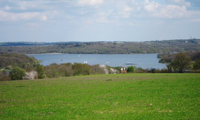
Bewl Water

Bewl Water is a reservoir in the valley of the River Bewl, straddling the boundary between Kent and East Sussex in England. It is about 2 miles (3.2 km...

Wadhurst

Wadhurst is a market town in East Sussex, England. It is the centre of the civil parish of Wadhurst, which also includes the hamlets of Cousley Wood and...

Wadhurst Castle

Wadhurst Castle is a 19th-century castellated mansion just to the west of the town of Wadhurst, East Sussex, England, in an elevated position overlooking...

Shover's Green Baptist Chapel

Shover's Green Baptist Chapel is a former Strict Baptist place of worship in the hamlet of Shover's Green in East Sussex, England. Shover's Green is in...

Lamberhurst

Lamberhurst ( is a village and civil parish in the borough of Tunbridge Wells in Kent, England. The parish contains the hamlets of The Down and Hook Green...

Nearby Amenities

Located within 500m of 51.07556,0.36278907
Nikwax
Man Made: works
Lat/Long: 51.0789396/0.3639436
The data included in this document is from www.openstreetmap.org. The data is made available under ODbL.

Have you been to Ladymeads Wood?

Leave your review of Ladymeads Wood below (or comments, questions and feedback).