Yewtree Green

Wood, Forest in Sussex Tunbridge Wells

England

Yewtree Green

Sussex Border Path Sussex border path and public footpath between Bewl Water and approaching Cousley Wood Road, near to the Vine pub.
Sussex Border Path Credit: Oast House Archive

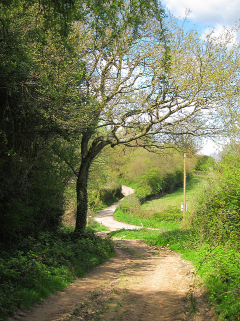
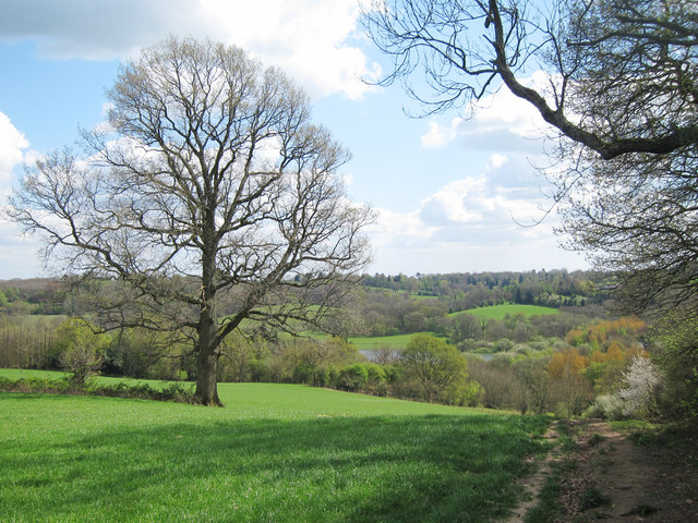
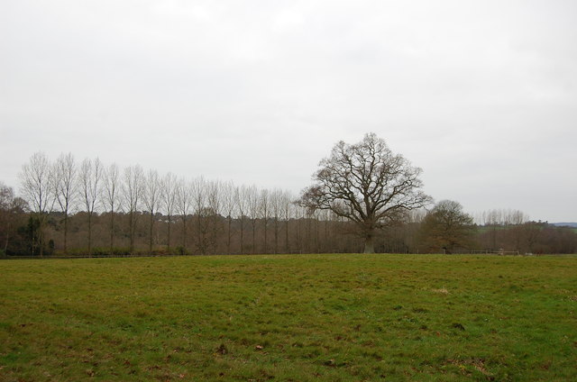
Yewtree Green, located in Sussex, England, is a picturesque wood that is renowned for its dense forest and enchanting atmosphere. Spanning over an area of approximately 100 acres, this woodland is characterized by its diverse range of tree species, with yew trees being the dominant feature and giving the place its name. The forest is known for its ancient yews, some of which are estimated to be over 500 years old.

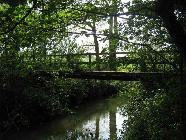
One of the main attractions of Yewtree Green is its tranquil ambiance, making it a popular spot for nature lovers and hikers. The dense canopy of trees creates a cool and shaded environment, providing respite from the summer heat and a refuge for wildlife. The forest floor is carpeted with a rich tapestry of mosses, ferns, and wildflowers, creating a vibrant display of colors throughout the seasons.

Yewtree Green is also home to a diverse range of fauna, including numerous bird species, small mammals, and insects. Birdwatchers can spot species such as woodpeckers, owls, and various songbirds that thrive in the woodland. Additionally, the forest provides a habitat for badgers, foxes, and deer, adding to its ecological significance.

For those interested in history, Yewtree Green holds cultural importance too. It is believed that the forest was once part of an ancient hunting ground used by nobility, and remnants of this past can still be seen in the form of old hunting lodges and pathways.

Overall, Yewtree Green offers visitors a chance to immerse themselves in the beauty of Sussex's woodlands, providing a haven for wildlife and a serene escape from the hustle and bustle of everyday life.

If you have any feedback on the listing, please let us know in the comments section below.

Yewtree Green Images

Images are sourced within 2km of 51.087881/0.36236031 or Grid Reference TQ6534. Thanks to Geograph Open Source API. All images are credited.

Sussex Border Path Sussex border path and public footpath between Bewl Water and approaching Cousley Wood Road, near to the Vine pub.
Sussex Border Path
Sussex border path and public footpath between Bewl Water and approaching Cousley Wood Road, near to the Vine pub.
Butts Lane Dead end lane to Little Butts Farm.
Butts Lane
Dead end lane to Little Butts Farm.
View to Bewl Water Reservoir Looking from the Sussex Border Path towards the reservoir. Little Butts Farm at the end of the field. The dam of the reservoir just seen to the left.
View to Bewl Water Reservoir
Looking from the Sussex Border Path towards the reservoir. Little Butts Farm at the end of the field. The dam of the reservoir just seen to the left.
Tree by the Sussex Border Path The Sussex Border Path is a footpath route nearly 150 miles long around the inland boundary of the county of Sussex. The county owes its origins to the kingdom of the South Saxons and can claim to have one of the longest inland county boundaries from Emsworth to Rye. The route was devised in 1983 and is well signed along most of the route. Website <span class="nowrap"><a title="http://www.sussexborderpath.co.uk/" rel="nofollow ugc noopener" href="http://www.sussexborderpath.co.uk/">Link</a><img style="margin-left:2px;" alt="External link" title="External link - shift click to open in new window" src="https://s1.geograph.org.uk/img/external.png" width="10" height="10"/></span> 
Map: <a title="https://www.geograph.org.uk/search.php?i=40140109&page=1&displayclass=map#i=40140109&page=1&displayclass=map&zoom=2&lat=51.03263&lon=-0.05427&layers=FTTB00000000000T" href="https://www.geograph.org.uk/search.php?i=40140109&page=1&displayclass=map#i=40140109&page=1&displayclass=map&zoom=2&lat=51.03263&lon=-0.05427&layers=FTTB00000000000T">Link</a>
Tree by the Sussex Border Path
The Sussex Border Path is a footpath route nearly 150 miles long around the inland boundary of the county of Sussex. The county owes its origins to the kingdom of the South Saxons and can claim to have one of the longest inland county boundaries from Emsworth to Rye. The route was devised in 1983 and is well signed along most of the route. Website LinkExternal link Map: Link
View of Bayham Abbey As seen from Clay Hill Road.
Looks across the old ruins of the former abbey beside the River Teise.
View of Bayham Abbey
As seen from Clay Hill Road. Looks across the old ruins of the former abbey beside the River Teise.
Damselfly near Hook Green Beside a footpath near B2169 Bayham Road, on a private hedge.
A female Beautiful Demoiselle, (Calopteryx virgo).

See <span class="nowrap"><a title="http://en.wikipedia.org/wiki/Beautiful_Demoiselle" rel="nofollow ugc noopener" href="http://en.wikipedia.org/wiki/Beautiful_Demoiselle">Link</a><img style="margin-left:2px;" alt="External link" title="External link - shift click to open in new window" src="https://s1.geograph.org.uk/img/external.png" width="10" height="10"/></span> for more details.
My first of the year!
Damselfly near Hook Green
Beside a footpath near B2169 Bayham Road, on a private hedge. A female Beautiful Demoiselle, (Calopteryx virgo). See LinkExternal link for more details. My first of the year!
Access road to Bayham Old Abbey This access road leads from the B2169 towards the English Heritage site of Bayham Old Abbey (ruins).
Access road to Bayham Old Abbey
This access road leads from the B2169 towards the English Heritage site of Bayham Old Abbey (ruins).
B2169 Bayham Road This road leads from Spray Hill, near Lamberhurst towards Frant and onwards to Tunbridge Wells.
B2169 Bayham Road
This road leads from Spray Hill, near Lamberhurst towards Frant and onwards to Tunbridge Wells.
Forge Garage  On the B2169 Bayham Road.
Forge Garage
On the B2169 Bayham Road.
Footpath past Sluice Wood A path leads from the B2169 Bayham Road, past the wood and heads towards Wickhurst Farm and onwards to Buss's Green.
Footpath past Sluice Wood
A path leads from the B2169 Bayham Road, past the wood and heads towards Wickhurst Farm and onwards to Buss's Green.
Sluice Wood Stream This stream leads from Puxty Wood near Wadhurst, past Brick Kiln Wood, then it leads through Sluice Wood via two streams, before leading towards Bayham Abbey.
Sluice Wood Stream
This stream leads from Puxty Wood near Wadhurst, past Brick Kiln Wood, then it leads through Sluice Wood via two streams, before leading towards Bayham Abbey.
Footbridge in Sluice Wood This bridge is used by a footpath heading right towards the A2169 Bayham Road, or left towards Wickhurst Farm.
Footbridge in Sluice Wood
This bridge is used by a footpath heading right towards the A2169 Bayham Road, or left towards Wickhurst Farm.
Footbridge in Sluice Wood (2) This bridge is used by a footpath heading right towards the A2169 Bayham Road, or left towards Wickhurst Farm. It heads over a stream in the wood.
Footbridge in Sluice Wood (2)
This bridge is used by a footpath heading right towards the A2169 Bayham Road, or left towards Wickhurst Farm. It heads over a stream in the wood.
Footpath towards Wickhurst Farm A path leads from the B2169 Bayham Road, past Sluice Wood and towards the farm before heading towards Buss's Green.
Footpath towards Wickhurst Farm
A path leads from the B2169 Bayham Road, past Sluice Wood and towards the farm before heading towards Buss's Green.
Footpath past Gage's Wood A path leads from the A2169 Bayham Road, past Wickhurst Farm and then onwards along this track towards Buss's Green.
Gage's Wood is on the left, Wickhurst Wood is on the right.
Footpath past Gage's Wood
A path leads from the A2169 Bayham Road, past Wickhurst Farm and then onwards along this track towards Buss's Green. Gage's Wood is on the left, Wickhurst Wood is on the right.
Tank Cottages On Bartley Mill Road.
Tank Cottages
On Bartley Mill Road.
Vineyard Oast, Lamberhurst Down Single round kiln oast house. As a working oast house the building had three round kilns.

Grade II listed.
Vineyard Oast, Lamberhurst Down
Single round kiln oast house. As a working oast house the building had three round kilns. Grade II listed.
Field and Trees off Monk's Lane
Show me another place!

Yewtree Green is located at Grid Ref: TQ6534 (Lat: 51.087881, Lng: 0.36236031)

Administrative County: Kent

District: Tunbridge Wells

Police Authority: Kent

What 3 Words

///clays.scarves.encoded. Near Lamberhurst, Kent

Related Wikis

Bayham Old Abbey

Bayham Old Abbey is an English Heritage property, located near Lamberhurst, Kent, England. Founded c. 1208 through a combination of the failing Premonstratensian...

Rehoboth Chapel, Pell Green

Rehoboth Chapel is a former Strict Baptist place of worship in the hamlet of Pell Green in East Sussex, England. Pell Green is in the parish of Wadhurst...

Bewl Bridge Rowing Club

Bewl Bridge Rowing Club is a rowing club on the Bewl Water, based at Bewlbridge Lane, Lamberhurst, Wadhurst, Tunbridge Wells. Rowers aged 12 and upwards...
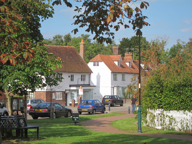
Lamberhurst

Lamberhurst ( is a village and civil parish in the borough of Tunbridge Wells in Kent, England. The parish contains the hamlets of The Down and Hook Green...
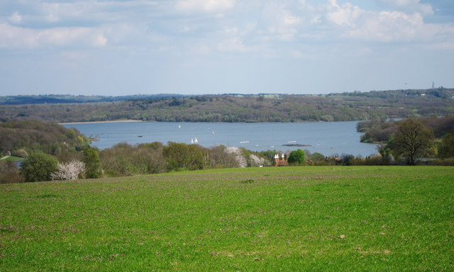
Bewl Water

Bewl Water is a reservoir in the valley of the River Bewl, straddling the boundary between Kent and East Sussex in England. It is about 2 miles (3.2 km...

Scotney Castle

Scotney Castle is an English country house with formal gardens south-east of Lamberhurst in the valley of the River Bewl in Kent, England. It belongs to...

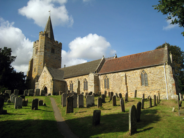
St Mary's Church, Lamberhurst

St Mary's Church is a parish church in Lamberhurst, Kent. It is a Grade I listed building. == Building == The first buildings on the site were erected...

Wadhurst

Wadhurst is a market town in East Sussex, England. It is the centre of the civil parish of Wadhurst, which also includes the hamlets of Cousley Wood and...

Nearby Amenities

Located within 500m of 51.087881,0.36236031
Barrier: kissing_gate
Bicycle: no
Foot: yes
Material: metal
Source: survey
Lat/Long: 51.0897262/0.3672288
Barrier: kissing_gate
Bicycle: no
Foot: yes
Source: survey
Lat/Long: 51.0913624/0.3624077
The data included in this document is from www.openstreetmap.org. The data is made available under ODbL.

Have you been to Yewtree Green?

Leave your review of Yewtree Green below (or comments, questions and feedback).