Stoneyground Spring

Wood, Forest in Essex Uttlesford

England

Stoneyground Spring

St Andrew's, Parish Church Barnston
St Andrew's, Parish Church Barnston Credit: Trevor Harris

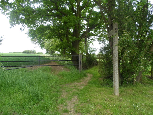
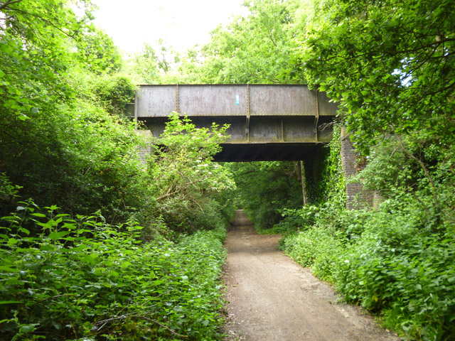
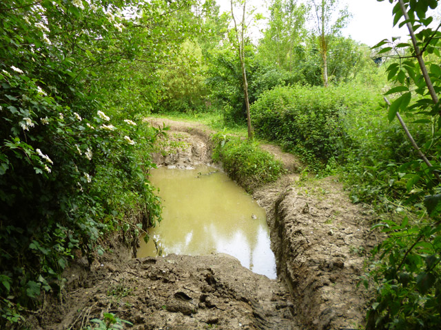
Stoneyground Spring is a picturesque woodland located in the county of Essex, England. Situated in the heart of the county, this enchanting forest covers an area of approximately 100 acres. The woodland takes its name from the prominent stony ground and the natural spring that runs through it, creating a unique and diverse ecosystem.

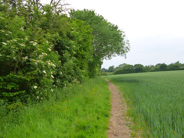
The forest is predominantly made up of deciduous trees, with a wide variety of species such as oak, beech, and birch, which contribute to its rich and vibrant colors throughout the seasons. The dense canopy allows for filtered sunlight to penetrate the forest floor, creating a dappled effect that adds to the area's natural charm.

Stoneyground Spring is a haven for wildlife enthusiasts, as it provides a habitat for an array of animal species. Visitors may be lucky enough to spot deer, foxes, squirrels, and a wide variety of birdlife, including woodpeckers and owls. The serene atmosphere and unspoiled nature of the woodland make it an ideal spot for birdwatching and nature walks.

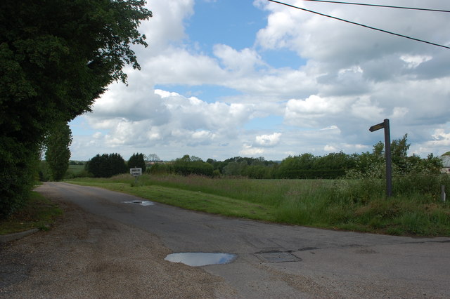
In addition to its natural beauty, Stoneyground Spring offers several walking trails that wind through the forest, allowing visitors to explore its hidden treasures. These trails vary in difficulty, catering to both casual walkers and more experienced hikers. Along the way, visitors will encounter picturesque streams, tranquil ponds, and breathtaking viewpoints that provide stunning vistas of the surrounding countryside.

Overall, Stoneyground Spring in Essex is a truly enchanting woodland that offers a tranquil escape from the hustle and bustle of everyday life. With its diverse flora and fauna, scenic trails, and serene ambiance, it is a destination that should not be missed by nature lovers and outdoor enthusiasts alike.

If you have any feedback on the listing, please let us know in the comments section below.

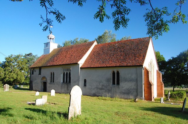
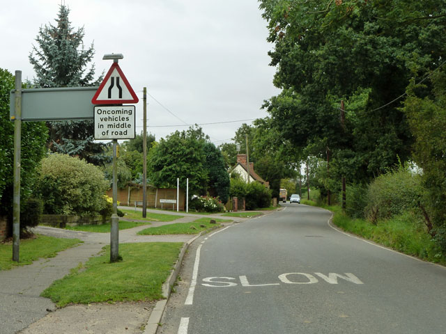
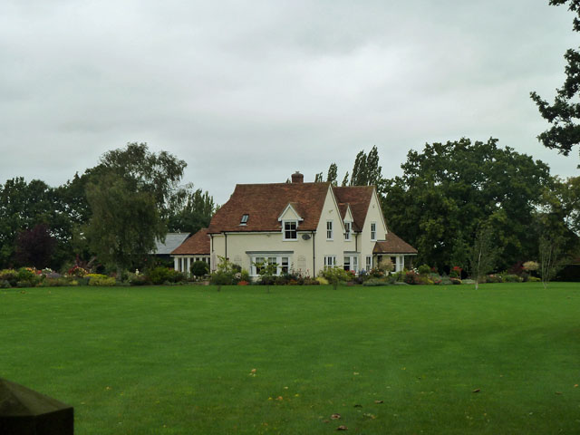
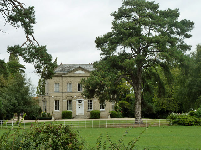
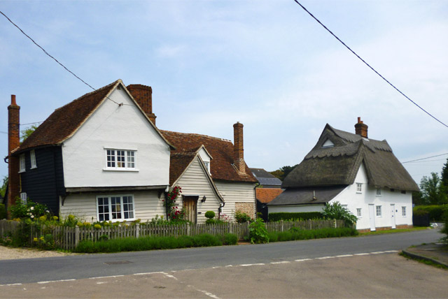
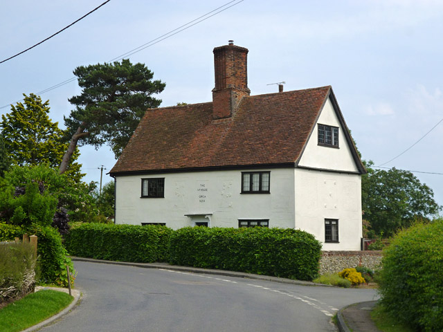
Stoneyground Spring Images

Images are sourced within 2km of 51.857338/0.38961962 or Grid Reference TL6420. Thanks to Geograph Open Source API. All images are credited.

St Andrew's, Parish Church Barnston
High Easter Road, Barnston A country road with quite a lot of modern residential development feeding into it from the left.
High Easter Road, Barnston
A country road with quite a lot of modern residential development feeding into it from the left.
Medhurst A house of no great age, appearing on maps about 1950.
Medhurst
A house of no great age, appearing on maps about 1950.
Barnston Lodge Clearly not the gatehouse sort of lodge, this Georgian country house is now used as a wedding venue.
Barnston Lodge
Clearly not the gatehouse sort of lodge, this Georgian country house is now used as a wedding venue.
Footpath to Sallets Farm
Private road to Martels Manor The private road is also the route of a public footpath, the finger post for which can be seen here. Taken from its junction with High Easter Road.
Private road to Martels Manor
The private road is also the route of a public footpath, the finger post for which can be seen here. Taken from its junction with High Easter Road.
A120, Great Dunmow Bypass The A120 is a trunk road that runs east-west across East Anglia from Harwich to Puckeridge, 63 miles in length. It follows the route of the Roman Road, Stane Street. <span class="nowrap"><a title="http://www.sabre-roads.org.uk/wiki/index.php?title=A120" rel="nofollow ugc noopener" href="http://www.sabre-roads.org.uk/wiki/index.php?title=A120">Link</a><img style="margin-left:2px;" alt="External link" title="External link - shift click to open in new window" src="https://s1.geograph.org.uk/img/external.png" width="10" height="10"/></span>
A120, Great Dunmow Bypass
The A120 is a trunk road that runs east-west across East Anglia from Harwich to Puckeridge, 63 miles in length. It follows the route of the Roman Road, Stane Street. LinkExternal link
Footbridge, A120 The A120 is a trunk road that runs east-west across East Anglia from Harwich to Puckeridge, 63 miles in length. It follows the route of the Roman Road, Stane Street. <span class="nowrap"><a title="http://www.sabre-roads.org.uk/wiki/index.php?title=A120" rel="nofollow ugc noopener" href="http://www.sabre-roads.org.uk/wiki/index.php?title=A120">Link</a><img style="margin-left:2px;" alt="External link" title="External link - shift click to open in new window" src="https://s1.geograph.org.uk/img/external.png" width="10" height="10"/></span>
Footbridge, A120
The A120 is a trunk road that runs east-west across East Anglia from Harwich to Puckeridge, 63 miles in length. It follows the route of the Roman Road, Stane Street. LinkExternal link
Station Road Bridge, A120 The A120 is a trunk road that runs east-west across East Anglia from Harwich to Puckeridge, 63 miles in length. It follows the route of the Roman Road, Stane Street. <span class="nowrap"><a title="http://www.sabre-roads.org.uk/wiki/index.php?title=A120" rel="nofollow ugc noopener" href="http://www.sabre-roads.org.uk/wiki/index.php?title=A120">Link</a><img style="margin-left:2px;" alt="External link" title="External link - shift click to open in new window" src="https://s1.geograph.org.uk/img/external.png" width="10" height="10"/></span>
Station Road Bridge, A120
The A120 is a trunk road that runs east-west across East Anglia from Harwich to Puckeridge, 63 miles in length. It follows the route of the Roman Road, Stane Street. LinkExternal link
Grange Lane near the A120 The lane ramps up to a farm and footpath bridge over the A120, but itself turns left and after a short distance degenerates to a public byway through to Great Dunmow.
Grange Lane near the A120
The lane ramps up to a farm and footpath bridge over the A120, but itself turns left and after a short distance degenerates to a public byway through to Great Dunmow.
Old railway bridge, Little Dunmow Brook Lane crosses the former Bishop's Stortford - Braintree railway, now a cycle path.
Old railway bridge, Little Dunmow
Brook Lane crosses the former Bishop's Stortford - Braintree railway, now a cycle path.
The Flitch Way The former Bishop's Stortford - Braintree railway, now a cycle path.
The Flitch Way
The former Bishop's Stortford - Braintree railway, now a cycle path.
Old railway bridge The former Bishop's Stortford - Braintree railway crosses a byway. The Flitch Way cycle path, mostly using the railway route, does not cross here, but ramps down from the embankment on the other side of the bridge. It then passes under the bridge and uses the byway for the rest of the way into Great Dunmow.
Old railway bridge
The former Bishop's Stortford - Braintree railway crosses a byway. The Flitch Way cycle path, mostly using the railway route, does not cross here, but ramps down from the embankment on the other side of the bridge. It then passes under the bridge and uses the byway for the rest of the way into Great Dunmow.
Off-roaders' wallow The public byway here is a magnet for off-roaders, who, fortunately for other users, confine their more extreme fun to tracks off the byway, between the byway and the River Chelmer. This is perhaps the most extreme bit I found. It appears to be rather deep.
Off-roaders' wallow
The public byway here is a magnet for off-roaders, who, fortunately for other users, confine their more extreme fun to tracks off the byway, between the byway and the River Chelmer. This is perhaps the most extreme bit I found. It appears to be rather deep.
Houses on Baynard Avenue, Flitch Green A 21st century civil parish built on the site of a sugar refinery, between Little Dunmow and Felsted.
Houses on Baynard Avenue, Flitch Green
A 21st century civil parish built on the site of a sugar refinery, between Little Dunmow and Felsted.
Footpath to Little Dunmow The path skirts round The Moors to the left. In these parts such a name implies a pretty damp area. The mapped route of the public path actually passes through this, but there is no trace of anybody trying to follow the route. There is a fair bit of optimistic routing of public paths through marshes around here, fortunately most have reasonable ways round, as this.
Footpath to Little Dunmow
The path skirts round The Moors to the left. In these parts such a name implies a pretty damp area. The mapped route of the public path actually passes through this, but there is no trace of anybody trying to follow the route. There is a fair bit of optimistic routing of public paths through marshes around here, fortunately most have reasonable ways round, as this.
Rose Farm and Rose Farm Cottage, Little Dunmow Rose Farm, on the left, was built around 1400. The thatched house is of 16th century or earlier build. Both are grade II listed.
Rose Farm and Rose Farm Cottage, Little Dunmow
Rose Farm, on the left, was built around 1400. The thatched house is of 16th century or earlier build. Both are grade II listed.
The Ivy House, Little Dunmow Dated 'circa 1630' on the front, it is grade II listed.
The Ivy House, Little Dunmow
Dated 'circa 1630' on the front, it is grade II listed.
Show me another place!

Stoneyground Spring is located at Grid Ref: TL6420 (Lat: 51.857338, Lng: 0.38961962)

Administrative County: Essex

District: Uttlesford

Police Authority: Essex

What 3 Words

///confusion.pats.fallen. Near Little Dunmow, Essex

Related Wikis

Barnston, Essex

Barnston is a village and civil parish in Essex, England. The village is on the B1008 road, about 1+3⁄4 miles (2.8 km) south-east of Great Dunmow and...

Little Dunmow Priory

Little Dunmow Priory in Little Dunmow was an Augustinian priory in Essex, England. The priory was founded as a church by Juga de Baynard in 1104, dedicated...

Little Dunmow

Little Dunmow is a village situated in the Uttlesford district, in rural Essex, England, in the vale of the River Chelmer about 3 miles (4.8 km) east-southeast...

Wellstye Green

Wellstye Green or Wells Tye Green is a hamlet located between the villages of High Easter and Barnston, in the Uttlesford district of Essex. It is the...

Dunmow railway station

Dunmow railway station was a station serving Great Dunmow, Essex. The station was 9 miles 38 chains (15.25 km) from Bishop's Stortford on the Bishop's...

Flitch Green

Flitch Green is a civil parish in the Uttlesford district of Essex, England. It consists of a housing development built outside the village of Little Dunmow...

Felsted railway station

Felsted railway station was located in Essex between Felsted and Little Dunmow. The station was 11 miles 61 chains (18.93 km) from Bishop's Stortford on...

Hounslow Green

Hounslow Green or Onslow Green is a hamlet on the B1008 road (historically the A130 road), located in between the villages of Barnston and Ford End, in...

Nearby Amenities

Located within 500m of 51.857338,0.38961962
Mini Roundabout
Direction: clockwise
Lat/Long: 51.854476/0.3848959
Bus Stop
High Easter Road
Bus: yes
Naptan AtcoCode: 150002005011
Naptan Bearing: NW
Naptan CommonName: High Easter Road
Naptan Crossing: High Easter Road
Naptan Indicator: Adj
Naptan Landmark: High Easter Road
Naptan NaptanCode: esxatwjt
Naptan Street: Chelmsford Road
Naptan Verified: no
Public Transport: platform
Source: naptan_import
Lat/Long: 51.8552851/0.3838674
High Easter Road
Naptan AtcoCode: 1500020050Y1
Naptan Bearing: SE
Naptan BusStopType: CUS
Naptan CommonName: High Easter Road
Naptan Crossing: High Easter Road
Naptan Indicator: Opp
Naptan Landmark: High Easter Road
Naptan NaptanCode: esxgpmgj
Naptan Street: Chelmsford Road
Naptan Verified: no
Public Transport: platform
Source: naptan_import
Lat/Long: 51.8553372/0.3839573
Fixme: incomplete
Lat/Long: 51.8549327/0.3876007
Restaurant
Chapslee
Fixme: check if still open. The Restaurant is now closed but may still have rooms.
Lat/Long: 51.855302/0.3845682
The Bog
Place: locality
Lat/Long: 51.8550812/0.3952274
Barrier: bollard
Lat/Long: 51.853671/0.3893891
Give Way
Direction: forward
Lat/Long: 51.8545497/0.3848575
Give Way
Direction: backward
Lat/Long: 51.8544176/0.3849829
Give Way
Direction: forward
Lat/Long: 51.8544529/0.3848104
The data included in this document is from www.openstreetmap.org. The data is made available under ODbL.

Have you been to Stoneyground Spring?

Leave your review of Stoneyground Spring below (or comments, questions and feedback).