Spring Wood

Wood, Forest in Norfolk King's Lynn and West Norfolk

England

Spring Wood

Cropmarks on field east of King's Lynn: aerial 2022 (1)
Cropmarks on field east of King's Lynn: aerial 2022 (1) Credit: Simon Tomson

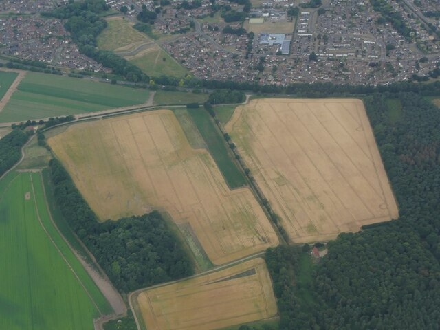
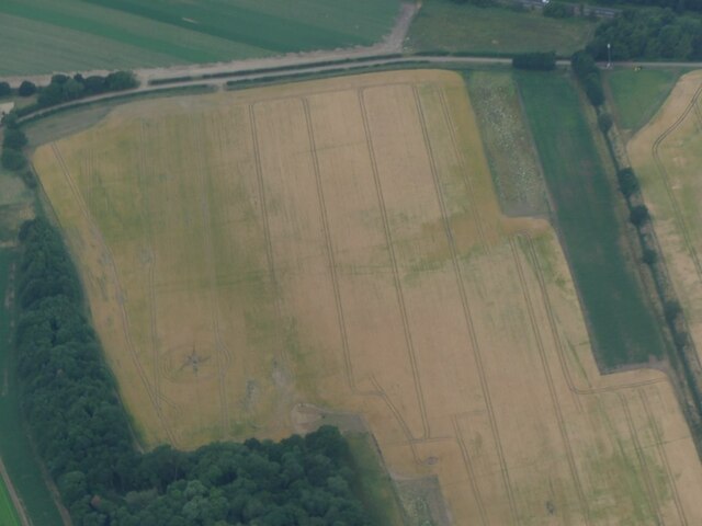
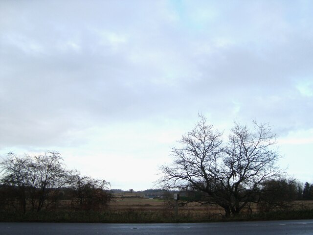
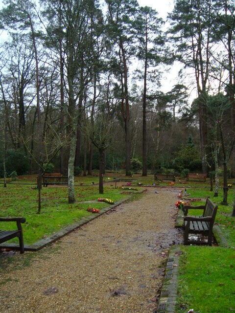
Spring Wood is a picturesque woodland located in Norfolk, England. Covering an area of approximately 100 acres, this enchanting forest is a haven for nature enthusiasts and offers a tranquil escape from the hustle and bustle of everyday life.

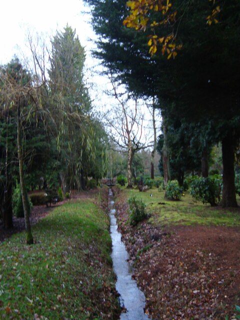
The wood is characterized by its diverse range of tree species, including oak, beech, birch, and pine, which create a vibrant and ever-changing landscape throughout the year. In spring, the forest comes alive with a carpet of bluebells, creating a breathtaking sight that attracts visitors from far and wide.

Numerous walking trails wind their way through Spring Wood, allowing visitors to explore its hidden gems and discover the beauty of its flora and fauna. The paths are well-maintained and suitable for all ages and fitness levels, making it a popular destination for families and nature lovers alike.

Wildlife thrives in this natural habitat, and lucky visitors may catch a glimpse of deer, foxes, and a variety of bird species, including woodpeckers and owls. The wood is also home to a rich variety of insects and small mammals, adding to its ecological importance.

Spring Wood offers more than just natural beauty; it also holds historical significance. The remains of an ancient Roman road can be found within its boundaries, serving as a reminder of the area's rich heritage.

With its breathtaking scenery, diverse wildlife, and historical significance, Spring Wood is a must-visit destination for anyone seeking a peaceful retreat in the heart of Norfolk.

If you have any feedback on the listing, please let us know in the comments section below.
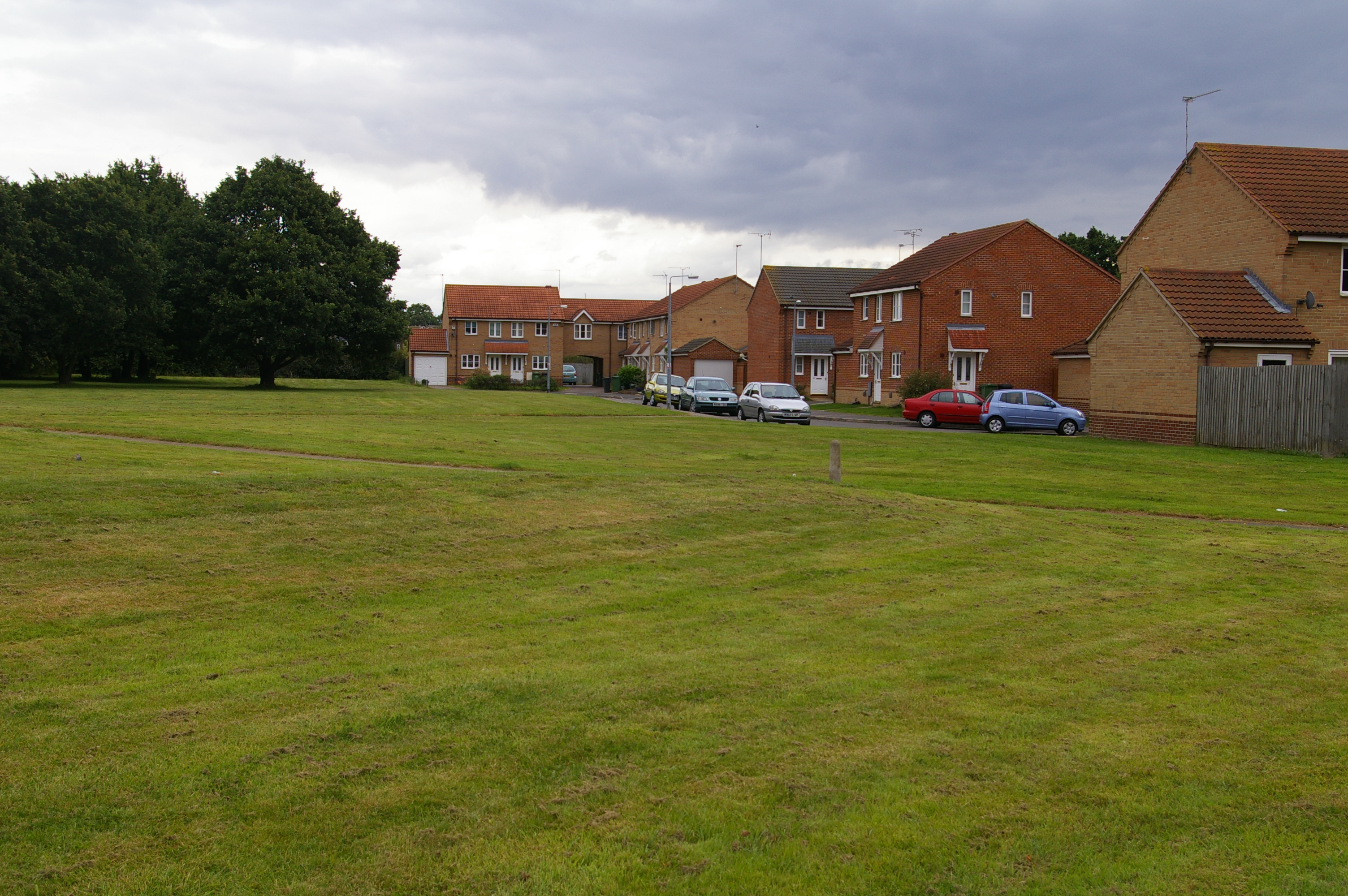
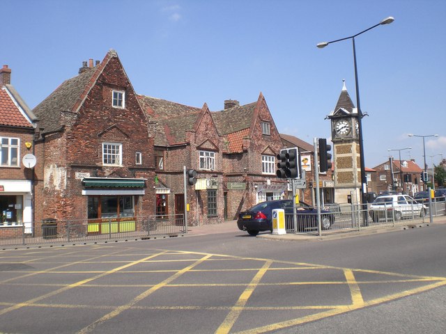
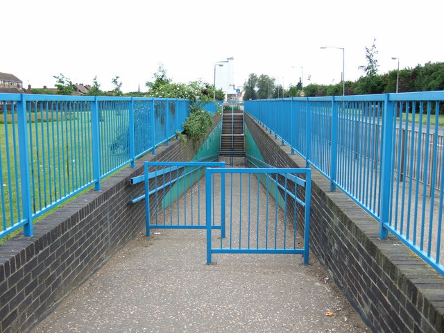
Spring Wood Images

Images are sourced within 2km of 52.757257/0.43742198 or Grid Reference TF6420. Thanks to Geograph Open Source API. All images are credited.

Cropmarks on field east of King's Lynn: aerial 2022 (1)
Cropmarks on field east of King's Lynn: aerial 2022 (2)
Steam at King's Lynn A zoom assisted picture of Black 5 44932 pulling coaches from the sidings in preparation to reverse into the station for the final day of the Great Britain XV rail tour.
Steam at King's Lynn
A zoom assisted picture of Black 5 44932 pulling coaches from the sidings in preparation to reverse into the station for the final day of the Great Britain XV rail tour.
The A149 King's Lynn to Cromer road Passing by the Queen Elizabeth Hospital
The A149 King's Lynn to Cromer road
Passing by the Queen Elizabeth Hospital
View towards Church Farm From the entrance to Mintlyn Crematorium
View towards Church Farm
From the entrance to Mintlyn Crematorium
Gardens of Remembrance at Mintlyn Crematorium Part of the extensive gardens and woodlands around the crematorium
Gardens of Remembrance at Mintlyn Crematorium
Part of the extensive gardens and woodlands around the crematorium
Overflow car park at Mintlyn Crematorium
Drain in Hammonds Covert Mintlyn Wood
Drain in Hammonds Covert
Mintlyn Wood
Walks Sculptures Two sculptures at the Tennyson Avenue end of the walks.
Walks Sculptures
Two sculptures at the Tennyson Avenue end of the walks.
Mintlyn Crematorium The crematorium is in the very north east corner of the grid square just off the B1145 Kings Lynn to Bawsey road just west of Kings Lynn.
Mintlyn Crematorium
The crematorium is in the very north east corner of the grid square just off the B1145 Kings Lynn to Bawsey road just west of Kings Lynn.
Garden of Remembrance. This is one of several gardens of remembrance surrounding the crematorium at Mintlyn.
Garden of Remembrance.
This is one of several gardens of remembrance surrounding the crematorium at Mintlyn.
King's Lynn Stabling Point 03175 shares the stabling point with 08205 (inside the shed) and 37107 on a misty January day.  The stabling point, along with the extensive sidings on the north side of the station, has since disappeared being no longer required.
King's Lynn Stabling Point
03175 shares the stabling point with 08205 (inside the shed) and 37107 on a misty January day. The stabling point, along with the extensive sidings on the north side of the station, has since disappeared being no longer required.
B1145 heading towards King's Lynn
Gas Governor
Gas Governor
Boggy land near King's Lynn This field is situated on the eastern edge of the A149 King's Lynn bypass (Queen Elizabeth Way). Having passed this area numerous times I had always assumed it was a naturally boggy low lying area next to Gaywood River. Closer examination, however, makes me think it is not quite as natural as it first appears and some enterprising landowner is probably earning  a few quid on this poor quality land from some environmental organisation by keeping it flooded. There is a floating pump in the river (see Google Earth) which I assume feeds water onto the land and it has a brand new fence around it and a wide grass strip outside the fence. The telegraph/electricity poles follow the line of an old railway line removed decades ago.
Boggy land near King's Lynn
This field is situated on the eastern edge of the A149 King's Lynn bypass (Queen Elizabeth Way). Having passed this area numerous times I had always assumed it was a naturally boggy low lying area next to Gaywood River. Closer examination, however, makes me think it is not quite as natural as it first appears and some enterprising landowner is probably earning a few quid on this poor quality land from some environmental organisation by keeping it flooded. There is a floating pump in the river (see Google Earth) which I assume feeds water onto the land and it has a brand new fence around it and a wide grass strip outside the fence. The telegraph/electricity poles follow the line of an old railway line removed decades ago.
Wootton Road Bridge A little bridge over the Bawsey Drain in Wootton Road.
Wootton Road Bridge
A little bridge over the Bawsey Drain in Wootton Road.
Part of The College Of West Anglia demolished
Rope Walk A private drive in North Lynn.
Rope Walk
A private drive in North Lynn.
Show me another place!

Spring Wood is located at Grid Ref: TF6420 (Lat: 52.757257, Lng: 0.43742198)

Administrative County: Norfolk

District: King's Lynn and West Norfolk

Police Authority: Norfolk

What 3 Words

///craziest.runs.seat. Near King's Lynn, Norfolk

Nearby Locations

Spring Wood

Related Wikis

Springwood High School, King's Lynn

Springwood High School is a secondary school with academy status in the town of King's Lynn in Norfolk, England. It was formed by the merger of several...

Fairstead, Norfolk

The Fairstead Estate is a suburb of King's Lynn, Norfolk, England. The population of Fairstead ward of King's Lynn and West Norfolk Borough at the 2011...

Queen Elizabeth Hospital, King's Lynn

Queen Elizabeth Hospital in King's Lynn, Norfolk, England. It is located on the outskirts of King's Lynn, to the eastern edge of the town. The catchment...

Gaywood, Norfolk

Gaywood is an eastern suburb of King's Lynn, in the King's Lynn and West Norfolk district, in the county of Norfolk, England. Previously a civil parish...

King's Lynn Academy

King's Lynn Academy (formerly "the Park High School") is a 11-16 mixed secondary school in the West Norfolk town of King's Lynn. It is situated on Queen...

King Edward VII Academy

King Edward VII Academy (known as KES Academy) is a large, mixed comprehensive secondary school in Gaywood Road (A148), King's Lynn, Norfolk, England with...

North Lynn

North Lynn is an urban residential area of King's Lynn, in the King's Lynn and West Norfolk district, in the county of Norfolk, England. There are three...

King's Lynn F.C.

King's Lynn Football Club was an English association football club based in King's Lynn, Norfolk. The club was founded in 1881 and they were wound up at...

Nearby Amenities

Located within 500m of 52.757257,0.43742198
Crossing
Crossing: traffic_signals
Crossing Ref: toucan
Lat/Long: 52.7559043/0.43595
Traffic Calming: cushion
Lat/Long: 52.7537331/0.4390101
Traffic Calming: cushion
Lat/Long: 52.754468/0.4361688
Mini Roundabout
Direction: clockwise
Lat/Long: 52.7543467/0.4337966
Mini Roundabout
Direction: clockwise
Lat/Long: 52.7559306/0.4411072
Mini Roundabout
Direction: clockwise
Lat/Long: 52.7553055/0.4408874
Turning Circle
Lat/Long: 52.7589134/0.4325544
Turning Circle
Lat/Long: 52.7555428/0.4419329
Turning Circle
Lat/Long: 52.7568641/0.4408956
Turning Circle
Lat/Long: 52.7577648/0.4412691
Turning Circle
Lat/Long: 52.7559896/0.4392875
Turning Circle
Lat/Long: 52.7575295/0.4404576
Traffic Calming: hump
Lat/Long: 52.7540698/0.4337093
Crossing
Crossing: unmarked
Crossing Island: no
Kerb: lowered
Tactile Paving: no
Lat/Long: 52.7552039/0.4334121
Recycling
Lat/Long: 52.7536328/0.4390137
King's Lynn Persimmon
Power: substation
Ref: F6446 2086_
Lat/Long: 52.7533143/0.4354526
Bus Stop
Elvington Road, adj
Bus: yes
Naptan AtcoCode: 2900K13119
Naptan Bearing: E
Naptan CommonName: Elvington Road
Naptan Indicator: adj
Naptan Landmark: Elvington Road
Naptan Locality: King's Lynn
Naptan NaptanCode: nfodamag
Naptan PlusbusZoneRef: KLYNN
Naptan Street: Gayton Road
Naptan Verified: no
Public Transport: platform
Source: naptan_import
Lat/Long: 52.7552407/0.4416933
Bus Stop
William Booth Road, opp
Bus: yes
Naptan AtcoCode: 2900K13121
Naptan Bearing: N
Naptan CommonName: William Booth Road
Naptan Indicator: opp
Naptan Locality: Fairstead
Naptan NaptanCode: nfodamam
Naptan PlusbusZoneRef: KLYNN
Naptan Street: Winston Churchill Drive
Naptan Verified: no
Public Transport: platform
Source: naptan_import
Lat/Long: 52.7539515/0.4335441
Bus Stop
Glavon, adj
Bus: yes
Naptan AtcoCode: 2900K13125
Naptan Bearing: E
Naptan CommonName: Glavon
Naptan Indicator: adj
Naptan Locality: Fairstead
Naptan NaptanCode: nfodamda
Naptan PlusbusZoneRef: KLYNN
Naptan Street: William Booth Road
Naptan Verified: no
Public Transport: platform
Source: naptan_import
Lat/Long: 52.7545561/0.4360676
Bus Stop
Queensway, opp
Bus: yes
Naptan AtcoCode: 2900K13131
Naptan Bearing: W
Naptan CommonName: Queensway
Naptan Indicator: opp
Naptan Landmark: Queensway
Naptan Locality: King's Lynn
Naptan NaptanCode: nfodamdw
Naptan PlusbusZoneRef: KLYNN
Naptan Street: Gayton Road
Naptan Verified: no
Public Transport: platform
Source: naptan_import
Lat/Long: 52.7564127/0.4310432
Bus Stop
Queensway, adj
Bench: no
Bin: yes
Bus: yes
Lit: no
Naptan AtcoCode: 2900K13132
Naptan Bearing: E
Naptan CommonName: Queensway
Naptan Indicator: adj
Naptan Locality: King's Lynn
Naptan NaptanCode: nfodamga
Naptan PlusbusZoneRef: KLYNN
Naptan Street: Gayton Road
Naptan Verified: no
Public Transport: platform
Shelter: no
Source: naptan_import
Tactile Paving: yes
Lat/Long: 52.756349/0.432833
Bus Stop
Elvington Road, opp
Bus: yes
Naptan AtcoCode: 2900K1348
Naptan Bearing: W
Naptan CommonName: Elvington Road
Naptan Indicator: opp
Naptan Locality: King's Lynn
Naptan NaptanCode: nfodapjd
Naptan PlusbusZoneRef: KLYNN
Naptan Street: Gayton Road
Naptan Verified: no
Public Transport: platform
Source: naptan_import
Lat/Long: 52.754933/0.4430988
Bus Stop
William Booth Rd, adj
Bench: no
Bus: yes
Naptan AtcoCode: 2900K1402
Naptan Bearing: S
Naptan CommonName: William Booth Rd
Naptan Indicator: adj
Naptan Locality: Fairstead
Naptan NaptanCode: nfogpdgm
Naptan PlusbusZoneRef: KLYNN
Naptan Street: Winston Churhill Drive
Naptan Verified: no
Public Transport: platform
Shelter: no
Source: naptan_import
Lat/Long: 52.7547706/0.4339455
Bus Stop
Mulberry Road, opp
Bus: yes
Naptan AtcoCode: 2900K1403
Naptan Bearing: SE
Naptan CommonName: Mulberry Road
Naptan Indicator: opp
Naptan Locality: Fairstead
Naptan NaptanCode: nfogpdgp
Naptan PlusbusZoneRef: KLYNN
Naptan Street: William Booth Road
Naptan Verified: no
Public Transport: platform
Source: naptan_import
Lat/Long: 52.7541527/0.4381941
Turning Circle
Lat/Long: 52.7575577/0.4395549
Turning Circle
Lat/Long: 52.7572283/0.4430674
Turning Circle
Lat/Long: 52.7579651/0.4393198
Traffic Calming: cushion
Lat/Long: 52.7533528/0.4394304
Traffic Calming: cushion
Lat/Long: 52.7539916/0.4383625
Filberts
Place: locality
Lat/Long: 52.7537372/0.4375525
Waste Basket
Lat/Long: 52.7529744/0.4384663
Barrier: bollard
Lat/Long: 52.7530247/0.4386318
Barrier: bollard
Lat/Long: 52.7530558/0.4385055
Telephone
Booth: KX100
Covered: booth
Lat/Long: 52.7530587/0.4386651
Ranworth
Place: locality
Lat/Long: 52.7534189/0.4411305
Crossing
Crossing: uncontrolled
Lat/Long: 52.7607545/0.4328401
Crossing
Crossing: uncontrolled
Lat/Long: 52.7606588/0.4328938
Crossing
Crossing: uncontrolled
Lat/Long: 52.7604368/0.4329166
Crossing
Crossing: uncontrolled
Lat/Long: 52.7600943/0.4328361
Traffic Calming: cushion
Lat/Long: 52.7542782/0.4374615
Traffic Calming: cushion
Lat/Long: 52.7543713/0.4351133
Fast Food
Golden Fish Bar
Addr City: King's Lynn
Addr Housenumber: 1
Addr Postcode: PE30 4SR
Addr Street: Centre Point
Cuisine: chinese;fish_and_chips
Fhrs Id: 91220
Phone: +44 1553766519
Source Addr: FHRS Open Data
Lat/Long: 52.7529656/0.4387079
Noexit: yes
Lat/Long: 52.7535902/0.4406916
Barrier: cycle_barrier
Cycle Barrier: double
Lat/Long: 52.7540736/0.433628
The data included in this document is from www.openstreetmap.org. The data is made available under ODbL.

Have you been to Spring Wood?

Leave your review of Spring Wood below (or comments, questions and feedback).