Church Belt

Wood, Forest in Norfolk King's Lynn and West Norfolk

England

Church Belt

King's Lynn station The northern terminus of the Great Northern electrified Fen line from Kings Cross, with additional trains by Greater Anglia from Liverpool Street. This building dates to 1871-2.
King's Lynn station Credit: Chris Morgan

Church Belt is a small village located in the county of Norfolk, England. Situated within the beautiful woodlands and forests of the region, it offers a serene and picturesque setting for residents and visitors alike. The village is nestled among the lush greenery, with tall trees and dense foliage surrounding the area.

Known for its tranquility and natural beauty, Church Belt is a haven for nature enthusiasts and those seeking a peaceful retreat. The woodlands provide ample opportunities for walking, hiking, and exploring, allowing visitors to immerse themselves in the stunning natural surroundings. The forest is home to a diverse range of flora and fauna, with various species of trees, plants, and wildlife thriving in the area.

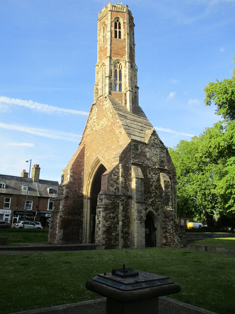
In addition to its natural attractions, Church Belt is also home to a charming church, from which the village derives its name. The church, with its distinctive architecture and historical significance, adds to the village's character and charm. It serves as a focal point for the community, hosting regular religious services and occasional events.

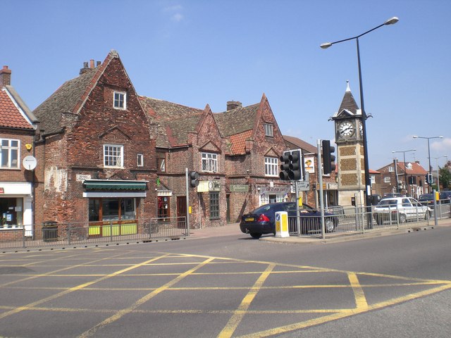
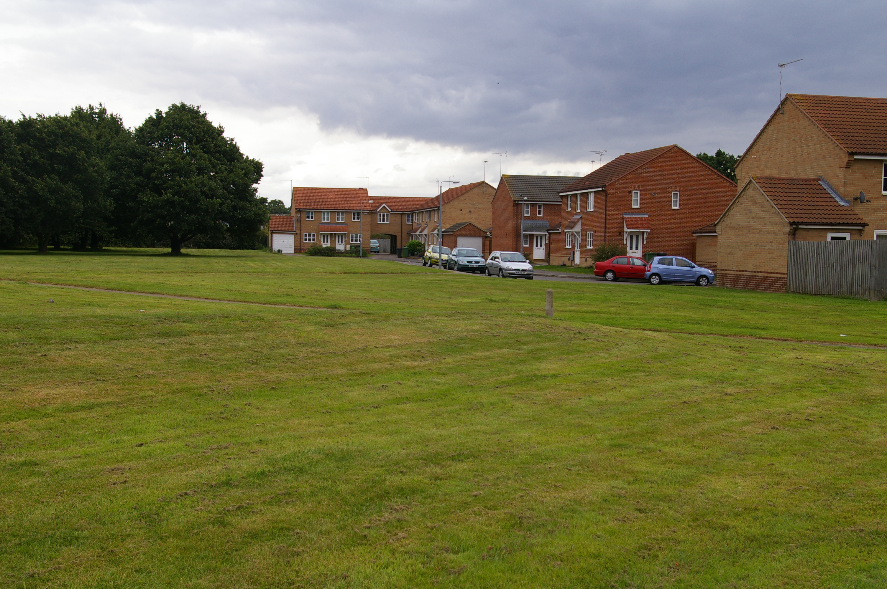
Despite its tranquil and rural setting, Church Belt is not far from larger towns and cities, making it an ideal location for those seeking a balance between peaceful country living and access to amenities. The village offers a sense of community and a slower pace of life, making it an attractive destination for those looking to escape the hustle and bustle of urban areas.

Overall, Church Belt in Norfolk is a hidden gem, offering a harmonious blend of natural beauty, historical significance, and a close-knit community. It is a place where one can find solace in the peaceful woodlands and embrace the simple pleasures of countryside living.

If you have any feedback on the listing, please let us know in the comments section below.

Church Belt Images

Images are sourced within 2km of 52.755673/0.42303178 or Grid Reference TF6320. Thanks to Geograph Open Source API. All images are credited.

King's Lynn station The northern terminus of the Great Northern electrified Fen line from Kings Cross, with additional trains by Greater Anglia from Liverpool Street. This building dates to 1871-2.
King's Lynn station
The northern terminus of the Great Northern electrified Fen line from Kings Cross, with additional trains by Greater Anglia from Liverpool Street. This building dates to 1871-2.
St James' Park, King's Lynn Part of the larger Walks, see the Friends of the Walks website: <span class="nowrap"><a title="http://www.thewalks.uk/history-of-the-walks/" rel="nofollow ugc noopener" href="http://www.thewalks.uk/history-of-the-walks/">Link</a><img style="margin-left:2px;" alt="External link" title="External link - shift click to open in new window" src="https://s1.geograph.org.uk/img/external.png" width="10" height="10"/></span>
St James' Park, King's Lynn
Part of the larger Walks, see the Friends of the Walks website: LinkExternal link
King's Lynn Town Hall
High Water Marks, St Margaret's Church, King's Lynn
Priory and Parish church of St Margaret Dedicated as King's Lynn's Minster in 2011. Apparently one tower is for the local parish and community, and one tower is for the priory and monks.
Priory and Parish church of St Margaret
Dedicated as King's Lynn's Minster in 2011. Apparently one tower is for the local parish and community, and one tower is for the priory and monks.
Guannock Gate and town wall, King's Lynn
King's Lynn Minster The parish church of St Margaret was elevated to become King's Lynn Minster <span class="nowrap"><a title="https://kingslynnminster.org/" rel="nofollow ugc noopener" href="https://kingslynnminster.org/">Link</a><img style="margin-left:2px;" alt="External link" title="External link - shift click to open in new window" src="https://s1.geograph.org.uk/img/external.png" width="10" height="10"/></span> in 2011, one of a wave of churches which gained Minster status around that time.  

On the right can be seen Hanse House <span class="nowrap"><a title="http://www.hansehouse.co.uk/history/" rel="nofollow ugc noopener" href="http://www.hansehouse.co.uk/history/">Link</a><img style="margin-left:2px;" alt="External link" title="External link - shift click to open in new window" src="https://s1.geograph.org.uk/img/external.png" width="10" height="10"/></span> ; this incorporates a mediaeval warehouse once owned by the Hanseatic League, which used the town as a trading post. Today the building has a variety of uses, including offices, an indoor market, three flats, function rooms and a wine bar <span class="nowrap"><a title="https://www.therathskeller.co.uk/" rel="nofollow ugc noopener" href="https://www.therathskeller.co.uk/">Link</a><img style="margin-left:2px;" alt="External link" title="External link - shift click to open in new window" src="https://s1.geograph.org.uk/img/external.png" width="10" height="10"/></span> .
King's Lynn Minster
The parish church of St Margaret was elevated to become King's Lynn Minster LinkExternal link in 2011, one of a wave of churches which gained Minster status around that time. On the right can be seen Hanse House LinkExternal link ; this incorporates a mediaeval warehouse once owned by the Hanseatic League, which used the town as a trading post. Today the building has a variety of uses, including offices, an indoor market, three flats, function rooms and a wine bar LinkExternal link .
Millfleet Burial Ground A small brick enclosure used for the burial of a community of Dutch Jews who lived in Lynn from the mid eighteenth to the mid nineteenth centuries. The walls of the enclosure, however, date from the sixteenth century <span class="nowrap"><a title="https://historicengland.org.uk/listing/the-list/list-entry/1298159?section=official-list-entry" rel="nofollow ugc noopener" href="https://historicengland.org.uk/listing/the-list/list-entry/1298159?section=official-list-entry">Link</a><img style="margin-left:2px;" alt="External link" title="External link - shift click to open in new window" src="https://s1.geograph.org.uk/img/external.png" width="10" height="10"/></span>
Millfleet Burial Ground
A small brick enclosure used for the burial of a community of Dutch Jews who lived in Lynn from the mid eighteenth to the mid nineteenth centuries. The walls of the enclosure, however, date from the sixteenth century LinkExternal link
King's Lynn Railway Station Built for the Great Eastern Railway 1871-2 <span class="nowrap"><a title="https://historicengland.org.uk/listing/the-list/list-entry/1389399?section=official-list-entry" rel="nofollow ugc noopener" href="https://historicengland.org.uk/listing/the-list/list-entry/1389399?section=official-list-entry">Link</a><img style="margin-left:2px;" alt="External link" title="External link - shift click to open in new window" src="https://s1.geograph.org.uk/img/external.png" width="10" height="10"/></span>
King's Lynn Railway Station
Built for the Great Eastern Railway 1871-2 LinkExternal link
Red Mount Chapel, King's Lynn Late fifteenth century Pilgrimage Chapel <span class="nowrap"><a title="https://historicengland.org.uk/listing/the-list/list-entry/1195403?section=official-list-entry" rel="nofollow ugc noopener" href="https://historicengland.org.uk/listing/the-list/list-entry/1195403?section=official-list-entry">Link</a><img style="margin-left:2px;" alt="External link" title="External link - shift click to open in new window" src="https://s1.geograph.org.uk/img/external.png" width="10" height="10"/></span>
Red Mount Chapel, King's Lynn
Late fifteenth century Pilgrimage Chapel LinkExternal link
The Gaywood River, King's Lynn Looking from St. John's Walk towards the culvert beneath the railway.
The Gaywood River, King's Lynn
Looking from St. John's Walk towards the culvert beneath the railway.
Mayor's Avenue, The Walks, King's Lynn Follows the line of the town walls.
Mayor's Avenue, The Walks, King's Lynn
Follows the line of the town walls.
North Guannock Gate and parts of the town wall The originals dated from the thirteenth century but much of what remains dates from the early nineteenth century
North Guannock Gate and parts of the town wall
The originals dated from the thirteenth century but much of what remains dates from the early nineteenth century
Greyfriars Tower The tower stood at the crossing of the church of the Greyfriars (Franciscans) church <span class="nowrap"><a title="https://historicengland.org.uk/listing/the-list/list-entry/1195428?section=official-list-entry" rel="nofollow ugc noopener" href="https://historicengland.org.uk/listing/the-list/list-entry/1195428?section=official-list-entry">Link</a><img style="margin-left:2px;" alt="External link" title="External link - shift click to open in new window" src="https://s1.geograph.org.uk/img/external.png" width="10" height="10"/></span>
Greyfriars Tower
The tower stood at the crossing of the church of the Greyfriars (Franciscans) church LinkExternal link
Tower Gardens, King's Lynn
Arches in Tower Gardens, King's Lynn Resited from a house near Tuesday Market <span class="nowrap"><a title="https://historicengland.org.uk/listing/the-list/list-entry/1290265?section=official-list-entry" rel="nofollow ugc noopener" href="https://historicengland.org.uk/listing/the-list/list-entry/1290265?section=official-list-entry">Link</a><img style="margin-left:2px;" alt="External link" title="External link - shift click to open in new window" src="https://s1.geograph.org.uk/img/external.png" width="10" height="10"/></span>
Arches in Tower Gardens, King's Lynn
Resited from a house near Tuesday Market LinkExternal link
County Court, King's Lynn Dates from 1861 <span class="nowrap"><a title="https://historicengland.org.uk/listing/the-list/list-entry/1210671?section=official-list-entry" rel="nofollow ugc noopener" href="https://historicengland.org.uk/listing/the-list/list-entry/1210671?section=official-list-entry">Link</a><img style="margin-left:2px;" alt="External link" title="External link - shift click to open in new window" src="https://s1.geograph.org.uk/img/external.png" width="10" height="10"/></span>
County Court, King's Lynn
Dates from 1861 LinkExternal link
Tyre depot, St. James Street, King's Lynn An early example of a concrete framed building dating from 1908 <span class="nowrap"><a title="https://historicengland.org.uk/listing/the-list/list-entry/1459413?section=official-list-entry" rel="nofollow ugc noopener" href="https://historicengland.org.uk/listing/the-list/list-entry/1459413?section=official-list-entry">Link</a><img style="margin-left:2px;" alt="External link" title="External link - shift click to open in new window" src="https://s1.geograph.org.uk/img/external.png" width="10" height="10"/></span>
Tyre depot, St. James Street, King's Lynn
An early example of a concrete framed building dating from 1908 LinkExternal link
Show me another place!

Church Belt is located at Grid Ref: TF6320 (Lat: 52.755673, Lng: 0.42303178)

Administrative County: Norfolk

District: King's Lynn and West Norfolk

Police Authority: Norfolk

What 3 Words

///reworked.lawfully.nitrate. Near King's Lynn, Norfolk

Nearby Locations

Gaywood Church Belt

Related Wikis

Gaywood, Norfolk

Gaywood is an eastern suburb of King's Lynn, in the King's Lynn and West Norfolk district, in the county of Norfolk, England. Previously a civil parish...

King's Lynn Academy

King's Lynn Academy (formerly "the Park High School") is a 11-16 mixed secondary school in the West Norfolk town of King's Lynn. It is situated on Queen...

King Edward VII Academy

King Edward VII Academy (known as KES Academy) is a large, mixed comprehensive secondary school in Gaywood Road (A148), King's Lynn, Norfolk, England with...

Springwood High School, King's Lynn

Springwood High School is a secondary school with academy status in the town of King's Lynn in Norfolk, England. It was formed by the merger of several...

Fairstead, Norfolk

The Fairstead Estate is a suburb of King's Lynn, Norfolk, England. The population of Fairstead ward of King's Lynn and West Norfolk Borough at the 2011...

King's Lynn F.C.

King's Lynn Football Club was an English association football club based in King's Lynn, Norfolk. The club was founded in 1881 and they were wound up at...

King's Lynn Town F.C.

King's Lynn Town Football Club is a football club based in King's Lynn, Norfolk, England. Nicknamed 'The Linnets', they are currently members of the National...

North Lynn

North Lynn is an urban residential area of King's Lynn, in the King's Lynn and West Norfolk district, in the county of Norfolk, England. There are three...

Nearby Amenities

Located within 500m of 52.755673,0.42303178
Traffic Signals
Lat/Long: 52.7572655/0.4208211
Traffic Signals
Lat/Long: 52.7574014/0.4186973
Traffic Signals
Lat/Long: 52.7571894/0.4198134
Mini Roundabout
Direction: clockwise
Lat/Long: 52.7547907/0.4192741
Turning Circle
Lat/Long: 52.7550855/0.4162529
Turning Circle
Lat/Long: 52.7575215/0.4264511
Gaywood
Is In: King's Lynn, Norfolk, England, UK
Place: suburb
Lat/Long: 52.7569976/0.4198576
Crossing
Crossing: traffic_signals
Crossing Ref: pelican
Lat/Long: 52.7573422/0.4181275
Barrier: bollard
Lat/Long: 52.7576504/0.4181148
Recycling
Lat/Long: 52.7585348/0.4174247
Barrier: bollard
Lat/Long: 52.7576438/0.4204688
Bicycle Parking
Lat/Long: 52.7577375/0.4195473
Clock
Description: Clock tower
Display: analog
Faces: 4
Historic: monument
Support: wall_mounted
Tower: square
Visibility: street
Lat/Long: 52.7571536/0.4203132
Health Centre, adj
Naptan AtcoCode: 2900K13128
Naptan Bearing: E
Naptan BusStopType: CUS
Naptan CommonName: Health Centre
Naptan Indicator: adj
Naptan Locality: King's Lynn
Naptan NaptanCode: nfodamdm
Naptan PlusbusZoneRef: KLYNN
Naptan Street: Gayton Road
Naptan Verified: no
Source: naptan_import
Lat/Long: 52.7570719/0.4243214
Bus Stop
Health Centre, opp
Bus: yes
Naptan AtcoCode: 2900K13129
Naptan Bearing: W
Naptan CommonName: Health Centre
Naptan Indicator: opp
Naptan Landmark: Health Centre
Naptan Locality: King's Lynn
Naptan NaptanCode: nfodamdp
Naptan PlusbusZoneRef: KLYNN
Naptan Street: Gayton Road
Naptan Verified: no
Public Transport: platform
Source: naptan_import
Lat/Long: 52.7569846/0.4237533
Bus Stop
Kent Road, adj
Bus: yes
Naptan AtcoCode: 2900K13130
Naptan Bearing: E
Naptan CommonName: Kent Road
Naptan Indicator: adj
Naptan Landmark: Kent Road
Naptan Locality: King's Lynn
Naptan NaptanCode: nfodamdt
Naptan PlusbusZoneRef: KLYNN
Naptan Street: Gayton Road
Naptan Verified: no
Public Transport: platform
Source: naptan_import
Lat/Long: 52.7567894/0.4284556
Bus Stop
Tesco, adj
Bus: yes
Naptan AtcoCode: 2900K1315
Naptan Bearing: E
Naptan CommonName: Tesco
Naptan Indicator: adj
Naptan Locality: King's Lynn
Naptan NaptanCode: nfodampj
Naptan PlusbusZoneRef: KLYNN
Naptan Street: Gaywood Road
Naptan Verified: no
Public Transport: platform
Source: naptan_import
Lat/Long: 52.7573625/0.4171343
The Park High School, adj
Naptan AtcoCode: 2900K1347
Naptan Bearing: NE
Naptan BusStopType: CUS
Naptan CommonName: The Park High School
Naptan Indicator: adj
Naptan Landmark: Queen Mary Road
Naptan Locality: King's Lynn
Naptan NaptanCode: nfodapja
Naptan PlusbusZoneRef: KLYNN
Naptan Street: The Park High School Grounds
Naptan Verified: no
Source: naptan_import
Lat/Long: 52.7536332/0.4187803
Bus Stop
Tesco, opp
Bus: yes
Naptan AtcoCode: 2900K1350
Naptan Bearing: W
Naptan CommonName: Tesco
Naptan Indicator: opp
Naptan Locality: King's Lynn
Naptan NaptanCode: nfodapjm
Naptan PlusbusZoneRef: KLYNN
Naptan Street: Gaywood Road
Naptan Verified: no
Public Transport: platform
Source: naptan_import
Lat/Long: 52.7572678/0.4173662
Bus Stop
Bishops Road, adj
Bus: yes
Naptan AtcoCode: 2900K1351
Naptan Bearing: W
Naptan CommonName: Bishops Road
Naptan Indicator: adj
Naptan Landmark: Bishops Road
Naptan Locality: Gaywood Park
Naptan NaptanCode: nfodapjp
Naptan PlusbusZoneRef: KLYNN
Naptan Street: Bagge Road
Naptan Verified: no
Public Transport: platform
Source: naptan_import
Lat/Long: 52.7547579/0.4213917
Bus Stop
Henry Bell Close, opp
Bus: yes
Naptan AtcoCode: 2900K1366
Naptan Bearing: N
Naptan CommonName: Henry Bell Close
Naptan Indicator: opp
Naptan Landmark: Henry Bell Close
Naptan Locality: Gaywood Park
Naptan NaptanCode: nfodaptp
Naptan PlusbusZoneRef: KLYNN
Naptan Street: Queen Mary Road
Naptan Verified: no
Public Transport: platform
Source: naptan_import
Lat/Long: 52.7551705/0.419236
Bus Stop
King John Avenue, opp
Bus: yes
Naptan AtcoCode: 2900K13661
Naptan Bearing: S
Naptan CommonName: King John Avenue
Naptan Indicator: opp
Naptan Locality: Gaywood Park
Naptan NaptanCode: nfogmwdm
Naptan PlusbusZoneRef: KLYNN
Naptan Street: Queen Mary Road
Naptan Verified: no
Public Transport: platform
Source: naptan_import
Lat/Long: 52.7553627/0.4195134
Bus Stop
Leicester Avenue, opp
Bus: yes
Naptan AtcoCode: 2900K1367
Naptan Bearing: N
Naptan CommonName: Leicester Avenue
Naptan Indicator: opp
Naptan Locality: Gaywood Park
Naptan NaptanCode: nfodaptw
Naptan PlusbusZoneRef: KLYNN
Naptan Street: De Grey Road
Naptan Verified: no
Public Transport: platform
Source: naptan_import
Lat/Long: 52.7545866/0.4227309
Bus Stop
No 18, adj
Bus: yes
Naptan AtcoCode: 2900K1368
Naptan Bearing: W
Naptan CommonName: No 18
Naptan Indicator: adj
Naptan Locality: Gaywood Park
Naptan NaptanCode: nfodapwa
Naptan PlusbusZoneRef: KLYNN
Naptan Street: Hall View Road
Naptan Verified: no
Public Transport: platform
Source: naptan_import
Lat/Long: 52.7521252/0.4256916
Bus Stop
Raynham Close, adj
Bus: yes
Naptan AtcoCode: 2900K1369
Naptan Bearing: SE
Naptan CommonName: Raynham Close
Naptan Indicator: adj
Naptan Landmark: Raynham Close
Naptan Locality: Gaywood Park
Naptan NaptanCode: nfodapwd
Naptan PlusbusZoneRef: KLYNN
Naptan Street: Parkway
Naptan Verified: no
Public Transport: platform
Source: naptan_import
Lat/Long: 52.7520316/0.4197141
Bus Stop
Oak Circle, adj
Bus: yes
Naptan AtcoCode: 2900K1370
Naptan Bearing: W
Naptan CommonName: Oak Circle
Naptan Indicator: adj
Naptan Landmark: Bus Shelter
Naptan Locality: Gaywood Park
Naptan NaptanCode: nfodapwg
Naptan PlusbusZoneRef: KLYNN
Naptan Street: Hall View Road
Naptan Verified: no
Public Transport: platform
Source: naptan_import
Lat/Long: 52.7518533/0.4236017
Bus Stop
Lavender Road, adj
Bus: yes
Naptan AtcoCode: 2900K1389
Naptan Bearing: S
Naptan CommonName: Lavender Road
Naptan Indicator: adj
Naptan Landmark: Lavender Road
Naptan Locality: King's Lynn
Naptan NaptanCode: nfodatdw
Naptan PlusbusZoneRef: KLYNN
Naptan Street: Wootton Road
Naptan Verified: no
Public Transport: platform
Source: naptan_import
Lat/Long: 52.7579713/0.4212292
Bus Stop
Lavender Road, opp
Bus: yes
Naptan AtcoCode: 2900K1390
Naptan Bearing: SW
Naptan CommonName: Lavender Road
Naptan Indicator: opp
Naptan Landmark: No. 11 Wootton road
Naptan Locality: King's Lynn
Naptan NaptanCode: nfodatgd
Naptan PlusbusZoneRef: KLYNN
Naptan Street: Wootton Road
Naptan Verified: no
Public Transport: platform
Source: naptan_import
Lat/Long: 52.7582404/0.4212589
Crossing
Crossing: unmarked
Crossing Markings: no
Tactile Paving: yes
Traffic Calming: table
Lat/Long: 52.7595537/0.4258012
Speed Camera
Direction: WNW;ESE
Maxspeed: 30 mph
Note: Monitors both lanes given staggered measurement white line marks
Ref: F25
Website: http://norfolk-safety-camera.org.uk/index.php?page=fixed-cameras
Lat/Long: 52.7565299/0.4299479
Barrier: cycle_barrier
Cycle Barrier: triple
Lat/Long: 52.7531638/0.4277639
Turning Circle
Lat/Long: 52.757774/0.426513
Crossing
Crossing: uncontrolled
Crossing Ref: zebra
Lat/Long: 52.7580819/0.4188044
Crossing
Crossing: uncontrolled
Crossing Ref: zebra
Lat/Long: 52.758093/0.4181604
Crossing
Crossing: uncontrolled
Crossing Ref: zebra
Lat/Long: 52.7584493/0.4180809
Crossing
Crossing: uncontrolled
Crossing Ref: zebra
Lat/Long: 52.7585991/0.4180738
Bus Stop
Rosebery Avenue, adj
Bus: yes
Naptan AtcoCode: 2900K1391
Naptan Bearing: SW
Naptan CommonName: Rosebery Avenue
Naptan Indicator: adj
Naptan Landmark: Rosebery Avenue
Naptan Locality: King's Lynn
Naptan NaptanCode: nfodatgj
Naptan PlusbusZoneRef: KLYNN
Naptan Street: Wootton Road
Naptan Verified: no
Public Transport: platform
Source: naptan_import
Lat/Long: 52.7599126/0.423916
Bicycle Parking
Aldi
Bicycle Parking: stands
Lat/Long: 52.756698/0.4204191
Bicycle Parking
Gaywood Library
Bicycle Parking: stands
Capacity: 8
Covered: no
Lat/Long: 52.7577285/0.4203313
Bicycle Parking
Tesco
Bicycle Parking: stands
Covered: yes
Lat/Long: 52.7579401/0.4180445
Barrier: bollard
Lat/Long: 52.7538409/0.4191746
Post Box
Operator: Royal Mail
Operator Wikidata: Q638098
Post Box Type: pillar
Lat/Long: 52.7553134/0.4194055
Crossing
Crossing: traffic_signals
Crossing Ref: pelican
Tactile Paving: yes
Lat/Long: 52.7571326/0.4200589
Crossing
Crossing: unmarked
Crossing Markings: no
Tactile Paving: yes
Lat/Long: 52.757202/0.4207534
Entrance: yes
Lat/Long: 52.7564725/0.4231801
Entrance: main
Lat/Long: 52.7565332/0.4230004
Bench
Backrest: yes
Lat/Long: 52.756813/0.4229602
Give Way
Lat/Long: 52.7584248/0.4282863
Give Way
Lat/Long: 52.7584123/0.4284016
Gaywood
Inscription: Spes Est In Deo / 2004
Man Made: village_sign
Material: metal
Start Date: 2004
Lat/Long: 52.757102/0.4194921
Crossing
Crossing: traffic_signals
Crossing Ref: pelican
Tactile Paving: yes
Lat/Long: 52.7570352/0.4196901
Crossing
Crossing: traffic_signals
Crossing Ref: pelican
Tactile Paving: yes
Lat/Long: 52.7569598/0.419792
Crossing
Crossing: traffic_signals
Crossing Ref: pelican
Tactile Paving: yes
Lat/Long: 52.7571814/0.4210748
Crossing
Crossing: traffic_signals
Crossing Ref: pelican
Tactile Paving: yes
Lat/Long: 52.7572549/0.4212194
Crossing
Crossing: unmarked
Crossing Markings: no
Tactile Paving: yes
Lat/Long: 52.7571531/0.4208363
Crossing
Crossing: traffic_signals
Crossing Ref: pelican
Tactile Paving: yes
Lat/Long: 52.757032/0.4200759
Generator Method: photovoltaic
Generator Output Electricity: yes
Generator Source: solar
Generator Type: solar_photovoltaic_panel
Location: roof
Power: generator
Source: Maxar imagery
Lat/Long: 52.7521686/0.424591
Generator Method: photovoltaic
Generator Output Electricity: yes
Generator Source: solar
Generator Type: solar_photovoltaic_panel
Location: roof
Power: generator
Source: Maxar imagery
Lat/Long: 52.7522676/0.4262486
Noexit: yes
Lat/Long: 52.7521272/0.421796
Crossing
Crossing: uncontrolled
Crossing Ref: zebra
Lat/Long: 52.7580856/0.4193433
Crossing
Crossing: unmarked
Crossing Markings: no
Lat/Long: 52.7576576/0.4185998
Crossing
Crossing: unmarked
Crossing Markings: no
Lat/Long: 52.7576021/0.4187178
Crossing
Crossing: uncontrolled
Crossing Ref: zebra
Lat/Long: 52.757834/0.4181274
Barrier: bollard
Lat/Long: 52.7574632/0.4181425
Crossing
Crossing: traffic_signals
Crossing Ref: pelican
Lat/Long: 52.7574079/0.4184112
Crossing
Crossing: traffic_signals
Crossing Ref: toucan
Lat/Long: 52.7574021/0.4209494
Crossing
Crossing: uncontrolled
Crossing Ref: zebra
Lat/Long: 52.7583649/0.4181617
Restaurant
Amy's Restaurant and Take-a-Way
Addr City: King's Lynn
Addr Housenumber: 26-28
Addr Postcode: PE30 4EX
Addr Street: Wootton Road
Addr Suburb: Gaywood
Contact Facebook: https://www.facebook.com/amyschineserestaurant/
Cuisine: chinese
Fhrs Id: 150302
Source Addr: FHRS Open Data
Lat/Long: 52.7579274/0.4213375
Restaurant
Jade Garden
Addr City: King's Lynn
Addr Housenumber: 22
Addr Postcode: PE30 4EX
Addr Street: Wootton Road
Addr Suburb: Gaywood
Contact Facebook: https://www.facebook.com/people/Jade-Garden-Chinese-Kings-Lynn/100057334454471/
Cuisine: chinese
Fhrs Id: 40836
Source Addr: FHRS Open Data
Lat/Long: 52.7578454/0.4212932
Deb's Florist
Addr City: King's Lynn
Addr Housenumber: 18-20
Addr Postcode: PE30 4EX
Addr Street: Wootton Road
Addr Suburb: Gaywood
Shop: florist
Website: https://www.debsflorist.co.uk/
Lat/Long: 52.7577926/0.4212651
Balloon World
Addr City: King's Lynn
Addr Postcode: PE30 4EX
Addr Street: Wootton Road
Addr Suburb: Gaywood
Old Name: Belle Femme
Shop: party
Source Addr Postcode: code-point_open
Website: http://balloonworldonline.co.uk/
Lat/Long: 52.7577293/0.4212315
Fast Food
Gaywood Pizza House
Addr City: King's Lynn
Addr Housenumber: 16
Addr Postcode: PE30 4EX
Addr Street: Wootton Road
Addr Suburb: Gaywood
Cuisine: pizza
Fhrs Id: 1003088
Source Addr: FHRS Open Data
Lat/Long: 52.7576027/0.4211645
Volume One
Addr City: King's Lynn
Addr Housenumber: 14
Addr Postcode: PE30 4EX
Addr Street: Wootton Road
Addr Suburb: Gaywood
Shop: hairdresser
Source Addr Postcode: code-point_open
Website: https://www.volumeonebarbers.co.uk/
Lat/Long: 52.7575573/0.4211511
Sunrise Blinds
Addr City: King's Lynn
Addr Housenumber: 8-12
Addr Postcode: PE30 4EX
Addr Street: Wootton Road
Addr Suburb: Gaywood
Shop: window_blind
Website: https://www.sunriseblinds.co.uk/
Lat/Long: 52.7574883/0.4211524
Addr City: King's Lynn
Addr Postcode: PE30 4EX
Addr Street: Wootton Road
Addr Suburb: Gaywood
Disused Amenity: fast_food
Old Name: Marmaris Kebab
Source Addr Postcode: ons_uprn_directory
Lat/Long: 52.7574104/0.421147
Pharmacy
Clock Tower Pharmacy
Addr City: King's Lynn
Addr Postcode: PE30 4EA
Addr Street: Gayton Road
Addr Suburb: Gaywood
Dispensing: yes
Healthcare: pharmacy
Source Addr Postcode: ons_uprn_directory
Lat/Long: 52.7573584/0.4211377
Fast Food
River Lane
Addr City: King's Lynn
Addr Housenumber: 1
Addr Postcode: PE30 4HD
Addr Street: River Lane
Addr Suburb: Gaywood
Cuisine: fish_and_chips
Fhrs Id: 1050876
Source Addr: FHRS Open Data
Lat/Long: 52.7576685/0.4207246
Restaurant
Top Chef
Addr City: King's Lynn
Addr Housenumber: 7A
Addr Postcode: PE30 4EZ
Addr Street: Wootton Road
Addr Suburb: Gaywood
Cuisine: chinese
Fhrs Id: 741818
Source Addr: FHRS Open Data
Lat/Long: 52.7575922/0.4208131
Betfred
Addr City: King's Lynn
Addr Street: Wootton Road
Addr Suburb: Gaywood
Brand: Betfred
Brand Wikidata: Q4897425
Brand Wikipedia: en:Betfred
Shop: bookmaker
Lat/Long: 52.7575143/0.4208031
Norfolk Phone Repairs
Addr City: King's Lynn
Addr Street: Wootton Road
Addr Suburb: Gaywood
Shop: mobile_phone
Lat/Long: 52.7574518/0.4207702
Restaurant
King's Lynn Tandoori
Addr City: King's Lynn
Addr Housenumber: 1
Addr Postcode: PE30 4EZ
Addr Street: Wootton Road
Addr Suburb: Gaywood
Cuisine: indian
Fhrs Id: 1224201
Source Addr: FHRS Open Data
Lat/Long: 52.7574027/0.4207548
Spice Market
Addr City: King's Lynn
Addr Housenumber: 83
Addr Postcode: PE30 4PR
Addr Street: Lynn Road
Addr Suburb: Gaywood
Fhrs Id: 608111
Shop: health_food
Source Addr: FHRS Open Data
Lat/Long: 52.7572854/0.4205918
Tanfastic
Addr City: King's Lynn
Addr Housenumber: 81
Addr Postcode: PE30 4PR
Addr Street: Lynn Road
Addr Suburb: Gaywood
Beauty: tanning
Shop: beauty
Source Addr Postcode: code-point_open
Lat/Long: 52.7572448/0.4204376
Clockwork Tattoo
Addr City: King's Lynn
Addr Housenumber: 79
Addr Postcode: PE30 4PR
Addr Street: Lynn Road
Addr Suburb: Gaywood
Shop: tattoo
Website: https://clock-work-tattoos.business.site/
Lat/Long: 52.7572464/0.4203558
Restaurant
Dawinee's
Addr City: King's Lynn
Addr Housenumber: 77
Addr Postcode: PE30 4PR
Addr Street: Lynn Road
Addr Suburb: Gaywood
Cuisine: thai
Fhrs Id: 847789
Old Name: Thai Royale
Source Addr: FHRS Open Data
Website: https://www.dawinee.co.uk/
Lat/Long: 52.7572403/0.42027
Restaurant
Galliano's
Addr City: King's Lynn
Addr Housenumber: 75
Addr Postcode: PE30 4PR
Addr Street: Lynn Road
Addr Suburb: Gaywood
Cuisine: italian
Fhrs Id: 719936
Source Addr: FHRS Open Data
Lat/Long: 52.757242/0.4201915
Heidi's Hair & Beauty
Addr City: King's Lynn
Addr Housenumber: 73
Addr Postcode: PE30 4PR
Addr Street: Lynn Road
Addr Suburb: Gaywood
Contact Facebook: https://www.facebook.com/heidishairandbeauty/
Shop: hairdresser
Source Addr Postcode: code-point_open
Lat/Long: 52.757242/0.4201164
Bowers Butchers
Addr City: King's Lynn
Addr Housenumber: 71
Addr Postcode: PE30 4PR
Addr Street: Lynn Road
Addr Suburb: Gaywood
Fhrs Id: 110260
Shop: butcher
Source Addr: FHRS Open Data
Lat/Long: 52.757244/0.4200312
Fast Food
Subway
Addr City: King's Lynn
Addr County: Norfolk
Addr Housenumber: 69
Addr Postcode: PE30 4PR
Addr Street: Lynn Road
Addr Suburb: Gaywood
Brand: Subway
Brand Wikidata: Q244457
Brand Wikipedia: en:Subway (restaurant)
Contact Website: https://restaurants.subway.com/united-kingdom/en/kings-lynn/69-lynn-rd
Cuisine: sandwich
Fhrs Id: 773349
Not Addr Postcode: PE30 4QT
Source Addr: FHRS Open Data
Source Addr Postcode: code-point_open
Takeaway: yes
Lat/Long: 52.7572789/0.4199535
Class 11
Addr City: King's Lynn
Addr Housenumber: 67
Addr Postcode: PE30 4PR
Addr Street: Lynn Road
Addr Suburb: Gaywood
Contact Facebook: https://www.facebook.com/class11/
Old Name: The Salvation Army
Shop: beauty
Source Addr Postcode: code-point_open
Lat/Long: 52.7572878/0.4198851
Coral
Addr City: King's Lynn
Addr Postcode: PE30 4PR
Addr Street: Lynn Road
Addr Suburb: Gaywood
Brand: Coral
Brand Wikidata: Q54621344
Brand Wikipedia: en:Coral (bookmaker)
Shop: bookmaker
Source Addr Postcode: code-point_open
Lat/Long: 52.757304/0.4197764
Charlie's
Addr City: King's Lynn
Addr Postcode: PE30 4PR
Addr Street: Lynn Road
Addr Suburb: Gaywood
Shop: hairdresser
Source Addr Postcode: code-point_open
Lat/Long: 52.7573187/0.4196852
Europe Express
Addr City: King's Lynn
Addr Housenumber: 59B-59C
Addr Postcode: PE30 4PR
Addr Street: Lynn Road
Addr Suburb: Gaywood
Fhrs Id: 1106740
Shop: supermarket
Source Addr: FHRS Open Data
Lat/Long: 52.7573349/0.4195914
Clock Barber
Addr City: King's Lynn
Addr Postcode: PE30 4PR
Addr Street: Lynn Road
Addr Suburb: Gaywood
Old Name: KL Electronic Repairs
Shop: hairdresser
Source Addr Postcode: code-point_open
Lat/Long: 52.7573812/0.4195257
Restaurant
New Lowes
Addr City: King's Lynn
Addr Housenumber: 59
Addr Postcode: PE30 4PR
Addr Street: Lynn Road
Addr Suburb: Gaywood
Cuisine: chinese
Fhrs Id: 1017516
Source Addr: FHRS Open Data
Lat/Long: 52.7574014/0.4194599
East Coast Barbers
Addr City: King's Lynn
Addr Housenumber: 55
Addr Postcode: PE30 4PR
Addr Street: Lynn Road
Addr Suburb: Gaywood
Shop: hairdresser
Source Addr Postcode: code-point_open
Lat/Long: 52.7574355/0.4192574
Dentist
Lynn Road Dental Practice
Addr City: King's Lynn
Addr Housenumber: 53
Addr Postcode: PE30 4PR
Addr Street: Lynn Road
Addr Suburb: Gaywood
Healthcare: dentist
Website: http://www.lynnroaddentist.uk/
Lat/Long: 52.7574542/0.4191555
Medusa Juice
Addr City: King's Lynn
Addr Housenumber: 47-49
Addr Postcode: PE30 4PR
Addr Street: Lynn Road
Addr Suburb: Gaywood
Shop: e-cigarette
Website: https://www.medusajuice.co.uk/
Lat/Long: 52.7574526/0.4190335
Bargain Booze
Addr City: King's Lynn
Addr Housenumber: 45
Addr Postcode: PE30 4PR
Addr Street: Lynn Road
Addr Suburb: Gaywood
Brand: Bargain Booze
Brand Wikidata: Q16971315
Fhrs Id: 91350
Old Name: Feeney's
Shop: alcohol
Source Addr: FHRS Open Data
Lat/Long: 52.7574664/0.4189222
Pharmacy
Well Pharmacy
Addr City: King's Lynn
Addr Housename: Gayton Road Health Centre
Addr Postcode: PE30 4DY
Addr Street: Gayton Road
Addr Suburb: Gaywood
Brand: Well Pharmacy
Brand Wikidata: Q7726524
Fhrs Id: 955940
Healthcare: pharmacy
Source Addr: FHRS Open Data
Website: https://finder.well.co.uk/store/kings-lynn-gayton-road-hc
Lat/Long: 52.7573105/0.4230072
Entrance: main
Lat/Long: 52.7580474/0.4214851
Defibrillator
Defibrillator Location: On exterior side wall of Co-operative Funeralcare building on Wootton Road, around the corner to the left of the main entrance, facing Lavender Road.
Emergency: defibrillator
Lat/Long: 52.7581104/0.4215322
Waste Basket
Lat/Long: 52.7572075/0.4199709
Cafe
Clock
Addr City: King's Lynn
Addr Housenumber: 57
Addr Postcode: PE30 4PR
Addr Street: Lynn Road
Addr Suburb: Gaywood
Fhrs Id: 1640466
Source Addr Postcode: code-point_open
Lat/Long: 52.7574299/0.4193339
Henderson Art & Framing
Addr City: King's Lynn
Addr Postcode: PE30 4PU
Addr Street: Saint Faith's Drive
Addr Suburb: Gaywood
Shop: frame
Source Addr Postcode: ons_uprn_directory
Lat/Long: 52.7577431/0.4189369
Clock Clean
Addr City: King's Lynn
Addr Housenumber: 20
Addr Postcode: PE30 4PU
Addr Street: Saint Faith's Drive
Addr Suburb: Gaywood
Shop: dry_cleaning
Website: https://clockwash.co.uk/drycleaners.php
Lat/Long: 52.7577021/0.4188886
Clock Wash
Addr City: King's Lynn
Addr Housenumber: 21
Addr Postcode: PE30 4PU
Addr Street: Saint Faith's Drive
Addr Suburb: Gaywood
Self Service: yes
Shop: laundry
Website: https://clockwash.co.uk/launderette.php
Lat/Long: 52.7576595/0.4188792
Dentist
Gayton Dental Clinic
Addr City: King's Lynn
Addr Postcode: PE30 4EA
Addr Street: Gayton Road
Addr Suburb: Gaywood
Healthcare: dentist
Source Addr Postcode: ons_uprn_directory
Lat/Long: 52.7573114/0.4214287
Post Box
Indoor: yes
Note: Inside Tesco store, on the left after going in main entrance.
Post Box Type: indoor_pillar
Ref: PE30 2
Lat/Long: 52.7581343/0.4179794
Parcel Locker
Brand: InPost
Brand Wikidata: Q3182097
Operator: InPost
Parcel Mail In: yes
Parcel Pickup: yes
Lat/Long: 52.7578787/0.4180142
Charging Station
Gene-Alma
Operator: Pod Point
Operator Wikidata: Q42888154
Socket Type2: 2
Socket Type2 Output: 7 kW
Lat/Long: 52.7585247/0.4178761
Charging Station
Mack-Aida
Operator: Pod Point
Operator Wikidata: Q42888154
Socket Type2: 2
Socket Type2 Output: 22 kW
Lat/Long: 52.7585357/0.4178774
Charging Station
Juhi-Mary
Operator: Pod Point
Operator Wikidata: Q42888154
Socket Chademo: 1
Socket Chademo Output: 50 kW
Socket Type2 Combo: 1
Socket Type2 Combo Output: 50 kW
Lat/Long: 52.7585357/0.4178432
Addr City: King's Lynn
Addr Postcode: PE30 4PR
Addr Street: Lynn Road
Addr Suburb: Gaywood
Disused Shop: yes
Lat/Long: 52.7574688/0.4188095
Barrier: cycle_barrier
Cycle Barrier: double
Lat/Long: 52.757056/0.4247966
Colour: grey
Communication Mobile Phone: yes
Man Made: mast
Material: metal
Operator: O2-UK;Vodafone UK
Tower Construction: freestanding
Tower Type: communication
Lat/Long: 52.7576181/0.4208594
Give Way
Lat/Long: 52.7576725/0.420969
The data included in this document is from www.openstreetmap.org. The data is made available under ODbL.

Have you been to Church Belt?

Leave your review of Church Belt below (or comments, questions and feedback).