Felthamhill

Settlement in Middlesex Spelthorne

England

Felthamhill

On Anderson Drive
On Anderson Drive Credit: Dave Thompson

Felthamhill is a small suburban area located in the London Borough of Hounslow, in the county of Middlesex, England. Situated approximately 13 miles west of central London, it forms part of the wider district of Feltham.

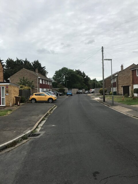
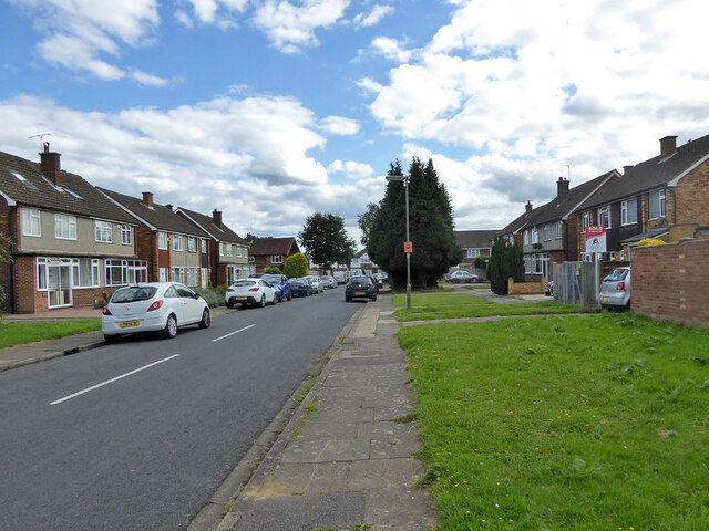
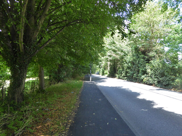
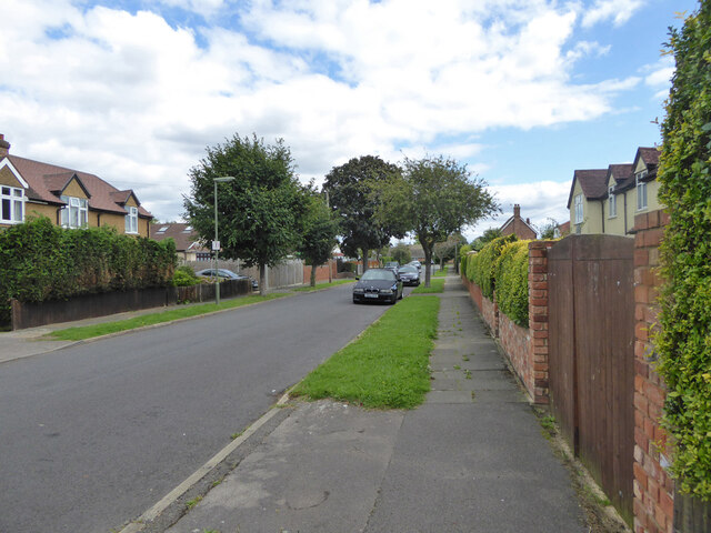
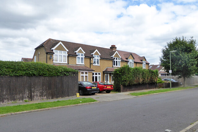
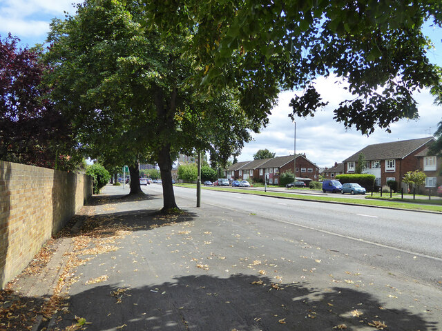
The area is primarily residential, consisting mainly of semi-detached and terraced houses. The architecture is predominantly from the mid-20th century, with some newer developments interspersed. Felthamhill is known for its leafy streets and well-maintained gardens, providing a pleasant environment for its residents.

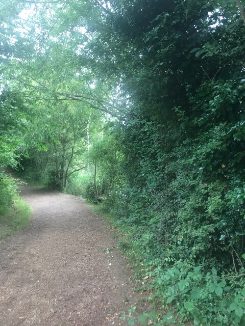
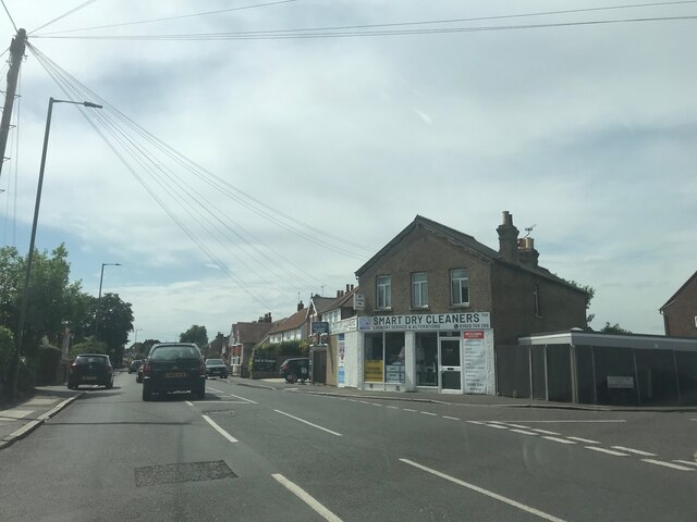
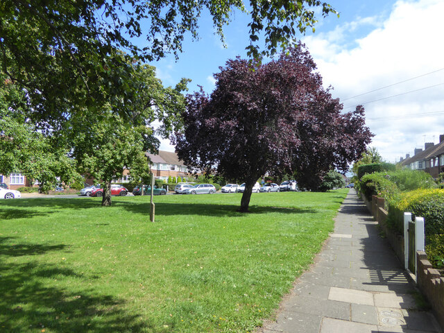
Felthamhill benefits from its proximity to several amenities and services. The nearby town center of Feltham offers a range of shops, supermarkets, and restaurants, catering to the needs of the local community. The area also benefits from a number of green spaces, including the picturesque Feltham Park, which provides opportunities for outdoor activities and relaxation.

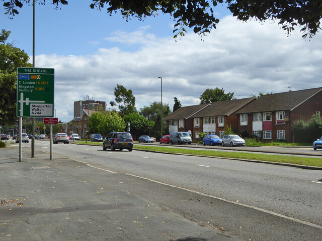
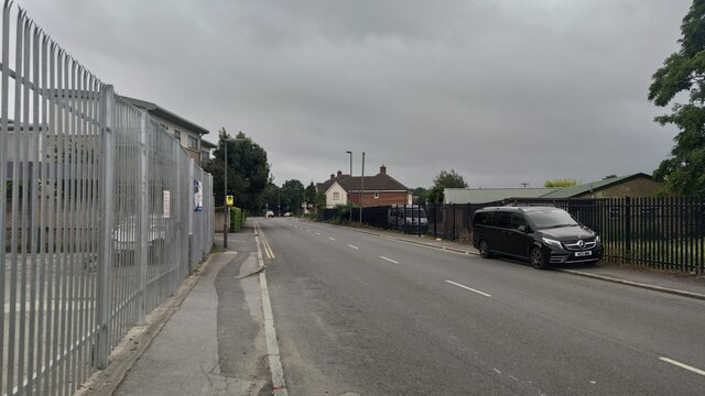
Transport links in Felthamhill are well-developed. The area is served by the Feltham railway station, which provides regular trains to London Waterloo, Clapham Junction, and other destinations. Additionally, several bus routes connect Felthamhill to nearby areas, making it easily accessible for commuters and visitors alike.

Felthamhill is home to a diverse community, with residents from various cultural backgrounds. The area boasts a strong sense of community spirit, with local events and activities organized throughout the year. Schools and healthcare facilities are available in the vicinity, ensuring that the needs of families and individuals are well catered for.

Overall, Felthamhill offers a peaceful and convenient living environment, combining the benefits of suburban living with easy access to the amenities and opportunities of London.

If you have any feedback on the listing, please let us know in the comments section below.

Felthamhill Images

Images are sourced within 2km of 51.427695/-0.424823 or Grid Reference TQ0971. Thanks to Geograph Open Source API. All images are credited.

On Anderson Drive
On Anderson Drive
Path in Bedford Lakes Country Park
Smart Dry Cleaners - near Ashford
Ashford Road
Ashford Road
Ashford Road
Ashford Road
Postbox TW15 162D, School Road, Ashford A George V box, with attached drop box.
Postbox TW15 162D, School Road, Ashford
A George V box, with attached drop box.
Sundown Road, Ashford
Path under railway, Feltham
Woodmans House under construction, 2017 Flats.
Woodmans House under construction, 2017
Flats.
A244 Chertsey Road Heading north.
A244 Chertsey Road
Heading north.
Scotts Way, Ashford Common
Houses on Scotts Way, Ashford Common
A308 Staines Road West Heading east.
A308 Staines Road West
Heading east.
A308 Staines Road West Heading east.
A308 Staines Road West
Heading east.
Path and green, Elgin Avenue
Glenfield Road, Ashford
Ashford Road Close to the roundabout going towards Carlton.
Ashford Road
Close to the roundabout going towards Carlton.
BP Offices BP Offices in Sunbury on Thames
BP Offices
BP Offices in Sunbury on Thames
Show me another place!

Felthamhill is located at Grid Ref: TQ0971 (Lat: 51.427695, Lng: -0.424823)

Administrative County: Surrey

District: Spelthorne

Police Authority: Surrey

What 3 Words

///pipes.lace.budget. Near Feltham, London

Nearby Locations

Felthamhill

Related Wikis

Sunbury-on-Thames

Sunbury-on-Thames (or commonly Sunbury) is a town on the north bank of the River Thames in the Borough of Spelthorne, Surrey, centred 13 mi (21 km) southwest...

Spelthorne Hundred

Spelthorne was a hundred (dated subdivision) of the historic county of Middlesex, England. It contained these parishes and settlements: Ashford East Bedfont...

Sunbury railway station (Surrey)

Sunbury railway station serves the town of Sunbury-on-Thames, in the Spelthorne district of Surrey, England. It is 16 miles 64 chains (27.0 km) down the...

Spelthorne Sports F.C.

Spelthorne Sports F.C. is a football club based in the borough of Spelthorne. They play in the Combined Counties League Premier Division South. == History... ==

Nearby Amenities

Located within 500m of 51.427695,-0.424823
Crossing
Crossing: uncontrolled
Crossing Ref: zebra
Lat/Long: 51.4273734/-0.4292851
Source: Personal memory.
Traffic Sign: low_emission_zone
Lat/Long: 51.4309303/-0.427435
Crossing
Crossing: marked
Lat/Long: 51.4269573/-0.4281894
Bus Stop
Kinross Drive
Naptan AtcoCode: 40004402061A
Naptan Bearing: NE
Naptan CommonName: Groveley Road
Naptan Indicator: adj
Naptan Landmark: Groveley Road
Naptan NaptanCode: surdjdwt
Naptan Street: Vicarage Road
Naptan Verified: no
Public Transport: platform
Source: naptan_import
Lat/Long: 51.4293875/-0.4209213
Bus Stop
Kings Avenue
Naptan AtcoCode: 40004402061B
Naptan Bearing: SE
Naptan CommonName: Groveley Road
Naptan Indicator: Just after
Naptan Landmark: Groveley Road
Naptan NaptanCode: surdjgad
Naptan Street: Vicarage Road
Naptan Verified: no
Public Transport: platform
Ref: 47004
Source: naptan_import
Lat/Long: 51.4283055/-0.4205801
Bus Stop
Kings Avenue
Naptan AtcoCode: 40004402061C
Naptan Bearing: NW
Naptan CommonName: Kings Avenue
Naptan Indicator: Just after
Naptan Landmark: Kings Avenue
Naptan NaptanCode: surdjgag
Naptan Street: Vicarage Road
Naptan Verified: no
Public Transport: platform
Ref: 73504
Source: naptan_import
Lat/Long: 51.4275636/-0.4203515
Bus Stop
Beechwood Avenue
Naptan AtcoCode: 40004402062A
Naptan Bearing: N
Naptan CommonName: Vicarage Road
Naptan Indicator: O/s 81
Naptan Landmark: Vicarage Road
Naptan NaptanCode: surdjgat
Naptan Street: Vicarage Road
Naptan Verified: no
Public Transport: platform
Ref: 49598
Source: naptan_import
Lat/Long: 51.4251394/-0.4194912
Bus Stop
Beechwood Avenue
Naptan AtcoCode: 40004402062B
Naptan Bearing: SE
Naptan CommonName: Vicarage Road
Naptan Indicator: O/s 74
Naptan Landmark: Vicarage Road / Beechwood Avenue
Naptan NaptanCode: surdjgaw
Naptan Street: Vicarage Road
Naptan Verified: no
Public Transport: platform
Ref: 49205
Source: naptan_import
Lat/Long: 51.4258906/-0.4194938
Bus Stop
BP Centre
Naptan AtcoCode: 40004402093A
Naptan Bearing: NE
Naptan CommonName: BP Centre
Naptan Indicator: adj
Naptan Landmark: BP Centre
Naptan NaptanCode: surdmjwg
Naptan Street: Chertsey Road
Naptan Verified: no
Public Transport: platform
Source: naptan_import
Lat/Long: 51.4273895/-0.4305063
Bus Stop
BP Centre
Naptan AtcoCode: 40004402093B
Naptan Bearing: SW
Naptan CommonName: BP Centre
Naptan Indicator: Opp
Naptan Landmark: BP Centre
Naptan NaptanCode: surdmjwj
Naptan Street: Chertsey Road
Naptan Verified: no
Public Transport: platform
Source: naptan_import
Lat/Long: 51.4272898/-0.4304522
Crossing
Crossing: marked
Lat/Long: 51.4254963/-0.4302345
Crossing
Crossing: uncontrolled
Crossing Ref: zebra
Lat/Long: 51.4270121/-0.4290988
Crossing
Crossing: marked
Lat/Long: 51.4255407/-0.4296648
Crossing
Crossing: marked
Lat/Long: 51.4257957/-0.4290881
Crossing
Crossing: marked
Lat/Long: 51.4254167/-0.4286265
Crossing
Crossing: marked
Lat/Long: 51.4255407/-0.4287777
Crossing
Crossing: marked
Lat/Long: 51.4256696/-0.42893
Crossing
Crossing: marked
Lat/Long: 51.4252222/-0.429599
Crossing
Crossing: marked
Lat/Long: 51.4253907/-0.4296284
Crossing
Crossing: marked
Lat/Long: 51.4253444/-0.4302022
Crossing
Crossing: marked
Lat/Long: 51.4253033/-0.4288559
Crossing
Crossing: marked
Lat/Long: 51.4254281/-0.4290132
Crossing
Crossing: marked
Lat/Long: 51.4255554/-0.4291562
Crossing
Crossing: marked
Lat/Long: 51.4256831/-0.4293109
Crossing
Crossing: marked
Lat/Long: 51.4263354/-0.4280569
Crossing
Crossing: marked
Lat/Long: 51.4267011/-0.4278933
Traffic Signals
Traffic Signals: signal
Traffic Signals Direction: forward
Lat/Long: 51.428294/-0.4280841
Turning Circle
Lat/Long: 51.4281669/-0.4218265
Turning Circle
Lat/Long: 51.4232467/-0.4246252
Crossing
Crossing: marked
Lat/Long: 51.4263888/-0.4282679
Crossing
Crossing: marked
Lat/Long: 51.4266785/-0.4281251
Junction: mini_roundabout
Lat/Long: 51.4270749/-0.4282214
Crossing
Crossing: uncontrolled
Traffic Calming: table
Lat/Long: 51.4278777/-0.4303541
Speed Camera
Direction: 55
Lat/Long: 51.4280252/-0.4313499
Crossing
Crossing: marked
Lat/Long: 51.4292097/-0.4285302
Traffic Calming: hump
Lat/Long: 51.4290665/-0.4211959
Pub
The Running Horse
Addr City: Sunbury-on-Thames
Addr Postcode: TW16 7LB
Addr Street: Groveley Road
Opening Hours: Mo-Th 11:00-23:00; Fr,Sa 11:00-00:00; Su 11:00-23:00
Operator: Sizzling Pubs
Phone: +44 20 8890 3932
Source: Local knowledge
Website: https://www.sizzlingpubs.co.uk/therunninghorsesunburyonthames/
Lat/Long: 51.4294859/-0.420325
Felthamhill
Place: neighbourhood
Lat/Long: 51.4277215/-0.4241636
Traffic Calming: hump
Lat/Long: 51.4248636/-0.4199905
Dream Food & Wine
Addr Housenumber: 129
Addr Street: Groveley Road
Phone: +44 7800880090
Shop: convenience
Lat/Long: 51.4293933/-0.4211673
Restaurant
Istanbul Kebab
Addr Housenumber: 113
Addr Street: Groveley Road
Cuisine: kebab
Phone: +44 20 8890 0295
Lat/Long: 51.4291324/-0.4213189
Restaurant
Oriental Palace
Addr Housenumber: 123
Addr Street: Groveley Road
Cuisine: chinese
Phone: +44 20 8890 2985
Lat/Long: 51.4292073/-0.421256
Parrots Food Hall
Addr Housenumber: 115
Addr Street: Groveley Road
Phone: +44 20 8890 3044
Lat/Long: 51.4290461/-0.4213914
Stone Angel
Addr Housenumber: 127
Addr Street: Groveley Road
Phone: +44 20 7998 5808
Shop: florist
Website: stoneangelflorist.co.uk
Lat/Long: 51.4293294/-0.4212201
Cafe
Sunbury Cafe
Addr Housenumber: 121
Addr Street: Groveley Road
Phone: +44 20 8831 9467
Lat/Long: 51.4291681/-0.4212889
The Hair Studio
Shop: hairdresser
Lat/Long: 51.429095/-0.4213503
Money Transfer
Western Union
Lat/Long: 51.4290318/-0.4214067
William Hill
Brand: William Hill
Brand Wikidata: Q4053147
Shop: bookmaker
Lat/Long: 51.4292869/-0.421256
Atm
Lat/Long: 51.42941/-0.4211428
Traffic Signals
Traffic Signals: signal
Traffic Signals Direction: forward
Lat/Long: 51.4281462/-0.4279557
Give Way
Direction: forward
Lat/Long: 51.4285066/-0.4280669
Building C
Office: company
Lat/Long: 51.4279501/-0.4305579
Building C, Sunbury
Office: company
Lat/Long: 51.4281009/-0.4305978
Post Box
Collection Times: Mo-Fr 18:30; Sa 12:00
Operator: Royal Mail
Post Box Design: type_b
Post Box Type: pillar
Ref: TW16 235
Source: survey
Lat/Long: 51.4247347/-0.423148
Post Box
Collection Times: Mo-Fr 17:00; Sa 12:00
Operator: Royal Mail
Post Box Design: type_b
Post Box Type: pillar
Ref: TW16 244
Royal Cypher: GVIR
Royal Cypher Wikidata: Q33102169
Source: survey
Lat/Long: 51.4254624/-0.4193285
Post Box
Collection Times: Mo-Fr 17:00; Sa 12:00
Operator: Royal Mail
Post Box Design: type_b
Post Box Type: pillar
Ref: TW16 258
Royal Cypher: EIIR
Royal Cypher Wikidata: Q33102113
Source: survey
Lat/Long: 51.4290273/-0.4211772
Crossing
Crossing: uncontrolled
Crossing Ref: zebra
Lat/Long: 51.4286894/-0.4283164
Crossing
Crossing: uncontrolled
Crossing Ref: zebra
Lat/Long: 51.4286958/-0.4287304
Crossing
Crossing: uncontrolled
Crossing Ref: zebra
Lat/Long: 51.4285837/-0.4287456
Bus Stop
Cumbernauld Gardens
Physically Present: no
Public Transport: platform
Lat/Long: 51.4282765/-0.4228174
Bus Stop
Cumbernauld Gardens
Physically Present: no
Public Transport: platform
Lat/Long: 51.4283725/-0.4229073
Direction: both
Surface: asphalt
Traffic Calming: hump
Lat/Long: 51.4320675/-0.4258616
Crossing
Crossing: marked
Lat/Long: 51.4260537/-0.4285438
Crossing
Crossing: marked
Lat/Long: 51.4271828/-0.4279105
Barrier: spikes
Direction: forward
Lat/Long: 51.4278155/-0.4310973
Barrier: lift_gate
Foot: no
Locked: no
Motor Vehicle: private
Lat/Long: 51.4284204/-0.4304207
Traffic Signals
Traffic Signals: signal
Traffic Signals Direction: backward
Lat/Long: 51.4283337/-0.4276091
Traffic Signals
Traffic Signals: signal
Lat/Long: 51.4282989/-0.4280432
Traffic Signals
Traffic Signals: signal
Traffic Signals Direction: forward
Lat/Long: 51.428463/-0.4279428
Traffic Signals
Traffic Signals: signal
Traffic Signals Direction: backward
Lat/Long: 51.4281701/-0.4278151
Traffic Calming: bump
Lat/Long: 51.4280068/-0.429083
Barrier: lift_gate
Lat/Long: 51.4285325/-0.4297977
Barrier: lift_gate
Lat/Long: 51.4273899/-0.4319871
Crossing
Crossing: uncontrolled
Lat/Long: 51.4281246/-0.4300544
Give Way
Direction: forward
Lat/Long: 51.4288936/-0.4210622
Crossing
Button Operated: yes
Crossing: traffic_signals
Crossing Island: yes
Crossing Markings: dashes
Tactile Paving: no
Lat/Long: 51.4256964/-0.419504
Turning Circle
Lat/Long: 51.4246792/-0.4280497
Turning Circle
Lat/Long: 51.4248743/-0.4301558
Colour: white
Marker: post
Material: concrete
Utility: oil
Lat/Long: 51.4307547/-0.4275149
Colour: white
Marker: post
Material: concrete
Utility: oil
Lat/Long: 51.4307502/-0.4276269
Colour: white
Description: white post with red hat
Marker: aerial
Material: concrete
Utility: oil
Lat/Long: 51.4307562/-0.4274973
The data included in this document is from www.openstreetmap.org. The data is made available under ODbL.

Have you been to Felthamhill?

Leave your review of Felthamhill below (or comments, questions and feedback).