Felsted

Settlement in Essex Uttlesford

England

Felsted

Farm Track heading away from Causeway End Road
Farm Track heading away from Causeway End Road Credit: Chris Heaton

Felsted is a picturesque village located in the county of Essex, England. Situated approximately 6 miles northwest of the city of Chelmsford, it is surrounded by beautiful countryside and offers a peaceful and idyllic setting. The village has a population of around 3,500 people.

One of the main attractions in Felsted is the historic Felsted School, a prestigious independent school with a rich history dating back to 1564. The school is known for its excellent academic standards and offers both boarding and day facilities.

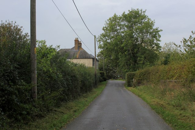
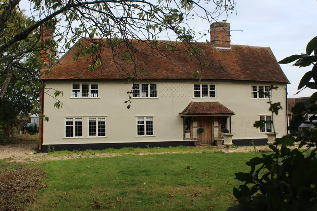
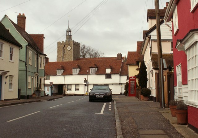
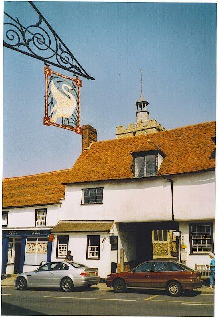
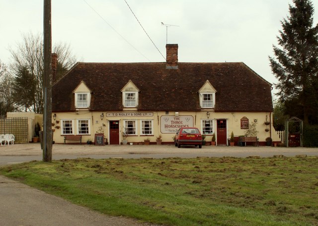
The village itself features an array of charming and well-preserved buildings, including a 15th-century church, St. Mary's, which is a focal point of the community. There are also several traditional pubs, restaurants, and quaint shops, creating a vibrant atmosphere for locals and visitors alike.

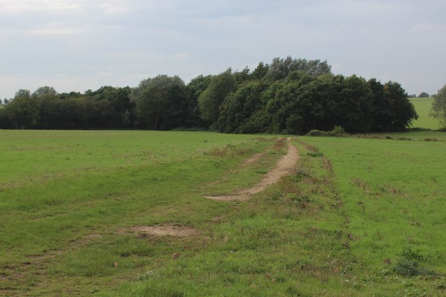
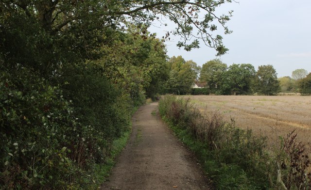
Felsted offers a range of recreational activities and outdoor spaces for residents to enjoy. The village is surrounded by scenic countryside, providing opportunities for walking, cycling, and exploring nature. The nearby Flitch Way, a former railway line converted into a walking and cycling path, is a popular destination for outdoor enthusiasts.

Transport links in Felsted are excellent, with easy access to major roadways such as the A120 and A131. The village is well-connected to nearby towns and cities, making it an attractive location for commuters.

Overall, Felsted is a charming and historic village that offers a peaceful and close-knit community, beautiful surroundings, and excellent educational opportunities.

If you have any feedback on the listing, please let us know in the comments section below.
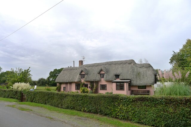
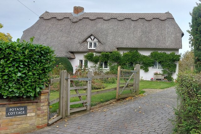
Felsted Images

Images are sourced within 2km of 51.856548/0.433298 or Grid Reference TL6720. Thanks to Geograph Open Source API. All images are credited.

Farm Track heading away from Causeway End Road
Approaching Cobler's Green
Bakers Lane Lane is rather a grand name for this thoroughfare - more a well maintained footpath approaching Jollyboys.
Bakers Lane
Lane is rather a grand name for this thoroughfare - more a well maintained footpath approaching Jollyboys.
Jollyboys House Grade II Listed building dating back to the 17th Century, with later alterations.
Jollyboys House
Grade II Listed building dating back to the 17th Century, with later alterations.
Breadlands, Cock Green Listed Grade II, "C16/C17 or earlier with later additions and alterations" <span class="nowrap"><a title="https://historicengland.org.uk/listing/the-list/list-entry/1112837?section=official-list-entry" rel="nofollow ugc noopener" href="https://historicengland.org.uk/listing/the-list/list-entry/1112837?section=official-list-entry">Link</a><img style="margin-left:2px;" alt="External link" title="External link - shift click to open in new window" src="https://s1.geograph.org.uk/img/external.png" width="10" height="10"/></span>
Breadlands, Cock Green
Listed Grade II, "C16/C17 or earlier with later additions and alterations" LinkExternal link
Potash Cottage Listed Grade II, 17th century or earlier <span class="nowrap"><a title="https://historicengland.org.uk/listing/the-list/list-entry/1147208?section=official-list-entry" rel="nofollow ugc noopener" href="https://historicengland.org.uk/listing/the-list/list-entry/1147208?section=official-list-entry">Link</a><img style="margin-left:2px;" alt="External link" title="External link - shift click to open in new window" src="https://s1.geograph.org.uk/img/external.png" width="10" height="10"/></span> . The name likely reflects the former production of potash in the area <span class="nowrap"><a title="https://www.wilcuma.org.uk/the-history-of-essex-after-1066/medieval-essex/" rel="nofollow ugc noopener" href="https://www.wilcuma.org.uk/the-history-of-essex-after-1066/medieval-essex/">Link</a><img style="margin-left:2px;" alt="External link" title="External link - shift click to open in new window" src="https://s1.geograph.org.uk/img/external.png" width="10" height="10"/></span>
Potash Cottage
Listed Grade II, 17th century or earlier LinkExternal link . The name likely reflects the former production of potash in the area LinkExternal link
Potash Farm Listed Grade II, 15th century or earlier! <span class="nowrap"><a title="https://historicengland.org.uk/listing/the-list/list-entry/1322248?section=official-list-entry" rel="nofollow ugc noopener" href="https://historicengland.org.uk/listing/the-list/list-entry/1322248?section=official-list-entry">Link</a><img style="margin-left:2px;" alt="External link" title="External link - shift click to open in new window" src="https://s1.geograph.org.uk/img/external.png" width="10" height="10"/></span> . The name likely reflects the past production of potash in the area <span class="nowrap"><a title="https://www.wilcuma.org.uk/the-history-of-essex-after-1066/medieval-essex/" rel="nofollow ugc noopener" href="https://www.wilcuma.org.uk/the-history-of-essex-after-1066/medieval-essex/">Link</a><img style="margin-left:2px;" alt="External link" title="External link - shift click to open in new window" src="https://s1.geograph.org.uk/img/external.png" width="10" height="10"/></span>
Potash Farm
Listed Grade II, 15th century or earlier! LinkExternal link . The name likely reflects the past production of potash in the area LinkExternal link
Byway approaching Jollyboys, Felsted
Absol Bridge The bridge takes Mill Road over the River Chelmer.
Absol Bridge
The bridge takes Mill Road over the River Chelmer.
River Chelmer above Absol Bridge It is not a very impressive river this far up, but it is probably at about minimum flow for the year and could do with some weed clearance.
River Chelmer above Absol Bridge
It is not a very impressive river this far up, but it is probably at about minimum flow for the year and could do with some weed clearance.
River Chelmer below Absol Bridge It is noticeable how much less congested the channel is under the shade of trees where growth of water plants in inhibited. Trees bring their own blockage problems however, as may be seen.
River Chelmer below Absol Bridge
It is noticeable how much less congested the channel is under the shade of trees where growth of water plants in inhibited. Trees bring their own blockage problems however, as may be seen.
Play apparatus, Cobler's Green It is not too clear if the field here is public or private. There is a house over the hedge on the left.
Play apparatus, Cobler's Green
It is not too clear if the field here is public or private. There is a house over the hedge on the left.
B1417 Chelmsford Road Towards Causeway End.
B1417 Chelmsford Road
Towards Causeway End.
B1417 at Causeway End
B1417 towards Hartford End
Church of the Holy Cross, Felsted Grade I building, extensively described at this <span class="nowrap"><a title="http://list.historicengland.org.uk/resultsingle.aspx?uid=1112864" rel="nofollow ugc noopener" href="http://list.historicengland.org.uk/resultsingle.aspx?uid=1112864">Link</a><img style="margin-left:2px;" alt="External link" title="External link - shift click to open in new window" src="https://s1.geograph.org.uk/img/external.png" width="10" height="10"/></span>.
Church of the Holy Cross, Felsted
Grade I building, extensively described at this LinkExternal link.
"The Chequers" public house, Felstead
Felsted almshouses Grade II listed: description at this <span class="nowrap"><a title="http://list.historicengland.org.uk/resultsingle.aspx?uid=1112890" rel="nofollow ugc noopener" href="http://list.historicengland.org.uk/resultsingle.aspx?uid=1112890">Link</a><img style="margin-left:2px;" alt="External link" title="External link - shift click to open in new window" src="https://s1.geograph.org.uk/img/external.png" width="10" height="10"/></span>.
Felsted almshouses
Grade II listed: description at this LinkExternal link.
Show me another place!

Felsted is located at Grid Ref: TL6720 (Lat: 51.856548, Lng: 0.433298)

Administrative County: Essex

District: Uttlesford

Police Authority: Essex

What 3 Words

///braked.directors.newsprint. Near Little Dunmow, Essex

Nearby Locations

Felsted

Related Wikis

Felsted

Felsted (sometimes spelt Felstead) is a village and civil parish in the Uttlesford district of Essex, England. The civil parish includes the hamlets of...

Felsted School

Felsted School is a co-educational independent boarding and day school, situated in Felsted in Essex, England. It is in the British public school tradition...

Flitch Green

Flitch Green is a civil parish in the Uttlesford district of Essex, England. It consists of a housing development built outside the village of Little Dunmow...

Bannister Green

Bannister Green is a village near Felsted, in the Uttlesford district, in the county of Essex, England. It was the site of Bannister Green Halt railway...

Nearby Amenities

Located within 500m of 51.856548,0.433298
Felsted
Created By: Potlatch 0.10f
Place: village
Source: npe
Lat/Long: 51.8559222/0.4369776
Bus Stop
The Chequers
Bus: yes
Naptan AtcoCode: 1500CHEQ1
Naptan Bearing: W
Naptan CommonName: The Chequers
Naptan Indicator: o/s
Naptan Landmark: The Chequers
Naptan NaptanCode: esxgwadt
Naptan Street: Braintree Road
Naptan Verified: no
Public Transport: platform
Source: naptan_import
Lat/Long: 51.8573239/0.4384669
Bus Stop
The Chequers
Bus: yes
Naptan AtcoCode: 1500CHEQ2
Naptan Bearing: E
Naptan CommonName: The Chequers
Naptan Indicator: Opp
Naptan Landmark: The Chequers
Naptan NaptanCode: esxgwadw
Naptan Street: Braintree Road
Naptan Verified: no
Public Transport: platform
Source: naptan_import
Lat/Long: 51.8574443/0.4387406
Bus Stop
Church
Bus: yes
Naptan AtcoCode: 1500FLSTDCH2
Naptan Bearing: W
Naptan CommonName: Church
Naptan Crossing: Chelmsford Road B1417
Naptan Indicator: Opp
Naptan Landmark: Church
Naptan NaptanCode: esxatwtp
Naptan Street: Braintree Road
Naptan Verified: no
Public Transport: platform
Source: naptan_import
Lat/Long: 51.8566777/0.4341453
Bus Stop
Riche Close
Bus: yes
Naptan AtcoCode: 1500FLSTDCH3
Naptan Bearing: S
Naptan CommonName: Riche Close
Naptan Crossing: Riche Close
Naptan Indicator: Adj
Naptan Landmark: Riche Close
Naptan NaptanCode: esxatwmw
Naptan Street: Chelmsford Road B1417
Naptan Verified: no
Public Transport: platform
Source: naptan_import
Lat/Long: 51.8555943/0.4341503
Bus Stop
Riche Close
Bus: yes
Naptan AtcoCode: 1500FLSTDCHY
Naptan Bearing: N
Naptan BusStopType: CUS
Naptan CommonName: Riche Close
Naptan Crossing: Riche Close
Naptan Indicator: Opp
Naptan Landmark: Riche Close
Naptan NaptanCode: esxgpdga
Naptan Street: Chelmsford Road B1417
Naptan Verified: no
Public Transport: platform
Source: naptan_import
Lat/Long: 51.8555341/0.4340425
Bus Stop
Church
Bus: yes
Naptan AtcoCode: 1500IM172
Naptan Bearing: E
Naptan CommonName: Church
Naptan Crossing: Chelmsford Road B1417
Naptan Indicator: o/s
Naptan Landmark: Church
Naptan NaptanCode: esxatwpa
Naptan Street: Station Road
Naptan Verified: no
Public Transport: platform
Source: naptan_import
Lat/Long: 51.8566305/0.4330761
The Chequers
Disused Amenity: pub
Lat/Long: 51.8572984/0.4366494
Place Of Worship
United Reformed Church
Religion: christian
Wikidata: Q26608083
Lat/Long: 51.8575059/0.4354608
Boote House
Disused Amenity: restaurant
Lat/Long: 51.8564377/0.4338226
Restaurant
Josephs
Lat/Long: 51.8567266/0.4344852
Fast Food
Raj Mahal
Lat/Long: 51.8572719/0.4362611
Doctors
Felsted Surgery
Healthcare: doctor
Lat/Long: 51.8574045/0.4379348
Post Office
Linsell's
Shop: convenience
Lat/Long: 51.856656/0.4328826
Cafe
Baker's Deli
Lat/Long: 51.856736/0.4349907
Building: pavilion
Lat/Long: 51.8575907/0.4381911
Post Box
Post Box Type: pillar
Royal Cypher: EIIR
Royal Cypher Wikidata: Q33102113
Lat/Long: 51.8566306/0.4329456
Parking
Felsted Village Car Park
Lat/Long: 51.8567651/0.4323236
Entrance: yes
Lat/Long: 51.8567709/0.4330298
Turning Circle
Lat/Long: 51.8586024/0.4342722
Crossing
Crossing: marked
Lat/Long: 51.8570169/0.4355999
Bench
Backrest: yes
Material: wood
Seats: 4
Lat/Long: 51.8566303/0.4306931
Bench
Backrest: yes
Material: wood
Lat/Long: 51.8572161/0.4327457
Bench
Backrest: yes
Material: wood
Lat/Long: 51.8568858/0.4328401
Bench
Backrest: yes
Material: wood
Lat/Long: 51.8568372/0.4328862
Bench
Backrest: yes
Material: wood
Lat/Long: 51.8568097/0.4331476
Bench
Backrest: yes
Material: wood
Lat/Long: 51.8571673/0.435927
Bench
Backrest: yes
Material: wood
Lat/Long: 51.8571875/0.436375
Bench
Backrest: yes
Material: wood
Lat/Long: 51.8574403/0.438718
Telephone
Booth: K6
Covered: booth
Listed Status: Grade II
Man Made: telephone_box
Phone: +44 1371 820310
Lat/Long: 51.8563664/0.4335651
Give Way
Direction: backward
Lat/Long: 51.856579/0.4333036
Information: guidepost
Tourism: information
Lat/Long: 51.8564564/0.4304269
The data included in this document is from www.openstreetmap.org. The data is made available under ODbL.

Have you been to Felsted?

Leave your review of Felsted below (or comments, questions and feedback).