Castle Camps Millennium Wood

Wood, Forest in Cambridgeshire South Cambridgeshire

England

Castle Camps Millennium Wood

Sunlight, shadow, woodland and rolling fields A late-August morning of high, fast-moving cloud, bright sunlight and shifting shadows. This is the lane from Camps Hall to Steventon End, in the south-eastern corner of Cambridgeshire.
Sunlight, shadow, woodland and rolling fields Credit: John Sutton

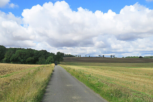
Castle Camps Millennium Wood is a beautiful woodland area located in the county of Cambridgeshire, England. Spanning across approximately 13 acres, this woodland was created as part of the Millennium celebrations in the year 2000.

The wood is a perfect example of a native English woodland, consisting primarily of broadleaf trees such as oak, ash, and hazel. These trees provide a rich habitat for a variety of flora and fauna, attracting a diverse range of wildlife. Visitors to the wood can expect to see an array of bird species, including woodpeckers and songbirds, as well as small mammals like squirrels and rabbits.

The wood is open to the public and offers a tranquil escape from the hustle and bustle of city life. It provides a peaceful environment for walking, picnicking, and enjoying the natural surroundings. There are well-maintained footpaths that wind through the wood, allowing visitors to explore its beauty at their own pace.

In addition to its recreational value, Castle Camps Millennium Wood also serves an important ecological purpose. The wood acts as a carbon sink, absorbing carbon dioxide from the atmosphere and helping to combat climate change. It also provides a habitat for endangered species and promotes biodiversity in the local area.

Overall, Castle Camps Millennium Wood is a valuable asset to the community of Cambridgeshire, offering a peaceful retreat and contributing to the preservation of the environment.

If you have any feedback on the listing, please let us know in the comments section below.

Castle Camps Millennium Wood Images

Images are sourced within 2km of 52.062305/0.37103312 or Grid Reference TL6243. Thanks to Geograph Open Source API. All images are credited.

Sunlight, shadow, woodland and rolling fields A late-August morning of high, fast-moving cloud, bright sunlight and shifting shadows. This is the lane from Camps Hall to Steventon End, in the south-eastern corner of Cambridgeshire.
Sunlight, shadow, woodland and rolling fields
A late-August morning of high, fast-moving cloud, bright sunlight and shifting shadows. This is the lane from Camps Hall to Steventon End, in the south-eastern corner of Cambridgeshire.
Camps Hall to Steventon End The road to Steventon End has just crossed a stream which is one of the easternmost tributaries of the many-stranded eastern arm of the River Cam network.
Camps Hall to Steventon End
The road to Steventon End has just crossed a stream which is one of the easternmost tributaries of the many-stranded eastern arm of the River Cam network.
Road junction at Camps Hall The road ahead, to Bartlow, follows one of the easternmost streams of the many-stranded River Cam, which rises near Castle Camps.
Road junction at Camps Hall
The road ahead, to Bartlow, follows one of the easternmost streams of the many-stranded River Cam, which rises near Castle Camps.
The road to Bartlow in August The road follows a stream which rises near Castle Camps and is one of the easternmost of the many strands of the complex River Cam network.
The road to Bartlow in August
The road follows a stream which rises near Castle Camps and is one of the easternmost of the many strands of the complex River Cam network.
Camps End: left to Bartlow, right to the Bumpsteads The words "Together in The Camps" are incised on the bench.
Camps End: left to Bartlow, right to the Bumpsteads
The words "Together in The Camps" are incised on the bench.
Camps End: Farm Cottage The timber-framed cottage is Grade II listed.
Camps End: Farm Cottage
The timber-framed cottage is Grade II listed.
Camps End: blue on the bend A pleasing timber-framed house with a slate roof.
Camps End: blue on the bend
A pleasing timber-framed house with a slate roof.
Cottages at Camps End On an otherwise sunny morning in late August the sun was briefly behind a scrap of high cloud.
Cottages at Camps End
On an otherwise sunny morning in late August the sun was briefly behind a scrap of high cloud.
Brownings House This Grade II listed timber-framed farmhouse of c 1700 is on a dead-end lane near Camps End, in a south-eastern corner of Cambridgeshire.
Brownings House
This Grade II listed timber-framed farmhouse of c 1700 is on a dead-end lane near Camps End, in a south-eastern corner of Cambridgeshire.
Outside Spindleberry Cottage A bench is kindly provided for the use of elderly cyclists. The fingerpost points along a path which leads eventually to Castle Camps.
Outside Spindleberry Cottage
A bench is kindly provided for the use of elderly cyclists. The fingerpost points along a path which leads eventually to Castle Camps.
Sunlight, shadows and Spindleberry Cottage The sun was in the wrong quarter of the sky for a successful picture of the whole cottage, taken from the road - but I discovered that Jonathan Billinger had photographed it clearly in 2007: <a href="https://www.geograph.org.uk/photo/599020">TL6141 : Spindleberry Cottage</a>.
Sunlight, shadows and Spindleberry Cottage
The sun was in the wrong quarter of the sky for a successful picture of the whole cottage, taken from the road - but I discovered that Jonathan Billinger had photographed it clearly in 2007: TL6141 : Spindleberry Cottage.
At Charlwood Farm The farmhouse is Grade II listed, but not the outbuildings....
At Charlwood Farm
The farmhouse is Grade II listed, but not the outbuildings....
On the byway to Camps End A remote corner of Cambridgeshire on a fine late-August morning.
On the byway to Camps End
A remote corner of Cambridgeshire on a fine late-August morning.
Stubble, bales and sky A remote part of south-east Cambridgeshire on a fine late-August morning.
Stubble, bales and sky
A remote part of south-east Cambridgeshire on a fine late-August morning.
Lane, mast and fingerpost Public paths - part of a dense network in these remote parts - from Red Oaks Hill (left) to Drapers Green cross the lane from Olmstead Green to Castle Camps and Camps End.
Lane, mast and fingerpost
Public paths - part of a dense network in these remote parts - from Red Oaks Hill (left) to Drapers Green cross the lane from Olmstead Green to Castle Camps and Camps End.
Drapers Green: Board Barn A number of businesses are based here, including a purveyor of bespoke firepits. The road links Castle Camps and Helions Bumpstead (right).
Drapers Green: Board Barn
A number of businesses are based here, including a purveyor of bespoke firepits. The road links Castle Camps and Helions Bumpstead (right).
A farm track with a history During the Second World War this concrete farm track was part of the perimeter road of RAF Castle Camps. Hawker Hurricanes were flown from here during the Battle of Britain.
A farm track with a history
During the Second World War this concrete farm track was part of the perimeter road of RAF Castle Camps. Hawker Hurricanes were flown from here during the Battle of Britain.
Castle Camps: near Moat Farm On the eastern edge of the village,
Castle Camps: near Moat Farm
On the eastern edge of the village,
Show me another place!

Castle Camps Millennium Wood is located at Grid Ref: TL6243 (Lat: 52.062305, Lng: 0.37103312)

Administrative County: Cambridgeshire

District: South Cambridgeshire

Police Authority: Cambridgeshire

What 3 Words

///seating.cook.vessel. Near Haverhill, Suffolk

Related Wikis

Castle Camps (village)

Castle Camps is a village and civil parish in the South Cambridgeshire district, in the county of Cambridgeshire, England. It is 15 miles (24 km) south...

Castle Camps

Castle Camps was a Norman Castle located in what is now the civil parish of Castle Camps, Cambridgeshire. == Owners == Castle Camps was originally a Saxon...

RAF Castle Camps

RAF Castle Camps was listed as being in Cambridgeshire as it is close to its namesake Cambridgeshire village. It is very near the Suffolk border and the...

Shudy Camps

Shudy Camps is a village in the south-east corner of Cambridgeshire, England, near the border of Essex and Suffolk, and is part of the Chilford Hundred...

Nearby Amenities

Located within 500m of 52.062305,0.37103312
Fixme: paths may be wrong here
Lat/Long: 52.0631431/0.3710638
Power: pole
Lat/Long: 52.0622297/0.3733028
Power: pole
Lat/Long: 52.0632425/0.3758122
Power: pole
Lat/Long: 52.0627815/0.3747366
Power: pole
Lat/Long: 52.0658408/0.3739187
Power: pole
Lat/Long: 52.0635961/0.3766692
Power: pole
Lat/Long: 52.0655836/0.3743908
Power: pole
Lat/Long: 52.0635026/0.3774592
Power: pole
Lat/Long: 52.0663214/0.3729088
Power: pole
Lat/Long: 52.0599237/0.3676801
Power: pole
Lat/Long: 52.0603823/0.3688039
Power: pole
Lat/Long: 52.0617522/0.3721403
Power: pole
Lat/Long: 52.0620741/0.373869
Power: pole
Lat/Long: 52.0594884/0.3666045
Power: pole
Lat/Long: 52.0607895/0.3698308
Power: pole
Lat/Long: 52.0612669/0.3709589
Barrier: kissing_gate
Lat/Long: 52.0578676/0.3698592
Barrier: kissing_gate
Lat/Long: 52.057957/0.3702233
Barrier: kissing_gate
Lat/Long: 52.0583969/0.3714778
Board Type: nature
Information: board
Operator: Woodland Trust
Tourism: information
Lat/Long: 52.0619001/0.3740206
Fixme: path continues
Lat/Long: 52.0620237/0.3705498
The data included in this document is from www.openstreetmap.org. The data is made available under ODbL.

Have you been to Castle Camps Millennium Wood?

Leave your review of Castle Camps Millennium Wood below (or comments, questions and feedback).