Coneyburrow Wood

Wood, Forest in Sussex Wealden

England

Coneyburrow Wood

Blackdown Mill This Windmill originally stood at "Three Chimneys" in Kent. It was purchased by Samuel Dallaway and brought to this site and erected in 1856 by a Heathfield millwright. It is known as the Blackdown Mill but perhaps more widely known as the Cherry Clack Mill as it was originally in a cherry orchard.
Blackdown Mill Credit: Janet Richardson

Coneyburrow Wood, located in Sussex, England, is a picturesque woodland area renowned for its natural beauty and diverse range of flora and fauna. Spanning over several acres, this enchanting forest is a haven for nature enthusiasts, hikers, and those seeking tranquility amidst the bustling city life.

The wood is predominantly composed of native broadleaf trees, such as oak, beech, and birch, which create a dense and leafy canopy overhead. This lush vegetation provides a vital habitat for numerous woodland creatures, including deer, squirrels, foxes, and an array of bird species.

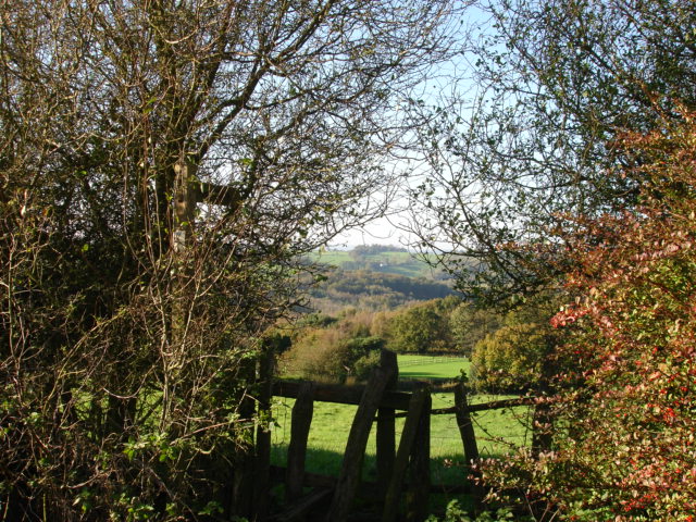
The forest floor is adorned with a rich tapestry of wildflowers, ferns, and mosses, adding to the wood's ethereal charm. A well-maintained network of winding trails and footpaths meanders through the woodland, offering visitors the opportunity to explore its hidden gems and discover its hidden secrets.

Coneyburrow Wood also boasts a small stream that meanders through its heart, adding a touch of serenity to the already idyllic setting. The babbling brook provides a refreshing spot for visitors to rest, unwind, and appreciate the symphony of nature.

With its close proximity to nearby towns and villages, Coneyburrow Wood is easily accessible to both locals and tourists alike. The wood serves as a popular destination for recreational activities such as picnicking, photography, or simply immersing oneself in the peaceful ambiance of nature.

In conclusion, Coneyburrow Wood in Sussex is a captivating woodland retreat that showcases the beauty and diversity of the English countryside. Whether one seeks solitude, adventure, or a simple connection with nature, this enchanting forest is sure to leave a lasting impression.

If you have any feedback on the listing, please let us know in the comments section below.

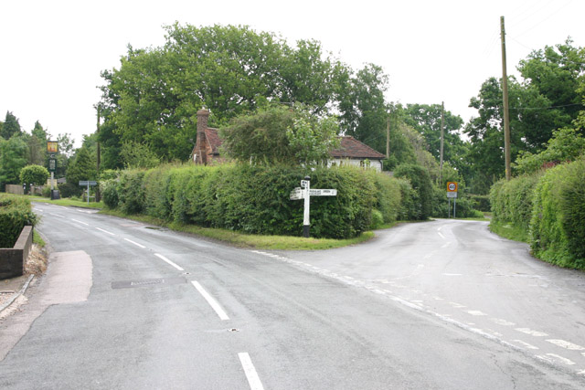
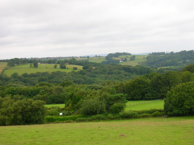
Coneyburrow Wood Images

Images are sourced within 2km of 50.949817/0.31164168 or Grid Reference TQ6219. Thanks to Geograph Open Source API. All images are credited.

Blackdown Mill This Windmill originally stood at "Three Chimneys" in Kent. It was purchased by Samuel Dallaway and brought to this site and erected in 1856 by a Heathfield millwright. It is known as the Blackdown Mill but perhaps more widely known as the Cherry Clack Mill as it was originally in a cherry orchard.
Blackdown Mill
This Windmill originally stood at "Three Chimneys" in Kent. It was purchased by Samuel Dallaway and brought to this site and erected in 1856 by a Heathfield millwright. It is known as the Blackdown Mill but perhaps more widely known as the Cherry Clack Mill as it was originally in a cherry orchard.
Footpath Punnets Town Footpath next to Blackdown Mill across farmland, Punnets Town East Sussex.
Footpath Punnets Town
Footpath next to Blackdown Mill across farmland, Punnets Town East Sussex.
Frost Cottage frost Cottage stands on Flitterbrook Lane in Warbleton Parish. It was named after my ancestor, John Frost, who lived there. John lived from about 1733 to 1809
Frost Cottage
frost Cottage stands on Flitterbrook Lane in Warbleton Parish. It was named after my ancestor, John Frost, who lived there. John lived from about 1733 to 1809
Chapel, Chapel Cross, East Sussex The Independent Chapel in Cade Street, Chapel Cross was built in 1767. It is a simple symmetrical building with oval window over its south facing porch. The chapel was known locally for many years as the chocolate church as the Pastor (P J Pont) gave the children going to Sunday School chocolates. Chapel cross was once considered to be part of Punnetts Town.
Chapel, Chapel Cross, East Sussex
The Independent Chapel in Cade Street, Chapel Cross was built in 1767. It is a simple symmetrical building with oval window over its south facing porch. The chapel was known locally for many years as the chocolate church as the Pastor (P J Pont) gave the children going to Sunday School chocolates. Chapel cross was once considered to be part of Punnetts Town.
Punnett's Town  "Blackdown Mill" Restored octagonal 3 storey white smock mill on elevated brick base.
Punnett's Town "Blackdown Mill"
Restored octagonal 3 storey white smock mill on elevated brick base.
The Three Cups Inn, Three Cups Corner, East Sussex Three Cups Corner probably derives its unusual name from its position on a watershed separating three streams.
The Three Cups Inn, Three Cups Corner, East Sussex
Three Cups Corner probably derives its unusual name from its position on a watershed separating three streams.
Three Cups Inn
Three Cups Inn
House, telephone  box and road junction at Three Cups Corner
House, telephone box and road junction at Three Cups Corner
Road junction, Three Cups Corner
Any old iron! Metal Waste Management Centre - scrapyard.
Any old iron!
Metal Waste Management Centre - scrapyard.
Blackdown Mill The original mill burnt down in 1859 and was replaced by another moved wholesale from Biddenden in Kent. Consequently, this mill is sometimes known by its original name, Cherry Clack Mill. The sweeps fell into disrepair and were removed sometime in the 1930s though the mill continued to grind using a combustion engine instead, it was after the war that the original family decided on restoration. Taken from the footpath that heads up the slope from Greenwoods Lane towards the mill.
Blackdown Mill
The original mill burnt down in 1859 and was replaced by another moved wholesale from Biddenden in Kent. Consequently, this mill is sometimes known by its original name, Cherry Clack Mill. The sweeps fell into disrepair and were removed sometime in the 1930s though the mill continued to grind using a combustion engine instead, it was after the war that the original family decided on restoration. Taken from the footpath that heads up the slope from Greenwoods Lane towards the mill.
View from Blackdown Hill The hedges in the foreground mark out Greenwoods Lane, beyond that is Binglett's Wood then on the lower end of the further slope are the woods around the River Dudwell, whilst the far ridge contains the village of Broad Oak.
View from Blackdown Hill
The hedges in the foreground mark out Greenwoods Lane, beyond that is Binglett's Wood then on the lower end of the further slope are the woods around the River Dudwell, whilst the far ridge contains the village of Broad Oak.
Blackdown Mill This is the view from Blackdown Road. See <a href="https://www.geograph.org.uk/photo/505786">TQ6220 : Blackdown Mill</a> for another view and a little history of the mill.
Blackdown Mill
This is the view from Blackdown Road. See TQ6220 : Blackdown Mill for another view and a little history of the mill.
Forest Lane The lane heads to Dallington Forest from Punnett's Town passing a number of farms and Rushlake Green Motors. The surfacing runs up to Little Poundfield Farm though it is now officially a bridlepath as mentioned on the back of the van which judging by the cobwebs hasn't been driven for a while.
Forest Lane
The lane heads to Dallington Forest from Punnett's Town passing a number of farms and Rushlake Green Motors. The surfacing runs up to Little Poundfield Farm though it is now officially a bridlepath as mentioned on the back of the van which judging by the cobwebs hasn't been driven for a while.
Independent Chapel, Cade Street The chapel is on the B2096 is dated 1809 but was probably built earlier. It has a bulls-eye window and a sun-dial above the porch. The obelisk behind the church board commemorates the Sussex Martyrs burnt at the stake in Lewes during the reign of Bloody Mary.
Independent Chapel, Cade Street
The chapel is on the B2096 is dated 1809 but was probably built earlier. It has a bulls-eye window and a sun-dial above the porch. The obelisk behind the church board commemorates the Sussex Martyrs burnt at the stake in Lewes during the reign of Bloody Mary.
Protestant Martyrs Memorial, Cade Street
The Weald from Cade Street Taken from the front of the Independendent Chapel on the B2096. The South Downs in the distance.
The Weald from Cade Street
Taken from the front of the Independendent Chapel on the B2096. The South Downs in the distance.
B2096, Punnett's Town
Show me another place!

Coneyburrow Wood is located at Grid Ref: TQ6219 (Lat: 50.949817, Lng: 0.31164168)

Administrative County: East Sussex

District: Wealden

Police Authority: Sussex

What 3 Words

///mime.strategy.bulge. Near Heathfield, East Sussex

Related Wikis

Punnett's Town

Punnett's Town is a village in the Wealden district of East Sussex. The main street is Battle road, which is part of the B2096 road. Blackdown Mill is...
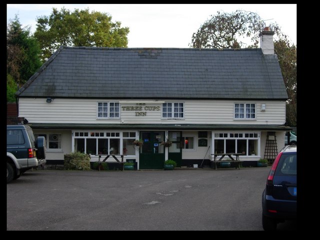
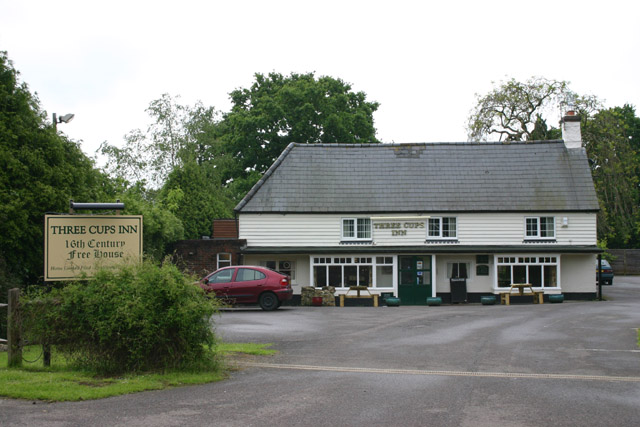
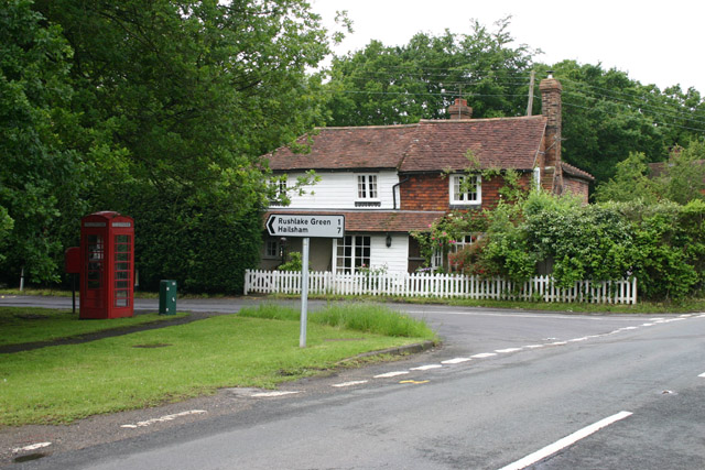
Rushlake Green

Rushlake Green is a small village in the civil parish of Warbleton in the Wealden district of East Sussex, England. Rushlake Green is situated on the slopes...

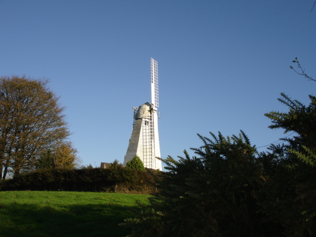
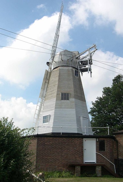
Blackdown Mill, Punnetts Town

Blackdown Mill or Cherry Clack Mill is a grade II listed smock mill at Punnetts Town, East Sussex, England, which has been restored. == History == Blackdown...

St Dunstan's Farm Meadows

St Dunstan's Farm Meadows is a 10.2-hectare (25-acre) biological Site of Special Scientific Interest south-east of Heathfield in East Sussex. It is in...

Warbleton

Warbleton is a village and civil parish in the Wealden district of East Sussex, England. Within its bounds are three other settlements. It is located south...

Bingletts Wood

Bingletts Wood is a 16-hectare (40-acre) biological Site of Special Scientific Interest east of Heathfield in East Sussex.Part of this ancient wood is...
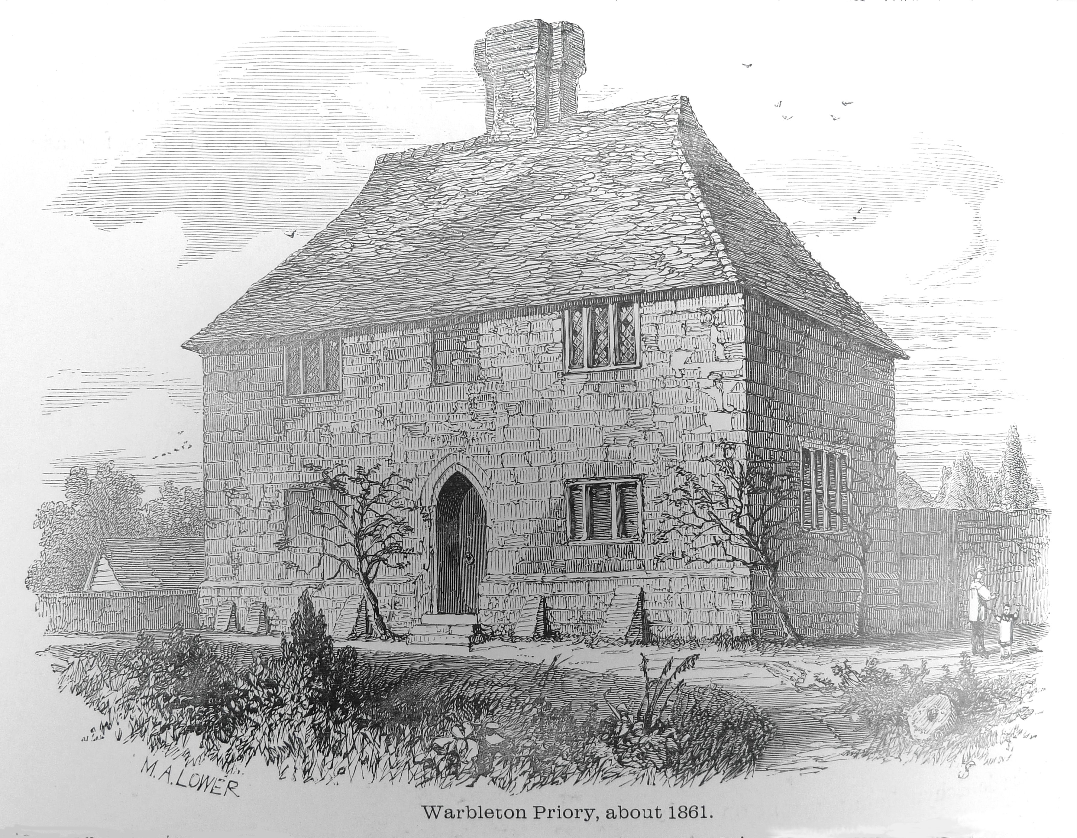
Warbleton Priory

Warbleton Priory was a medieval monastic house in East Sussex, England. The current house is a Grade II* listed building. == References == == External... ==

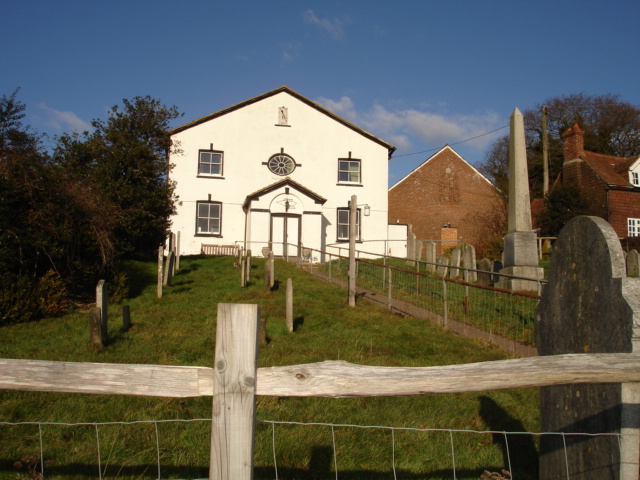
All Saints Church, Heathfield

All Saints Church is a Church of England parish church in Heathfield, East Sussex, England. It was constructed in the 14th century and is a Grade II* listed...

Nearby Amenities

Located within 500m of 50.949817,0.31164168
The data included in this document is from www.openstreetmap.org. The data is made available under ODbL.

Have you been to Coneyburrow Wood?

Leave your review of Coneyburrow Wood below (or comments, questions and feedback).