Nightingale Wood

Wood, Forest in Kent Tunbridge Wells

England

Nightingale Wood

Pembury Water Treatment Works This water treatment plant and reservoir is owned and managed by South East Water. It supplies water to Pembury and surrounding areas.
Pembury Water Treatment Works Credit: N Chadwick

Nightingale Wood, located in Kent, England, is a picturesque forest that covers an area of approximately 100 acres. This enchanting woodland is known for its breathtaking beauty and diverse range of flora and fauna. The wood is named after the melodious nightingales that sing their sweet melodies during the spring and summer months.

The wood is predominantly made up of native broadleaf trees, such as oak, beech, and ash, which create a dense canopy, providing shelter and habitat for a variety of wildlife. The forest floor is adorned with a carpet of wildflowers, including bluebells, primroses, and wood anemones, which add a vibrant burst of color to the woodland landscape.

Nightingale Wood is a popular destination for nature enthusiasts and avid hikers. It offers a network of well-maintained trails that wind through the forest, allowing visitors to explore its hidden treasures. The trails range from easy walks suitable for families to more challenging routes for experienced hikers.

The wood also features a small pond, attracting a diverse array of bird species, including kingfishers, herons, and ducks. Birdwatchers can often be found perched on the edge of the pond, patiently waiting for the opportunity to spot a rare feathered visitor.

Additionally, Nightingale Wood has a rich history, with evidence of human activity dating back centuries. Ancient burial mounds and remnants of old settlements can be found scattered throughout the forest, providing a glimpse into the area's past.

Overall, Nightingale Wood is a captivating destination that offers a tranquil escape from the hustle and bustle of everyday life, with its stunning scenery, abundant wildlife, and rich history.

If you have any feedback on the listing, please let us know in the comments section below.

Nightingale Wood Images

Images are sourced within 2km of 51.176372/0.32184117 or Grid Reference TQ6244. Thanks to Geograph Open Source API. All images are credited.

Pembury Water Treatment Works This water treatment plant and reservoir is owned and managed by South East Water. It supplies water to Pembury and surrounding areas.
Pembury Water Treatment Works
This water treatment plant and reservoir is owned and managed by South East Water. It supplies water to Pembury and surrounding areas.
Pond & Woodland This is taken outside Pembury Hall & Kent College (a private school).
Pond & Woodland
This is taken outside Pembury Hall & Kent College (a private school).
Dislingbury Road A Kent byway in the Pembury Woods
Dislingbury Road
A Kent byway in the Pembury Woods
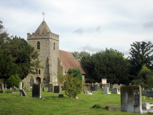
Church Spire at Kent College
Road through Pembury Woods Pembury Woods are a large woodland, East of Tunbridge Wells
Road through Pembury Woods
Pembury Woods are a large woodland, East of Tunbridge Wells
Busy A21 This is taken looking South towards Pembury. It is part of a 2 mile stretch that is not dual carriageway
Busy A21
This is taken looking South towards Pembury. It is part of a 2 mile stretch that is not dual carriageway
Railway Cutting Railway line between Redhill and Ashford. Taken from the railway bridge between Tonbridge and Paddock Wood.
Railway Cutting
Railway line between Redhill and Ashford. Taken from the railway bridge between Tonbridge and Paddock Wood.
Somerhill This 17th century manor house is part of the South Frith estate, dating back to Elizabethan times, on the southern edge of Tonbridge. It is now occupied by 3 prep schools collectively known as "The Schools at Somerhill".
Grade I listed. <span class="nowrap"><a title="http://www.britishlistedbuildings.co.uk/en-436723-somerhill-capel-kent" rel="nofollow ugc noopener" href="http://www.britishlistedbuildings.co.uk/en-436723-somerhill-capel-kent">Link</a><img style="margin-left:2px;" alt="External link" title="External link - shift click to open in new window" src="https://s1.geograph.org.uk/img/external.png" width="10" height="10"/></span>
Somerhill
This 17th century manor house is part of the South Frith estate, dating back to Elizabethan times, on the southern edge of Tonbridge. It is now occupied by 3 prep schools collectively known as "The Schools at Somerhill". Grade I listed. LinkExternal link
Clocktower, Summerhill Part of the large Summerhill manor house dating back to the 17th century. Now 3 schools.
Clocktower, Summerhill
Part of the large Summerhill manor house dating back to the 17th century. Now 3 schools.
Postern Lane. Small byway, East of Tonbridge
Postern Lane.
Small byway, East of Tonbridge
Goldsmid Hall A christian centre, East of Tonbridge.
Goldsmid Hall
A christian centre, East of Tonbridge.
Public footpath leading off the B2017, East of Tonbridge. The B2017 is a short (4 miles) rural road from Tonbridge to Paddock Wood <a href="https://www.geograph.org.uk/photo/3307155">TQ6644 : B2017</a>, Via Tudley and Five Oak Green.
Public footpath leading off the B2017, East of Tonbridge.
The B2017 is a short (4 miles) rural road from Tonbridge to Paddock Wood TQ6644 : B2017, Via Tudley and Five Oak Green.
Tudeley Church This small church is famous for its stained glass windows by Chagal.
Tudeley Church
This small church is famous for its stained glass windows by Chagal.
Converted Oast house, Tudeley Like many of the Oast houses in Kent, now a private residence.
Converted Oast house, Tudeley
Like many of the Oast houses in Kent, now a private residence.
A view across an arable field to an Crockhurst Farm Oast , Tudeley. An arable area in West Kent.
A view across an arable field to an Crockhurst Farm Oast , Tudeley.
An arable area in West Kent.
Wheat fields, North of Tudeley. Part of extensive arable crops in this area of west kent.
Wheat fields, North of Tudeley.
Part of extensive arable crops in this area of west kent.
The Poacher, North of Tudeley. Roadside inn and restaurant.
The Poacher, North of Tudeley.
Roadside inn and restaurant.
An arable field, North of Tudeley. There are many fields like this, in this area.
An arable field, North of Tudeley.
There are many fields like this, in this area.
Show me another place!

Nightingale Wood is located at Grid Ref: TQ6244 (Lat: 51.176372, Lng: 0.32184117)

Administrative County: Kent

District: Tunbridge Wells

Police Authority: Kent

What 3 Words

///blows.text.placed. Near Five Oak Green, Kent

Related Wikis

Tudeley

Tudeley is a village in the civil parish of Capel, in the Tunbridge Wells borough of Kent, England. The village is home to All Saints' Church, the only...

All Saints Church, Tudeley

All Saints Church in Tudeley, Kent, England, is the only church in the world that has all its windows in stained glass designed by Marc Chagall. ��2�...

Capel, Kent

Capel is a hamlet and civil parish in the borough of Tunbridge Wells in Kent, England. The parish is located on the north of the Weald, 3 miles (4.8 km...

Church of St Thomas à Becket, Capel

The Church of St Thomas à Becket is a redundant Anglican church in the village of Capel, Kent, England. It is recorded in the National Heritage List for...

Kent College, Pembury

Kent College is an independent day and boarding school from 3-18. Forest Explorers Nursery is for girls and boys from rising 3 years, boys can join Reception...

Somerhill House

Somerhill House () is a Grade I listed Jacobean mansion situated near Tonbridge, Kent, United Kingdom. It was built for The 4th Earl of Clanricarde in...

The Schools at Somerhill

Somerhill Independent School (formerly known as The Schools at Somerhill) is an independent prep school in Tonbridge, Kent, located at Somerhill House...

Yardley Court

Yardley Court is a private day preparatory school for boys in Tonbridge, Kent, England, founded in 1898 by Arthur Bickmore and his wife Lilian. It now...

Nearby Amenities

Located within 500m of 51.176372,0.32184117
Barrier: stile
Lat/Long: 51.1743612/0.319147
Barrier: stile
Lat/Long: 51.1776938/0.3206374
The data included in this document is from www.openstreetmap.org. The data is made available under ODbL.

Have you been to Nightingale Wood?

Leave your review of Nightingale Wood below (or comments, questions and feedback).