Old Furze Field

Wood, Forest in Kent Tunbridge Wells

England

Old Furze Field

Transmitter on top of Castle Hill Pembury TV transmitter amongst the trees
Transmitter on top of Castle Hill Credit: N Chadwick

Old Furze Field is a picturesque woodland area located in the county of Kent, England. Situated amidst the rolling countryside, it covers a vast expanse of approximately 100 acres. The woodland is named after the abundant growth of furze bushes, which are a common sight throughout the area.

The landscape of Old Furze Field is characterized by a mix of mature oak, beech, and ash trees, which provide ample shade and create a serene and tranquil atmosphere. The forest floor is adorned with a carpet of wildflowers and moss, adding to the natural beauty of the surroundings.

The woodland is home to a diverse range of wildlife, including various bird species, such as woodpeckers, nightingales, and tawny owls. Deer, foxes, and rabbits also inhabit the area, further enriching the biodiversity of the forest.

Old Furze Field offers numerous walking trails and paths, allowing visitors to explore the woodland at their own pace. These trails lead through enchanting groves and open glades, providing opportunities for nature enthusiasts to observe and appreciate the flora and fauna.

The woodland is a popular destination for both locals and tourists seeking a peaceful retreat from the hustle and bustle of everyday life. Its natural beauty and serene ambiance make it an ideal spot for picnics, photography, and nature walks.

Old Furze Field, with its ancient trees and abundant wildlife, serves as a valuable ecological habitat and a beloved natural treasure in the heart of Kent.

If you have any feedback on the listing, please let us know in the comments section below.

Old Furze Field Images

Images are sourced within 2km of 51.177451/0.31684471 or Grid Reference TQ6244. Thanks to Geograph Open Source API. All images are credited.

Transmitter on top of Castle Hill Pembury TV transmitter amongst the trees
Transmitter on top of Castle Hill
Pembury TV transmitter amongst the trees
Pond & Woodland This is taken outside Pembury Hall & Kent College (a private school).
Pond & Woodland
This is taken outside Pembury Hall & Kent College (a private school).
Dislingbury Road A Kent byway in the Pembury Woods
Dislingbury Road
A Kent byway in the Pembury Woods
Church Spire at Kent College
Road through Pembury Woods Pembury Woods are a large woodland, East of Tunbridge Wells
Road through Pembury Woods
Pembury Woods are a large woodland, East of Tunbridge Wells
Busy A21 This is taken looking South towards Pembury. It is part of a 2 mile stretch that is not dual carriageway
Busy A21
This is taken looking South towards Pembury. It is part of a 2 mile stretch that is not dual carriageway
Railway Cutting Railway line between Redhill and Ashford. Taken from the railway bridge between Tonbridge and Paddock Wood.
Railway Cutting
Railway line between Redhill and Ashford. Taken from the railway bridge between Tonbridge and Paddock Wood.
Somerhill This 17th century manor house is part of the South Frith estate, dating back to Elizabethan times, on the southern edge of Tonbridge. It is now occupied by 3 prep schools collectively known as "The Schools at Somerhill".
Grade I listed. <span class="nowrap"><a title="http://www.britishlistedbuildings.co.uk/en-436723-somerhill-capel-kent" rel="nofollow ugc noopener" href="http://www.britishlistedbuildings.co.uk/en-436723-somerhill-capel-kent">Link</a><img style="margin-left:2px;" alt="External link" title="External link - shift click to open in new window" src="https://s1.geograph.org.uk/img/external.png" width="10" height="10"/></span>
Somerhill
This 17th century manor house is part of the South Frith estate, dating back to Elizabethan times, on the southern edge of Tonbridge. It is now occupied by 3 prep schools collectively known as "The Schools at Somerhill". Grade I listed. LinkExternal link
Clocktower, Summerhill Part of the large Summerhill manor house dating back to the 17th century. Now 3 schools.
Clocktower, Summerhill
Part of the large Summerhill manor house dating back to the 17th century. Now 3 schools.
Postern Lane. Small byway, East of Tonbridge
Postern Lane.
Small byway, East of Tonbridge
Goldsmid Hall A christian centre, East of Tonbridge.
Goldsmid Hall
A christian centre, East of Tonbridge.
Public footpath leading off the B2017, East of Tonbridge. The B2017 is a short (4 miles) rural road from Tonbridge to Paddock Wood <a href="https://www.geograph.org.uk/photo/3307155">TQ6644 : B2017</a>, Via Tudley and Five Oak Green.
Public footpath leading off the B2017, East of Tonbridge.
The B2017 is a short (4 miles) rural road from Tonbridge to Paddock Wood TQ6644 : B2017, Via Tudley and Five Oak Green.
Tudeley Church This small church is famous for its stained glass windows by Chagal.
Tudeley Church
This small church is famous for its stained glass windows by Chagal.
Converted Oast house, Tudeley Like many of the Oast houses in Kent, now a private residence.
Converted Oast house, Tudeley
Like many of the Oast houses in Kent, now a private residence.
A view across an arable field to an Crockhurst Farm Oast , Tudeley. An arable area in West Kent.
A view across an arable field to an Crockhurst Farm Oast , Tudeley.
An arable area in West Kent.
Wheat fields, North of Tudeley. Part of extensive arable crops in this area of west kent.
Wheat fields, North of Tudeley.
Part of extensive arable crops in this area of west kent.
The Poacher, North of Tudeley. Roadside inn and restaurant.
The Poacher, North of Tudeley.
Roadside inn and restaurant.
An arable field, North of Tudeley. There are many fields like this, in this area.
An arable field, North of Tudeley.
There are many fields like this, in this area.
Show me another place!

Old Furze Field is located at Grid Ref: TQ6244 (Lat: 51.177451, Lng: 0.31684471)

Administrative County: Kent

District: Tunbridge Wells

Police Authority: Kent

What 3 Words

///glaze.flag.loads. Near Five Oak Green, Kent

Related Wikis

Tudeley

Tudeley is a village in the civil parish of Capel, in the Tunbridge Wells borough of Kent, England. The village is home to All Saints' Church, the only...

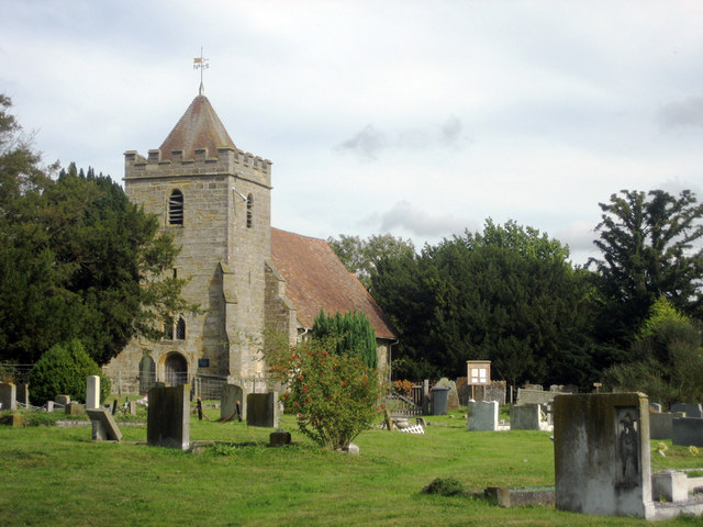
All Saints Church, Tudeley

All Saints Church in Tudeley, Kent, England, is the only church in the world that has all its windows in stained glass designed by Marc Chagall. ��2�...

Somerhill House

Somerhill House () is a Grade I listed Jacobean mansion situated near Tonbridge, Kent, United Kingdom. It was built for The 4th Earl of Clanricarde in...

Capel, Kent

Capel is a hamlet and civil parish in the borough of Tunbridge Wells in Kent, England. The parish is located on the north of the Weald, 3 miles (4.8 km...

The Schools at Somerhill

Somerhill Independent School (formerly known as The Schools at Somerhill) is an independent prep school in Tonbridge, Kent, located at Somerhill House...

Yardley Court

Yardley Court is a private day preparatory school for boys in Tonbridge, Kent, England, founded in 1898 by Arthur Bickmore and his wife Lilian. It now...

Kent College, Pembury

Kent College is an independent day and boarding school from 3-18. Forest Explorers Nursery is for girls and boys from rising 3 years, boys can join Reception...

Church of St Thomas à Becket, Capel

The Church of St Thomas à Becket is a redundant Anglican church in the village of Capel, Kent, England. It is recorded in the National Heritage List for...

Nearby Amenities

Located within 500m of 51.177451,0.31684471
Bus Stop
Oak PH
Naptan AtcoCode: 2400A013160A
Naptan Bearing: N
Naptan CommonName: Oak PH
Naptan Indicator: opp
Naptan Landmark: Op Oak Ph
Naptan NaptanCode: kntapatg
Naptan Street: Five Oak Green Road
Naptan Verified: no
Source: naptan_import
Lat/Long: 51.181396/0.3195474
Barrier: stile
Lat/Long: 51.1743612/0.319147
Barrier: stile
Lat/Long: 51.1776938/0.3206374
The data included in this document is from www.openstreetmap.org. The data is made available under ODbL.

Have you been to Old Furze Field?

Leave your review of Old Furze Field below (or comments, questions and feedback).