Lady's Plantation

Wood, Forest in Cambridgeshire East Cambridgeshire

England

Lady's Plantation

"the kings head", Dullingham Someone tell them about capital letters please! Still, it's a service in TL65 and there aren't many.
"the kings head", Dullingham Credit: Hugh Venables

Lady's Plantation, located in Cambridgeshire, England, is a picturesque woodland area known for its natural beauty and rich biodiversity. Covering an area of approximately 100 acres, the plantation is a haven for nature enthusiasts and offers a tranquil escape from the hustle and bustle of urban life.

The plantation is predominantly composed of a diverse range of tree species, including oak, beech, and birch, which create a dense and lush forest canopy. The varying heights and densities of the trees provide a unique habitat for a wide array of wildlife, making it a popular destination for birdwatchers and nature photographers.

Traversing through Lady's Plantation, visitors can explore an extensive network of well-maintained walking trails that wind their way through the woodland. These trails offer a chance to immerse oneself in nature, with opportunities to spot woodland creatures such as deer, foxes, and squirrels. The plantation also features several picnic areas and benches, allowing visitors to relax and enjoy the tranquil surroundings.

Beyond its natural beauty, Lady's Plantation holds historical significance. It is believed to have been originally established in the 17th century as part of a larger estate. Although the original manor house no longer stands, remnants of its foundations can still be spotted within the woodland.

Overall, Lady's Plantation in Cambridgeshire is a stunning woodland area that offers a peaceful retreat for nature lovers and a glimpse into the region's rich history. Whether visitors are seeking a scenic walk, wildlife spotting, or a moment of serenity, this enchanting woodland provides an idyllic setting for all.

If you have any feedback on the listing, please let us know in the comments section below.

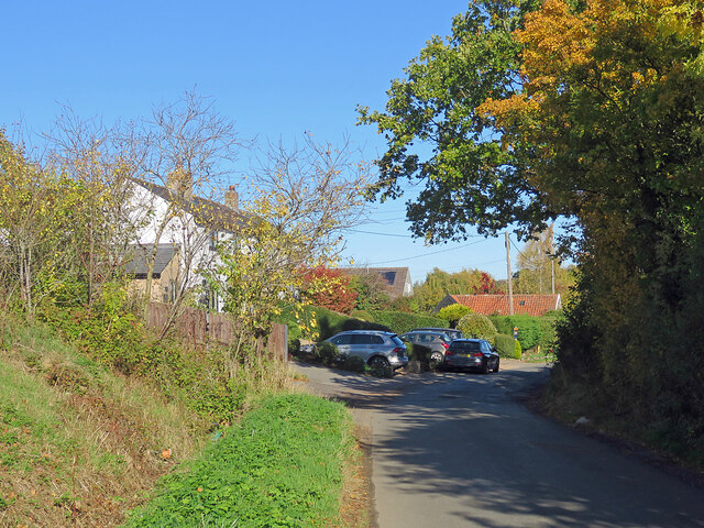
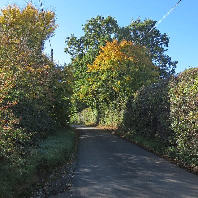
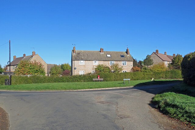
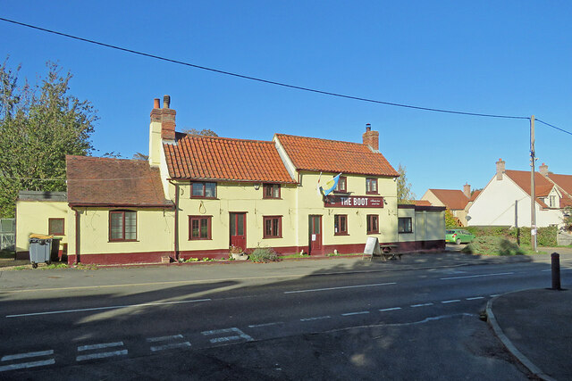
Lady's Plantation Images

Images are sourced within 2km of 52.199422/0.37144797 or Grid Reference TL6258. Thanks to Geograph Open Source API. All images are credited.

"the kings head", Dullingham Someone tell them about capital letters please! Still, it's a service in TL65 and there aren't many.
"the kings head", Dullingham
Someone tell them about capital letters please! Still, it's a service in TL65 and there aren't many.
North-west from Westley Waterless Straight on for Westley Bottom.
North-west from Westley Waterless
Straight on for Westley Bottom.
Houses at Cross Green A straggle of houses on the road from Dullingham Ley to Dullingham.
Houses at Cross Green
A straggle of houses on the road from Dullingham Ley to Dullingham.
Light, shade and changing colours A cloudless October morning in the horse-racing country south of Newmarket. This is the single-track dead-end lane to Dullingham Ley and Widgham Green, serving a scattering of houses and a number of stud farms.
Light, shade and changing colours
A cloudless October morning in the horse-racing country south of Newmarket. This is the single-track dead-end lane to Dullingham Ley and Widgham Green, serving a scattering of houses and a number of stud farms.
Stetchworth: The Marquis of Granby A 19th-century brick pub at the corner of High Street (ahead) and Tea Kettle Lane the road to Dullingham.
Stetchworth: The Marquis of Granby
A 19th-century brick pub at the corner of High Street (ahead) and Tea Kettle Lane the road to Dullingham.
Entering Stetchworth Bright sunlight and deep shadows on a fine October morning. This is where the road from Dullingham meets Mill Lane (left) and Tea Kettle Lane (ahead).
Entering Stetchworth
Bright sunlight and deep shadows on a fine October morning. This is where the road from Dullingham meets Mill Lane (left) and Tea Kettle Lane (ahead).
Down Stetchworth Road Council-built houses between Stetchworth and Dullingham (ahead).
Down Stetchworth Road
Council-built houses between Stetchworth and Dullingham (ahead).
Dullingham: houses on the corner Council-built houses on the sharp corner where the dead-end lane from Dullingham Ley meets Stetchworth Road on the edge of Dullingham.
Dullingham: houses on the corner
Council-built houses on the sharp corner where the dead-end lane from Dullingham Ley meets Stetchworth Road on the edge of Dullingham.
Dullingham: St Mary All things bright and beautiful on a lovely October morning. St Mary's is Grade I listed - see <span class="nowrap"><a title="http://www.britishlistedbuildings.co.uk/en-49159-parish-church-of-st-mary-dullingham-cambr" rel="nofollow ugc noopener" href="http://www.britishlistedbuildings.co.uk/en-49159-parish-church-of-st-mary-dullingham-cambr">Link</a><img style="margin-left:2px;" alt="External link" title="External link - shift click to open in new window" src="https://s1.geograph.org.uk/img/external.png" width="10" height="10"/></span> .
Dullingham: St Mary
All things bright and beautiful on a lovely October morning. St Mary's is Grade I listed - see LinkExternal link .
Dullingham: The Boot Photographed from the shadows of Church Close on a bright October morning. The pub was flying a Ukrainian flag during the eighth month of the Russian invasion of Ukraine.
Dullingham: The Boot
Photographed from the shadows of Church Close on a bright October morning. The pub was flying a Ukrainian flag during the eighth month of the Russian invasion of Ukraine.
Dullingham: a house with a history The Grade II listing for the house on the left begins "Originally the workhouse, now dwellings. Late C17 or early C18. Local red brick; red pantile roof. Two symmetrical stacks and rear stack. Two storeys and attic with outshut. Central facade gable with round window."
Dullingham: a house with a history
The Grade II listing for the house on the left begins "Originally the workhouse, now dwellings. Late C17 or early C18. Local red brick; red pantile roof. Two symmetrical stacks and rear stack. Two storeys and attic with outshut. Central facade gable with round window."
A crossroads near Stetchworth Park The road to the left leads to Dullingham, the one ahead is the road from Stetchworth to Newmarket and the one to the right to Cheveley. The lodge at the entrance to Stetchworth Park is out of the picture on the right.
A crossroads near Stetchworth Park
The road to the left leads to Dullingham, the one ahead is the road from Stetchworth to Newmarket and the one to the right to Cheveley. The lodge at the entrance to Stetchworth Park is out of the picture on the right.
Stetchworth: the shadowed side of The Old Mill "The building is unique in its architectural style and its original use remains evident from its surviving built form. The building is an important remnant of the industrial age in the village and makes a positive contribution to the character of the area" (Local Heritage List platform: <span class="nowrap"><a title="https://local-heritage-list.org.uk/asset/11072" rel="nofollow ugc noopener" href="https://local-heritage-list.org.uk/asset/11072">Link</a><img style="margin-left:2px;" alt="External link" title="External link - shift click to open in new window" src="https://s1.geograph.org.uk/img/external.png" width="10" height="10"/></span> ).
Stetchworth: the shadowed side of The Old Mill
"The building is unique in its architectural style and its original use remains evident from its surviving built form. The building is an important remnant of the industrial age in the village and makes a positive contribution to the character of the area" (Local Heritage List platform: LinkExternal link ).
Stetchworth: The Old Mill Now a house, The Old Mill has distinctive Dutch gables and iron-framed windows. "The building is unique in its architectural style and its original use remains evident from its surviving built form. The building is an important remnant of the industrial age in the village and makes a positive contribution to the character of the area" (Local Heritage List platform: <span class="nowrap"><a title="https://local-heritage-list.org.uk/asset/11072" rel="nofollow ugc noopener" href="https://local-heritage-list.org.uk/asset/11072">Link</a><img style="margin-left:2px;" alt="External link" title="External link - shift click to open in new window" src="https://s1.geograph.org.uk/img/external.png" width="10" height="10"/></span> ).
Stetchworth: The Old Mill
Now a house, The Old Mill has distinctive Dutch gables and iron-framed windows. "The building is unique in its architectural style and its original use remains evident from its surviving built form. The building is an important remnant of the industrial age in the village and makes a positive contribution to the character of the area" (Local Heritage List platform: LinkExternal link ).
Stetchworth: along Mill Lane The red-brick former mill is in the distance on the left. For more about it, see <a href="https://www.geograph.org.uk/photo/7430772">TL6358 : Stetchworth: The Old Mill</a>.
Stetchworth: along Mill Lane
The red-brick former mill is in the distance on the left. For more about it, see TL6358 : Stetchworth: The Old Mill.
Dullingham: along Station Road The level crossing is behind the camera. The road leads to the A1304 midway between Six Mile Bottom and Newmarket.
Dullingham: along Station Road
The level crossing is behind the camera. The road leads to the A1304 midway between Six Mile Bottom and Newmarket.
Dullingham Station and level crossing Dullingham is a stop for some Cambridge-Ipswich trains - and a reminder of railways as they used to be as it still has a signal box and traditional hand-operated crossing gates. The signal box is a good example of the Great Eastern Railway type once found all over East Anglia.
Dullingham Station and level crossing
Dullingham is a stop for some Cambridge-Ipswich trains - and a reminder of railways as they used to be as it still has a signal box and traditional hand-operated crossing gates. The signal box is a good example of the Great Eastern Railway type once found all over East Anglia.
The Guvnor's Belt Big fields edged by straight lines of shelter-belt trees are a predominant motif of the landscape of this part of East Cambridgeshire.
The Guvnor's Belt
Big fields edged by straight lines of shelter-belt trees are a predominant motif of the landscape of this part of East Cambridgeshire.
Show me another place!

Lady's Plantation is located at Grid Ref: TL6258 (Lat: 52.199422, Lng: 0.37144797)

Administrative County: Cambridgeshire

District: East Cambridgeshire

Police Authority: Cambridgeshire

What 3 Words

///upgrading.listening.retiring. Near Newmarket, Suffolk

Nearby Locations

Lady's Plantation

Related Wikis

Dullingham railway station

Dullingham is a railway station that serves the village of Dullingham in Cambridgeshire, England. It is about 1 mile (1.6 km) north-west of the centre...
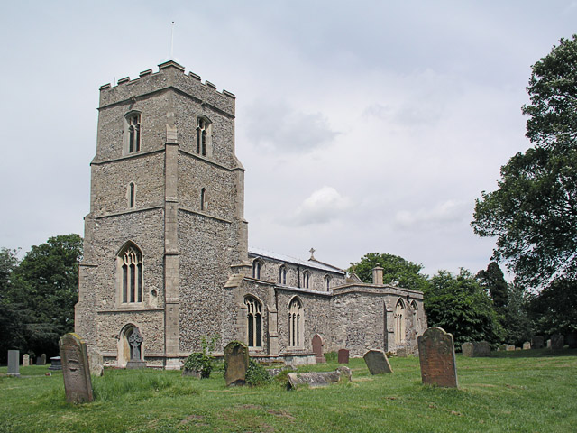
Dullingham

Dullingham is a small village and civil parish in East Cambridgeshire, England. It is situated 4 miles (6 km) south of Newmarket and 14 miles (23 km) east...
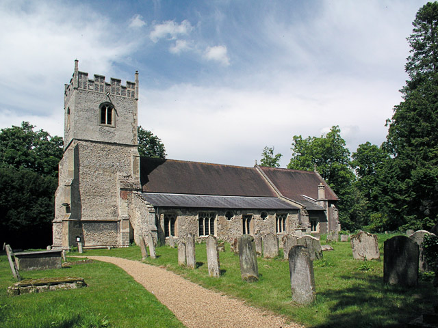
Stetchworth

Stetchworth is a small village and civil parish in East Cambridgeshire, England, 3 miles (5 km) to the south of the horse-racing centre of Newmarket and...

Westley Waterless

Westley Waterless is a small village and civil parish in East Cambridgeshire, England, 5 miles south west of Newmarket. == History == The parish of Westley...
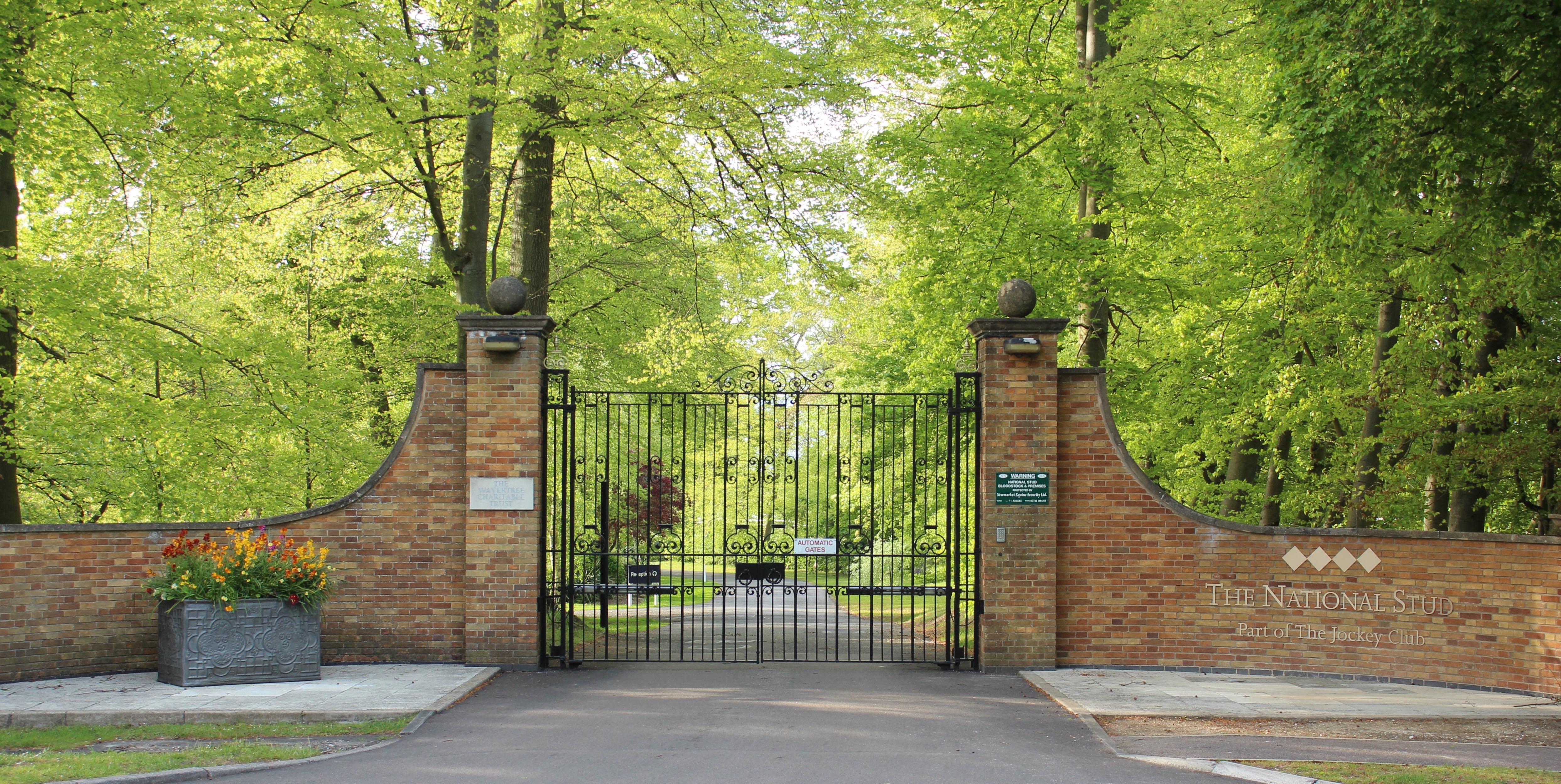
The National Stud

The National Stud is a United Kingdom Thoroughbred horse breeding farm located two miles from Newmarket. The Stud originated in 1916 as a result of a gift...

Devil's Dyke, Cambridgeshire

Devil's Dyke or Devil's Ditch is a linear earthen barrier, thought to be of Anglo-Saxon origin, in eastern Cambridgeshire and Suffolk. It runs for 11 kilometres...

Burrough Green

Burrough Green is a village and parish in Cambridgeshire, England. The population of the village at the 2011 census was 378. The soil is various; subsoil...

Brinkley, Cambridgeshire

Brinkley is a small village in Cambridgeshire, England. It is situated about 15 miles east of Cambridge and 5 miles south of Newmarket, the horse racing...

Nearby Amenities

Located within 500m of 52.199422,0.37144797
Dullingham
Naptan AtcoCode: 9100DULNGHM
Network: National Rail
Network Website: https://www.nationalrail.co.uk/stations/dul/
Network Wikidata: Q26334
Railway: station
Ref Crs: DUL
Wikidata: Q3353344
Wikipedia: en:Dullingham railway station
Lat/Long: 52.2015139/0.3658792
Crossing Audible: no
Crossing Gated: manual
Crossing Light: no
Note: Still using manual gates c. 2009
Operator: Network Rail (in adj. signal box)
Railway: level_crossing
Lat/Long: 52.2017153/0.3665589
Bicycle Parking
Bicycle Parking: two-tier
Capacity: 28
Covered: yes
Lat/Long: 52.2015526/0.3666659
Post Box
Collection Times: Mo-Fr 16:45; Sa 09:30
Operator: Royal Mail
Post Box Type: lamp
Ref: CB8 127
Royal Cypher: EIIR
Royal Cypher Wikidata: Q33102113
Source: survey
Lat/Long: 52.2020392/0.3658713
Bus Stop
The Crescent
Naptan AtcoCode: 0500EDULL001
Naptan Bearing: NE
Naptan CommonName: The Crescent
Naptan Indicator: near
Naptan Landmark: The Crescent
Naptan NaptanCode: cmbdgmtw
Naptan ShortCommonName: The Crescent
Naptan Street: Balsham Lane
Naptan Verified: no
Source: naptan_import
Lat/Long: 52.1971404/0.3713404
Bus Stop
The Crescent
Naptan AtcoCode: 0500EDULL004
Naptan Bearing: SW
Naptan BusStopType: CUS
Naptan CommonName: The Crescent
Naptan Indicator: opp
Naptan Landmark: The Crescent
Naptan NaptanCode: cmbdgmwg
Naptan ShortCommonName: The Crescent
Naptan Street: Balsham Lane
Naptan Verified: no
Source: naptan_import
Lat/Long: 52.197161/0.3714491
Bus Stop
Eagle Lane
Naptan AtcoCode: 0500EDULL008
Naptan Bearing: NW
Naptan BusStopType: CUS
Naptan CommonName: Eagle Lane
Naptan Indicator: opp
Naptan Landmark: Eagle Lane
Naptan NaptanCode: cmbdgmwp
Naptan ShortCommonName: Eagle Lane
Naptan Street: Station Road
Naptan Verified: no
Source: naptan_import
Lat/Long: 52.1984303/0.3741253
Bus Stop
Eagle Lane
Naptan AtcoCode: 0500EDULL009
Naptan Bearing: SE
Naptan BusStopType: CUS
Naptan CommonName: Eagle Lane
Naptan Indicator: near
Naptan Landmark: Eagle Lane
Naptan NaptanCode: cmbdgmwt
Naptan ShortCommonName: Eagle Lane
Naptan Street: Station Road
Naptan Verified: no
Source: naptan_import
Lat/Long: 52.198455/0.3743345
Railway Station
Naptan AtcoCode: 0500EDULL010
Naptan Bearing: NW
Naptan BusStopType: CUS
Naptan CommonName: Railway Station
Naptan Indicator: o/s
Naptan Landmark: Dullingham Railway Station
Naptan NaptanCode: cmbdgpad
Naptan ShortCommonName: Dullingham Railway Stn
Naptan Street: Station Road
Naptan Verified: no
Source: naptan_import
Lat/Long: 52.2016303/0.3666113
Railway Station
Naptan AtcoCode: 0500EDULL012
Naptan Bearing: SE
Naptan BusStopType: CUS
Naptan CommonName: Railway Station
Naptan Indicator: opp
Naptan Landmark: Dullingham Railway Station
Naptan NaptanCode: cmbdgpag
Naptan ShortCommonName: Dullingham Railway Stn
Naptan Street: Station Road
Naptan Verified: no
Source: naptan_import
Lat/Long: 52.2016908/0.3667316
Post Box
CB8 9 – Eagle Lane | Dullingham
Collection Times: Mo-Fr 09:00; Sa 07:00
Operator: Royal Mail
Post Box Type: lamp
Ref: CB8 128
Royal Cypher: EIIR
Royal Cypher Wikidata: Q33102113
Source: survey
Lat/Long: 52.1984075/0.3742546
Power: pole
Lat/Long: 52.1999858/0.366743
Power: pole
Lat/Long: 52.1999003/0.3652946
Power: pole
Lat/Long: 52.1995584/0.3697103
Power: pole
Lat/Long: 52.2000715/0.3689861
Power: pole
Lat/Long: 52.1989963/0.3705418
Location: overground
Power: pole
Transformer: distribution
Lat/Long: 52.2011976/0.3672264
Power: pole
Lat/Long: 52.2006533/0.3680632
Power: pole
Lat/Long: 52.2000318/0.3677306
Power: pole
Lat/Long: 52.1984503/0.3714001
Power: pole
Lat/Long: 52.1973064/0.3732188
Power: pole
Lat/Long: 52.1961562/0.3750057
Power: transformer
Lat/Long: 52.19818/0.3742437
Power: pole
Lat/Long: 52.1967283/0.3741098
Power: pole
Lat/Long: 52.1976408/0.3736083
Power: transformer
Lat/Long: 52.1979466/0.3722672
Power: pole
Lat/Long: 52.2034365/0.3717421
Power: pole
Lat/Long: 52.2027683/0.3704439
Power: pole
Lat/Long: 52.2021322/0.3691779
Crossing Audible: no
Crossing Gated: manual
Crossing Light: no
Note: Still using manual gates c. 2009
Operator: Network Rail (in adj. signal box)
Railway: level_crossing
Lat/Long: 52.2017356/0.3665167
Vending Machine
Vending: public_transport_tickets
Lat/Long: 52.2016258/0.3664273
Bench
Backrest: yes
Colour: red
Direction: sse
Material: steel
Lat/Long: 52.201627/0.3660625
Bench
Backrest: yes
Direction: nnw
Material: steel
Seats: 3
Surface: wood
Lat/Long: 52.201544/0.3661088
Bench
Backrest: yes
Colour: red
Direction: nnw
Material: steel
Lat/Long: 52.2015535/0.3661349
Bench
Backrest: yes
Direction: sse
Material: steel
Seats: 3
Surface: wood
Lat/Long: 52.201602/0.36598
Waste Basket
Lat/Long: 52.201468/0.365919
Bicycle Repair Station
Service Bicycle Pump: yes
Service Bicycle Stand: yes
Service Bicycle Tools: yes
Lat/Long: 52.2015843/0.366603
The data included in this document is from www.openstreetmap.org. The data is made available under ODbL.

Have you been to Lady's Plantation?

Leave your review of Lady's Plantation below (or comments, questions and feedback).