Felin-gwm-uchaf

Settlement in Carmarthenshire

Wales

Felin-gwm-uchaf

Holy Trinity Church near Pontargothi On the north side of the quiet Cothi valley, over a kilometre upstream from the village of Pontargothi along narrow back roads, lies this church in quite spacious grounds.
Holy Trinity Church near Pontargothi Credit: Nigel Davies

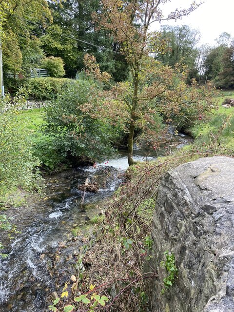
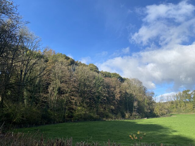
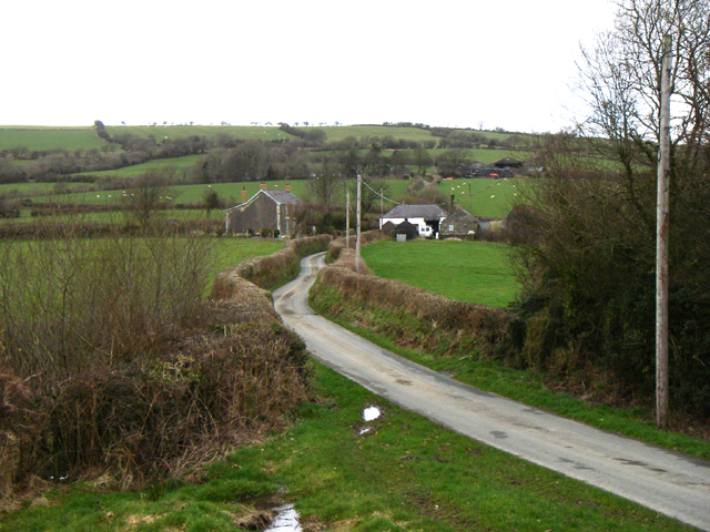
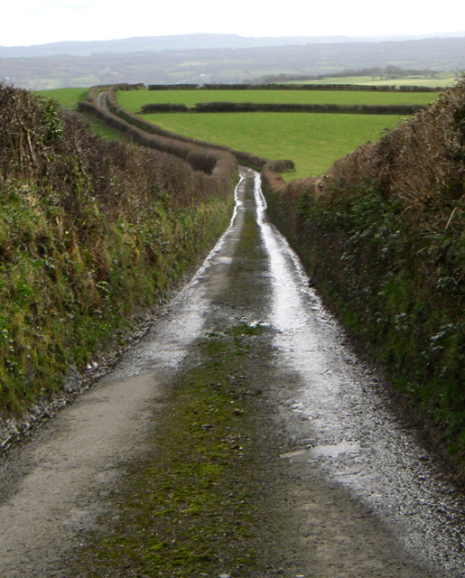
Felin-gwm-uchaf is a small village located in the county of Carmarthenshire, Wales. Situated in the picturesque countryside, it lies about 10 miles north of Carmarthen, the county's administrative center. The village is nestled amidst rolling green hills and offers breathtaking views of the surrounding landscape.

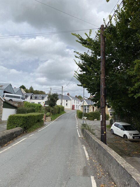
Felin-gwm-uchaf is a close-knit community with a population of around 200 residents. The village is renowned for its tranquility and rural charm, making it an ideal destination for those seeking a peaceful retreat. The residents mainly rely on agriculture and farming for their livelihoods, and the village is dotted with small family-run farms.

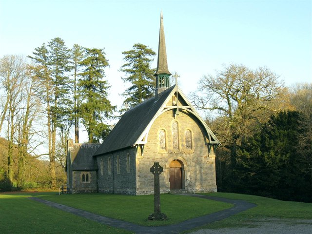
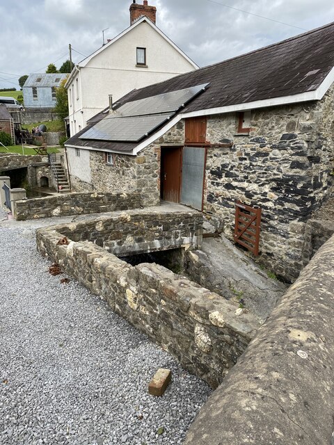
One of the notable features of Felin-gwm-uchaf is its historic watermill. The village derives its name from this ancient mill, "Felin" meaning "mill" in Welsh. The watermill, which dates back several centuries, is a testament to the village's rich heritage and provides a glimpse into its past.

Despite its small size, Felin-gwm-uchaf boasts a strong sense of community spirit. The villagers often come together to organize various events and activities, fostering a warm and welcoming atmosphere. The village also has a local pub, serving as a social hub for residents and visitors alike.

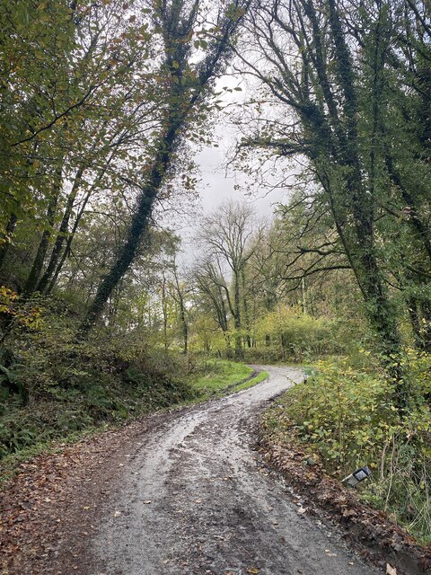
For those seeking outdoor adventures, Felin-gwm-uchaf offers plenty of opportunities. The surrounding countryside is perfect for hiking, cycling, and exploring the scenic beauty of Carmarthenshire. The village also provides easy access to nearby attractions such as historic castles, picturesque villages, and the stunning coastline.

Overall, Felin-gwm-uchaf is a picturesque village, embodying the rural charm of Carmarthenshire. Its rich history, breathtaking scenery, and close-knit community make it a delightful place to visit or call home.

If you have any feedback on the listing, please let us know in the comments section below.

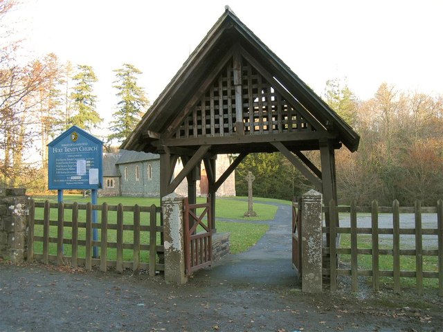
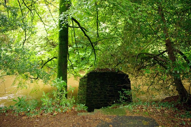
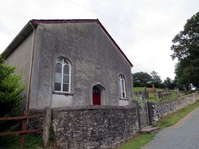
Felin-gwm-uchaf Images

Images are sourced within 2km of 51.898938/-4.16721 or Grid Reference SN5024. Thanks to Geograph Open Source API. All images are credited.

Holy Trinity Church near Pontargothi On the north side of the quiet Cothi valley, over a kilometre upstream from the village of Pontargothi along narrow back roads, lies this church in quite spacious grounds.
Holy Trinity Church near Pontargothi
On the north side of the quiet Cothi valley, over a kilometre upstream from the village of Pontargothi along narrow back roads, lies this church in quite spacious grounds.
Lychgate, Holy Trinity Church This is the gate at <a href="https://www.geograph.org.uk/photo/2714525">SN5022 : Holy Trinity Church near Pontargothi</a>
Lychgate, Holy Trinity Church
Another missing Carmarthenshire footbridge This is one of 44 bridges in the county in need of replacement, and another example of the shocking state of public footpaths in Carmarthenshire
Another missing Carmarthenshire footbridge
This is one of 44 bridges in the county in need of replacement, and another example of the shocking state of public footpaths in Carmarthenshire
Capel Sitim Chapel Sitim, Capel y Bedyddwyr yn Felingwm Isaf. Fe'i codwyd yn gyntaf yn 1817 ac fe'i hailadeiladwyd yn 1848. Mae'r addoldy presennol yn dyddio o 1874.

Sitim Baptist Chapel in Felingwm Isaf (trans. lower mill valley). The first meeting house was built in 1817 and it was rebuilt in 1848. The present chapel dates from 1874.
Capel Sitim Chapel
Sitim, Capel y Bedyddwyr yn Felingwm Isaf. Fe'i codwyd yn gyntaf yn 1817 ac fe'i hailadeiladwyd yn 1848. Mae'r addoldy presennol yn dyddio o 1874. Sitim Baptist Chapel in Felingwm Isaf (trans. lower mill valley). The first meeting house was built in 1817 and it was rebuilt in 1848. The present chapel dates from 1874.
Milestone - Nantgaredig 1
Another missing Carmarthenshire footbridge An overgrown stile leads to another of Carmarthenshire's many missing footbridges.
Another missing Carmarthenshire footbridge
An overgrown stile leads to another of Carmarthenshire's many missing footbridges.
OS Cut Mark - Felingwm-uchaf, Llammarch Bridge <span class="nowrap"><a title="https://www.bench-marks.org.uk/bm107255" rel="nofollow ugc noopener" href="https://www.bench-marks.org.uk/bm107255">Link</a><img style="margin-left:2px;" alt="External link" title="External link - shift click to open in new window" src="https://s1.geograph.org.uk/img/external.png" width="10" height="10"/></span>
OS Cut Mark - Felingwm-uchaf, Llammarch Bridge
Location of OS Cut Mark - Felingwm-uchaf, Llammarch Bridge
Afon Llammarch
Afon Llammarch
Afon Llammarch
Afon Llammarch
Felingwmuchaf
Felingwmuchaf
Muddy lane towards Ynyswen
Woodland at Allt Cwm Perrott
Ordnance Survey Cut Mark This OS cut mark can be found on the gatepost at the road junction. It marks a point 139.382m above mean sea level.
Ordnance Survey Cut Mark
This OS cut mark can be found on the gatepost at the road junction. It marks a point 139.382m above mean sea level.
Ordnance Survey Rivet This scruffy OS rivet can be found at the base of Pant-yr-onen. It marks a point 104.085m above mean sea level.
Ordnance Survey Rivet
This scruffy OS rivet can be found at the base of Pant-yr-onen. It marks a point 104.085m above mean sea level.
Ordnance Survey Cut Mark This OS cut mark can be found on the wall east side of the road. It marks a point 54.528m above mean sea level.
Ordnance Survey Cut Mark
This OS cut mark can be found on the wall east side of the road. It marks a point 54.528m above mean sea level.
Road Looking north, one of the properties is Llain-delyn - translation to follow.
Road
Looking north, one of the properties is Llain-delyn - translation to follow.
Hedges Looking due south from SN 498 239
Hedges
Looking due south from SN 498 239
Show me another place!

Felin-gwm-uchaf is located at Grid Ref: SN5024 (Lat: 51.898938, Lng: -4.16721)

Unitary Authority: Carmarthenshire

Police Authority: Dyfed Powys

What 3 Words

///fencing.vows.agreeable. Near Llanfynydd, Carmarthenshire

Related Wikis

Pont-ar-Gothi

Pont-ar-gothi (otherwise Pontargothi or Cothi Bridge) is a village in Carmarthenshire, West Wales. The village takes its name from the bridge where the...

Llanfihangel-uwch-Gwili

Llanfihangel-uwch-Gwili is a village in Carmarthenshire, Wales. The church is one of many in Wales dedicated to Saint Michael the Archangel. == References ==

Cae Cwm-tywyll

Cae Cwm-tywyll is an unimproved hay meadow that is a Site of Special Scientific Interest in Carmarthenshire, Wales. == See also == List of Sites of Special...

Llanegwad

Llanegwad () is a village and community located in Carmarthenshire, Wales. The population taken at the 2011 census was 1,473.Llanegwad is built up mainly...
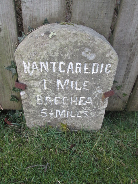
Nantgaredig

Nantgaredig is a village in Carmarthenshire, Wales. It is about 4 miles (6.4 km) east of the county town of Carmarthen on the A40 in the parish of Llanegwad...

Afon Cothi

The Afon Cothi (also known as the River Cothy) in Carmarthenshire is the largest tributary of the River Tywi in south Wales. From its source at Blaen Cothi...

Nantgaredig railway station

Nantgaredig railway station served to village of Nantgaredig, Carmarthenshire, Wales from 1865 to 1963 on the Llanelly Railway. == History == The station...

Brechfa transmitting station

The Brechfa television relay station is sited on high ground to the east of the village of Brechfa to the northeast of Carmarthen. It was originally built...

Nearby Amenities

Located within 500m of 51.898938,-4.16721
Felingwmuchaf
Place: hamlet
Lat/Long: 51.8992642/-4.1686561
Post Box
Collection Times: Mo-Fr 14:30; Sa 12:00
Post Box Type: lamp
Ref: SA32 189
Royal Cypher: EIIR
Royal Cypher Wikidata: Q33102113
Lat/Long: 51.9000121/-4.1688624
Direction: 255
Generator Method: photovoltaic
Generator Output Electricity: yes
Generator Solar Modules: 16
Generator Source: solar
Generator Type: solar_photovoltaic_panel
Location: roof
Power: generator
Lat/Long: 51.8994771/-4.169451
Direction: SSE
Generator Method: photovoltaic
Generator Output Electricity: yes
Generator Solar Modules: 8
Generator Source: solar
Generator Type: solar_photovoltaic_panel
Location: roof
Power: generator
Lat/Long: 51.8995468/-4.1696887
The data included in this document is from www.openstreetmap.org. The data is made available under ODbL.

Have you been to Felin-gwm-uchaf?

Leave your review of Felin-gwm-uchaf below (or comments, questions and feedback).