Clay Wood

Wood, Forest in Essex Uttlesford

England

Clay Wood

Thatched Cottages, Radwinter With signature hare finials
Thatched Cottages, Radwinter Credit: Chris Morgan

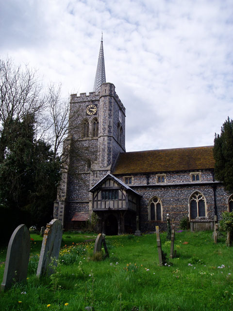
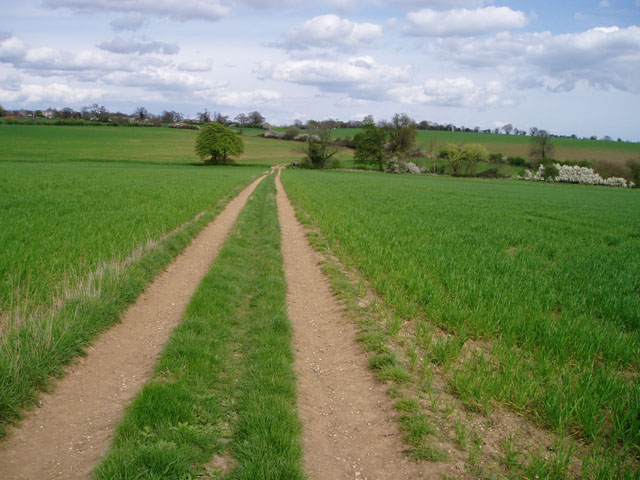
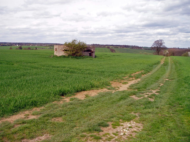
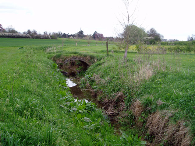
Clay Wood is a small area located in Essex, England, known for its dense forest and natural beauty. The wood is predominantly made up of oak, beech, and ash trees, creating a lush and diverse ecosystem. It is a popular destination for nature lovers, hikers, and birdwatchers, offering a peaceful retreat from the hustle and bustle of city life.

The wood is home to a variety of wildlife, including deer, foxes, rabbits, and a wide range of bird species. Visitors may also come across rare plants and fungi as they explore the winding trails and pathways that crisscross the area.

Clay Wood is managed by the Essex Wildlife Trust, which works to preserve and protect the natural environment for future generations to enjoy. The Trust also organizes educational programs and events to raise awareness about the importance of conservation and biodiversity.

In addition to its natural beauty, Clay Wood also has historical significance, with remnants of ancient settlements and archaeological sites scattered throughout the area. Overall, Clay Wood is a hidden gem in Essex, offering a tranquil escape into nature for all who visit.

If you have any feedback on the listing, please let us know in the comments section below.

Clay Wood Images

Images are sourced within 2km of 52.000905/0.35849097 or Grid Reference TL6136. Thanks to Geograph Open Source API. All images are credited.

Thatched Cottages, Radwinter With signature hare finials
Thatched Cottages, Radwinter
With signature hare finials
St Mary's church, Radwinter
Old Post Office, Radwinter Also the Village Hall
Old Post Office, Radwinter
Also the Village Hall
Radwinter post office This typical Essex building also houses the village hall. The school can be seen in the background, on the right.
Radwinter post office
This typical Essex building also houses the village hall. The school can be seen in the background, on the right.
St Mary's church, Radwinter View of the south side showing the fine half-timbered porch.
St Mary's church, Radwinter
View of the south side showing the fine half-timbered porch.
Farm track near Radwinter The track comes from Hill Farm, on the B1053 at TL617371, giving access to several fields. Not marked on the 1940s map.
Farm track near Radwinter
The track comes from Hill Farm, on the B1053 at TL617371, giving access to several fields. Not marked on the 1940s map.
WW2 pillbox near Wimbish Green Situated on a small ridge with a good view over the surrounding countryside on two sides, this pillbox was no doubt built to guard the flank of <a href="https://www.geograph.org.uk/photo/221943">TL6134 : Great Stampford Aerodrome</a>.
WW2 pillbox near Wimbish Green
Situated on a small ridge with a good view over the surrounding countryside on two sides, this pillbox was no doubt built to guard the flank of TL6134 : Great Stampford Aerodrome.
Houses in Wimbish Green This part of the hamlet is called Upper Green, as opposed to Lower Green which is by a stream to the south.
Houses in Wimbish Green
This part of the hamlet is called Upper Green, as opposed to Lower Green which is by a stream to the south.
Bridge over the River Pant near Radwinter In this dry, chalky landscape every little trickle seems to be called a river. The bridge, which carries a public footpath and gives access between two fields, is a rather nice brick arch construction.
Bridge over the River Pant near Radwinter
In this dry, chalky landscape every little trickle seems to be called a river. The bridge, which carries a public footpath and gives access between two fields, is a rather nice brick arch construction.
The Plough Inn, Radwinter Strategically situated on the crossroads at the edge of the village, this pub serves a wide area of scattered farms and hamlets.
The Plough Inn, Radwinter
Strategically situated on the crossroads at the edge of the village, this pub serves a wide area of scattered farms and hamlets.
Great Stampford Aerodrome This bridle path crosses the former Great Stampford Aerodrome. You can see from the picture why this level ground was chosen for an airfield. The runways were made from prefabricated metal tracking so there is no evidence of them now, although the perimeter track is still largely extant. The field was intended as a satellite to RAF Debden but after less than a year's operations Debden was reassigned to the USAAF. The site was then used by the RAF regiment as a training base until 1944. To go to the next field in an alphabetical tour of Essex WW2 airfields click on <a href="https://www.geograph.org.uk/photo/38560">TQ5384 : Swords into Ploughshares</a>. Much information was gleaned from Graham Smith’s book “Essex Airfields In The Second World War”. <span class="nowrap"><a title="https://books.google.co.uk/books/about/Essex_Airfields_in_the_Second_World_War.html?id=u3atAAAACAAJ&redir_esc=y" rel="nofollow ugc noopener" href="https://books.google.co.uk/books/about/Essex_Airfields_in_the_Second_World_War.html?id=u3atAAAACAAJ&redir_esc=y">Link</a><img style="margin-left:2px;" alt="External link" title="External link - shift click to open in new window" src="https://s1.geograph.org.uk/img/external.png" width="10" height="10"/></span>
Great Stampford Aerodrome
This bridle path crosses the former Great Stampford Aerodrome. You can see from the picture why this level ground was chosen for an airfield. The runways were made from prefabricated metal tracking so there is no evidence of them now, although the perimeter track is still largely extant. The field was intended as a satellite to RAF Debden but after less than a year's operations Debden was reassigned to the USAAF. The site was then used by the RAF regiment as a training base until 1944. To go to the next field in an alphabetical tour of Essex WW2 airfields click on TQ5384 : Swords into Ploughshares. Much information was gleaned from Graham Smith’s book “Essex Airfields In The Second World War”. LinkExternal link
Radwinter Churchyard
Road junction for the B.1055, near Great Sampford, Essex
The B1055 as it enters Hempstead, Essex
St Mary the Virgin Radwinter Essex - East end
S Mary the Virgin Radwinter Essex - Chancel
St Mary the Virgin, Radwinter, Essex
St Mary the Virgin, Radwinter, Essex - Porch
Show me another place!

Clay Wood is located at Grid Ref: TL6136 (Lat: 52.000905, Lng: 0.35849097)

Administrative County: Essex

District: Uttlesford

Police Authority: Essex

What 3 Words

///slab.importers.accompany. Near Thaxted, Essex

Nearby Locations

Clay Wood

Related Wikis

RAF Great Sampford

Royal Air Force Great Sampford or more simply RAF Great Sampford is a former Royal Air Force satellite station located 1.7 miles (2.7 km) west of Great...

Radwinter

Radwinter is a village and a civil parish on the B1053 road, in the Uttlesford district of the county of Essex, England. The population in the 2011 census...

Hempstead, Essex

Hempstead is a village and civil parish in the Uttlesford district of Essex, England. The village is 7 miles (11 km) east from Saffron Walden and 6 miles...

Wimbish

Wimbish is a village and civil parish within Uttlesford, in Essex, England. The first recorded mention of the village was in 1042, when it was referred...

Have you been to Clay Wood?

Leave your review of Clay Wood below (or comments, questions and feedback).