Spring Shaw

Wood, Forest in Kent Tunbridge Wells

England

Spring Shaw

Woodland track in Oxpasture Wood This track leads from Hawkenbury Road.
Woodland track in Oxpasture Wood Credit: David Anstiss

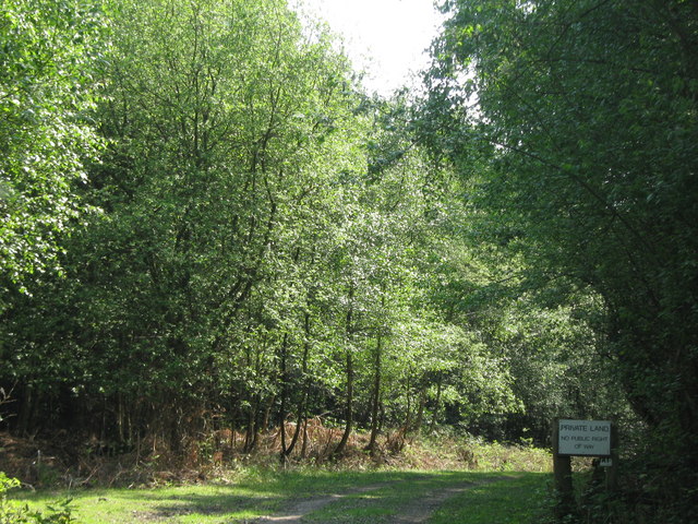
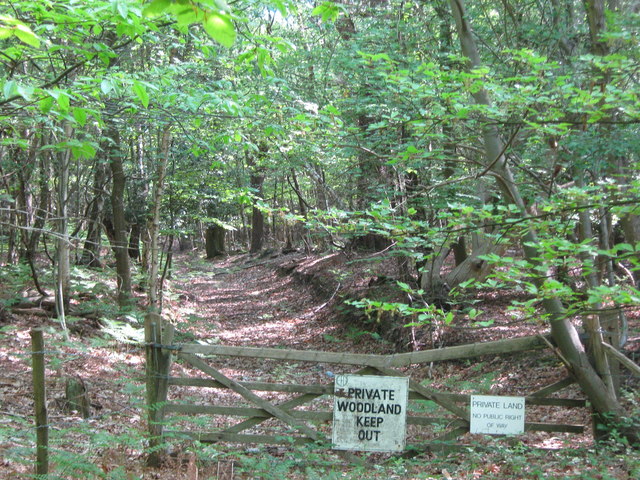
Spring Shaw, Kent (Wood, Forest) is a picturesque woodland located in the county of Kent, England. Covering an area of approximately 50 acres, this enchanting forest is nestled in the heart of the Kent Downs Area of Outstanding Natural Beauty.

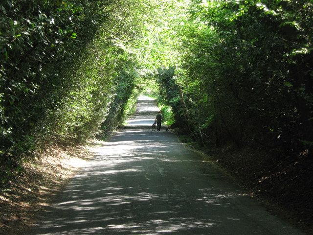
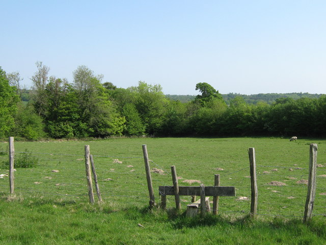
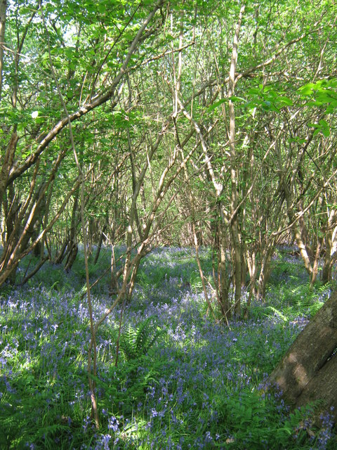
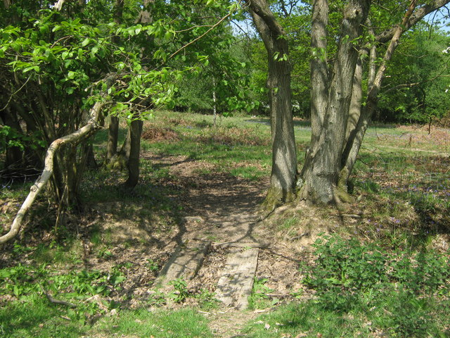
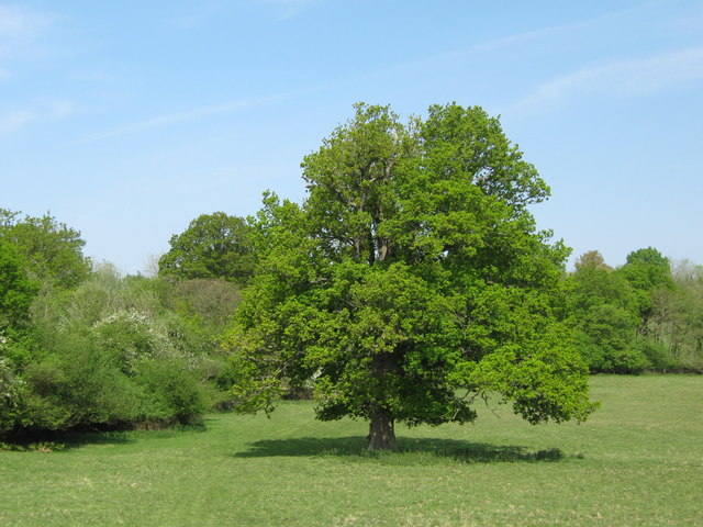
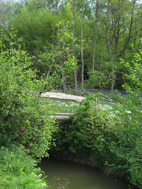
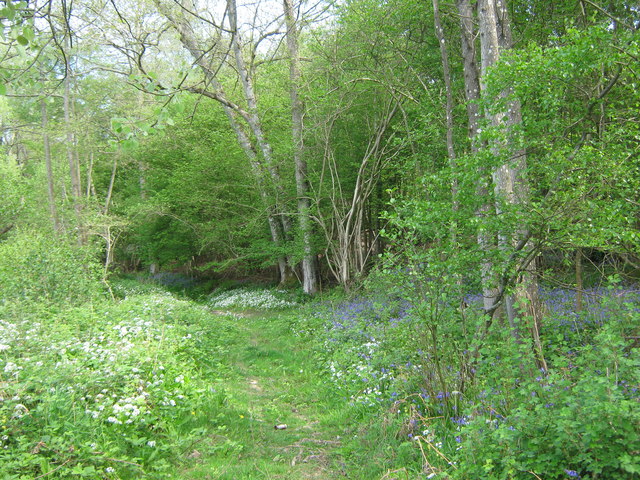
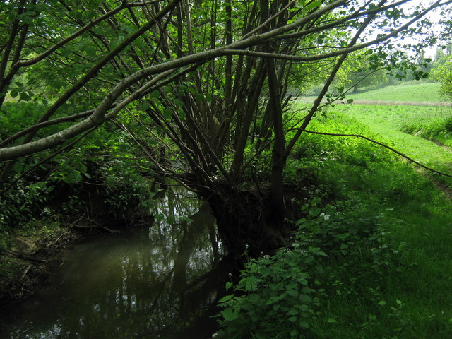
The woodland is characterized by its dense canopy of ancient oak, beech, and chestnut trees, which provide a habitat for a diverse range of flora and fauna. Bluebells carpet the forest floor in the spring, creating a stunning display of vibrant color. The tranquil atmosphere and the gentle sound of birdsong make Spring Shaw a haven for nature lovers and a popular destination for walkers, hikers, and photographers.

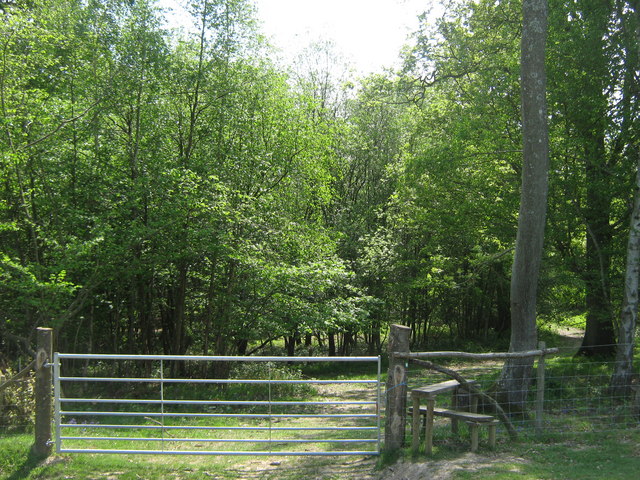
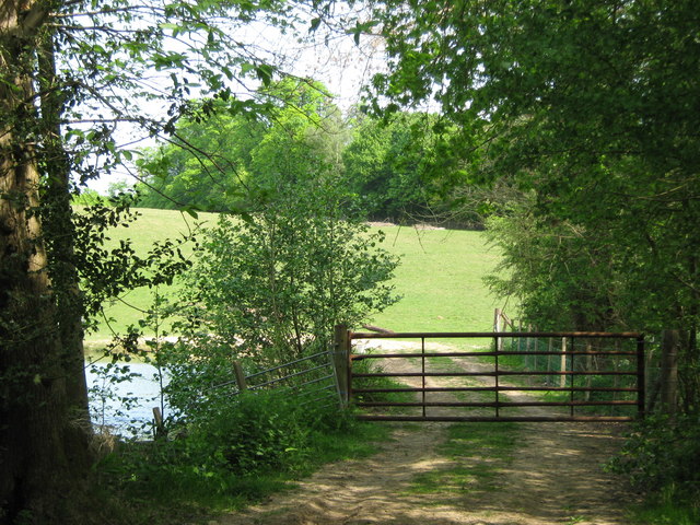
The forest boasts a network of well-maintained footpaths and trails, allowing visitors to explore its beauty at their own pace. These paths wind through the woodland, leading to hidden clearings and secluded spots where one can immerse themselves in the serenity of nature. The diverse wildlife includes deer, foxes, badgers, and a variety of bird species, making Spring Shaw a fantastic place for wildlife enthusiasts.

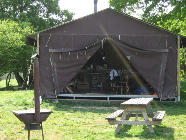
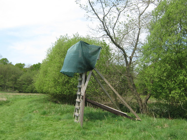
The wood is well-equipped with facilities for visitors, including picnic areas, benches, and designated parking spaces. Interpretive signs provide information about the local flora and fauna, adding an educational aspect to the experience. The management of Spring Shaw is carried out by a dedicated team of conservationists who work tirelessly to preserve and protect the woodland's natural beauty.

Overall, Spring Shaw, Kent (Wood, Forest) offers a tranquil sanctuary where visitors can escape the hustle and bustle of everyday life and connect with the beauty of nature. Its stunning landscapes, diverse wildlife, and well-maintained facilities make it a must-visit destination for nature enthusiasts and outdoor adventurers alike.

If you have any feedback on the listing, please let us know in the comments section below.

Spring Shaw Images

Images are sourced within 2km of 51.12343/0.30758061 or Grid Reference TQ6138. Thanks to Geograph Open Source API. All images are credited.

Woodland track in Oxpasture Wood This track leads from Hawkenbury Road.
Woodland track in Oxpasture Wood
This track leads from Hawkenbury Road.
Woodland Track in Oxpasture Wood This track leads from Hawkenbury Road. It is opposite the track to Frant Lakes.
Woodland Track in Oxpasture Wood
This track leads from Hawkenbury Road. It is opposite the track to Frant Lakes.
Bush House Field
Bush House Field
Dundale Road This road leads from Hawkenbury Road, towards Kipping's Cross.
On the left is Brown's Wood and Oxpasture Wood is on the right.
Dundale Road
This road leads from Hawkenbury Road, towards Kipping's Cross. On the left is Brown's Wood and Oxpasture Wood is on the right.
Stile near Brown's Wood This stile is on a Natural England permissive path from Dundale Road towards the wood in the background.
Stile near Brown's Wood
This stile is on a Natural England permissive path from Dundale Road towards the wood in the background.
Bluebells in Brown's Wood As seen from a permissive path near Dundale Road.
Bluebells in Brown's Wood
As seen from a permissive path near Dundale Road.
Track into Brown's Wood As seen from Hawkenbury Road. Track leads towards the River Teise.
Track into Brown's Wood
As seen from Hawkenbury Road. Track leads towards the River Teise.
Woodland Cabin near Sunningyle Farm Near Rushet Wood is a field with a group of holiday homes. Luxury camping style.
Woodland Cabin near Sunningyle Farm
Near Rushet Wood is a field with a group of holiday homes. Luxury camping style.
Stile and gate near Rushet Wood This stile is on a Natural England permissive path into the Wood and towards the River Teise.
Stile and gate near Rushet Wood
This stile is on a Natural England permissive path into the Wood and towards the River Teise.
Footbridge near Rushet Wood This bridge leads over a field drain near the wood. Currently it is dried out.
The bridge is used by a Natural England permissive path between the River Teise and Rushet Wood (in the background).
Footbridge near Rushet Wood
This bridge leads over a field drain near the wood. Currently it is dried out. The bridge is used by a Natural England permissive path between the River Teise and Rushet Wood (in the background).
Oak Tree near Rushet Wood This tree is beside a Natural England permissive path from the River Teise towards the wood (in the background).
Oak Tree near Rushet Wood
This tree is beside a Natural England permissive path from the River Teise towards the wood (in the background).
Gate near River Teise This gate is used by a Natural England permissive path leading from the Coneyburrow Wood beside the river, towards Rushet Wood near Dundale Road.
On the left is a small pond on the river.
Gate near River Teise
This gate is used by a Natural England permissive path leading from the Coneyburrow Wood beside the river, towards Rushet Wood near Dundale Road. On the left is a small pond on the river.
Footbridge over River Teise This bridge is used by a Natural England permissive path, leading over the river towards Furnace Wood.
Footbridge over River Teise
This bridge is used by a Natural England permissive path, leading over the river towards Furnace Wood.
Woodland Track in Furnace Wood This track leads from Bayham Lake through Furnace Wood towards Brown's Lodge.
On the left are masses of Wild Garlic and on the right (under the trees) are bluebells.
Woodland Track in Furnace Wood
This track leads from Bayham Lake through Furnace Wood towards Brown's Lodge. On the left are masses of Wild Garlic and on the right (under the trees) are bluebells.
Bluebells in Furnace Wood  As seen from the woodland track beside the wood.
Bluebells in Furnace Wood
As seen from the woodland track beside the wood.
Track in Furnace Wood This track leads from Tollslye Cottage near Bayham Lake, through the wood towards Brown's Lodge on Dundale Road.
Track in Furnace Wood
This track leads from Tollslye Cottage near Bayham Lake, through the wood towards Brown's Lodge on Dundale Road.
Hide beside the River Teise This raised view point gives a view of the wildlife around the River (on the right).
Hide beside the River Teise
This raised view point gives a view of the wildlife around the River (on the right).
River Teise This river leads from Siseley Wood, around Great Bayhall, and then through Furnace Wood, heading towards Bayham Lake. This is close to Furnace Wood.
River Teise
This river leads from Siseley Wood, around Great Bayhall, and then through Furnace Wood, heading towards Bayham Lake. This is close to Furnace Wood.
Show me another place!

Spring Shaw is located at Grid Ref: TQ6138 (Lat: 51.12343, Lng: 0.30758061)

Administrative County: Kent

District: Tunbridge Wells

Police Authority: Kent

What 3 Words

///cares.still.lowest. Near Pembury, Kent

Related Wikis

Tunbridge Wells (UK Parliament constituency)

Tunbridge Wells is a constituency in Kent represented in the House of Commons of the UK Parliament since 2005 by Greg Clark, a Conservative who served...

Dunorlan Park

Dunorlan Park is a park and grounds in Royal Tunbridge Wells, UK. Totalling approximately 78 acres (32 ha) and containing a 6-acre (2.4 ha) lake, the grounds...

Beechwood School, Royal Tunbridge Wells

Beechwood School is a co-educational independent day and boarding school for children aged 3–18, which comprises a Nursery, Preparatory School and Senior...

Hawkenbury, Tunbridge Wells

Hawkenbury is a small village area located in the south east of Royal Tunbridge Wells, Kent, England. == History == Hawkenbury was settled before Tunbridge...

The Skinners' Kent Academy

The Skinners' Kent Academy (formerly Sandown Court then later renamed to Tunbridge Wells High School) is a secondary school with academy status in Royal...

Frant railway station

Frant railway station is on the Hastings line in East Sussex, England, and serves the civil parish of Frant (although the station is actually located some...

Kent and Sussex Crematorium and Cemetery

The Kent and Sussex Crematorium and Cemetery is a crematorium and cemetery located in Royal Tunbridge Wells in the county of Kent, England. == Background... ==

Pembury

Pembury is a large village in Kent, in the south east of England, with a population of 6,128 at the 2011 Census. It lies just to the north-east of Royal...

Nearby Amenities

Located within 500m of 51.12343,0.30758061
Natural: spring
Lat/Long: 51.1230981/0.3076876
The data included in this document is from www.openstreetmap.org. The data is made available under ODbL.

Have you been to Spring Shaw?

Leave your review of Spring Shaw below (or comments, questions and feedback).