The Forest
Wood, Forest in Essex Brentwood
England
The Forest

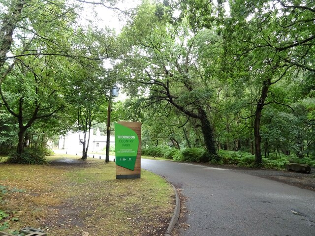
The Forest, Essex, also known as Wood or Forest, is a large woodland area located in the county of Essex, England. Spanning over 1,000 hectares, it is one of the largest forests in the region and offers a diverse range of natural landscapes and habitats.
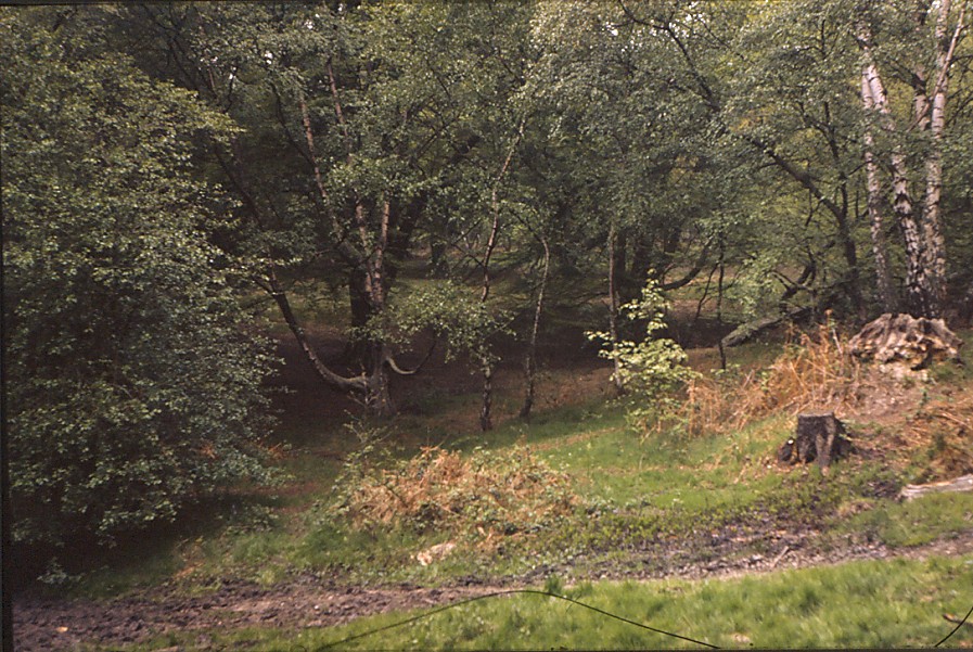
The Forest is predominantly comprised of oak and beech trees, which form a dense canopy that provides shelter for a variety of wildlife species. The woodland floor is covered in a rich carpet of bluebells, ferns, and wildflowers, creating a picturesque setting that attracts nature enthusiasts and photographers alike.
The Forest is home to a wide range of flora and fauna, including deer, badgers, foxes, and numerous bird species. It serves as an important habitat for several rare and protected species, such as the purple emperor butterfly and the red kite. The forest also hosts a number of nature trails and bird hides, allowing visitors to observe and appreciate the local wildlife.
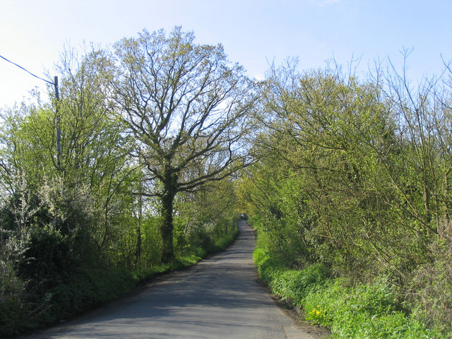
In addition to its natural beauty, The Forest offers numerous recreational activities for visitors. There are well-maintained walking and cycling trails that allow people to explore the forest at their own pace. The area is also popular for horseback riding, with designated bridleways and stables available for equestrian enthusiasts.
The Forest, Essex, is not only a haven for nature lovers but also a significant ecological site. Its preservation and management are essential to maintain a thriving ecosystem and ensure the continued enjoyment of its natural wonders for future generations.
If you have any feedback on the listing, please let us know in the comments section below.
The Forest Images
Images are sourced within 2km of 51.602773/0.32574048 or Grid Reference TQ6191. Thanks to Geograph Open Source API. All images are credited.


The Forest is located at Grid Ref: TQ6191 (Lat: 51.602773, Lng: 0.32574048)
Administrative County: Essex
District: Brentwood
Police Authority: Essex
What 3 Words
///angel.purely.metals. Near Ingrave, Essex
Nearby Locations
Related Wikis

Thorndon Park Chapel
Thorndon Park Chapel (The Petre Chapel) is a former Roman Catholic private chapel situated in Thorndon Park, near the grounds of Thorndon Hall near Ingrave...

Thorndon Hall
Thorndon Hall is a Georgian Palladian country house within Thorndon Park, Ingrave, Essex, England, approximately two miles south of Brentwood and 25 miles...
Thorndon Park
Thorndon Park is a 141.4-hectare (349-acre) biological Site of Special Scientific Interest in Brentwood in Essex. Part of it is run by Essex County Council...

Brentwood Urban District
Brentwood Urban District was a local government district in south Essex, England from 1899 to 1974. The district was created in 1899 from the parish of...

Ingrave
Ingrave is a village and former civil parish, now in the parish of Herongate and Ingrave, in the Brentwood district in Essex, England. It is situated on...
Little Warley
Little Warley is a village in the Brentwood district, in the county of Essex, England. It is situated south of Thorndon Country Park. The first outbreak...
Herongate and Ingrave
Herongate and Ingrave is a civil parish in the Brentwood borough in Essex, England. The parish includes the villages of Ingrave and Herongate. The parish...

Borough of Brentwood
The Borough of Brentwood is a local government district with borough status in Essex, England. The borough is named after its main town of Brentwood, where...
Nearby Amenities
Located within 500m of 51.602773,0.32574048Have you been to The Forest?
Leave your review of The Forest below (or comments, questions and feedback).