Wish Wood

Wood, Forest in Sussex Wealden

England

Wish Wood

Lambs Larder Village store on the B2169 Bayham Road.
Lambs Larder Credit: David Anstiss

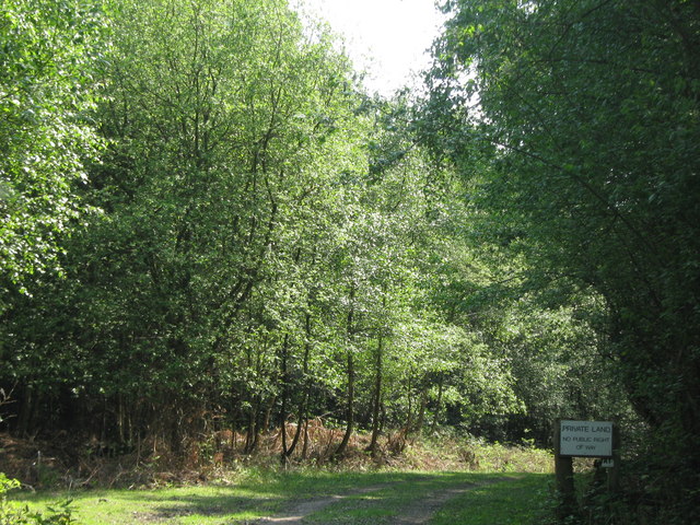
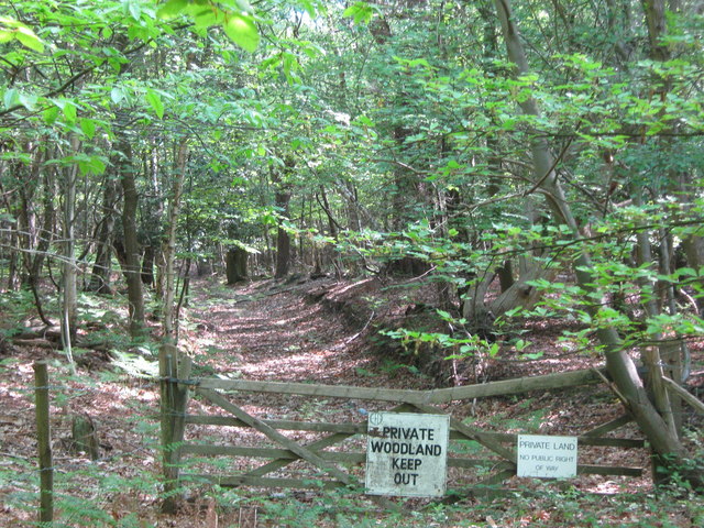
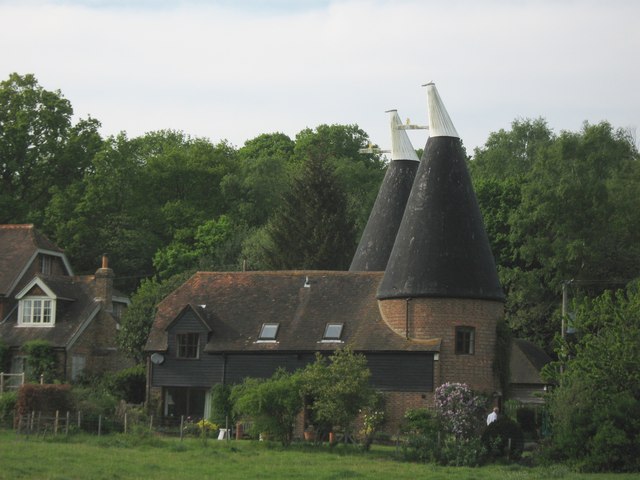
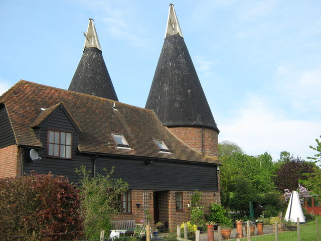
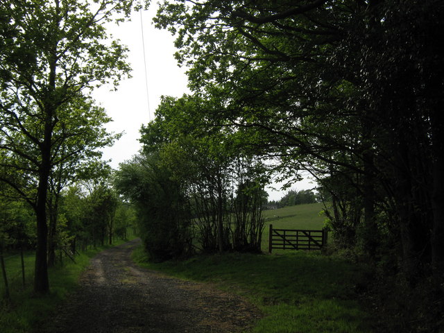
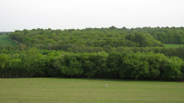
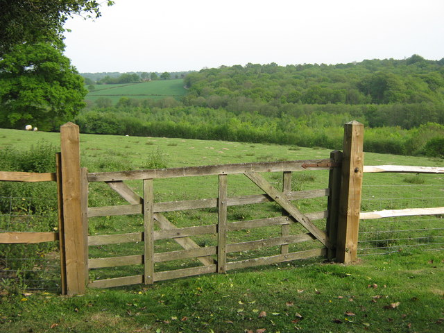
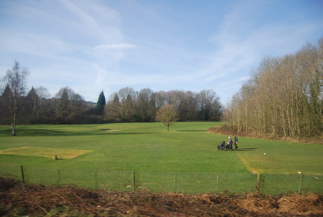
Wish Wood, located in Sussex, England, is a picturesque and enchanting woodland that holds a significant place in local history and folklore. Covering an area of approximately 50 acres, this ancient forest is a haven for nature lovers and a popular destination for outdoor enthusiasts.

The woodland is characterized by its dense canopy of towering oak, beech, and ash trees, which create a tranquil and shady atmosphere. The forest floor is carpeted with a variety of wildflowers, including bluebells, primroses, and wood anemones, adding bursts of color and fragrance to the surroundings.

Wish Wood is home to a diverse range of wildlife, making it a paradise for birdwatchers and animal enthusiasts. Visitors may spot common woodland birds such as robins, blackbirds, and great tits, as well as rarer species like tawny owls and woodpeckers. Deer, foxes, and badgers also inhabit the forest, providing a glimpse into the natural ecosystem.

The wood holds great historical significance, as it is believed to have been a sacred site for ancient Druids. Several ancient burial mounds and stone circles have been discovered within its boundaries, adding to the mystique and allure of the area. Local folklore suggests that the wood possesses magical qualities and that wishes made within its confines have a higher chance of coming true.

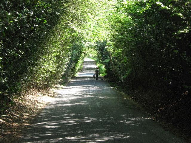
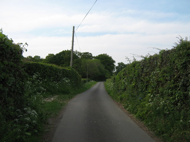
Wish Wood offers a variety of walking trails and paths, allowing visitors to explore its natural beauty at their own pace. Whether it's a leisurely stroll or a more challenging hike, the forest provides a serene and idyllic setting for outdoor activities.

In conclusion, Wish Wood in Sussex is a captivating woodland that combines natural beauty, wildlife diversity, and historical significance. Its peaceful ambiance and magical aura make it an ideal destination for those seeking a connection with nature and a touch of enchantment.

If you have any feedback on the listing, please let us know in the comments section below.

Wish Wood Images

Images are sourced within 2km of 51.1008/0.29903987 or Grid Reference TQ6136. Thanks to Geograph Open Source API. All images are credited.

Lambs Larder Village store on the B2169 Bayham Road.
Lambs Larder
Village store on the B2169 Bayham Road.
Bells Yew Green Village Hall On the B2169 Bayham Road.
Bells Yew Green Village Hall
On the B2169 Bayham Road.
Bells Yew Green Chapel Small chapel on the B2169 Bayham Road, behind a small cottage, facing the village green.
Bells Yew Green Chapel
Small chapel on the B2169 Bayham Road, behind a small cottage, facing the village green.
Brecknock Arms, Pub Sign Outside <a href="https://www.geograph.org.uk/photo/2039350">TQ6036 : The Brecknock Arms</a>, on the junction of Bayham Road and Bell Yew Road.
Brecknock Arms, Pub Sign
Outside TQ6036 : The Brecknock Arms, on the junction of Bayham Road and Bell Yew Road.
Woodland track in Oxpasture Wood This track leads from Hawkenbury Road.
Woodland track in Oxpasture Wood
This track leads from Hawkenbury Road.
Woodland Track in Oxpasture Wood This track leads from Hawkenbury Road. It is opposite the track to Frant Lakes.
Woodland Track in Oxpasture Wood
This track leads from Hawkenbury Road. It is opposite the track to Frant Lakes.
Bush House Field
Bush House Field
Dundale Road This road leads from Hawkenbury Road, towards Kipping's Cross.
On the left is Brown's Wood and Oxpasture Wood is on the right.
Dundale Road
This road leads from Hawkenbury Road, towards Kipping's Cross. On the left is Brown's Wood and Oxpasture Wood is on the right.
Footpath to Great Shoesmith Farm A path leads from Dewhurst Lane, past Little Showsmiths and then up to Great Shoesmith Farm.
Footpath to Great Shoesmith Farm
A path leads from Dewhurst Lane, past Little Showsmiths and then up to Great Shoesmith Farm.
Farm bridge near Little Shoesmiths This bridge leads over a stream, leading from Camden Wood towards Bartley Mill.
The bridge is used by a footpath heading towards Great Shoesmith Farm.
Farm bridge near Little Shoesmiths
This bridge leads over a stream, leading from Camden Wood towards Bartley Mill. The bridge is used by a footpath heading towards Great Shoesmith Farm.
Little Shoesmiths Oast House As seen from a footpath from Great Shoesmith Farm towards Higham Lane.
Little Shoesmiths Oast House
As seen from a footpath from Great Shoesmith Farm towards Higham Lane.
Little Shoesmiths Oast House (2) As seen from a footpath from Great Shoesmith Farm towards Higham Lane.

Note- in the garden a spare Oast Cowl and garden table made from a cowl.
Little Shoesmiths Oast House (2)
As seen from a footpath from Great Shoesmith Farm towards Higham Lane. Note- in the garden a spare Oast Cowl and garden table made from a cowl.
Gate on Little Shoesmiths Access Road This track leads from Little Shoesmiths Farm towards Higham Lane. 
The gate on the right is on a footpath towards Higham Lane.
Gate on Little Shoesmiths Access Road
This track leads from Little Shoesmiths Farm towards Higham Lane. The gate on the right is on a footpath towards Higham Lane.
View of Shoesmiths Wood As seen from a footpath from Higham Farm towards Little Shoesmiths.
View of Shoesmiths Wood
As seen from a footpath from Higham Farm towards Little Shoesmiths.
Gate near Higham Farm Cottage This gate is on a footpath from Higham Lane, leading past Higham Farm Cottage towards Little Shoesmiths.
Gate near Higham Farm Cottage
This gate is on a footpath from Higham Lane, leading past Higham Farm Cottage towards Little Shoesmiths.
Higham Lane This lane leads from Dewhurst Lane, past Higham Farm towards the A2169 Bayham Road, near Bells Yew Green.
Higham Lane
This lane leads from Dewhurst Lane, past Higham Farm towards the A2169 Bayham Road, near Bells Yew Green.
Train at Frant Station As seen from platform 1. The train on platform 2 leads from Tonbridge (via Royal Tunbridge Wells) and then on to Battle, Crowhurst and Hastings.
Train at Frant Station
As seen from platform 1. The train on platform 2 leads from Tonbridge (via Royal Tunbridge Wells) and then on to Battle, Crowhurst and Hastings.
Nevill Golf Course Nevill Golf Club was founded in 1914. The course is approx. 6500 yds and is well wooded.
Website: <span class="nowrap"><a title="http://www.nevillgolfclub.co.uk/" rel="nofollow ugc noopener" href="http://www.nevillgolfclub.co.uk/">Link</a><img style="margin-left:2px;" alt="External link" title="External link - shift click to open in new window" src="https://s1.geograph.org.uk/img/external.png" width="10" height="10"/></span>
Nevill Golf Course
Nevill Golf Club was founded in 1914. The course is approx. 6500 yds and is well wooded. Website: LinkExternal link
Show me another place!

Wish Wood is located at Grid Ref: TQ6136 (Lat: 51.1008, Lng: 0.29903987)

Administrative County: East Sussex

District: Wealden

Police Authority: Sussex

What 3 Words

///traded.play.rotate. Near Royal Tunbridge Wells, Kent

Related Wikis

Frant railway station

Frant railway station is on the Hastings line in East Sussex, England, and serves the civil parish of Frant (although the station is actually located some...

Frant

Frant is a village and civil parish in the Wealden District of East Sussex, England, on the Kentish border about three miles (5 km) south of Royal Tunbridge...

St Alban's Church, Frant

St Alban's Church is a Church of England parish church in Frant, East Sussex, England. It was built in 1819–22 in a fifteenth-century gothic revival style...

Kent and Sussex Crematorium and Cemetery

The Kent and Sussex Crematorium and Cemetery is a crematorium and cemetery located in Royal Tunbridge Wells in the county of Kent, England. == Background... ==

Hawkenbury, Tunbridge Wells

Hawkenbury is a small village area located in the south east of Royal Tunbridge Wells, Kent, England. == History == Hawkenbury was settled before Tunbridge...

Tunbridge Wells (UK Parliament constituency)

Tunbridge Wells is a constituency in Kent represented in the House of Commons of the UK Parliament since 2005 by Greg Clark, a Conservative who served...

Nevill Ground

The Nevill Ground is a cricket ground at Royal Tunbridge Wells in the English county of Kent. It is owned by Tunbridge Wells Borough Council and is used...

Wadhurst railway station

Wadhurst railway station is on the Hastings line in the south of England and serves the town of Wadhurst, East Sussex. It is 39 miles 23 chains (63.2 km...

Nearby Amenities

Located within 500m of 51.1008,0.29903987
Traffic Calming: chicane
Lat/Long: 51.1027914/0.2965153
Entrance: main
Lat/Long: 51.1022701/0.2966299
Bells Yew Green CC
Leisure: pitch
Sport: cricket
Surface: grass
Website: www.bygcc.uk
Lat/Long: 51.1033736/0.2988176
Frant
Naptan AtcoCode: 9100FRANT
Network: National Rail
Network Website: https://www.nationalrail.co.uk/stations/frt/
Network Wikidata: Q26334
Operator: Southeastern
Operator Website: https://www.southeasternrailway.co.uk/travel-information/more-travel-help/station-information/stations/frant
Operator Wikidata: Q1696490
Public Transport: station
Railway: station
Ref Crs: FRT
Source: NPE
Train: yes
Wikidata: Q1913083
Wikipedia: en:Frant railway station
Lat/Long: 51.1040897/0.2943374
Bells Yew Green
Place: village
Lat/Long: 51.1022581/0.2971498
Post Box
Operator: Royal Mail
Operator Wikidata: Q638098
Post Box Type: lamp
Ref: TN3 205D
Royal Cypher: EIIR
Royal Cypher Wikidata: Q33102113
Lat/Long: 51.1021367/0.2969798
Post Box
Operator: Royal Mail
Operator Wikidata: Q638098
Post Box Type: lamp
Ref: TN3 207
Royal Cypher: EIIR
Royal Cypher Wikidata: Q33102113
Lat/Long: 51.1041551/0.2944955
Lambs Larder
Addr City: Frant
Addr Hamlet: Bells Yew Green
Addr Postcode: TN3 9AF
Addr Street: Bayham Road
Fhrs Id: 183147
Shop: convenience
Source Addr: FHRS Open Data
Lat/Long: 51.1038509/0.2953467
Bicycle Parking
Bicycle Parking: stands
Capacity: 12
Covered: yes
Lat/Long: 51.1041086/0.2948332
Vending Machine
Vending: public_transport_tickets
Lat/Long: 51.10414/0.2944842
Frant
Public Transport: stop_position
Railway: stop
Train: yes
Lat/Long: 51.103502/0.2948892
Clock
Display: sundial
Lat/Long: 51.1022843/0.2971241
Bench
Lat/Long: 51.1023238/0.2971455
Bench
Lat/Long: 51.1023098/0.2970804
Bench
Lat/Long: 51.1023679/0.2974788
Bench
Lat/Long: 51.1021521/0.2974422
Traffic Calming: chicane
Lat/Long: 51.101904/0.2979739
Barrier: height_restrictor
Lat/Long: 51.104133/0.2950009
The data included in this document is from www.openstreetmap.org. The data is made available under ODbL.

Have you been to Wish Wood?

Leave your review of Wish Wood below (or comments, questions and feedback).