Benhall Wood
Wood, Forest in Sussex Wealden
England
Benhall Wood
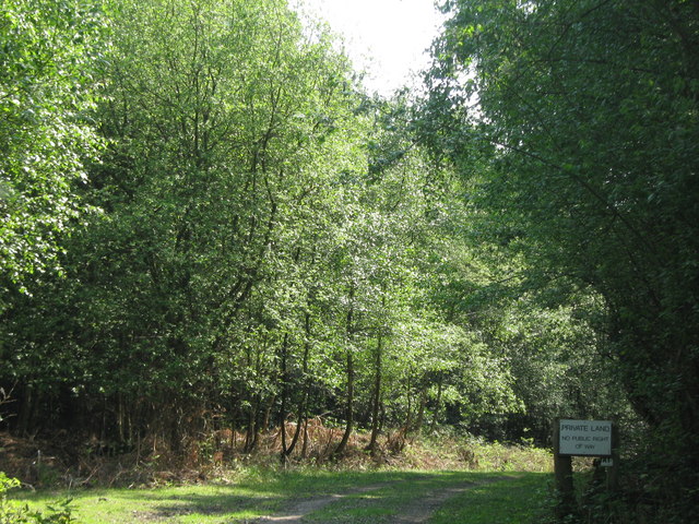
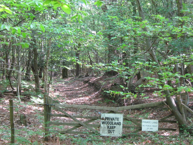
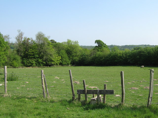
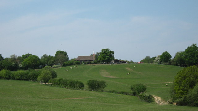
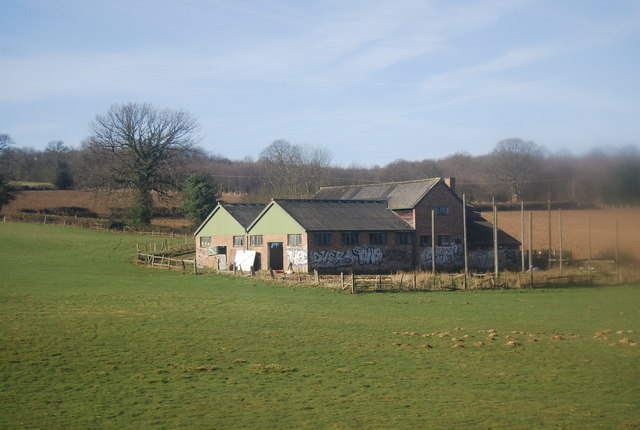
Benhall Wood is a captivating woodland located in the picturesque county of Sussex, England. Covering a vast area of approximately 100 hectares, it is a cherished destination for nature enthusiasts and those seeking solace in the beauty of the natural world. The wood is situated near the village of Benhall, which is renowned for its idyllic countryside and charming rural atmosphere.
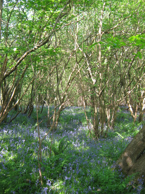
Dominated by a diverse range of tree species, including oak, beech, birch, and hazel, Benhall Wood boasts a rich and vibrant ecosystem. The dense canopy created by these towering trees provides shelter and sustenance to a wide array of wildlife, making it a haven for numerous species of birds, mammals, and insects. Visitors to the wood can often catch a glimpse of resident creatures such as deer, badgers, foxes, and various species of owls.
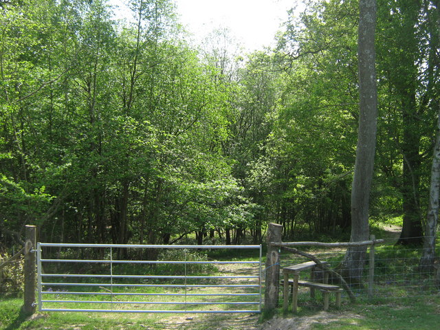
The woodland is crisscrossed with a network of well-maintained trails, allowing visitors to explore its natural wonders at their own pace. These pathways meander through a tapestry of vibrant wildflowers, ferns, and moss-covered boulders, adding to the enchanting aura of the wood. In spring, the forest floor comes alive with a riot of colors as bluebells and primroses carpet the ground.
Benhall Wood is not only a sanctuary for wildlife but also an important cultural and historical site. Archaeological evidence suggests that the wood has been inhabited for thousands of years, with remnants of Iron Age settlements and Roman occupation still visible. Today, the wood is managed by a dedicated team of conservationists, ensuring its preservation and continued enjoyment for generations to come.
If you have any feedback on the listing, please let us know in the comments section below.
Benhall Wood Images
Images are sourced within 2km of 51.118095/0.29306808 or Grid Reference TQ6037. Thanks to Geograph Open Source API. All images are credited.

Benhall Wood is located at Grid Ref: TQ6037 (Lat: 51.118095, Lng: 0.29306808)
Administrative County: East Sussex
District: Wealden
Police Authority: Sussex
What 3 Words
///wants.eggs.glare. Near Royal Tunbridge Wells, Kent
Nearby Locations
Related Wikis

Hawkenbury, Tunbridge Wells
Hawkenbury is a small village area located in the south east of Royal Tunbridge Wells, Kent, England. == History == Hawkenbury was settled before Tunbridge...

Kent and Sussex Crematorium and Cemetery
The Kent and Sussex Crematorium and Cemetery is a crematorium and cemetery located in Royal Tunbridge Wells in the county of Kent, England. == Background... ==

Frant railway station
Frant railway station is on the Hastings line in East Sussex, England, and serves the civil parish of Frant (although the station is actually located some...

Nevill Ground
The Nevill Ground is a cricket ground at Royal Tunbridge Wells in the English county of Kent. It is owned by Tunbridge Wells Borough Council and is used...

Dunorlan Park
Dunorlan Park is a park and grounds in Royal Tunbridge Wells, UK. Totalling approximately 78 acres (32 ha) and containing a 6-acre (2.4 ha) lake, the grounds...

Beechwood School, Royal Tunbridge Wells
Beechwood School is a co-educational independent day and boarding school for children aged 3–18, which comprises a Nursery, Preparatory School and Senior...

Assembly Hall Theatre, Tunbridge Wells
The Assembly Hall Theatre is a theatre in Tunbridge Wells seating 1,020 people. The theatre hosts a variety of popular music, comedy, family, dance, drama...

Hotel du Vin, Royal Tunbridge Wells
The Hotel du Vin & Bistro is a hotel in Crescent Road, Royal Tunbridge Wells, Kent, England. It lies in between St Augustine's Catholic Church and Eynshym...
Related Videos

Royal Tunbridge Wells 4K UHD | Walking Tour of Historic Pantiles & Royal Kent Town | Sept 2022
A sunny morning walk through Royal Tunbridge Wells, Kent, England. The town is approx 30 miles southeast of central London, ...

🇬🇧 Walking in Beautiful Royal Tunbridge Wells Town | England | UK 🇬🇧
"Music: www.bensound.com" | "Royalty Free Music from Bensound".

Winter in the English countryside | UK travel vlog
Hi, Merry Christmas! Wishing you a wonderful end to 2023 and a happy start to 2024. Thank you to everyone who has tuned in to ...

Nearby Amenities
Located within 500m of 51.118095,0.29306808Have you been to Benhall Wood?
Leave your review of Benhall Wood below (or comments, questions and feedback).