Carton Grange New Wood

Wood, Forest in Cambridgeshire South Cambridgeshire

England

Carton Grange New Wood

On Six Mile Bottom Road The road from Weston Colville to Lark Hall and Six Mile Bottom (ahead), photographed on a fine October morning.
On Six Mile Bottom Road Credit: John Sutton

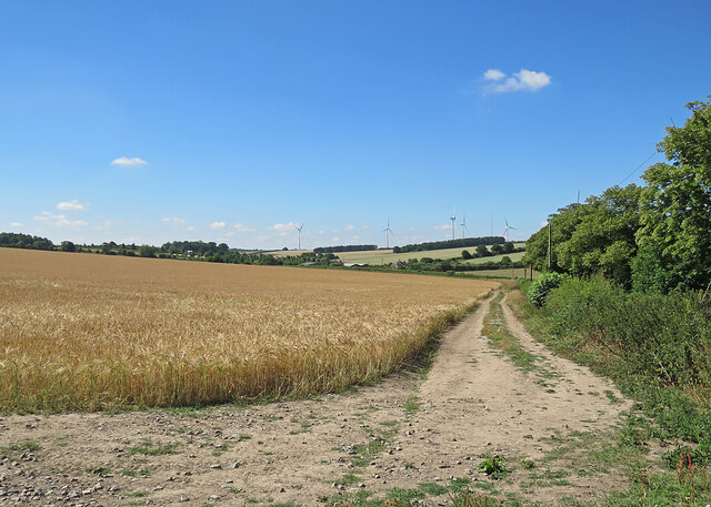
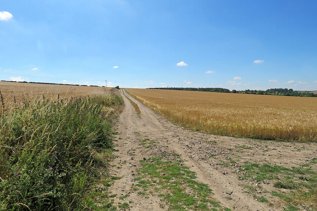
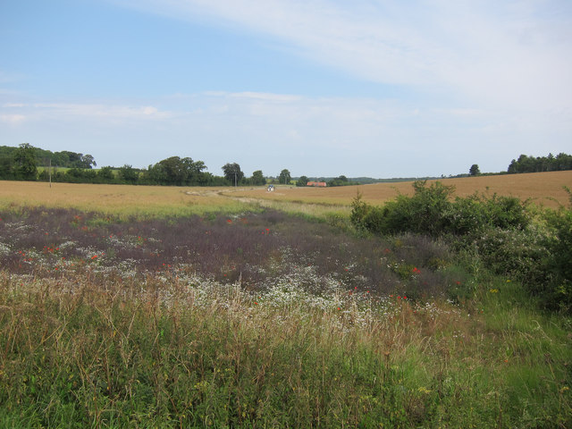
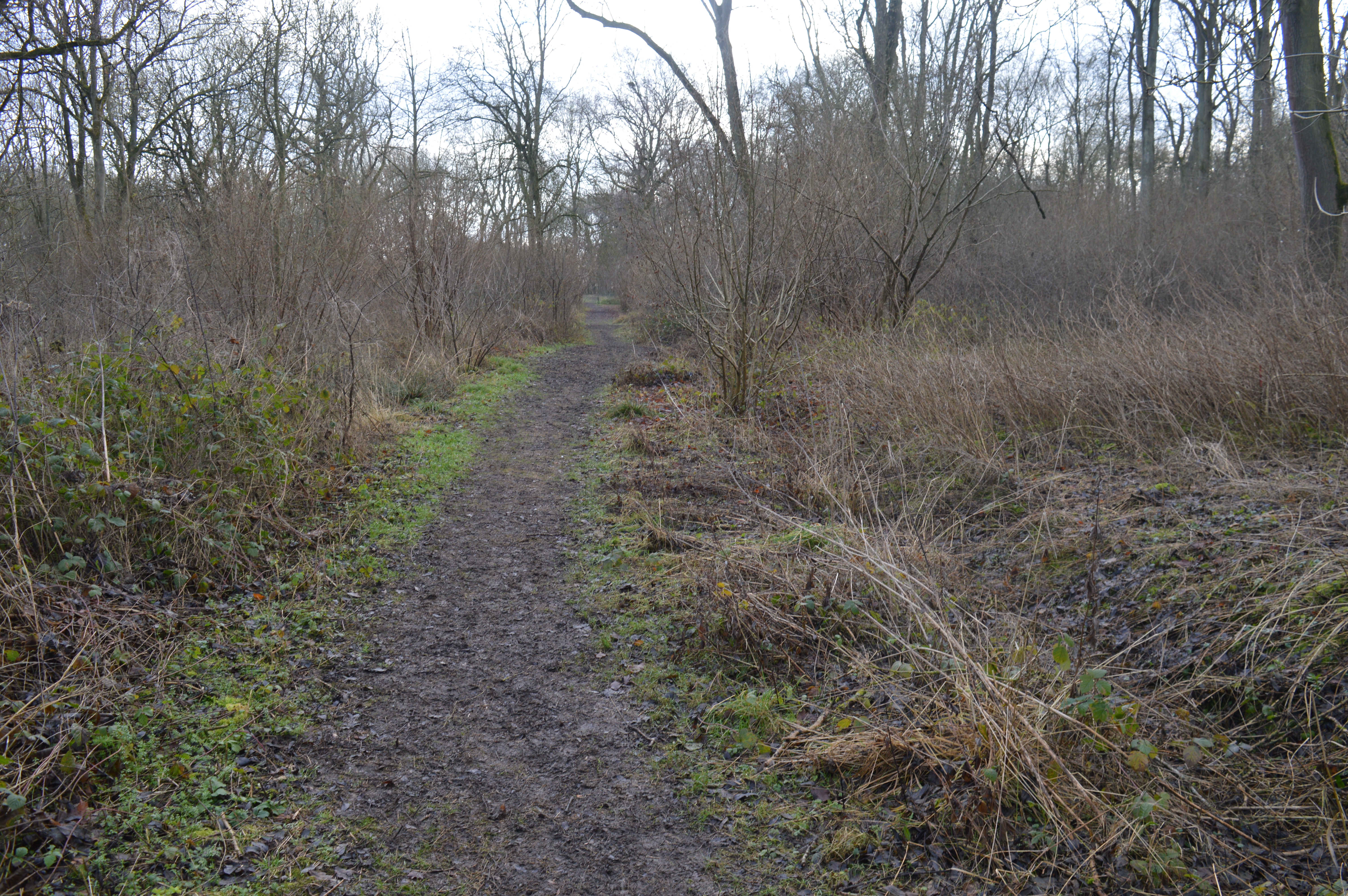
Carton Grange New Wood is a picturesque forest located in Cambridgeshire, England. Spread across an expansive area, this woodland is known for its lush greenery and diverse range of trees and wildlife.

The forest features a mix of deciduous and coniferous trees, including oak, beech, pine, and birch, which create a beautiful and serene atmosphere. The dense canopy of the trees provides shelter to a variety of animal species, such as deer, rabbits, foxes, and a wide array of bird species. The woodland is a haven for nature enthusiasts and birdwatchers, offering ample opportunities to observe and appreciate the local wildlife.

Carton Grange New Wood offers several walking trails that meander through the forest, allowing visitors to explore its natural beauty at their own pace. These trails are well-maintained and suitable for all ages and fitness levels. The forest also has designated picnic areas, making it a perfect spot for a family outing or a leisurely day trip.

In addition to its natural splendor, Carton Grange New Wood is also of historical significance. It is believed that the woodland has been present for centuries and has witnessed many changes over time. The forest has played a role in local folklore and has been a source of inspiration for artists and writers throughout the years.

Overall, Carton Grange New Wood is a captivating destination for nature lovers and history enthusiasts alike. Its tranquil ambiance, diverse flora and fauna, and ample recreational opportunities make it a must-visit location in Cambridgeshire.

If you have any feedback on the listing, please let us know in the comments section below.

Carton Grange New Wood Images

Images are sourced within 2km of 52.170397/0.34071283 or Grid Reference TL6055. Thanks to Geograph Open Source API. All images are credited.

On Six Mile Bottom Road The road from Weston Colville to Lark Hall and Six Mile Bottom (ahead), photographed on a fine October morning.
On Six Mile Bottom Road
The road from Weston Colville to Lark Hall and Six Mile Bottom (ahead), photographed on a fine October morning.
A crossroads on Brinkley Road Brinkley to the left, Six Mile Bottom and Cambridge to the right, Weston Colville and (not very directly) Balsham straight ahead. The road behind the camera runs to Dullingham.
A crossroads on Brinkley Road
Brinkley to the left, Six Mile Bottom and Cambridge to the right, Weston Colville and (not very directly) Balsham straight ahead. The road behind the camera runs to Dullingham.
Westley Waterless: St Mary - restoration Two men were working on the bellcote - one on the lead, the other painting the louvres. The spirelet replaced a round tower which collapsed in 1855.

Inside are two exquisite 14th-century brasses: <a href="https://www.geograph.org.uk/photo/3276297">TL6156 : Westley Waterless: brass of Sir John Creke (detail)</a> and <a href="https://www.geograph.org.uk/photo/3276294">TL6156 : Westley Waterless: brass of Lady Creke (detail)</a>.
Westley Waterless: St Mary - restoration
Two men were working on the bellcote - one on the lead, the other painting the louvres. The spirelet replaced a round tower which collapsed in 1855. Inside are two exquisite 14th-century brasses: TL6156 : Westley Waterless: brass of Sir John Creke (detail) and TL6156 : Westley Waterless: brass of Lady Creke (detail).
Footpath to Westley Waterless Taken from the side of the road from Six Mile Bottom to Brinkley (right) on a cloudless October morning.
Footpath to Westley Waterless
Taken from the side of the road from Six Mile Bottom to Brinkley (right) on a cloudless October morning.
The eastern edge of Brinkley Wood At over 350ft, the hills of East Cambridgeshire are a lot higher than much of the rest of the county. Big fields and large plantations typify the area.
The eastern edge of Brinkley Wood
At over 350ft, the hills of East Cambridgeshire are a lot higher than much of the rest of the county. Big fields and large plantations typify the area.
Towards Brinkley Wood At over 350ft, the hills of East Cambridgeshire are a lot higher than much of the rest of the county. Big fields and large plantations typify the area. A little further from here, Six Mile Bottom Road, from which this picture was taken, begins to slope down to the lower-lying villages east of Cambridge, near the edge of The Fens.
Towards Brinkley Wood
At over 350ft, the hills of East Cambridgeshire are a lot higher than much of the rest of the county. Big fields and large plantations typify the area. A little further from here, Six Mile Bottom Road, from which this picture was taken, begins to slope down to the lower-lying villages east of Cambridge, near the edge of The Fens.
The road to Six Mile Bottom This is the road from West Wratting to Six Mile Bottom, near Lark Hall. The signpost on the right points along a path which cuts a corner and leads to the Weston Colville road (see <a href="https://www.geograph.org.uk/photo/7221136">TL5854 : Footpath through barley</a>).
The road to Six Mile Bottom
This is the road from West Wratting to Six Mile Bottom, near Lark Hall. The signpost on the right points along a path which cuts a corner and leads to the Weston Colville road (see TL5854 : Footpath through barley).
Barley and turbines Looking towards Lark Hall Corner and, on the skyline, some of the turbines of Wadlow Wind Farm on a fine July morning.
Barley and turbines
Looking towards Lark Hall Corner and, on the skyline, some of the turbines of Wadlow Wind Farm on a fine July morning.
Footpath through barley The start, near Lark Hall, of a path which follows a farm track, cutting a corner and leading to the Weston Colville road.
Footpath through barley
The start, near Lark Hall, of a path which follows a farm track, cutting a corner and leading to the Weston Colville road.
Oil seed rape off Westley Bottom Road With a stream running towards Partridge Hall.
Oil seed rape off Westley Bottom Road
With a stream running towards Partridge Hall.
Barns by Balsham Lane
Icknield Way The strip on the left of the track is for game cover crops, see <a href="https://www.geograph.org.uk/photo/1637282">TL6054 : Icknield Way Path</a>.
Icknield Way
The strip on the left of the track is for game cover crops, see TL6054 : Icknield Way Path.
Oil seed rape field Looking past a lone tree towards Westley Waterless.
Oil seed rape field
Looking past a lone tree towards Westley Waterless.
Oil seed rape off Westley Bottom Road Compare with <a href="https://www.geograph.org.uk/photo/2562306">TL6056 : Oil seed rape off Westley Bottom Road</a> from three months earlier.
Oil seed rape off Westley Bottom Road
Compare with TL6056 : Oil seed rape off Westley Bottom Road from three months earlier.
Icknield Way This small part of the Icknield Way shares part of a minor country road near to Weston Colville, Cambridgeshire.
Icknield Way
This small part of the Icknield Way shares part of a minor country road near to Weston Colville, Cambridgeshire.
Signs Footpath sign and marker signs for the Icknield Way near to Weston Colville, Cambridgeshire.
Signs
Footpath sign and marker signs for the Icknield Way near to Weston Colville, Cambridgeshire.
Part Of The Icknield Way Looking west along part of the Icknield Way near to Weston Colville, Cambridgeshire.
Part Of The Icknield Way
Looking west along part of the Icknield Way near to Weston Colville, Cambridgeshire.
Long Distance Footpath The Icknield Way looking east near to Weston Colville, Cambridgeshire.
Long Distance Footpath
The Icknield Way looking east near to Weston Colville, Cambridgeshire.
Show me another place!

Carton Grange New Wood is located at Grid Ref: TL6055 (Lat: 52.170397, Lng: 0.34071283)

Administrative County: Cambridgeshire

District: South Cambridgeshire

Police Authority: Cambridgeshire

What 3 Words

///eased.festivity.launch. Near Balsham, Cambridgeshire

Related Wikis

Westley Waterless

Westley Waterless is a small village and civil parish in East Cambridgeshire, England, 5 miles south west of Newmarket. == History == The parish of Westley...

Weston Colville

Weston Colville is a village in South Cambridgeshire, 10 miles southeast of Cambridge and 6 miles south of Newmarket, close to the border with Suffolk...

West Wratting

West Wratting is a village and civil parish 10 miles southeast of Cambridge in Cambridgeshire. At 390 feet (120 m) above sea level, it can claim to be...

Brinkley, Cambridgeshire

Brinkley is a small village in Cambridgeshire, England. It is situated about 15 miles east of Cambridge and 5 miles south of Newmarket, the horse racing...

Shug Monkey

In the folklore of Cambridgeshire, the Shug Monkey is a creature that shares features of a dog and monkey, which reportedly haunted Slough Hill Lane (a...

Six Mile Bottom railway station

Six Mile Bottom railway station is a disused railway station on the Ipswich to Cambridge line between Dullingham and Fulbourn. It served the village of...

Six Mile Bottom

Six Mile Bottom is a hamlet within the parish of Little Wilbraham, near Cambridge in England. == Etymology == The hamlet was named in 1801, deriving its...

Lower Wood

Lower Wood is a 9 hectare nature reserve east of Weston Colville in Cambridgeshire. It is managed by the Wildlife Trust for Bedfordshire, Cambridgeshire...

Nearby Amenities

Located within 500m of 52.170397,0.34071283
Power: pole
Lat/Long: 52.1667794/0.3401567
Power: pole
Lat/Long: 52.1736426/0.3454353
Power: pole
Lat/Long: 52.171366/0.3439869
Power: pole
Lat/Long: 52.1696814/0.342796
Power: pole
Lat/Long: 52.1685628/0.3418626
Power: pole
Lat/Long: 52.1679705/0.341294
Power: pole
Lat/Long: 52.1703658/0.3449633
Power: pole
Lat/Long: 52.1673914/0.3406824
Power: pole
Lat/Long: 52.169642/0.3476138
Power: pole
Lat/Long: 52.1702276/0.3432145
Power: pole
Lat/Long: 52.1728066/0.344974
Power: pole
Lat/Long: 52.1707737/0.3435578
Power: pole
Lat/Long: 52.1691678/0.3423883
Power: pole
Lat/Long: 52.1661935/0.3396291
Power: pole
Lat/Long: 52.1728101/0.3365256
Power: pole
Lat/Long: 52.1711651/0.3422551
Power: pole
Lat/Long: 52.1723857/0.3379365
Power: pole
Lat/Long: 52.1719743/0.3393422
Power: pole
Lat/Long: 52.1732115/0.3350933
Power: pole
Lat/Long: 52.1719142/0.3444999
The data included in this document is from www.openstreetmap.org. The data is made available under ODbL.

Have you been to Carton Grange New Wood?

Leave your review of Carton Grange New Wood below (or comments, questions and feedback).