Featherstone

Settlement in Staffordshire South Staffordshire

England

Featherstone

Former colliery railway - Hilton Main South of the Bognop Road level crossing.
Former colliery railway - Hilton Main Credit: John M

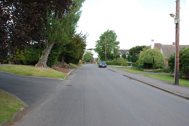
Featherstone is a small village located in the county of Staffordshire, England. Situated approximately 5 miles southeast of the town of Wolverhampton, Featherstone lies within the South Staffordshire district. The village is surrounded by picturesque countryside, offering residents and visitors a tranquil and scenic environment.

With a population of around 1,500 people, Featherstone maintains a close-knit community feel. The village is home to a range of amenities, including a primary school, a post office, and a local convenience store, providing essential services to its residents. Additionally, there are several pubs and restaurants that offer a variety of dining options.

Featherstone boasts a rich history, with evidence of human settlement in the area dating back to the Bronze Age. The village is known for its historic buildings, including St. Mary's Church, which dates back to the 12th century. The church features stunning architecture and serves as a reminder of Featherstone's past.

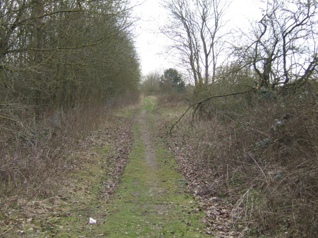
For outdoor enthusiasts, Featherstone offers ample opportunities for exploration and recreation. The surrounding countryside provides beautiful walking trails, cycling routes, and green spaces, allowing residents to enjoy the natural beauty of the area. Cannock Chase, a designated Area of Outstanding Natural Beauty, is nearby, offering further outdoor activities such as hiking and wildlife spotting.

Overall, Featherstone provides a peaceful and idyllic setting for its residents, combining a rich history with a range of amenities and natural beauty.

If you have any feedback on the listing, please let us know in the comments section below.
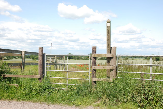
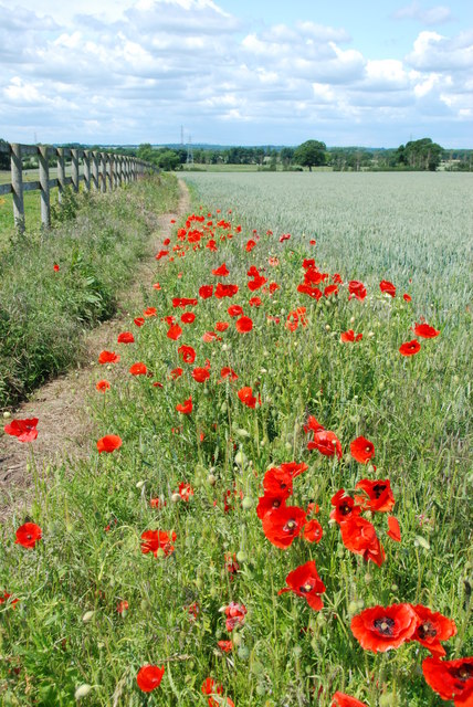
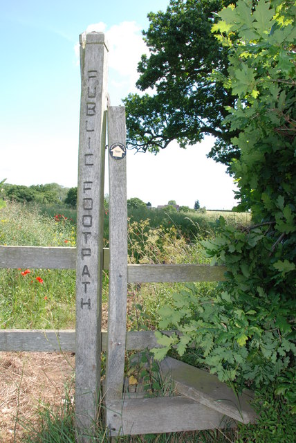
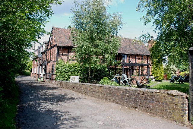
Featherstone Images

Images are sourced within 2km of 52.64306/-2.087785 or Grid Reference SJ9405. Thanks to Geograph Open Source API. All images are credited.

Former colliery railway - Hilton Main South of the Bognop Road level crossing.
Former colliery railway - Hilton Main
South of the Bognop Road level crossing.
Former colliery railway - Hilton Main Looking across the level crossing on Bognop Road into the colliery site at Hilton Main.
Former colliery railway - Hilton Main
Looking across the level crossing on Bognop Road into the colliery site at Hilton Main.
HMP Oakwood (previously known as Featherstone 2) Work is progressing steadily on the new 1605 bed Category B prison near Wolverhampton. Completion is expected in April 2012. The three cell blocks will each house 480 inmates. The new prison will share the former Royal Ordnance Factory site with the existing HMP Featherstone Prison and Brinsford Young Offenders Institution.

The prison operated by G4S had the distinction of receiving the worst ever report by the HM Inspector of Prisons in October 2013.
HMP Oakwood (previously known as Featherstone 2)
Work is progressing steadily on the new 1605 bed Category B prison near Wolverhampton. Completion is expected in April 2012. The three cell blocks will each house 480 inmates. The new prison will share the former Royal Ordnance Factory site with the existing HMP Featherstone Prison and Brinsford Young Offenders Institution. The prison operated by G4S had the distinction of receiving the worst ever report by the HM Inspector of Prisons in October 2013.
A460 from Old Cannock Road Junction Near Sharehill. The area to the right of the road is the site of a large boot sale
A460 from Old Cannock Road Junction
Near Sharehill. The area to the right of the road is the site of a large boot sale
Public Bridleway, Featherstone Lane
Bridleway from Featherstone Lane
Footpath from Featherstone Lane
Entrance to Featherstone Lane
Featherstone Farm Hotel, Featherstone
Cat and Kittens Lane, Featherstone This road runs between the former ordnance site near Featherstone and the M54, hence the road sign.
Cat and Kittens Lane, Featherstone
This road runs between the former ordnance site near Featherstone and the M54, hence the road sign.
Baneberry Drive, Featherstone
Church Road, Shareshill
Shareshill Post Office and Stores, Shareshill
Moseley Gate The front gated entrance to Moseley Old Hall.
Moseley Gate
The front gated entrance to Moseley Old Hall.
Moseley Wall Moseley Old Hall front elevation viewed from Moseley Old Hall Lane.
Moseley Wall
Moseley Old Hall front elevation viewed from Moseley Old Hall Lane.
Moseley Old Hall The Knot garden to the side elevation of Moseley Old Hall.
Moseley Old Hall
The Knot garden to the side elevation of Moseley Old Hall.
Behind Moseley Rear elevation of Moseley Old Hall.
Behind Moseley
Rear elevation of Moseley Old Hall.
Moseley Knot Knot garden to the side of Moseley Old Hall.
Moseley Knot
Knot garden to the side of Moseley Old Hall.
Show me another place!

Featherstone is located at Grid Ref: SJ9405 (Lat: 52.64306, Lng: -2.087785)

Administrative County: Staffordshire

District: South Staffordshire

Police Authority: Staffordshire

What 3 Words

///farms.artist.ashes. Near Featherstone, Staffordshire

Related Wikis

Featherstone, Staffordshire

Featherstone is a town in the district of South Staffordshire, England, near to the border with Wolverhampton. == History == Originally a farming community...
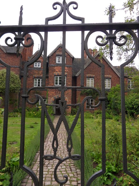
Brinsford Lodge

Brinsford Lodge was a hall of residence for The Polytechnic, Wolverhampton (now the University of Wolverhampton) from the mid-1960s to the early 1980s...
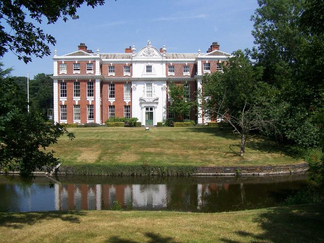
Hilton Hall

Hilton Hall is an 18th-century mansion house now in use as an Office and Business Centre at Hilton, near Wolverhampton, in Staffordshire. It is a Grade...

Moseley Old Hall

Moseley Old Hall is located in Fordhouses, north of Wolverhampton in the United Kingdom. It is notable as one of the hiding places of Charles II during...

Nearby Amenities

Located within 500m of 52.64306,-2.087785
Note: 40 mph speed limit sign
Lat/Long: 52.6402812/-2.0890019
Featherstone
Is In: Staffordshire
Place: village
Source: OS-1:25000-SJ90-1947(A)
Wikidata: Q2108566
Lat/Long: 52.6449402/-2.0925245
Bus Stop
Sanderling Close
Bus: yes
Naptan AtcoCode: 3800C603200
Naptan Bearing: NE
Naptan CommonName: Sanderling Close
Naptan Indicator: Opp
Naptan Landmark: Sanderling Close
Naptan Street: Turnstone Dr
Naptan Verified: no
Public Transport: platform
Source: naptan_import
Lat/Long: 52.6453263/-2.0940598
Bus Stop
South Crescent
Bus: yes
Naptan AtcoCode: 3800C613601
Naptan Bearing: W
Naptan CommonName: South Crescent
Naptan Indicator: Adj
Naptan Landmark: South Crescent
Naptan Street: The Avenue
Naptan Verified: no
Public Transport: platform
Source: naptan_import
Lat/Long: 52.6431337/-2.0888131
Bus Stop
South Crescent
Bus: yes
Naptan AtcoCode: 3800C613602
Naptan Bearing: E
Naptan CommonName: Olde Hall Road
Naptan Indicator: Adj
Naptan Landmark: Olde Hall Road
Naptan Street: The Avenue
Naptan Verified: no
Public Transport: platform
Source: naptan_import
Lat/Long: 52.6432533/-2.0892965
Bus Stop
Whitgreave School
Bus: yes
Naptan AtcoCode: 3800C613701
Naptan Bearing: E
Naptan BusStopType: CUS
Naptan CommonName: Whitgreave School
Naptan Indicator: Opp
Naptan Landmark: Whitgreave Sch
Naptan Street: The Avenue
Naptan Verified: no
Public Transport: platform
Source: naptan_import
Lat/Long: 52.6434335/-2.0925554
Bus Stop
Whitgreave School
Bus: yes
Naptan AtcoCode: 3800C613702
Naptan Bearing: W
Naptan CommonName: Whitgreave School
Naptan Indicator: Adj
Naptan Landmark: Whitgreave Sch
Naptan Street: The Avenue
Naptan Verified: no
Public Transport: platform
Source: naptan_import
Lat/Long: 52.6433528/-2.0926561
Bus Stop
Brookhouse Close
Bus: yes
Naptan AtcoCode: 3800C614501
Naptan Bearing: W
Naptan CommonName: Brookhouse Close
Naptan Indicator: Adj
Naptan Landmark: Brookhouse Close
Naptan Street: Brookhouse Lane
Naptan Verified: no
Public Transport: platform
Source: naptan_import
Lat/Long: 52.6433838/-2.0948241
Bus Stop
Brookhouse Close
Bus: yes
Naptan AtcoCode: 3800C614502
Naptan Bearing: E
Naptan BusStopType: CUS
Naptan CommonName: Brookhouse Close
Naptan Indicator: Opp
Naptan Landmark: Brookhouse Clo
Naptan Street: Brook House Ln
Naptan Verified: no
Public Transport: platform
Source: naptan_import
Lat/Long: 52.6434647/-2.0948834
Bus Stop
Shepwell Gardens
Bus: yes
Naptan AtcoCode: 3800C615801
Naptan Bearing: NW
Naptan CommonName: Hilton Road
Naptan Indicator: Adj
Naptan Landmark: Hilton Road
Naptan Street: New Road
Naptan Verified: no
Public Transport: platform
Source: naptan_import
Lat/Long: 52.6469172/-2.0860371
Bus Stop
Shepwell Gardens
Bus: yes
Naptan AtcoCode: 3800C615802
Naptan Bearing: E
Naptan CommonName: Shepwell Gardens
Naptan Indicator: Adj
Naptan Landmark: Shepwell Gardens
Naptan Street: New Road
Naptan Verified: no
Public Transport: platform
Source: naptan_import
Lat/Long: 52.6471719/-2.0870368
Bus Stop
The Leas
Bus: yes
Naptan AtcoCode: 3800C616001
Naptan Bearing: SW
Naptan BusStopType: CUS
Naptan CommonName: The Leas
Naptan Indicator: Adj
Naptan Landmark: The Leas
Naptan Street: Hilton Road
Naptan Verified: no
Public Transport: platform
Source: naptan_import
Lat/Long: 52.6457869/-2.0874132
Bus Stop
Old Lane
Bus: yes
Naptan AtcoCode: 3800C616002
Naptan Bearing: NE
Naptan CommonName: Old Lane
Naptan Indicator: Adj
Naptan Landmark: Old Lane
Naptan Street: Hilton Road
Naptan Verified: no
Public Transport: platform
Source: naptan_import
Lat/Long: 52.6453645/-2.089197
Bus Stop
Brook House Lane
Bus: yes
Naptan AtcoCode: 3800C616301
Naptan Bearing: NE
Naptan CommonName: Brook House Lane
Naptan Indicator: Adj
Naptan Landmark: Brook House Lane
Naptan Street: Hilton Road
Naptan Verified: no
Public Transport: platform
Source: naptan_import
Lat/Long: 52.6442126/-2.0927125
The Avenue
Naptan AtcoCode: 3800C616302
Naptan Bearing: S
Naptan BusStopType: CUS
Naptan CommonName: The Avenue
Naptan Indicator: Adj
Naptan Landmark: The Avenue
Naptan Street: Hilton Road
Naptan Verified: no
Source: naptan_import
Lat/Long: 52.6442397/-2.0924613
Roundabout
Naptan AtcoCode: 3800C618101
Naptan Bearing: S
Naptan CommonName: Roundabout
Naptan Indicator: Adj
Naptan Landmark: Roundabout
Naptan Street: Cannock Road
Naptan Verified: no
Source: naptan_import
Lat/Long: 52.641457/-2.0868986
Bus Stop
The Avenue
Bus: yes
Naptan AtcoCode: 3800C618102
Naptan Bearing: N
Naptan CommonName: The Avenue
Naptan Indicator: adj
Naptan Street: Cannock Road
Naptan Verified: no
Public Transport: platform
Source: naptan_import
Lat/Long: 52.6416457/-2.0870911
Bus Stop
The Avenue
Bus: yes
Naptan AtcoCode: 3800C622301
Naptan Bearing: S
Naptan CommonName: The Avenue
Naptan Indicator: Opp
Naptan Street: Cannock Road
Naptan Verified: no
Public Transport: platform
Source: naptan_import
Lat/Long: 52.6421675/-2.0865453
Post Office
Featherstone Post Office
Addr City: Wolverhampton
Addr Housenumber: 10
Addr Postcode: WV10 7AA
Addr Street: Cannock Road
Addr Village: Featherstone
Brand: Post Office
Brand Wikidata: Q1783168
Opening Hours: Mo-Sa 07:30-20:00; Su 11:00-18:00
Ref Pol Id: 5127
Website: https://www.postoffice.co.uk/branch-finder/1782460/featherstone
Lat/Long: 52.6428877/-2.0869154
Fuel
Hilton Service Station
Brand: Harvest Energy
Operator: Harvest Energy
Lat/Long: 52.6448118/-2.086214
Pub
Red White & Blue
Lat/Long: 52.6443987/-2.08657
Recycling
Lat/Long: 52.6457032/-2.0883276
Traffic Calming: hump
Lat/Long: 52.6437607/-2.0931601
Traffic Calming: hump
Lat/Long: 52.6445593/-2.0917596
Traffic Calming: hump
Lat/Long: 52.6447129/-2.0910475
Traffic Calming: hump
Lat/Long: 52.6452556/-2.0893628
Traffic Signals
Lat/Long: 52.6466837/-2.0842017
Parking
Lat/Long: 52.6456869/-2.0884511
Traffic Calming: hump
Lat/Long: 52.6456522/-2.0881635
Doctors
Dr Lee
Healthcare: doctor
Layer: 3
Lat/Long: 52.6459431/-2.0892347
Doctors
Healthcare: doctor
Lat/Long: 52.6429057/-2.0877717
Pharmacy
Healthcare: pharmacy
Lat/Long: 52.6430554/-2.0873318
Cafe
Lat/Long: 52.6430749/-2.0877073
Fast Food
Featherstone Fish Bar
Lat/Long: 52.6431358/-2.0897028
Place Of Worship
Methodist Chapel
Denomination: methodist
Religion: christian
Lat/Long: 52.6432247/-2.0873961
Parking
Lat/Long: 52.6463161/-2.0908431
Parking
Lat/Long: 52.6461468/-2.0903764
Post Box
Lat/Long: 52.6461974/-2.0923336
Speed Camera
Lat/Long: 52.6434363/-2.0866911
Speed Camera
Lat/Long: 52.6461488/-2.0846906
Bus Stop
Sanderling Close
Bus: yes
Naptan AtcoCode: 3800C603201
Naptan Bearing: SW
Naptan CommonName: Widgeon Grove
Naptan Indicator: Adj
Naptan Landmark: Widgeon Grove
Naptan Street: Turnstone Drive
Naptan Verified: no
Public Transport: platform
Source: naptan_import
Lat/Long: 52.6457099/-2.093045
Generator Method: photovoltaic
Generator Output Electricity: yes
Generator Source: solar
Generator Type: solar_photovoltaic_panel
Location: roof
Power: generator
Lat/Long: 52.6447658/-2.0943171
Generator Method: photovoltaic
Generator Output Electricity: yes
Generator Source: solar
Generator Type: solar_photovoltaic_panel
Location: roof
Power: generator
Lat/Long: 52.6436656/-2.0947194
Generator Method: photovoltaic
Generator Output Electricity: yes
Generator Source: solar
Generator Type: solar_photovoltaic_panel
Location: roof
Power: generator
Lat/Long: 52.6462418/-2.0884806
Generator Method: photovoltaic
Generator Output Electricity: yes
Generator Source: solar
Generator Type: solar_photovoltaic_panel
Location: roof
Power: generator
Lat/Long: 52.6463379/-2.088199
Generator Method: photovoltaic
Generator Output Electricity: yes
Generator Source: solar
Generator Type: solar_photovoltaic_panel
Location: roof
Power: generator
Lat/Long: 52.6465348/-2.0876893
Generator Method: photovoltaic
Generator Output Electricity: yes
Generator Source: solar
Generator Type: solar_photovoltaic_panel
Location: roof
Power: generator
Lat/Long: 52.6464339/-2.0879495
Generator Method: photovoltaic
Generator Output Electricity: yes
Generator Source: solar
Generator Type: solar_photovoltaic_panel
Location: roof
Power: generator
Lat/Long: 52.6467219/-2.0902535
Generator Method: photovoltaic
Generator Output Electricity: yes
Generator Source: solar
Generator Type: solar_photovoltaic_panel
Location: roof
Power: generator
Lat/Long: 52.6447576/-2.0901462
Generator Method: photovoltaic
Generator Output Electricity: yes
Generator Source: solar
Generator Type: solar_photovoltaic_panel
Location: roof
Power: generator
Lat/Long: 52.643428/-2.0914283
Generator Method: photovoltaic
Generator Output Electricity: yes
Generator Source: solar
Generator Type: solar_photovoltaic_panel
Location: roof
Power: generator
Lat/Long: 52.6424564/-2.0920774
Generator Method: photovoltaic
Generator Output Electricity: yes
Generator Source: solar
Generator Type: solar_photovoltaic_panel
Location: roof
Power: generator
Lat/Long: 52.6451352/-2.0889017
Generator Method: photovoltaic
Generator Output Electricity: yes
Generator Source: solar
Generator Type: solar_photovoltaic_panel
Location: roof
Power: generator
Lat/Long: 52.6452768/-2.0865387
Generator Method: photovoltaic
Generator Output Electricity: yes
Generator Source: solar
Generator Type: solar_photovoltaic_panel
Location: roof
Power: generator
Lat/Long: 52.6459977/-2.0861229
Generator Method: photovoltaic
Generator Output Electricity: yes
Generator Source: solar
Generator Type: solar_photovoltaic_panel
Location: roof
Power: generator
Lat/Long: 52.6472443/-2.0899022
Bus Stop
Community Centre
Bus: yes
Naptan AtcoCode: 3800C629802
Naptan Verified: no
Public Transport: platform
Source: naptan
Lat/Long: 52.6462217/-2.0921538
Bus Stop
Honeysuckle Drive
Bus: yes
Naptan AtcoCode: 3800C627301
Naptan Verified: no
Public Transport: platform
Source: naptan
Lat/Long: 52.6470049/-2.0908105
Bus Stop
Community Centre
Bus: yes
Naptan AtcoCode: 3800C629801
Naptan Verified: no
Public Transport: platform
Source: naptan
Lat/Long: 52.6463207/-2.0920654
Traffic Calming: hump
Lat/Long: 52.6433311/-2.0913206
Traffic Calming: hump
Lat/Long: 52.6432233/-2.0894802
Traffic Calming: hump
Lat/Long: 52.643056/-2.0870864
Traffic Calming: hump
Lat/Long: 52.6465268/-2.0855545
Traffic Calming: hump
Lat/Long: 52.6453985/-2.0937791
The data included in this document is from www.openstreetmap.org. The data is made available under ODbL.

Have you been to Featherstone?

Leave your review of Featherstone below (or comments, questions and feedback).