Ryecrofts Wood

Wood, Forest in Kent Sevenoaks

England

Ryecrofts Wood

Longfield Station This is the main line from Victoria to the Medway Towns and Kent Coast. The fast trains do not stop here though.
Longfield Station Credit: Danny P Robinson

Ryecrofts Wood is a picturesque woodland located in the county of Kent, England. Spanning over an area of approximately 30 acres, it is a popular destination for nature enthusiasts and outdoor enthusiasts alike.

The wood is predominantly made up of native broadleaf trees, such as oak, beech, and ash, creating a diverse and vibrant ecosystem. The dense canopy created by these trees provides shelter for a variety of wildlife, including birds, squirrels, and deer. Visitors to Ryecrofts Wood can often spot these animals roaming freely within the woodlands, making it a great spot for wildlife observation and photography.

There are several walking trails that wind their way through the wood, allowing visitors to explore its natural beauty at their own pace. These well-maintained paths offer a peaceful and tranquil atmosphere, making it an ideal location for those seeking a break from the hustle and bustle of everyday life.

In addition to its natural charm, Ryecrofts Wood also boasts a rich history. It is believed to have been in existence since at least the 17th century and has served various purposes over the years, including timber production and as a hunting ground for local landowners.

Overall, Ryecrofts Wood is a captivating destination for nature lovers, offering a serene environment, diverse wildlife, and a glimpse into the area's historical roots. Whether it's a leisurely stroll through the woods or a birdwatching adventure, this woodland in Kent provides a unique and enriching experience for visitors of all ages.

If you have any feedback on the listing, please let us know in the comments section below.

Ryecrofts Wood Images

Images are sourced within 2km of 51.405083/0.27599443 or Grid Reference TQ5869. Thanks to Geograph Open Source API. All images are credited.

Longfield Station This is the main line from Victoria to the Medway Towns and Kent Coast. The fast trains do not stop here though.
Longfield Station
This is the main line from Victoria to the Medway Towns and Kent Coast. The fast trains do not stop here though.
Station Road, Longfield Taken at the junction of Main Road, the library is behind photographer.
Station Road, Longfield
Taken at the junction of Main Road, the library is behind photographer.
Railway Tavern Pub, Longfield On junction of B260 Main Road (in front) and Station Road (on right).
Railway Tavern Pub, Longfield
On junction of B260 Main Road (in front) and Station Road (on right).
Longfield Library On junction of B260 Main Road (in front) and Northdown Road (small lane on right).
Longfield Library
On junction of B260 Main Road (in front) and Northdown Road (small lane on right).
Converted Oast House into shops On Station Road. 4, 4A (empty shops), 4B Kebab Shop, with flats above the shops with carparking behind.
Converted Oast House into shops
On Station Road. 4, 4A (empty shops), 4B Kebab Shop, with flats above the shops with carparking behind.
Longfield Railway Station
Shops, Station Road, Longfield
Main Road, Longfield
Railway Tavern Public House, Longfield
Oast at 4 Station Road, Longfield, Kent A single round kiln oast, with modern attached shop building.
Oast at 4 Station Road, Longfield, Kent
A single round kiln oast, with modern attached shop building.
Railway Tavern, Longfield
Oast House, Longfield Behind the Railway Tavern.
Oast House, Longfield
Behind the Railway Tavern.
Longfield Railway Station
Closed pub, Green Street Green, near Dartford The Ship pub in the hamlet of Green Street Green, near Dartford in Kent.  The pub had been closed for about two years when this image was taken.
Closed pub, Green Street Green, near Dartford
The Ship pub in the hamlet of Green Street Green, near Dartford in Kent. The pub had been closed for about two years when this image was taken.
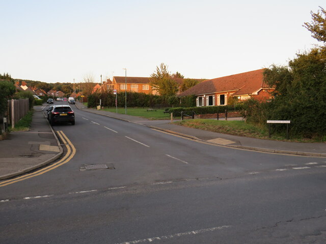
Ladywood Road, Darenth, near Dartford, at sunset Ladywood Road in the village of Darenth, in north Kent.  This image was taken at sunset on an October day.
Ladywood Road, Darenth, near Dartford, at sunset
Ladywood Road in the village of Darenth, in north Kent. This image was taken at sunset on an October day.
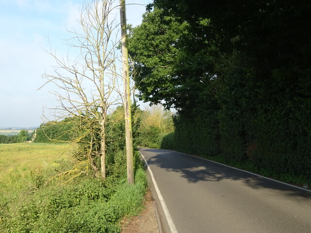
Crop field off the B262
B262 towards Green Street Green
Show me another place!

Ryecrofts Wood is located at Grid Ref: TQ5869 (Lat: 51.405083, Lng: 0.27599443)

Administrative County: Kent

District: Sevenoaks

Police Authority: Kent

What 3 Words

///marked.myself.tasty. Near Longfield, Kent

Nearby Locations

Ryecrofts Wood

Related Wikis

North West Kent

North West Kent is a geographical area in Kent, a county in south-east England. The term North West Kent may refer to one or both of two distinct areas...

Longfield Chalk Bank

Longfield Chalk Bank is a 2-hectare (4.9-acre) nature reserve in Longfield in Kent. It is managed by the Kent Wildlife Trust.This chalk grassland site...

Longfield Halt railway station

Longfield Halt (also known as Longfield Halt for Pinden and Westwood) was a railway station on the Gravesend West Line which served the settlement of Grubb...

Westwood, Southfleet

Westwood is a hamlet in the parish of Southfleet in Kent, England, in the west of the parish. It is one mile west of the village of Southfleet. In the...

Horton Kirby Boys Home railway station

Horton Kirby Boys Home also known as Home for Little Boys was a private railway station opened in 1870 by the London, Chatham and Dover Railway to serve...

DA postcode area

The DA postcode area, also known as the Dartford postcode area, is a group of eighteen postcode districts in England, within eleven post towns. These cover...

Horton Kirby and South Darenth

Horton Kirby and South Darenth, formerly just Horton Kirby is a civil parish in the Sevenoaks district of Kent, England. The parish is located in the River...

Longfield railway station

Longfield railway station is on the Chatham Main Line in England, serving the villages of Longfield, Hartley, and New Ash Green. It is 23 miles 30 chains...

Nearby Amenities

Located within 500m of 51.405083,0.27599443
Power: tower
Lat/Long: 51.4015285/0.2789183
Bus Stop
Gill's Road
Bus: yes
Local Ref: opp
Naptan AtcoCode: 2400A019150A
Naptan Bearing: S
Naptan BusStopType: MKD
Naptan CommonName: Gill's Road
Naptan Indicator: opp
Naptan Landmark: Gill's Road
Naptan NaptanCode: kntatpmw
Naptan RevisionNumber: 3
Naptan Status: act
Naptan Street: Green Street Green Road
Naptan Verified: no
Public Transport: platform
Ref: kntatpmw
Source: naptan_import
Source Date: 2018-06-27
Lat/Long: 51.4071866/0.2821383
Grubb Street
Place: locality
Source: NLS - OS 1:25k 1st Series 1937-61
Lat/Long: 51.4062513/0.28073
Barrier: kissing_gate
Material: metal
Lat/Long: 51.4069495/0.2821629
Gill's Road
Bus: yes
Public Transport: stop_position
Lat/Long: 51.4071961/0.2821154
Barrier: bollard
Colour: black;white
Height: 1.1
Material: plastic
Reflector: yes
Lat/Long: 51.4070081/0.2820041
Barrier: entrance
Width: 0.4
Lat/Long: 51.4064743/0.2755567
The data included in this document is from www.openstreetmap.org. The data is made available under ODbL.

Have you been to Ryecrofts Wood?

Leave your review of Ryecrofts Wood below (or comments, questions and feedback).