Crowney Wood

Wood, Forest in Essex Uttlesford

England

Crowney Wood

'White Hart' public house, Rowney Corner, Essex Rowney Corner is on the B184 near Wimbish.
'White Hart' public house, Rowney Corner, Essex Credit: Robert Edwards

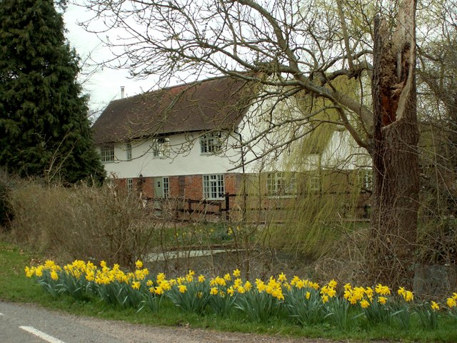
Crowney Wood is a picturesque woodland located in the county of Essex, England. Covering an area of approximately 60 acres, this forested area is a haven for nature lovers and outdoor enthusiasts alike. The wood is situated near the village of Crowney, which lends its name to the woodland.

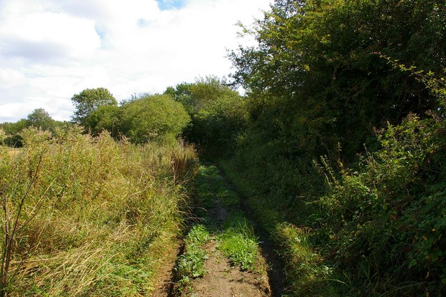
Crowney Wood boasts a diverse range of flora and fauna, making it an important ecological site. The woodland is predominantly made up of deciduous trees, such as oak, beech, and ash, which provide a stunning display of colors during the autumn months. The forest floor is covered in a lush carpet of ferns, bluebells, and wildflowers, creating a vibrant and enchanting atmosphere.

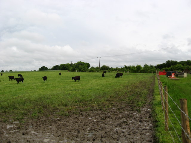
Home to a wide variety of bird species, Crowney Wood is a popular destination for birdwatching. Visitors may spot woodpeckers, owls, and various songbirds flitting among the trees. The wood is also home to a range of mammal species, including deer, foxes, and rabbits.

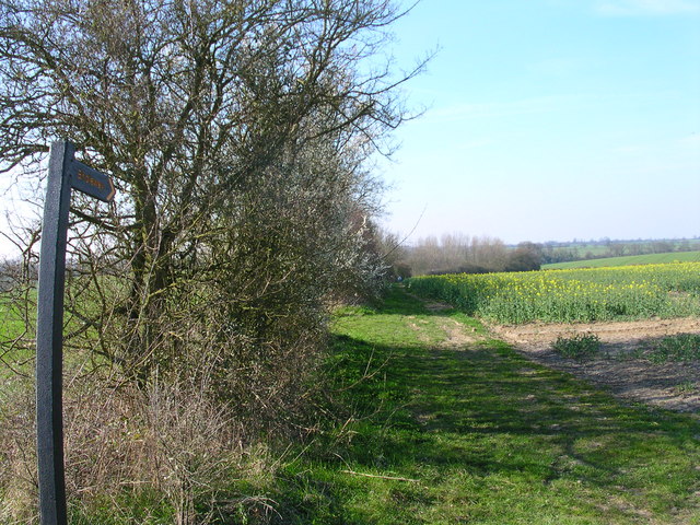
For those seeking outdoor activities, Crowney Wood offers several walking trails and picnic areas. The well-maintained paths wind through the forest, allowing visitors to immerse themselves in the tranquil surroundings. The wood is also intersected by a small stream, adding to its natural beauty.

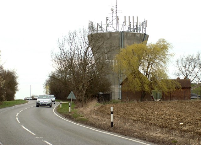
Crowney Wood is easily accessible, located just a short drive from nearby towns and villages. It provides a peaceful retreat from the bustle of everyday life, offering visitors the opportunity to connect with nature and appreciate the beauty of the Essex countryside.

If you have any feedback on the listing, please let us know in the comments section below.

Crowney Wood Images

Images are sourced within 2km of 52.000022/0.28465265 or Grid Reference TL5635. Thanks to Geograph Open Source API. All images are credited.

'White Hart' public house, Rowney Corner, Essex Rowney Corner is on the B184 near Wimbish.
'White Hart' public house, Rowney Corner, Essex
Rowney Corner is on the B184 near Wimbish.
Debden Bridle Path This bridle path runs to the south of the former Debden Aerodrome. Hedges and earth banks prevented any sight of the field but judging from the row at least part of the airfield is now used for (go)carting
Debden Bridle Path
This bridle path runs to the south of the former Debden Aerodrome. Hedges and earth banks prevented any sight of the field but judging from the row at least part of the airfield is now used for (go)carting
Carver Barracks nee RAF Debden This is Carver Barracks it occupies the site of the former RAF Debden. It became operational in April of 1937. It was a sector airfield of 12 Group during the Battle of Britain and was home to one of the "Eagle Squadrons" of American volunteer RAF pilots. The RAF vacated and USAAF took up residence in 1942. The base remained in RAF service until 1975. As can be guessed from the photo the 33rd Engineer Regiment now in residence are concerned with bomb disposal. To go to the next field in an alphabetical tour of Essex WW2 airfields click on <a href="https://www.geograph.org.uk/photo/149989">TL8427 : Earls Colne Airfield</a>. Much information was gleaned from Graham Smith’s book “Essex Airfields In The Second World War”.
<span class="nowrap"><a title="https://books.google.co.uk/books/about/Essex_Airfields_in_the_Second_World_War.html?id=u3atAAAACAAJ&redir_esc=y" rel="nofollow ugc noopener" href="https://books.google.co.uk/books/about/Essex_Airfields_in_the_Second_World_War.html?id=u3atAAAACAAJ&redir_esc=y">Link</a><img style="margin-left:2px;" alt="External link" title="External link - shift click to open in new window" src="https://s1.geograph.org.uk/img/external.png" width="10" height="10"/></span>
Carver Barracks nee RAF Debden
This is Carver Barracks it occupies the site of the former RAF Debden. It became operational in April of 1937. It was a sector airfield of 12 Group during the Battle of Britain and was home to one of the "Eagle Squadrons" of American volunteer RAF pilots. The RAF vacated and USAAF took up residence in 1942. The base remained in RAF service until 1975. As can be guessed from the photo the 33rd Engineer Regiment now in residence are concerned with bomb disposal. To go to the next field in an alphabetical tour of Essex WW2 airfields click on TL8427 : Earls Colne Airfield. Much information was gleaned from Graham Smith’s book “Essex Airfields In The Second World War”. LinkExternal link
Thunderley Parsonage Farmhouse, Cole End, Essex
Farmhouse at Burnt House Farm
Bears Hall This stands along Cole End Lane, just south of Sewards End.
Bears Hall
This stands along Cole End Lane, just south of Sewards End.
Water tower along the B.184 This is the view seen heading towards Saffron Walden.
Water tower along the B.184
This is the view seen heading towards Saffron Walden.
The spot but not interesting enough for a walk.
Pastoral scene at Cole End Farm Nice to see some grazing in this area; a relief from the seemingly endless fields of cereals and oilseed-rape.
Pastoral scene at Cole End Farm
Nice to see some grazing in this area; a relief from the seemingly endless fields of cereals and oilseed-rape.
Brooklands Garage Garage and filling station opposite Carver Barracks, Wimbish
Brooklands Garage
Garage and filling station opposite Carver Barracks, Wimbish
Straw bales and crossing cables near Frogsgreen Farm
White Hart at Rowney Corner on B184
Road to Wimbish Green from B184
Cottage just west of Rowney Corner
Brooklands Garage on B184
Byway to Smithfield Bottom
Farmland looking north from the byway
Mill Road at Rowney Corner Mill Road leading off the main Thaxted/Saffron Walden Road at Rowney Corner near Howlett End - in pouring rain
Mill Road at Rowney Corner
Mill Road leading off the main Thaxted/Saffron Walden Road at Rowney Corner near Howlett End - in pouring rain
Show me another place!

Crowney Wood is located at Grid Ref: TL5635 (Lat: 52.000022, Lng: 0.28465265)

Administrative County: Essex

District: Uttlesford

Police Authority: Essex

What 3 Words

///diplomats.reward.darkest. Near Saffron Walden, Essex

Related Wikis

RAF Debden

Royal Air Force Debden or more simply RAF Debden is a former Royal Air Force station located 3 miles (4.8 km) southeast of Saffron Walden and approximately...

Carver Barracks

Carver Barracks is a British Army base on the former site of RAF Debden, approximately 1 mile north of the village of Debden, in Essex. The nearest town...

Wimbish

Wimbish is a village and civil parish within Uttlesford, in Essex, England. The first recorded mention of the village was in 1042, when it was referred...

Sewards End

Sewards End is a village and civil parish in the Uttlesford district of Essex, England. Its area is 1211 acres. It is set in the rolling countryside...

Debden, Uttlesford

Debden is a small rural village in the Uttlesford district of Essex in the East of England. It is located 4 miles (6 km) from Saffron Walden and 17 miles...

Debden Windmill

Debden Windmill is a grade II listed Tower mill at Debden, Essex, England which has been converted to residential use. == History == Debden Windmill was...

Debden Hall, Uttlesford

There was another Debden Hall in Essex, in Epping ForestDebden Hall was a country house in the north-west of the county of Essex, in England. It was demolished...

Acrow Halt railway station

Acrow Halt was a railway station on the Saffron Walden Railway. Located at the north-eastern edge of Saffron Walden, Essex, the station was close to the...

Have you been to Crowney Wood?

Leave your review of Crowney Wood below (or comments, questions and feedback).