Birch Wood

Wood, Forest in Kent Tunbridge Wells

England

Birch Wood

A21 flyover The A21 is a 63 mile major trunk road running  from Lewisham in Greater London to Hastings, East Sussex. The road is broken up by the M25 motorway between junction 4 and 5.
Wikipedia <span class="nowrap"><a title="http://en.wikipedia.org/wiki/A21_road_(England)" rel="nofollow ugc noopener" href="http://en.wikipedia.org/wiki/A21_road_(England)">Link</a><img style="margin-left:2px;" alt="External link" title="External link - shift click to open in new window" src="https://s1.geograph.org.uk/img/external.png" width="10" height="10"/></span>
A21 flyover Credit: N Chadwick

Birch Wood, located in the county of Kent, England, is a picturesque and enchanting forest that spans over a vast area. It is renowned for its abundant birch trees, which dominate the landscape and give the wood its name. The wood is a popular destination for nature enthusiasts, hikers, and birdwatchers due to its diverse flora and fauna.

The woodland itself is characterized by its dense vegetation, with towering birch trees that create a serene and peaceful atmosphere. The trees, known for their distinctive white bark, provide a stunning contrast against the lush greenery of the forest floor. The wood is also home to a variety of other tree species, including oak, beech, and pine, adding to its rich and diverse ecosystem.

Birch Wood is not only visually appealing but also teeming with wildlife. The forest provides a habitat for numerous bird species, such as nightingales, woodpeckers, and warblers, making it a haven for birdwatchers. Additionally, the wood is home to several mammals, including deer, foxes, and squirrels, which can often be spotted amidst the trees and undergrowth.

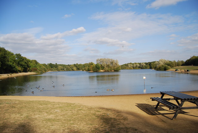
Visitors to Birch Wood can explore its many walking trails, which wind through the forest and offer breathtaking views of the surrounding countryside. The wood also features designated picnic areas, allowing visitors to relax and enjoy the tranquility of their surroundings.

If you have any feedback on the listing, please let us know in the comments section below.

Birch Wood Images

Images are sourced within 2km of 51.174974/0.2418517 or Grid Reference TQ5644. Thanks to Geograph Open Source API. All images are credited.

A21 flyover The A21 is a 63 mile major trunk road running  from Lewisham in Greater London to Hastings, East Sussex. The road is broken up by the M25 motorway between junction 4 and 5.
Wikipedia <span class="nowrap"><a title="http://en.wikipedia.org/wiki/A21_road_(England)" rel="nofollow ugc noopener" href="http://en.wikipedia.org/wiki/A21_road_(England)">Link</a><img style="margin-left:2px;" alt="External link" title="External link - shift click to open in new window" src="https://s1.geograph.org.uk/img/external.png" width="10" height="10"/></span>
A21 flyover
The A21 is a 63 mile major trunk road running from Lewisham in Greater London to Hastings, East Sussex. The road is broken up by the M25 motorway between junction 4 and 5. Wikipedia LinkExternal link
Embankment for the Leigh Flood Barrier  Built in 1981, the flood barrier was constructed near Leigh to protect Tonbridge, which had been severely affected by the flooding of 1968. During periods of high flow, the downstream flow is controlled by allowing up to 1 square mile (2.6 km2) of farmland upstream of the barrier to flood. This is an in-line storage scheme. An embankment has been built across the Medway valley to hold back the water.
Embankment for the Leigh Flood Barrier
Built in 1981, the flood barrier was constructed near Leigh to protect Tonbridge, which had been severely affected by the flooding of 1968. During periods of high flow, the downstream flow is controlled by allowing up to 1 square mile (2.6 km2) of farmland upstream of the barrier to flood. This is an in-line storage scheme. An embankment has been built across the Medway valley to hold back the water.
A21 flyover The A21 is a 63 mile major trunk road running  from Lewisham in Greater London to Hastings, East Sussex. The road is broken up by the M25 motorway between junction 4 and 5.
Wikipedia <span class="nowrap"><a title="http://en.wikipedia.org/wiki/A21_road_(England)" rel="nofollow ugc noopener" href="http://en.wikipedia.org/wiki/A21_road_(England)">Link</a><img style="margin-left:2px;" alt="External link" title="External link - shift click to open in new window" src="https://s1.geograph.org.uk/img/external.png" width="10" height="10"/></span>
A21 flyover
The A21 is a 63 mile major trunk road running from Lewisham in Greater London to Hastings, East Sussex. The road is broken up by the M25 motorway between junction 4 and 5. Wikipedia LinkExternal link
The Straight Mile Haysden Country Park is situated to the West of Tonbridge in Kent. The 64 hectare area of land comprising open grass land, woods and lakes, is rich in wildlife and is a site of Nature Conservation interest. The River Medway also runs through a stretch of it. There are paths for walking, riding and cycling.
The Straight Mile
Haysden Country Park is situated to the West of Tonbridge in Kent. The 64 hectare area of land comprising open grass land, woods and lakes, is rich in wildlife and is a site of Nature Conservation interest. The River Medway also runs through a stretch of it. There are paths for walking, riding and cycling.
Eden Valley Way Haysden Country Park is situated to the West of Tonbridge in Kent. The 64 hectare area of land comprising open grass land, woods and lakes, is rich in wildlife and is a site of Nature Conservation interest. The River Medway also runs through a stretch of it. There are paths for walking, riding and cycling.
Eden Valley Way
Haysden Country Park is situated to the West of Tonbridge in Kent. The 64 hectare area of land comprising open grass land, woods and lakes, is rich in wildlife and is a site of Nature Conservation interest. The River Medway also runs through a stretch of it. There are paths for walking, riding and cycling.
Straight Mile Bridge Haysden Country Park is situated to the West of Tonbridge in Kent. The 64 hectare area of land comprising open grass land, woods and lakes, is rich in wildlife and is a site of Nature Conservation interest. The River Medway also runs through a stretch of it. There are paths for walking, riding and cycling.
Straight Mile Bridge
Haysden Country Park is situated to the West of Tonbridge in Kent. The 64 hectare area of land comprising open grass land, woods and lakes, is rich in wildlife and is a site of Nature Conservation interest. The River Medway also runs through a stretch of it. There are paths for walking, riding and cycling.
Straight Mile  A history of this canal can be read at <span class="nowrap"><a title="http://www.tonbridgehistory.org.uk/events/penshurst-canal.htm" rel="nofollow ugc noopener" href="http://www.tonbridgehistory.org.uk/events/penshurst-canal.htm">Link</a><img style="margin-left:2px;" alt="External link" title="External link - shift click to open in new window" src="https://s1.geograph.org.uk/img/external.png" width="10" height="10"/></span> 
The only parts that can still be found are in Haysden Country Park (The Straight Mile and Stone Lock).
Straight Mile
A history of this canal can be read at LinkExternal link The only parts that can still be found are in Haysden Country Park (The Straight Mile and Stone Lock).
Rainbow Bridge Haysden Country Park is situated to the West of Tonbridge in Kent. The 64 hectare area of land comprising open grass land, woods and lakes, is rich in wildlife and is a site of Nature Conservation interest. The River Medway also runs through a stretch of it. There are paths for walking, riding and cycling.
Rainbow Bridge
Haysden Country Park is situated to the West of Tonbridge in Kent. The 64 hectare area of land comprising open grass land, woods and lakes, is rich in wildlife and is a site of Nature Conservation interest. The River Medway also runs through a stretch of it. There are paths for walking, riding and cycling.
Heusenstamm Wood Heusenstamm is a town in the state of Hesse, Germany. It is the twin town of Tonbridge. This woodland was donated by the town to Tonbridge to replace trees blown over in the great storm of 1987.
Heusenstamm Wood
Heusenstamm is a town in the state of Hesse, Germany. It is the twin town of Tonbridge. This woodland was donated by the town to Tonbridge to replace trees blown over in the great storm of 1987.
Friendship Bridge Haysden Country Park is situated to the West of Tonbridge in Kent. The 64 hectare area of land comprising open grass land, woods and lakes, is rich in wildlife and is a site of Nature Conservation interest. The River Medway also runs through a stretch of it. There are paths for walking, riding and cycling.
Friendship Bridge
Haysden Country Park is situated to the West of Tonbridge in Kent. The 64 hectare area of land comprising open grass land, woods and lakes, is rich in wildlife and is a site of Nature Conservation interest. The River Medway also runs through a stretch of it. There are paths for walking, riding and cycling.
River Medway The River Medway is 70 miles long and flows almost  entirely within Kent. It rises in Ashdown Forest and joins the Thames near Chatham. Apart from the Thames it has the largest catchment area in southern England. The river is navigable as far as Tonbridge by large craft and as far as Penshurst by small craft. There are 11 locks on the river, between Allington and Tonbridge. The river is tidal to Allington Lock. The River divides Kent in two, those born west of the river are known as Kentish Men, whilst those born east of the river are Men of Kent. The river was used as a line of defence against possible invasion during WWII.
River Medway
The River Medway is 70 miles long and flows almost entirely within Kent. It rises in Ashdown Forest and joins the Thames near Chatham. Apart from the Thames it has the largest catchment area in southern England. The river is navigable as far as Tonbridge by large craft and as far as Penshurst by small craft. There are 11 locks on the river, between Allington and Tonbridge. The river is tidal to Allington Lock. The River divides Kent in two, those born west of the river are known as Kentish Men, whilst those born east of the river are Men of Kent. The river was used as a line of defence against possible invasion during WWII.
Footpath in Haysden Country Park
Stone Lock Bridge Haysden Country Park is situated to the West of Tonbridge in Kent. The 64 hectare area of land comprising open grass land, woods and lakes, is rich in wildlife and is a site of Nature Conservation interest. The River Medway also runs through a stretch of it. There are paths for walking, riding and cycling.
Stone Lock Bridge
Haysden Country Park is situated to the West of Tonbridge in Kent. The 64 hectare area of land comprising open grass land, woods and lakes, is rich in wildlife and is a site of Nature Conservation interest. The River Medway also runs through a stretch of it. There are paths for walking, riding and cycling.
Stone Lock Haysden Country Park is situated to the West of Tonbridge in Kent. The 64 hectare area of land comprising open grass land, woods and lakes, is rich in wildlife and is a site of Nature Conservation interest. The River Medway also runs through a stretch of it. There are paths for walking, riding and cycling.
Stone Lock
Haysden Country Park is situated to the West of Tonbridge in Kent. The 64 hectare area of land comprising open grass land, woods and lakes, is rich in wildlife and is a site of Nature Conservation interest. The River Medway also runs through a stretch of it. There are paths for walking, riding and cycling.
Low bridge
Low bridge
Show me another place!

Birch Wood is located at Grid Ref: TQ5644 (Lat: 51.174974, Lng: 0.2418517)

Administrative County: Kent

District: Tunbridge Wells

Police Authority: Kent

What 3 Words

///risk.float.clock. Near Tonbridge, Kent

Nearby Locations

New Plantation Birch Wood

Related Wikis

Bidborough

Bidborough is a village and civil parish in the borough of Tunbridge Wells in Kent, England, north of Royal Tunbridge Wells and south of Tonbridge. According...

Bidborough Windmill

Bidborough Mill is a Grade II listed, house converted tower mill west of Bidborough, Kent, England. It is now incorporated into a housing development called...

Haysden Country Park

Haysden Country Park is a 64-hectare (160-acre) country park and Local Nature Reserve on the outskirts of Tonbridge in Kent. It is owned by Tonbridge...

Lullingstone Country Park

Lullingstone Country Park is near Eynsford, in Kent, England. A former deer park of a large estate, it was later sold to become an open-space and woodland...

Leigh Academy Tonbridge

Leigh Academy Tonbridge, formerly Hayesbrook School, is a non-selective secondary school with academy status in Tonbridge, Kent, United Kingdom. It has...

West Kent College (2014)

North Kent College is a further education and higher education college in Kent, England founded in 2014. Its campus in Tonbridge offers numerous courses...

Tonbridge Half Marathon

The Tonbridge Half Marathon is an English annual road running event that was introduced on 25 September 2011. Organised by the Tonbridge Lions Club and...

K College

K College, also known as South & West Kent College, was an English college of Further Education and Higher Education with facilities across Kent, formed...

Nearby Amenities

Located within 500m of 51.174974,0.2418517
ASHOUR1
Disused: yes
Man Made: petroleum_well
Ref GB Decc: LS/22-2
Source: DECC
Lat/Long: 51.1768611/0.2374167
Power: tower
Lat/Long: 51.1736385/0.2428388
Power: tower
Lat/Long: 51.1739601/0.2387895
Power: tower
Lat/Long: 51.1733398/0.2465124
The data included in this document is from www.openstreetmap.org. The data is made available under ODbL.

Have you been to Birch Wood?

Leave your review of Birch Wood below (or comments, questions and feedback).