The Grove

Wood, Forest in Essex

England

The Grove

Houses on Shevon Way, Brentwood
Houses on Shevon Way, Brentwood Credit: JThomas

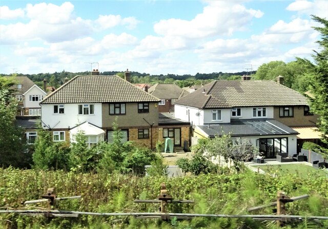
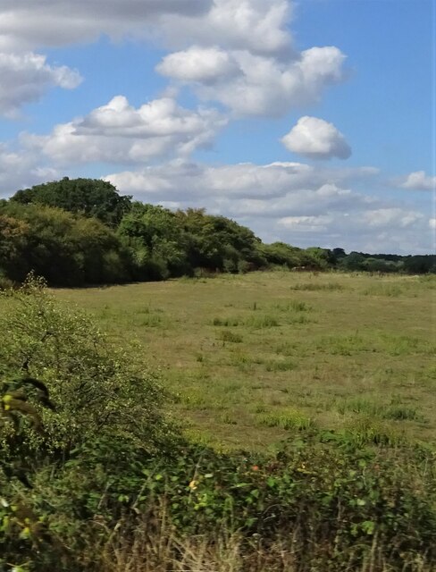
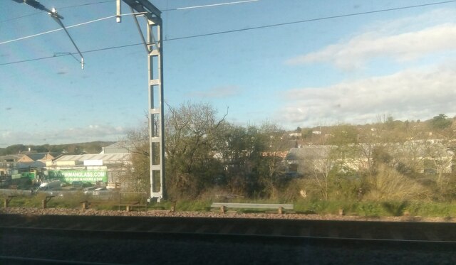
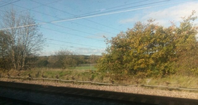
The Grove, Essex is a stunning wooded area located in the county of Essex, England. Spanning over a vast expanse of land, this forest is a natural treasure that attracts nature enthusiasts, hikers, and outdoor lovers from all around.

Covering an area of approximately 500 acres, The Grove is home to a diverse range of flora and fauna. Towering oak trees, beech trees, and silver birches dominate the landscape, creating a picturesque and serene atmosphere. The forest floor is adorned with a carpet of bluebells and wildflowers during the spring season, adding bursts of color to the already breathtaking scenery.

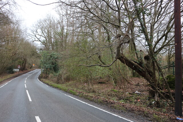
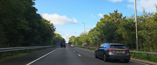
The Grove boasts an extensive network of walking trails that wind through the woodland, allowing visitors to explore the area at their leisure. These well-maintained paths cater to all levels of fitness, from easy strolls to more challenging hikes. Along the way, visitors may come across enchanting streams, hidden glades, and peaceful ponds, providing opportunities for relaxation and contemplation.

Aside from its natural beauty, The Grove also plays host to a variety of wildlife. Birdwatchers will delight in the chance to spot rare species such as woodpeckers, owls, and buzzards, while squirrels and deer can be seen darting through the undergrowth. The forest is also known for its rich biodiversity, with a number of protected species making it their habitat.

Whether one seeks a tranquil escape or an adventurous exploration, The Grove, Essex offers an unforgettable experience for all who venture into its leafy embrace.

If you have any feedback on the listing, please let us know in the comments section below.
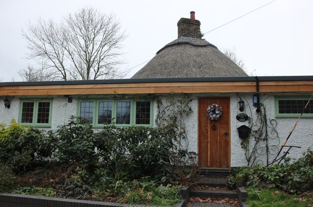
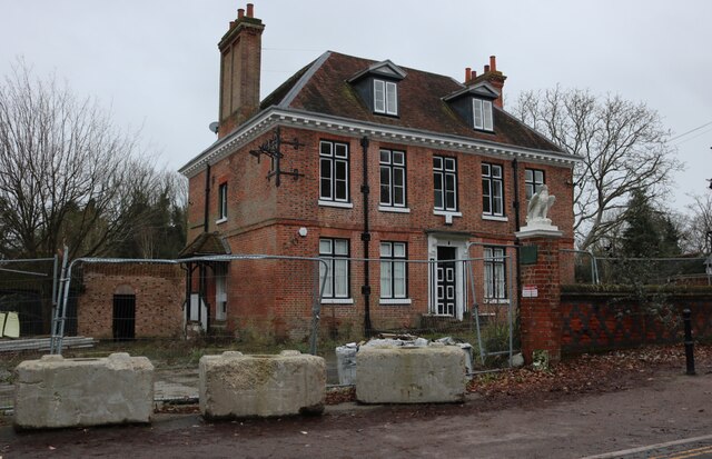
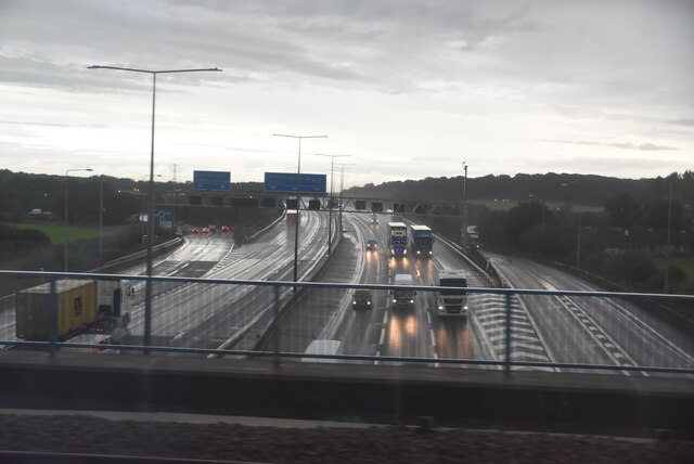
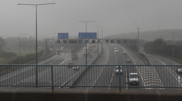
The Grove Images

Images are sourced within 2km of 51.608256/0.25821072 or Grid Reference TQ5692. Thanks to Geograph Open Source API. All images are credited.

Houses on Shevon Way, Brentwood
Grazing near Brook Street
Elms Industrial Estate, Harold Park
Traffic jam
Traffic jam
The Old Brickworks building, Bates Industrial Estate, Harold Wood, from the railway
Industrial premises on Bates Road, Harold Wood, from the railway Beyond the industrial estate, the residential areas of Harold Wood climb away from the camera.
Industrial premises on Bates Road, Harold Wood, from the railway
Beyond the industrial estate, the residential areas of Harold Wood climb away from the camera.
Looking north off the railway line, between Harold Wood and the M25 Taken where the railway passes underneath the pylon line.
Looking north off the railway line, between Harold Wood and the M25
Taken where the railway passes underneath the pylon line.
Houses in South Weald On the corner of Weald Road and Wigley Bush Lane
Houses in South Weald
On the corner of Weald Road and Wigley Bush Lane
Weald Road entering South Weald
Thatched bungalow on Weald Road, South Weald
Derelict pub in South Weald This was the Tower Arms, and has been empty since soon after 2012.
Derelict pub in South Weald
This was the Tower Arms, and has been empty since soon after 2012.
M25 approaching J28 The M25 is a 117 mile orbital motorway that encircles London. It was constructed between 1975 and 1986.
The motorway is not a continuous loop as a section to the East of London at The Dartford Crossing is an A-Road.
Wikipedia; <span class="nowrap"><a title="http://en.wikipedia.org/wiki/M25_motorway" rel="nofollow ugc noopener" href="http://en.wikipedia.org/wiki/M25_motorway">Link</a><img style="margin-left:2px;" alt="External link" title="External link - shift click to open in new window" src="https://s1.geograph.org.uk/img/external.png" width="10" height="10"/></span>
M25 approaching J28
The M25 is a 117 mile orbital motorway that encircles London. It was constructed between 1975 and 1986. The motorway is not a continuous loop as a section to the East of London at The Dartford Crossing is an A-Road. Wikipedia; LinkExternal link
Farmland at Great Warley
Misty M25 The M25 is a 117 mile orbital motorway that encircles London. It was constructed between 1975 and 1986.
The motorway is not a continuous loop as a section to the East of London at The Dartford Crossing is an A-Road.
Wikipedia; <span class="nowrap"><a title="http://en.wikipedia.org/wiki/M25_motorway" rel="nofollow ugc noopener" href="http://en.wikipedia.org/wiki/M25_motorway">Link</a><img style="margin-left:2px;" alt="External link" title="External link - shift click to open in new window" src="https://s1.geograph.org.uk/img/external.png" width="10" height="10"/></span>
Misty M25
The M25 is a 117 mile orbital motorway that encircles London. It was constructed between 1975 and 1986. The motorway is not a continuous loop as a section to the East of London at The Dartford Crossing is an A-Road. Wikipedia; LinkExternal link
A12 Brentwood bypass westbound, approaching M25 The A12 is a 129 mile long trunk road from London to Great Yarmouth. It runs through Greater London, Essex, Suffolk and Norfolk. It passes by Brentwood, Colchester and Ipswich as well as passing through Lowestoft.
<span class="nowrap"><a title="http://www.sabre-roads.org.uk/wiki/index.php?title=A12" rel="nofollow ugc noopener" href="http://www.sabre-roads.org.uk/wiki/index.php?title=A12">Link</a><img style="margin-left:2px;" alt="External link" title="External link - shift click to open in new window" src="https://s1.geograph.org.uk/img/external.png" width="10" height="10"/></span> 
Wikipedia: <span class="nowrap"><a title="http://en.wikipedia.org/wiki/A12_road_(England)" rel="nofollow ugc noopener" href="http://en.wikipedia.org/wiki/A12_road_(England)">Link</a><img style="margin-left:2px;" alt="External link" title="External link - shift click to open in new window" src="https://s1.geograph.org.uk/img/external.png" width="10" height="10"/></span>
A12 Brentwood bypass westbound, approaching M25
The A12 is a 129 mile long trunk road from London to Great Yarmouth. It runs through Greater London, Essex, Suffolk and Norfolk. It passes by Brentwood, Colchester and Ipswich as well as passing through Lowestoft. LinkExternal link Wikipedia: LinkExternal link
The M25 looking north at junction 28
Field near the M25 junction 28
Show me another place!

The Grove is located at Grid Ref: TQ5692 (Lat: 51.608256, Lng: 0.25821072)

Unitary Authority: Havering

Police Authority: Metropolitan

What 3 Words

///themes.likely.goals. Near Harold Wood, London

Nearby Locations

Alder Wood The Grove

Related Wikis

King's Wood School

King's Wood School was a secondary school in Harold Hill near Romford, London Borough of Havering, England. It was a mixed school of non-denominational...

Drapers' Academy

Drapers' Academy is a secondary school for girls and boys, from years 7 to 13 sixth form with academy status, located in Harold Hill near Romford, Greater...
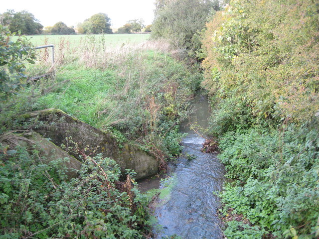
Weald Brook

Weald Brook is a water course in the parliamentary constituency of Hornchurch and Upminster. Weald Brook flows into the River Ingrebourne. Weald Brook...

Harold Park

Harold Park is a place in the London Borough of Havering. == History == Harold Park is north-eastern part of Harold Wood, occupying an isthmus of land...

Dagnam Park

Dagnam Park is a public park located in Harold Hill in the London Borough of Havering. It is a remnant of the grounds of Dagnams Park, the house of the...

Harold Hill

Harold Hill is a suburban area in the London Borough of Havering, East London. 16.6 miles (26.7 km) northeast of Charing Cross. It is a district centre...

Tylers Common

Tylers Common, also known as Upminster Common, is common land in the London Borough of Havering. It is one of the largest areas of common land in Greater...

South Weald

South Weald is a mainly farmland and park settlement and former civil parish, on the western edge of Brentwood, in the Brentwood district, in Essex, England...

Related Videos

OLD MAC-DONALDS FARM - ESSEX, ENGLAND | FAMILY TRAVEL VIDEO | 4K HD VIDEO - JUNE 2023

HISTORY OF OLD MAC DONALDS FARM: Farm is a part of a large farmland area that has been used for many centuries with a ...

Travel across the sea bridge... SUBSCRIBE

king_games #lana_del_rey #sourav_joshi #souravjoshivlogs #frostbite #ujjwal #king_games #sokher_gamer #goosiest ...

Nearby Amenities

Located within 500m of 51.608256,0.25821072
Traffic Signals
Traffic Signals: traffic_lights
Traffic Signals Direction: forward
Lat/Long: 51.6093149/0.2618748
Traffic Signals
Traffic Signals: traffic_lights
Traffic Signals Direction: forward
Lat/Long: 51.6075826/0.2632654
Traffic Signals
Traffic Signals: traffic_lights
Traffic Signals Direction: forward
Lat/Long: 51.608933/0.2636021
Crossing
Crossing: unmarked
Crossing Markings: no
Lat/Long: 51.6076379/0.2617565
Power: tower
Lat/Long: 51.605618/0.2590477
Power: tower
Lat/Long: 51.6113415/0.2564299
Power: tower
Lat/Long: 51.60827/0.2579105
Traffic Signals
Traffic Signals: traffic_lights
Traffic Signals Direction: forward
Lat/Long: 51.6073819/0.2632203
Crossing
Kerb: lowered
Tactile Paving: yes
Lat/Long: 51.6078357/0.2641902
Traffic Signals
Traffic Signals: traffic_lights
Traffic Signals Direction: forward
Lat/Long: 51.6083573/0.2612078
Traffic Signals
Maxspeed: 70 mph
Maxspeed Type: GB:nsl_dual
Traffic Sign: maxspeed
Traffic Signals: traffic_lights
Traffic Signals Direction: forward
Lat/Long: 51.6094547/0.2619301
Traffic Signals
Traffic Signals: traffic_lights
Traffic Signals Direction: forward
Lat/Long: 51.6083835/0.2614692
Traffic Signals
Traffic Signals: traffic_lights
Traffic Signals Direction: forward
Lat/Long: 51.6089659/0.2638509
Street Lamp
Lamp Model: Schréder Sapphire 2
Lamp Type: high_pressure_sodium
Light Count: 1
Source: Local knowledge.
Lat/Long: 51.6063574/0.2645841
Motorway Junction
Brook Street
Ref: 11
Lat/Long: 51.6062024/0.2561764
Oak Farm
Place: farm
Lat/Long: 51.6052524/0.2577084
Putwell Bridge Farm
Old Name: Putwell Farm
Place: farm
Lat/Long: 51.6068909/0.2605837
Maxspeed: 70 mph
Maxspeed Type: GB:nsl_dual
Traffic Sign: maxspeed
Lat/Long: 51.6055261/0.2540842
Street Lamp
Lamp Model: Philips MA50
Lamp Type: SOX
Source: Personal memory
Lat/Long: 51.6090715/0.2608464
Street Lamp
Lamp Model: Philips MA50
Lamp Type: SOX
Source: Personal memory
Lat/Long: 51.6089593/0.2611853
Street Lamp
Lamp Model: Philips MA50
Lamp Type: SOX
Source: Personal memory
Lat/Long: 51.6094387/0.2604668
Street Lamp
Lamp Model: Philips MA50
Lamp Type: SOX
Source: Personal memory
Lat/Long: 51.6092222/0.2606837
Street Lamp
Lamp Model: OrangeTek AriaLED 160
Lamp Type: LED
Light Count: 1
Source: Personal memory
Lat/Long: 51.6078528/0.2602353
Street Lamp
Lamp Model: OrangeTek AriaLED 160
Lamp Type: LED
Light Count: 1
Source: Personal memory
Lat/Long: 51.6074187/0.2592461
Street Lamp
Lamp Model: OrangeTek AriaLED 160
Lamp Type: LED
Light Count: 1
Source: Personal memory
Lat/Long: 51.6068504/0.2577246
Street Lamp
Lamp Model: OrangeTek AriaLED 160
Lamp Type: LED
Light Count: 1
Source: Personal memory
Lat/Long: 51.6063184/0.2562605
Street Lamp
Lamp Model: OrangeTek AriaLED 160
Lamp Type: LED
Light Count: 1
Source: Personal memory
Lat/Long: 51.6059445/0.2551162
Street Lamp
Lamp Model: OrangeTek AriaLED 160
Lamp Type: LED
Light Count: 1
Source: Personal memory
Lat/Long: 51.6053445/0.2532973
Street Lamp
Lamp Model: OrangeTek AriaLED 160
Lamp Type: LED
Light Count: 1
Source: Personal memory
Lat/Long: 51.6053054/0.254115
Street Lamp
Lamp Model: OrangeTek AriaLED 160
Lamp Type: LED
Light Count: 1
Source: Personal memory
Lat/Long: 51.6060486/0.2564326
Street Lamp
Lamp Model: Schréder Sapphire 2
Lamp Type: high_pressure_sodium
Light Count: 2
Source: Local knowledge.
Lat/Long: 51.6068214/0.2645947
Street Lamp
Lamp Model: Schréder Sapphire 2
Lamp Type: high_pressure_sodium
Light Count: 2
Source: Local knowledge.
Lat/Long: 51.6072533/0.2641222
Street Lamp
Lamp Model: Schréder Sapphire 2
Lamp Type: high_pressure_sodium
Layer: 2
Light Count: 2
Source: Local knowledge.
Lat/Long: 51.6076786/0.2636555
Phone
Emergency: phone
Source: Mapillary (2019-04-08)
Lat/Long: 51.6100568/0.260188
Phone
Emergency: phone
Source: Mapillary (2019-04-08)
Lat/Long: 51.6102423/0.2605869
Milestone
Distance: 172.3
Ref: A
Source: Mapillary (2019-04-08)
Lat/Long: 51.6095245/0.2613714
Milestone
Distance: 172.3
Ref: B
Source: Mapillary (2019-04-08)
Lat/Long: 51.6094394/0.2612042
Street Lamp
Lamp Model: OrangeTek AriaLED 160
Lamp Type: LED
Light Count: 1
Source: Personal memory
Lat/Long: 51.6051056/0.2535226
Street Lamp
Lamp Model: OrangeTek AriaLED 160
Lamp Type: LED
Light Count: 1
Source: Personal memory
Lat/Long: 51.6054994/0.2546903
Street Lamp
Lamp Model: OrangeTek AriaLED 160
Lamp Type: LED
Light Count: 1
Source: Personal memory
Lat/Long: 51.6073894/0.260999
Street Lamp
Lamp Model: OrangeTek AriaLED 160
Lamp Type: LED
Light Count: 1
Source: Personal memory
Lat/Long: 51.6070502/0.2598417
Street Lamp
Lamp Model: OrangeTek AriaLED 160
Lamp Type: LED
Light Count: 1
Source: Personal memory
Lat/Long: 51.6071491/0.2602273
Street Lamp
Lamp Model: OrangeTek AriaLED 160
Lamp Type: LED
Light Count: 1
Source: Personal memory
Lat/Long: 51.6069627/0.2594501
Street Lamp
Lamp Model: OrangeTek AriaLED 160
Lamp Type: LED
Light Count: 1
Source: Personal memory
Lat/Long: 51.6072518/0.2606067
Street Lamp
Lamp Model: OrangeTek AriaLED 160
Lamp Type: LED
Light Count: 1
Source: Personal memory
Lat/Long: 51.6068567/0.2590496
Street Lamp
Lamp Model: OrangeTek AriaLED 160
Lamp Type: LED
Light Count: 1
Source: Personal memory
Lat/Long: 51.6067607/0.2587122
Street Lamp
Lamp Model: OrangeTek AriaLED 160
Lamp Type: LED
Light Count: 1
Source: Personal memory
Lat/Long: 51.6066395/0.2583239
Street Lamp
Lamp Model: OrangeTek AriaLED 160
Lamp Type: LED
Light Count: 1
Source: Personal memory
Lat/Long: 51.6063898/0.2575949
Street Lamp
Lamp Model: OrangeTek AriaLED 160
Lamp Type: LED
Light Count: 1
Source: Personal memory
Lat/Long: 51.6065013/0.257973
Street Lamp
Lamp Model: OrangeTek AriaLED 160
Lamp Type: LED
Light Count: 1
Source: Personal memory
Lat/Long: 51.6061634/0.2568247
Street Lamp
Lamp Model: OrangeTek AriaLED 160
Lamp Type: LED
Light Count: 1
Source: Personal memory
Lat/Long: 51.6062782/0.2572168
Street Lamp
Lamp Model: OrangeTek AriaLED 160
Lamp Type: LED
Light Count: 1
Source: Personal memory
Lat/Long: 51.6056935/0.2552913
Street Lamp
Lamp Model: OrangeTek AriaLED 160
Lamp Type: LED
Light Count: 1
Source: Personal memory
Lat/Long: 51.6058768/0.255864
Street Lamp
Lamp Model: OrangeTek AriaLED 160
Lamp Type: LED
Light Count: 2
Source: Personal memory
Lat/Long: 51.6066437/0.2577289
Street Lamp
Lamp Model: OrangeTek AriaLED 160
Lamp Type: LED
Light Count: 2
Source: Personal memory
Lat/Long: 51.6064792/0.2572222
Street Lamp
Lamp Model: OrangeTek AriaLED 160
Lamp Type: LED
Light Count: 2
Source: Personal memory
Lat/Long: 51.6068081/0.2582355
Street Lamp
Lamp Model: OrangeTek AriaLED 160
Lamp Type: LED
Light Count: 2
Source: Personal memory
Lat/Long: 51.6069574/0.2586941
Street Lamp
Lamp Model: OrangeTek AriaLED 160
Lamp Type: LED
Light Count: 2
Source: Personal memory
Lat/Long: 51.6071067/0.2591527
Street Lamp
Lamp Model: OrangeTek AriaLED 160
Lamp Type: LED
Light Count: 2
Source: Personal memory
Lat/Long: 51.6072689/0.2596432
Street Lamp
Lamp Model: OrangeTek AriaLED 160
Lamp Type: LED
Light Count: 2
Source: Personal memory
Lat/Long: 51.6074255/0.260102
Street Lamp
Lamp Model: OrangeTek AriaLED 160
Lamp Type: LED
Light Count: 2
Source: Personal memory
Lat/Long: 51.607602/0.2605626
Street Lamp
Lamp Model: OrangeTek AriaLED 160
Lamp Type: LED
Light Count: 2
Source: Personal memory
Lat/Long: 51.6077788/0.2609802
Street Lamp
Lamp Model: OrangeTek AriaLED 160
Lamp Type: LED
Light Count: 2
Source: Personal memory
Lat/Long: 51.6079818/0.2614073
Street Lamp
Lamp Model: OrangeTek AriaLED 160
Lamp Type: LED
Light Count: 2
Source: Personal memory
Lat/Long: 51.6082162/0.2618526
Street Lamp
Lamp Model: OrangeTek AriaLED 160
Lamp Type: LED
Light Count: 2
Source: Personal memory
Lat/Long: 51.6084403/0.262231
Street Lamp
Lamp Model: OrangeTek AriaLED 160
Lamp Type: LED
Light Count: 2
Source: Personal memory
Lat/Long: 51.6087276/0.2626565
Street Lamp
Lamp Model: OrangeTek AriaLED 160
Lamp Type: LED
Light Count: 2
Source: Personal memory
Lat/Long: 51.6089964/0.2630387
Street Lamp
Lamp Model: OrangeTek AriaLED 160
Lamp Type: LED
Light Count: 2
Source: Personal memory
Lat/Long: 51.6092788/0.2634131
Street Lamp
Lamp Model: OrangeTek AriaLED 160
Lamp Type: LED
Light Count: 1
Source: Personal memory
Lat/Long: 51.6057473/0.2545135
Street Lamp
Lamp Model: OrangeTek AriaLED 160
Lamp Type: LED
Light Count: 1
Source: Personal memory
Lat/Long: 51.6055544/0.2539272
Street Lamp
Lamp Model: OrangeTek AriaLED 160
Lamp Type: LED
Light Count: 1
Source: Personal memory
Lat/Long: 51.6061229/0.2556627
Street Lamp
Lamp Model: OrangeTek AriaLED 160
Lamp Type: LED
Light Count: 1
Source: Personal memory
Lat/Long: 51.6064482/0.2566324
Street Lamp
Lamp Model: OrangeTek AriaLED 160
Lamp Type: LED
Light Count: 1
Source: Personal memory
Lat/Long: 51.6067169/0.2573617
Street Lamp
Lamp Model: OrangeTek AriaLED 160
Lamp Type: LED
Light Count: 1
Source: Personal memory
Lat/Long: 51.6065834/0.2569987
Street Lamp
Lamp Model: OrangeTek AriaLED 160
Lamp Type: LED
Light Count: 1
Source: Personal memory
Lat/Long: 51.607108/0.258427
Street Lamp
Lamp Model: OrangeTek AriaLED 160
Lamp Type: LED
Light Count: 1
Source: Personal memory
Lat/Long: 51.6072611/0.2588384
Street Lamp
Lamp Model: OrangeTek AriaLED 160
Lamp Type: LED
Light Count: 1
Source: Personal memory
Lat/Long: 51.6070296/0.2582162
Street Lamp
Lamp Model: OrangeTek AriaLED 160
Lamp Type: LED
Light Count: 1
Source: Personal memory
Lat/Long: 51.6076978/0.2599009
Street Lamp
Lamp Model: OrangeTek AriaLED 160
Lamp Type: LED
Light Count: 1
Source: Personal memory
Lat/Long: 51.6075483/0.2595576
Street Lamp
Lamp Model: OrangeTek AriaLED 160
Lamp Type: LED
Light Count: 1
Source: Personal memory
Lat/Long: 51.6080264/0.260568
Communication Mobile Phone: yes
Man Made: mast
Tower Construction: lattice
Tower Type: communication
Lat/Long: 51.6070167/0.2604095
Atm
Cash In: no
Currency GBP: yes
Drive Through: no
Network: Link
Operator: CashZone
Lat/Long: 51.608892/0.2647924
Crossing
Crossing Markings: yes
Lat/Long: 51.6083722/0.2612212
Crossing
Crossing: traffic_signals
Tactile Paving: yes
Lat/Long: 51.6074063/0.2631761
The data included in this document is from www.openstreetmap.org. The data is made available under ODbL.

Have you been to The Grove?

Leave your review of The Grove below (or comments, questions and feedback).