Dicker Wood

Wood, Forest in Sussex Wealden

England

Dicker Wood

Upper reaches of River Cuckmere Upper reaches of River Cuckmere at Hellingly
Upper reaches of River Cuckmere Credit: Terry Jones

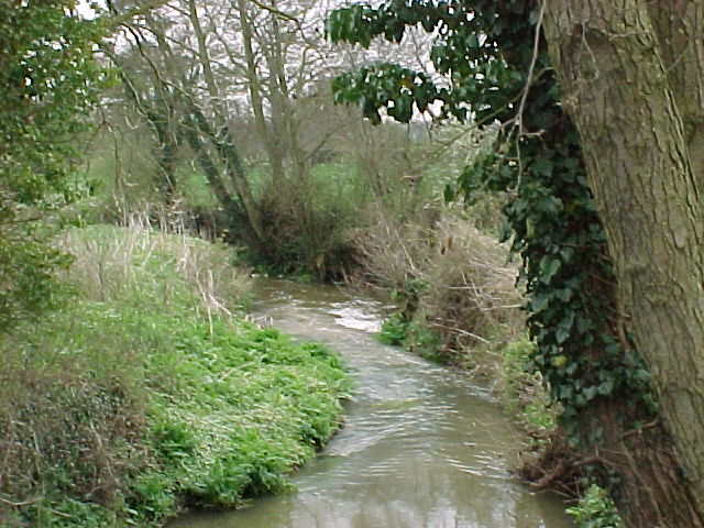
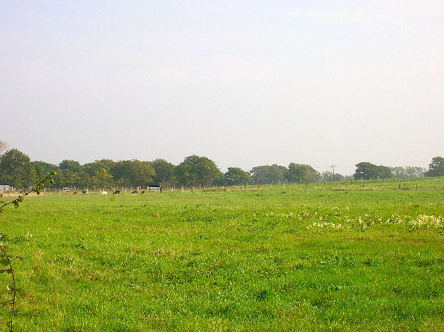
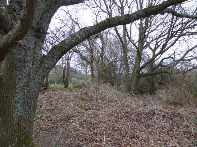
Dicker Wood is a picturesque woodland located in the county of Sussex, England. It is situated near the village of Hailsham, within the larger area known as the High Weald, a designated Area of Outstanding Natural Beauty. The wood covers an area of approximately 100 acres and is predominantly composed of broadleaf trees, including oak, beech, and ash.

Dicker Wood is known for its rich biodiversity, providing a habitat for a wide range of flora and fauna. The woodland floor is adorned with a vibrant carpet of bluebells during the spring months, creating a breathtaking spectacle for visitors. In addition to bluebells, the wood is also home to various species of wildflowers such as primroses, wood anemones, and violets.

The wood is crisscrossed with a network of footpaths, allowing visitors to explore its natural beauty at their own pace. These paths meander through the dense foliage, offering glimpses of wildlife such as deer, badgers, foxes, and numerous bird species. The peaceful ambiance of Dicker Wood makes it an ideal location for nature enthusiasts, walkers, and photographers alike.

Managed by a local conservation organization, Dicker Wood is actively maintained to preserve its ecological integrity. Sustainable forestry practices, including selective logging and planting of native tree species, are implemented to ensure the long-term health and sustainability of the woodland ecosystem.

Overall, Dicker Wood serves as a tranquil oasis in the heart of Sussex, offering a haven for both nature and outdoor enthusiasts to appreciate and enjoy the beauty of the natural world.

If you have any feedback on the listing, please let us know in the comments section below.

Dicker Wood Images

Images are sourced within 2km of 50.887618/0.21409167 or Grid Reference TQ5512. Thanks to Geograph Open Source API. All images are credited.

Upper reaches of River Cuckmere Upper reaches of River Cuckmere at Hellingly
Upper reaches of River Cuckmere
Upper reaches of River Cuckmere at Hellingly
Coldharbour Road, Lower Dicker Looking north towards the junction with the A22.
Coldharbour Road, Lower Dicker
Looking north towards the junction with the A22.
Farmland, Coldharbour Road Looking east north east from Coldharbour Road near The Nurseries at a field of llamas.
Farmland, Coldharbour Road
Looking east north east from Coldharbour Road near The Nurseries at a field of llamas.
Quinces, Camberlot Road, near Upper Dicker Looking south. The cottage is just north of Clover Farm.
Quinces, Camberlot Road, near Upper Dicker
Looking south. The cottage is just north of Clover Farm.
Camberlot Farm Looking west from Camberlot Road.
Camberlot Farm
Looking west from Camberlot Road.
Old lane near Chalvington Many lanes and roads in this area of Sussex lead south to the pastures on the South Downs. With the arrival of the car many lanes were made up but some did not, lost their importance and now are bridleways or footpaths. This route begins deep in the Weald then heads south but stops at the A22, becoming a track until it reaches Chalvington Stud Farm before becoming a made up road again. What initially looks like a lane from the period of enclosures actually dates back to the Roman times. This view looks south and is taken the crossroads of tracks just south of the A22. See <a href="https://www.geograph.org.uk/gridref/TQ5311">TQ5311</a> for where the west track ends.
Old lane near Chalvington
Many lanes and roads in this area of Sussex lead south to the pastures on the South Downs. With the arrival of the car many lanes were made up but some did not, lost their importance and now are bridleways or footpaths. This route begins deep in the Weald then heads south but stops at the A22, becoming a track until it reaches Chalvington Stud Farm before becoming a made up road again. What initially looks like a lane from the period of enclosures actually dates back to the Roman times. This view looks south and is taken the crossroads of tracks just south of the A22. See TQ5311 for where the west track ends.
Scrappers Hill Farm Viewed from fields north of Hamly Bridge
Scrappers Hill Farm
Viewed from fields north of Hamly Bridge
Eight Acre Wood Taken from Nash Street.
Eight Acre Wood
Taken from Nash Street.
Nash Street Wood Following the footpath that leads to Thunder Hill
Nash Street Wood
Following the footpath that leads to Thunder Hill
Barn, Nash Street Farm Taken from Nash Street.
Barn, Nash Street Farm
Taken from Nash Street.
Peacocks, Nash Street Farm My first peacock point too.
Peacocks, Nash Street Farm
My first peacock point too.
The Old Toll House, Muddles Green The lane in muddles Green is not a major artery so I am assuming this was for tolls to use the turnpike that is now the A22 a little to the south of this hamlet. At one point this was also a shoe shop.
The Old Toll House, Muddles Green
The lane in muddles Green is not a major artery so I am assuming this was for tolls to use the turnpike that is now the A22 a little to the south of this hamlet. At one point this was also a shoe shop.
Chiddingly County Primary School Located in the hamlet of Muddles Green which is within the parish of Chiddingly.
Chiddingly County Primary School
Located in the hamlet of Muddles Green which is within the parish of Chiddingly.
View to World's End The trees mark the course of a stream whilst Nut Knowles Farm at World's End can be seen beyond. Typical Wealden countryside of woods, streams and farmland.
View to World's End
The trees mark the course of a stream whilst Nut Knowles Farm at World's End can be seen beyond. Typical Wealden countryside of woods, streams and farmland.
Broken Footbridge Taking the footpath from World's End to Boggy Wood. Had the choice of a two mile detour or a possible early bath.
Broken Footbridge
Taking the footpath from World's End to Boggy Wood. Had the choice of a two mile detour or a possible early bath.
Hawthbush Farm The trees at the bottom of the field follow the course of a stream whilst Riverfield Shaw is to the right. The field is also suffering the after effects of the previous night's downpour.
Hawthbush Farm
The trees at the bottom of the field follow the course of a stream whilst Riverfield Shaw is to the right. The field is also suffering the after effects of the previous night's downpour.
Motocross Circuit, Boggy Wood The circuit runs around the central areas of Boggy Wood the footpath diverted to accommodate it. Needless to say the wood lives up to its name.
Motocross Circuit, Boggy Wood
The circuit runs around the central areas of Boggy Wood the footpath diverted to accommodate it. Needless to say the wood lives up to its name.
Farmland North of Boggy Wood The wood is to the right whilst Broad Farm is just visible on the horizon.
Farmland North of Boggy Wood
The wood is to the right whilst Broad Farm is just visible on the horizon.
Show me another place!

Dicker Wood is located at Grid Ref: TQ5512 (Lat: 50.887618, Lng: 0.21409167)

Administrative County: East Sussex

District: Wealden

Police Authority: Sussex

What 3 Words

///surround.revamped.wacky. Near Hailsham, East Sussex

Related Wikis

Lower Dicker

Lower Dicker is a 0.1-hectare (0.25-acre) geological Site of Special Scientific Interest west of Hailsham in East Sussex. It is a Geological Conservation...

Zoar Strict Baptist Chapel

Zoar Strict Baptist Chapel is a Strict Baptist place of worship in the hamlet of Lower Dicker in the English county of East Sussex. Founded in 1837 and...

Farleys House

Farleys House near Chiddingly, East Sussex, has been converted into a museum and archive featuring the lives and work of its former residents, the photographer...

Golden Cross, East Sussex

Golden Cross is a small village in the Wealden district of East Sussex, England. Its nearest town is Hailsham, which lies approximately 3+1⁄2 miles (6...

Burgh Hill Farm Meadow

Burgh Hill Farm Meadow is a 0.9-hectare (2.2-acre) biological Site of Special Scientific Interest west of Hailsham in East Sussex.This meadow is managed...

Horselunges Manor

Horselunges Manor is a 15th-century manor house in Hellingly, East Sussex, that was restored in the 20th century. The house was previously owned by Peter...

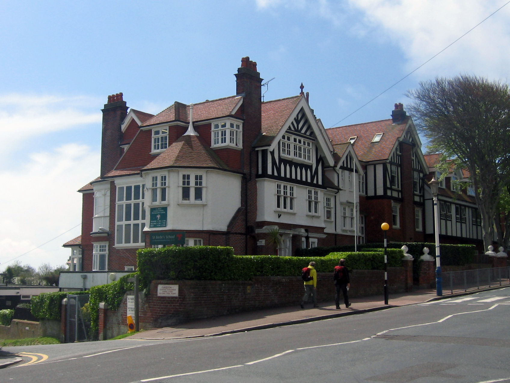
Bede's School, Eastbourne

Bede's School (until 2012, known as St Bede's School), consists of a preparatory school and pre-preparatory nursery in Holywell, Meads, Eastbourne, East...

Hellingly

Hellingly (pronounced 'Helling-lye') is a village, and can also refer to a civil parish, and to a district ward, in the Wealden District of East Sussex...

Nearby Amenities

Located within 500m of 50.887618,0.21409167
Power: pole
Lat/Long: 50.8836392/0.2147645
Power: portal
Lat/Long: 50.8856486/0.2081354
Power: pole
Lat/Long: 50.88557/0.2083929
The data included in this document is from www.openstreetmap.org. The data is made available under ODbL.

Have you been to Dicker Wood?

Leave your review of Dicker Wood below (or comments, questions and feedback).