Dewlands Wood

Wood, Forest in Sussex Wealden

England

Dewlands Wood

Gable Oast, Argos Hill Single round kiln oast house.
Gable Oast, Argos Hill Credit: N Chadwick

Dewlands Wood is a picturesque woodland located in the county of Sussex, England. Spread over an area of approximately 100 acres, it is a popular destination for nature enthusiasts and hikers alike. The wood is situated near the village of Dewlands, hence its name.

The forest is predominantly composed of native broadleaf trees, such as oak, beech, and chestnut, which create a diverse and vibrant ecosystem. The dense canopy of these towering trees provides a sheltered habitat for a wide variety of flora and fauna.

Walking through Dewlands Wood, visitors are treated to a mesmerizing display of natural beauty. The forest floor is covered with a thick carpet of moss, ferns, and wildflowers, creating a lush and vibrant environment. The gentle rustling of leaves and the chorus of birdsong add to the serene ambiance of the wood.

The wood is also home to a number of animal species. Squirrels dart through the branches, while a keen eye might spot the occasional deer or fox. Birdwatchers will delight in the sightings of woodpeckers, owls, and various songbirds that inhabit the area.

Several well-marked trails wind their way through the wood, offering visitors the opportunity to explore its enchanting landscape. These paths lead to scenic viewpoints, secluded glades, and small ponds, adding to the charm of the woodland experience.

Dewlands Wood is a cherished natural treasure in Sussex, providing a tranquil retreat for those seeking solace in nature's embrace.

If you have any feedback on the listing, please let us know in the comments section below.

Dewlands Wood Images

Images are sourced within 2km of 51.040246/0.21382888 or Grid Reference TQ5529. Thanks to Geograph Open Source API. All images are credited.

Gable Oast, Argos Hill Single round kiln oast house.
Gable Oast, Argos Hill
Single round kiln oast house.
Mayfield Rd (A267) and Bicycle Arms Rd (B2101) junction, Argos Hill The A267 road is a 21 mile long road from Tunbridge Wells <a href="https://www.geograph.org.uk/photo/6669020">TQ5838 : A26, A267 junction</a> to Horsebridge.
Website: <span class="nowrap"><a title="http://www.sabre-roads.org.uk/wiki/index.php?title=A267" rel="nofollow ugc noopener" href="http://www.sabre-roads.org.uk/wiki/index.php?title=A267">Link</a><img style="margin-left:2px;" alt="External link" title="External link - shift click to open in new window" src="https://s1.geograph.org.uk/img/external.png" width="10" height="10"/></span>
Mayfield Rd (A267) and Bicycle Arms Rd (B2101) junction, Argos Hill
The A267 road is a 21 mile long road from Tunbridge Wells TQ5838 : A26, A267 junction to Horsebridge. Website: LinkExternal link
Crowborough Railway Station, Sussex Train seen departing for Uckfield, from Crowborough Railway Station. This station was formerly known as Jarvis Brook, and is nearly a mile from the town itself.
Crowborough Railway Station, Sussex
Train seen departing for Uckfield, from Crowborough Railway Station. This station was formerly known as Jarvis Brook, and is nearly a mile from the town itself.
Welcome Stranger, Jarvis Brook, Sussex Public house, just outside Crowborough Railway Station.
Welcome Stranger, Jarvis Brook, Sussex
Public house, just outside Crowborough Railway Station.
Catts Inn, Rotherfield The inn, on the Square at the end of the High Street, bears a date of 1741.  The Union Flags were probably flying as it was the day after St George's Day.
Catts Inn, Rotherfield
The inn, on the Square at the end of the High Street, bears a date of 1741. The Union Flags were probably flying as it was the day after St George's Day.
Rotherfield Stores A general store on The Square in the centre of the village.
Rotherfield Stores
A general store on The Square in the centre of the village.
Mayfield Rd (A267) and Bicycle Arms  Junction
Mayfield Rd (A267) and Bicycle Arms Junction
Welcome Stranger, Jarvis Brook A Shepherd Neame pub at Farningham Road and Rotherfield Road junction.
Welcome Stranger, Jarvis Brook
A Shepherd Neame pub at Farningham Road and Rotherfield Road junction.
Welcome Stranger sign Sign for <a href="https://www.geograph.org.uk/photo/2426473">TQ5329 : Welcome Stranger, Jarvis Brook</a>, a Shepherd Neame pub at Farningham Road and Rotherfield Road junction.
Welcome Stranger sign
Sign for TQ5329 : Welcome Stranger, Jarvis Brook, a Shepherd Neame pub at Farningham Road and Rotherfield Road junction.
Railway Bridge over Crowborough Hill Stone and bridge arched bridge carrying the Oxted Line over the main road. Crowborough Station is just out of sight to the left of the bridge.
Railway Bridge over Crowborough Hill
Stone and bridge arched bridge carrying the Oxted Line over the main road. Crowborough Station is just out of sight to the left of the bridge.
Railway Bridge over Crowborough Hill Stone and bridge arched bridge carrying the Oxted Line over the B2100 main road towards Crowborough centre. Crowborough Station is just out of sight to the left of the bridge.
Railway Bridge over Crowborough Hill
Stone and bridge arched bridge carrying the Oxted Line over the B2100 main road towards Crowborough centre. Crowborough Station is just out of sight to the left of the bridge.
B2100 Crowborough Hill
St Michael & All Angels, Jarvis Brook
St Michael & All Angels, Jarvis Brook - Stained glass window St Nicholas
St Michael & All Angels, Jarvis Brook - Stained glass window
St Nicholas
St Michael & All Angels, Jarvis Brook - Stained glass window
St Michael & All Angels, Jarvis Brook - Chancel
Show me another place!

Dewlands Wood is located at Grid Ref: TQ5529 (Lat: 51.040246, Lng: 0.21382888)

Administrative County: East Sussex

District: Wealden

Police Authority: Sussex

What 3 Words

///dolphins.screeches.depend. Near Town Row, East Sussex

Related Wikis

Rotherfield

Rotherfield is a village and civil parish in the Wealden District of East Sussex, England. It is one of the largest parishes in East Sussex. There are...

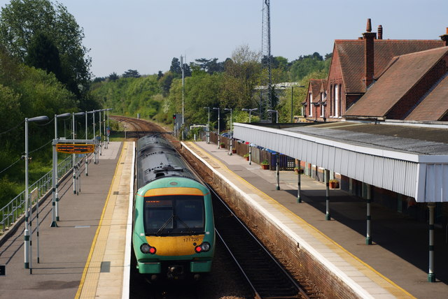
Rotherfield and Mark Cross railway station

Rotherfield and Mark Cross (also Rotherfield) is the name of a closed station on the Eridge - Heathfield - Polegate railway (the Cuckoo Line) in East Sussex...

Crowborough railway station

Crowborough railway station is on the Uckfield branch of the Oxted Line in England, serving the town of Crowborough, East Sussex. It is 39 miles 11 chains...

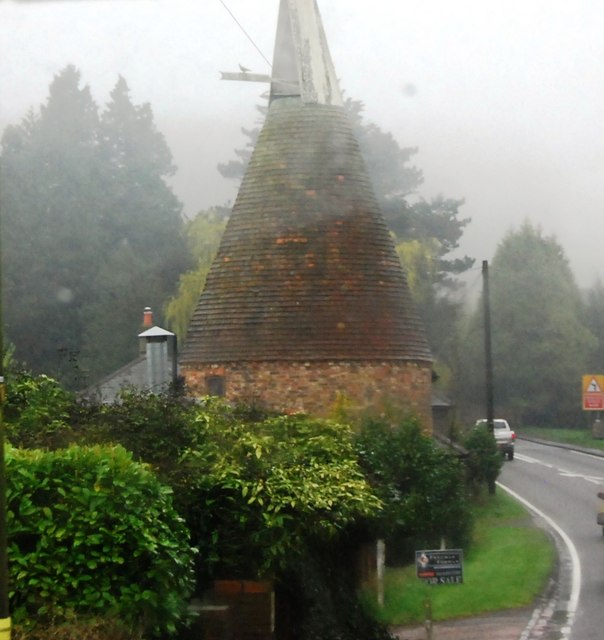
Argos Hill Mill, Mayfield

Argos Hill Mill is a grade II* listed post mill at Argos Hill, Mayfield, East Sussex, England As of 2017 it is in the process of restoration by the Argos...

Jarvis Brook

Jarvis Brook is a village between Crowborough and Rotherfield in the Borough of Wealden East Sussex. Crowborough Railway Station, on the Uckfield branch...

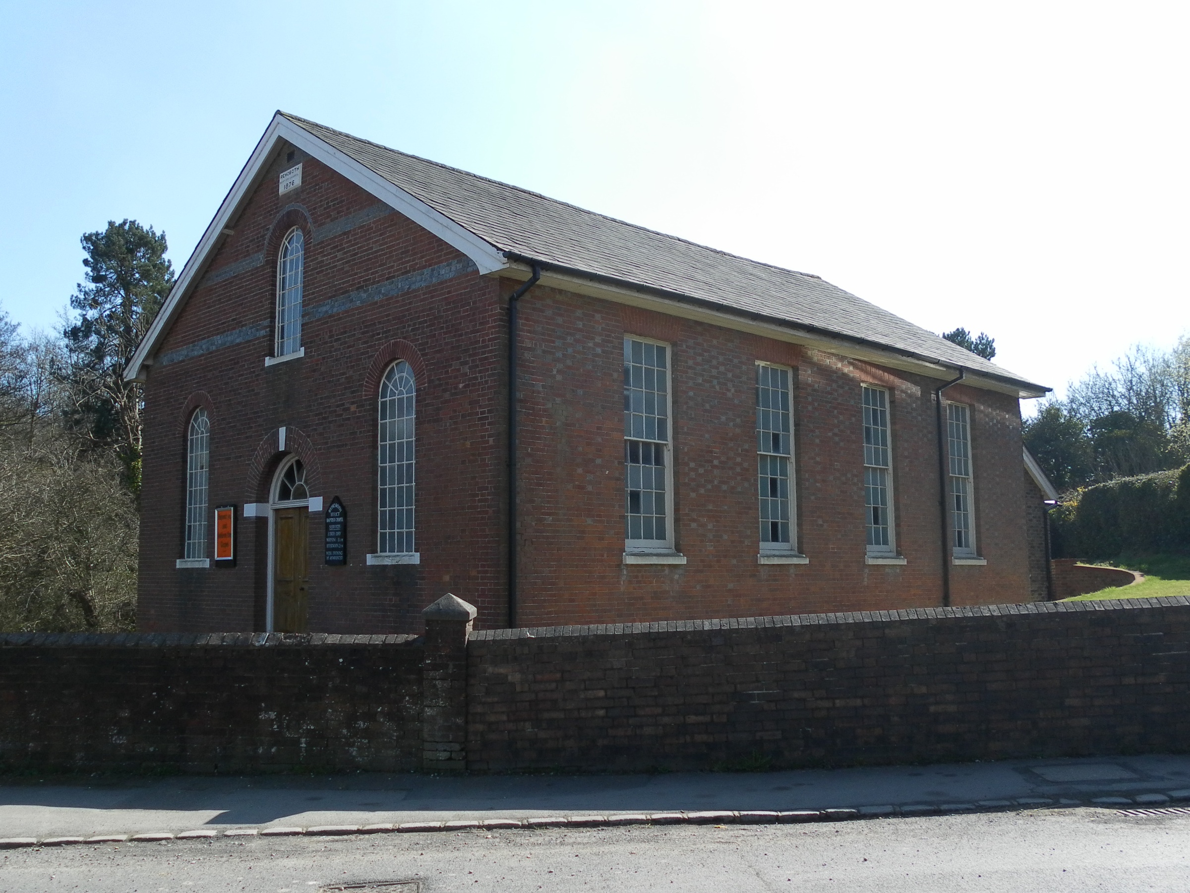
Rehoboth Chapel, Jarvis Brook

The Rehoboth Chapel is a Strict Baptist place of worship in the village of Jarvis Brook in the English county of East Sussex. The red- and blue-brick building...

Crowborough Country Park

Crowborough Country Park is a 7.3-hectare (18-acre) Local Nature Reserve on the western outskirts of Crowborough in East Sussex. It is owned and managed...
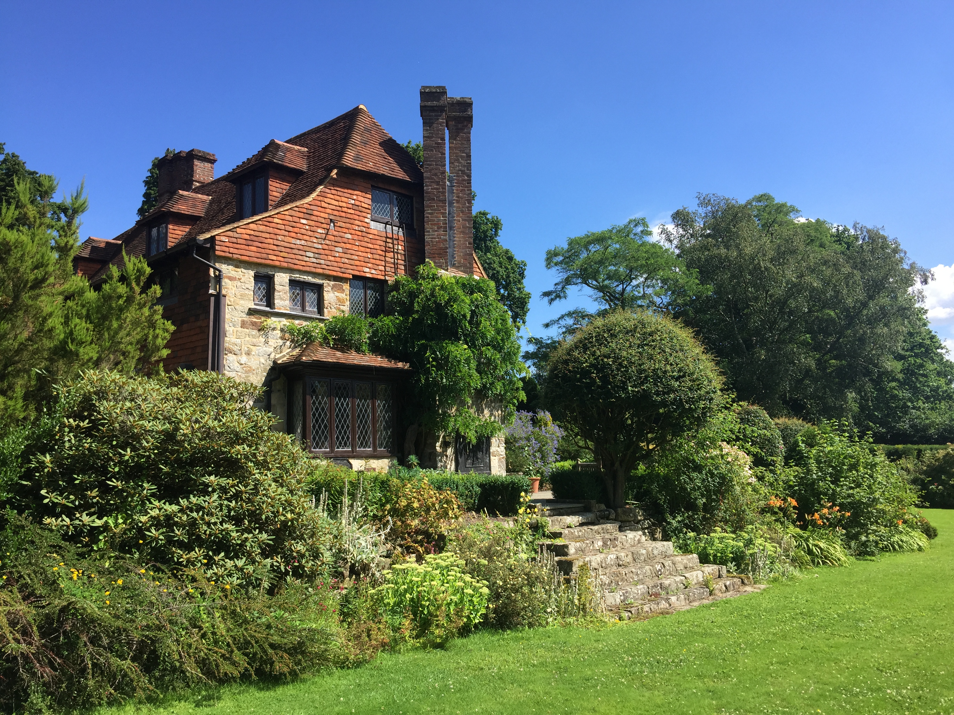
Luxford House

Luxford House is a 16th-century Grade II listed building near Crowborough, East Sussex. It is near the 11.5-acre (4.7 ha) Luxford Farm. It was used by...

Nearby Amenities

Located within 500m of 51.040246,0.21382888
Place Of Worship
St Peter's Roman Catholic Church
Denomination: roman_catholic
Node Id: 1145707777
Religion: christian
Source: OS OpenData StreetView
Source Name: OS Open Local Important Buildings Layer
Lat/Long: 51.0419185/0.2164686
Post Box
Operator: Royal Mail
Post Box Type: lamp
Ref: TN6 161D
Royal Cypher: EIIR
Royal Cypher Wikidata: Q33102113
Lat/Long: 51.0411318/0.2168298
Give Way
Direction: backward
Lat/Long: 51.0406609/0.21673
The data included in this document is from www.openstreetmap.org. The data is made available under ODbL.

Have you been to Dewlands Wood?

Leave your review of Dewlands Wood below (or comments, questions and feedback).