The Holt
Wood, Forest in Sussex Wealden
England
The Holt

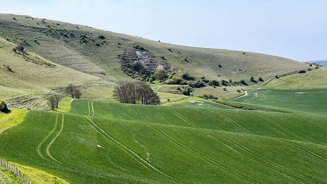
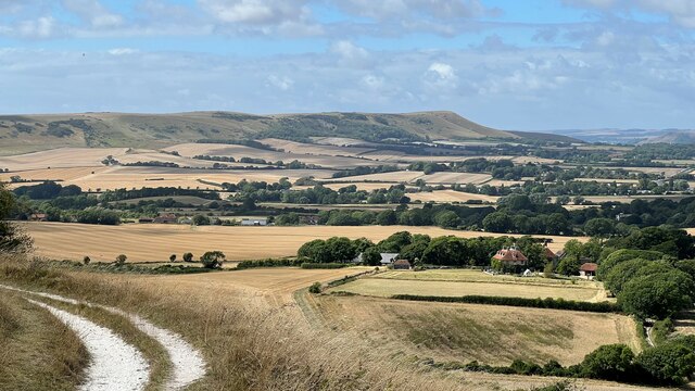
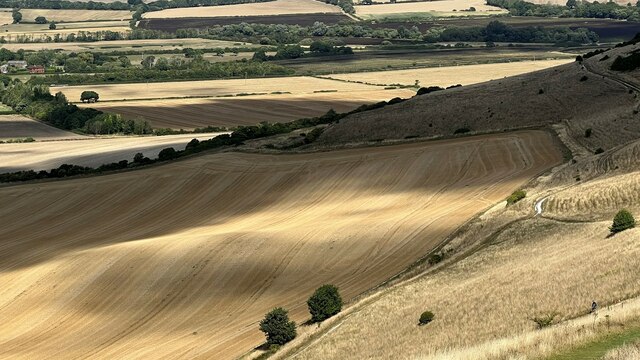
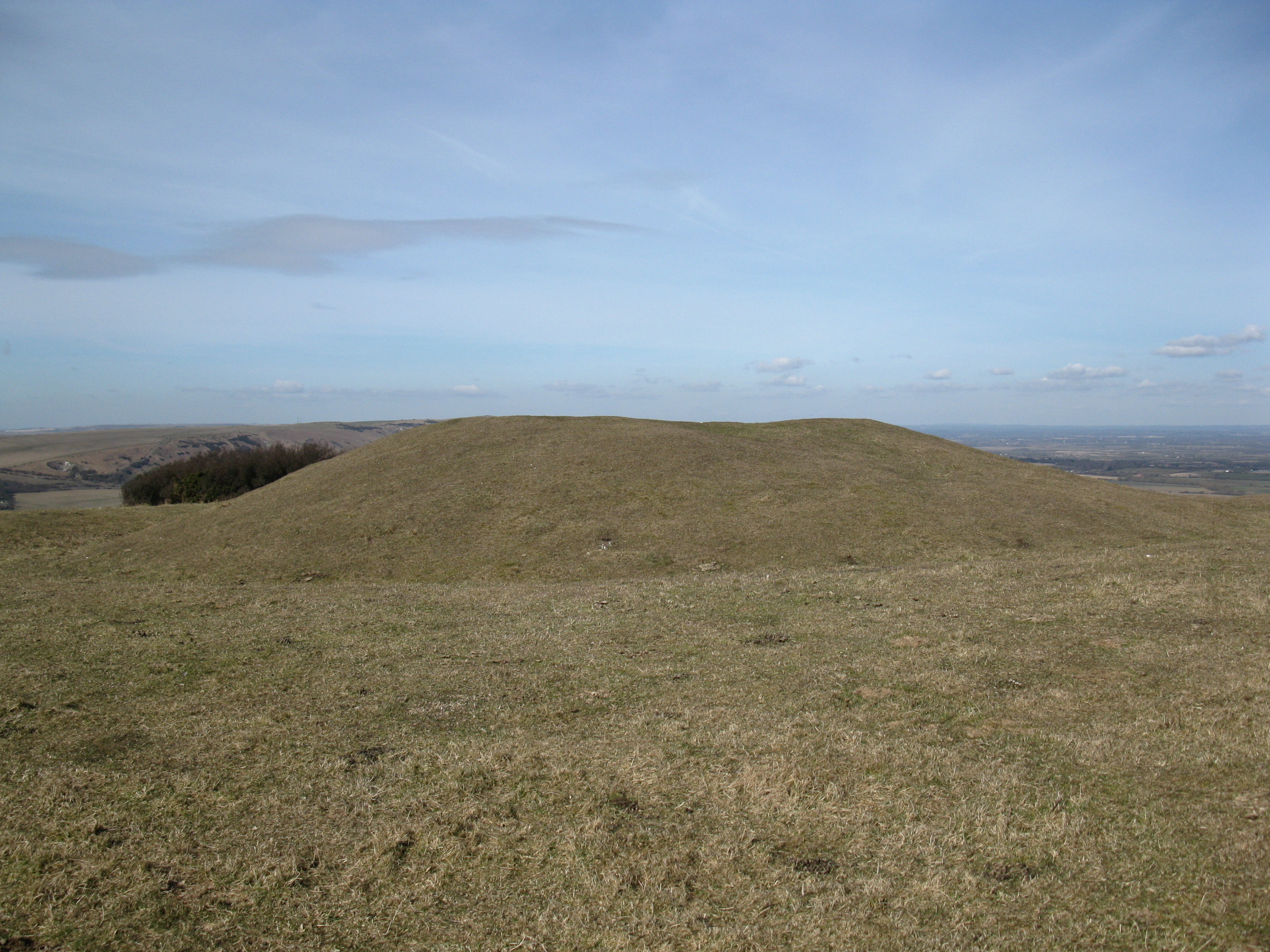
The Holt is a picturesque woodland area located in Sussex, England. Nestled among the rolling hills and lush greenery, this forest is a haven for nature lovers and outdoor enthusiasts alike. Covering an extensive area of approximately 300 hectares, The Holt is a diverse and thriving ecosystem.
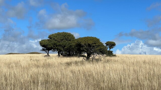
The forest is primarily composed of a mix of deciduous and coniferous trees, including oak, beech, and pine. These towering giants create a dense canopy that provides shade and shelter for a wide range of flora and fauna. The forest floor is adorned with an array of wildflowers, ferns, and mosses, adding a splash of color to the landscape.
The Holt is home to a rich variety of wildlife. Visitors may catch a glimpse of elusive creatures such as deer, foxes, and badgers roaming freely through the undergrowth. Birdwatchers will be delighted by the sight of various avian species, including woodpeckers, nightingales, and owls. The forest also houses a diverse range of insects, from buzzing bees to delicate butterflies.
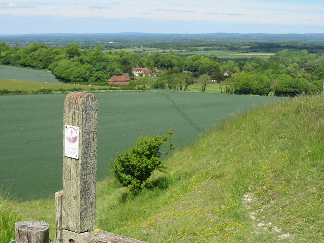
For those seeking outdoor adventures, The Holt offers numerous walking trails and cycling routes. These well-maintained paths wind their way through the forest, allowing visitors to explore its beauty at their own pace. There are also designated picnic areas and viewpoints, providing opportunities for visitors to relax and appreciate the stunning scenery.
The Holt, Sussex, is a true gem of natural beauty. Its tranquil atmosphere, breathtaking landscapes, and abundant wildlife make it a must-visit destination for nature enthusiasts and anyone looking to escape the hustle and bustle of city life.
If you have any feedback on the listing, please let us know in the comments section below.
The Holt Images
Images are sourced within 2km of 50.815239/0.20158074 or Grid Reference TQ5504. Thanks to Geograph Open Source API. All images are credited.

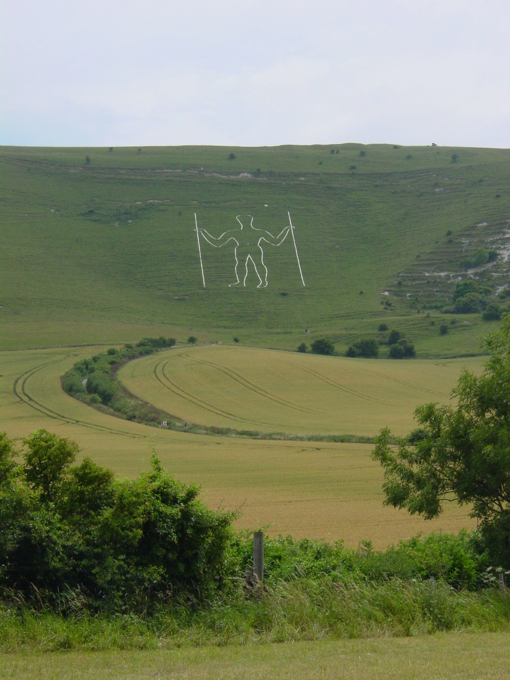
![Wilmington village [1] The Long Man is cut on the slopes of Windover Hill, near Wilmington. The figure is 235 feet (72 metres) tall. The figure may have been cut in the 16th or 17th century. The figure is formed from white-painted breeze blocks and lime mortar.
The village of Wilmington, in East Sussex, is about 6 miles (10 kilometres) northwest of Eastbourne. The place-name 'Wilmington' is first attested in the Domesday Book of 1086. The name means 'the town or settlement of Wighelm's or Wilhelm's people'. Near the village is the hill figure, The Long Man.](https://s0.geograph.org.uk/geophotos/07/22/18/7221864_0b4bebd9.jpg)
![Wilmington village [2] An information board about The Long Man.
The Long Man is cut on the slopes of Windover Hill, near Wilmington. The figure is 235 feet (72 metres) tall. The figure may have been cut in the 16th or 17th century. The figure is formed from white-painted breeze blocks and lime mortar.
The village of Wilmington, in East Sussex, is about 6 miles (10 kilometres) northwest of Eastbourne. The place-name 'Wilmington' is first attested in the Domesday Book of 1086. The name means 'the town or settlement of Wighelm's or Wilhelm's people'. Near the village is the hill figure, The Long Man.](https://s3.geograph.org.uk/geophotos/07/22/18/7221867_6ece0960.jpg)
![Wilmington village [3] Two horses graze in a field of buttercups.
The village of Wilmington, in East Sussex, is about 6 miles (10 kilometres) northwest of Eastbourne. The place-name 'Wilmington' is first attested in the Domesday Book of 1086. The name means 'the town or settlement of Wighelm's or Wilhelm's people'. Near the village is the hill figure, The Long Man.](https://s2.geograph.org.uk/geophotos/07/22/18/7221870_8edd74de.jpg)
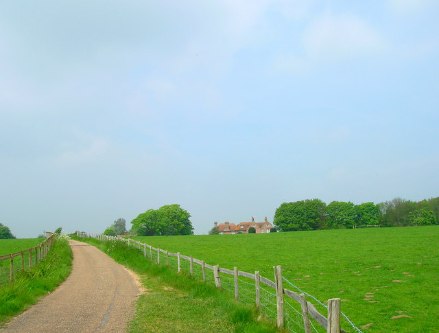
![Wilmington village [4] This recently created footpath runs alongside the minor road to meet the path across the fields to The Long Man. This avoids walkers having to use the narrow minor road.
The village of Wilmington, in East Sussex, is about 6 miles (10 kilometres) northwest of Eastbourne. The place-name 'Wilmington' is first attested in the Domesday Book of 1086. The name means 'the town or settlement of Wighelm's or Wilhelm's people'. Near the village is the hill figure, The Long Man.](https://s3.geograph.org.uk/geophotos/07/22/18/7221875_e5ed93c5.jpg)
![Wilmington village [5] Alongside the minor road is the former village pound, a rectangle of flint walls, probably 19th century, in the corner of the farmyard of Priory Farm. Listed, grade II, with details at: <span class="nowrap"><a title="https://historicengland.org.uk/listing/the-list/list-entry/1028510" rel="nofollow ugc noopener" href="https://historicengland.org.uk/listing/the-list/list-entry/1028510">Link</a><img style="margin-left:2px;" alt="External link" title="External link - shift click to open in new window" src="https://s1.geograph.org.uk/img/external.png" width="10" height="10"/></span>
The village of Wilmington, in East Sussex, is about 6 miles (10 kilometres) northwest of Eastbourne. The place-name &#039;Wilmington&#039; is first attested in the Domesday Book of 1086. The name means &#039;the town or settlement of Wighelm&#039;s or Wilhelm&#039;s people&#039;. Near the village is the hill figure, The Long Man.](https://s2.geograph.org.uk/geophotos/07/22/18/7221878_79102f72.jpg)
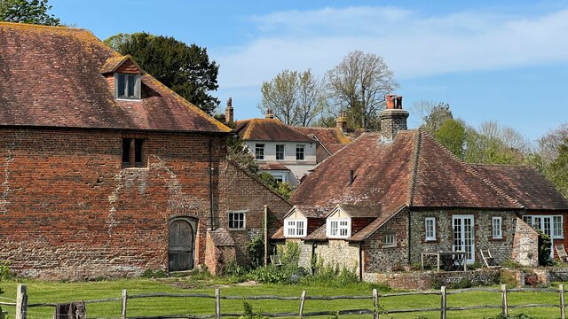
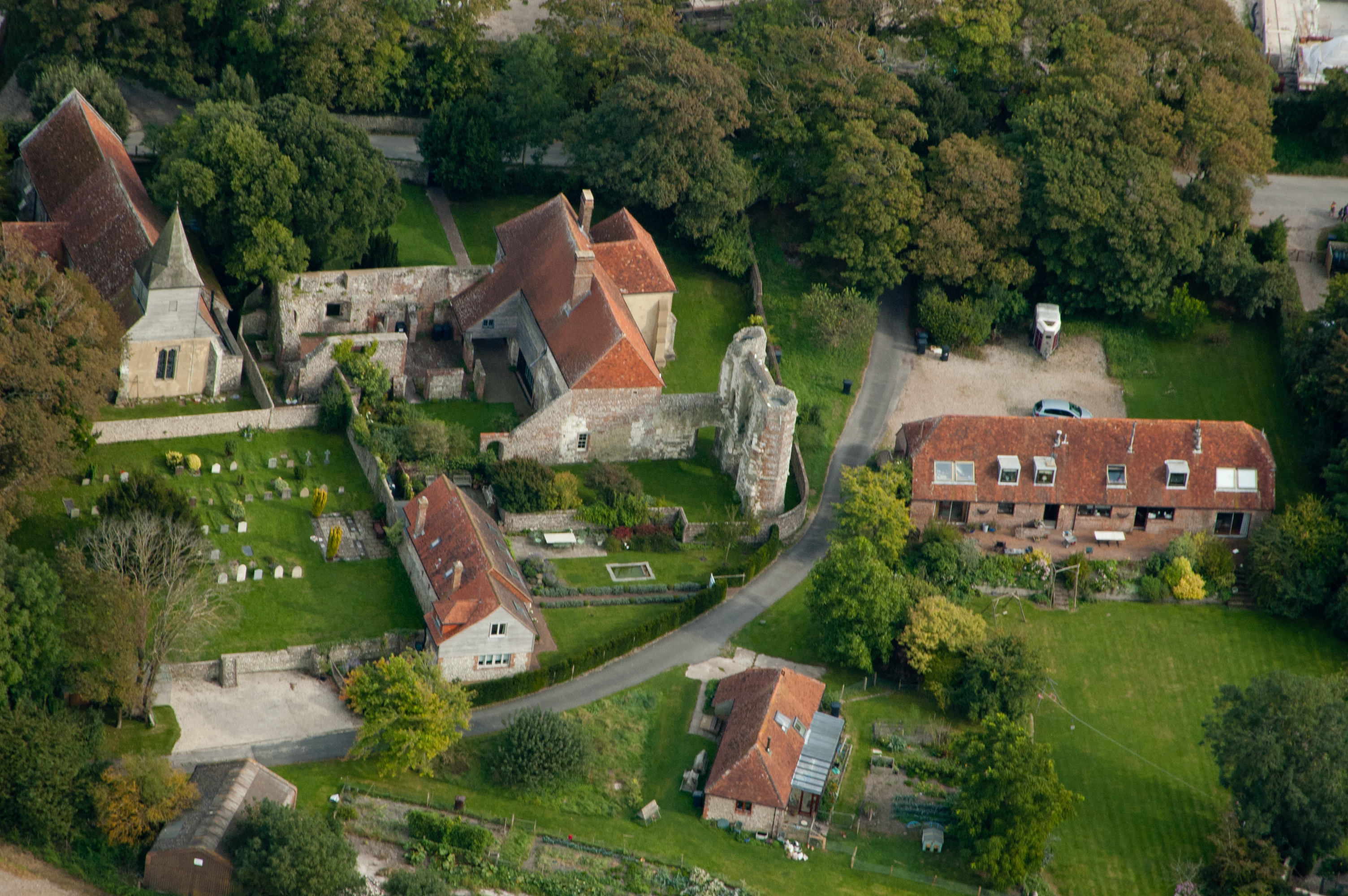
![Wilmington village [6] The remains of Wilmington Priory. The priory was part of the Benedictine Abbey of Grestain in Normandy and was founded circa 1200 as a grange for the supervision of the Abbey&#039;s English estates. It was suppressed in 1414. The present L-shaped house, seen at <a href="https://www.geograph.org.uk/photo/7221893">TQ5404 : Wilmington village [7]</a> is 14th century, altered and adapted in the 18th century. Seen here are the ruins of the 14th century Upper Hall of two octagonal turrets with a wall between them. To the north of the house are further ruins, beneath which is a 14th century vaulted undercroft. Listed, grade I, with details at: <span class="nowrap"><a title="https://historicengland.org.uk/listing/the-list/list-entry/1185052" rel="nofollow ugc noopener" href="https://historicengland.org.uk/listing/the-list/list-entry/1185052">Link</a><img style="margin-left:2px;" alt="External link" title="External link - shift click to open in new window" src="https://s1.geograph.org.uk/img/external.png" width="10" height="10"/></span> The site is a Scheduled Ancient Monument with history and detail at: <span class="nowrap"><a title="https://historicengland.org.uk/listing/the-list/list-entry/1002292" rel="nofollow ugc noopener" href="https://historicengland.org.uk/listing/the-list/list-entry/1002292">Link</a><img style="margin-left:2px;" alt="External link" title="External link - shift click to open in new window" src="https://s1.geograph.org.uk/img/external.png" width="10" height="10"/></span>
The village of Wilmington, in East Sussex, is about 6 miles (10 kilometres) northwest of Eastbourne. The place-name &#039;Wilmington&#039; is first attested in the Domesday Book of 1086. The name means &#039;the town or settlement of Wighelm&#039;s or Wilhelm&#039;s people&#039;. Near the village is the hill figure, The Long Man.](https://s2.geograph.org.uk/geophotos/07/22/18/7221886_71f9b40a.jpg)
![Wilmington village [7] The remains of Wilmington Priory. The priory was part of the Benedictine Abbey of Grestain in Normandy and was founded circa 1200 as a grange for the supervision of the Abbey&#039;s English estates. It was suppressed in 1414. The present L-shaped house, seen here is 14th century, altered and adapted in the 18th century. The ruins of the 14th century Upper Hall, seen at <a href="https://www.geograph.org.uk/photo/7221886">TQ5404 : Wilmington village [6]</a>, are two octagonal turrets with a wall between them. To the north of the house are further ruins, beneath which is a 14th century vaulted undercroft. Listed, grade I, with details at: <span class="nowrap"><a title="https://historicengland.org.uk/listing/the-list/list-entry/1185052" rel="nofollow ugc noopener" href="https://historicengland.org.uk/listing/the-list/list-entry/1185052">Link</a><img style="margin-left:2px;" alt="External link" title="External link - shift click to open in new window" src="https://s1.geograph.org.uk/img/external.png" width="10" height="10"/></span> The site is a Scheduled Ancient Monument with history and detail at: <span class="nowrap"><a title="https://historicengland.org.uk/listing/the-list/list-entry/1002292" rel="nofollow ugc noopener" href="https://historicengland.org.uk/listing/the-list/list-entry/1002292">Link</a><img style="margin-left:2px;" alt="External link" title="External link - shift click to open in new window" src="https://s1.geograph.org.uk/img/external.png" width="10" height="10"/></span>
The village of Wilmington, in East Sussex, is about 6 miles (10 kilometres) northwest of Eastbourne. The place-name &#039;Wilmington&#039; is first attested in the Domesday Book of 1086. The name means &#039;the town or settlement of Wighelm&#039;s or Wilhelm&#039;s people&#039;. Near the village is the hill figure, The Long Man.](https://s1.geograph.org.uk/geophotos/07/22/18/7221893_7a963394.jpg)
![Wilmington village [8] Glimpsed through the trees is Priory Barn, now converted into a dwelling. The barn was part of Wilmington Priory.
The village of Wilmington, in East Sussex, is about 6 miles (10 kilometres) northwest of Eastbourne. The place-name &#039;Wilmington&#039; is first attested in the Domesday Book of 1086. The name means &#039;the town or settlement of Wighelm&#039;s or Wilhelm&#039;s people&#039;. Near the village is the hill figure, The Long Man.](https://s3.geograph.org.uk/geophotos/07/22/18/7221895_6b719feb.jpg)


The Holt is located at Grid Ref: TQ5504 (Lat: 50.815239, Lng: 0.20158074)
Administrative County: East Sussex
District: Wealden
Police Authority: Sussex
What 3 Words
///hook.counts.daily. Near Friston, East Sussex
Nearby Locations
Related Wikis

Church of St Peter ad Vincula, Folkington
The Church of St Peter ad Vincula, Folkington, East Sussex is a parish church dating from the 13th century. Built of flint and rubble, it is a Grade I...

St Mary and St Peter's Church, Wilmington
St Mary and St Peter's Church is in the village of Wilmington, East Sussex, England. It is an active Anglican parish church on the deanery of Lewes and...
Wilmington Priory
Wilmington Priory was a Benedictine priory in the civil parish of Long Man, East Sussex, England. The surviving building is now owned by the Landmark Trust...

Folkington Manor
Folkington Manor (pronounced Fo'ington) is a grade II* listed country house situated in the village of Folkington two miles (3.2 km) west of Polegate,...
Long Man of Wilmington
The Long Man of Wilmington or Wilmington Giant is a hill figure on the steep slopes of Windover Hill near Wilmington, East Sussex, England. It is 6 miles...
Wilmington Downs
Wilmington Downs is a 209.8-hectare (518-acre) biological Site of Special Scientific Interest north-west of Eastbourne in East Sussex. The site includes...

Folkington Reservoir
Folkington Reservoir is a 5.8-hectare (14-acre) biological Site of Special Scientific Interest south-west of Polegate in East Sussex.The banks of the reservoir...
Wootton Manor
Wootton Manor is a country house in Folkington, East Sussex. Originally a mediaeval manor house, from which parts of the chapel survive, it was rebuilt...
Nearby Amenities
Located within 500m of 50.815239,0.20158074Have you been to The Holt?
Leave your review of The Holt below (or comments, questions and feedback).