Shoulder of Mutton Wood

Wood, Forest in Essex

England

Shoulder of Mutton Wood

Harold Wood Station - Elizabeth Line Platform 3 with a westbound train about to depart.
Harold Wood Station - Elizabeth Line Credit: Trevor Harris

Shoulder of Mutton Wood is a picturesque woodland located in Essex, England. Covering an area of approximately 100 hectares, it is a popular destination for nature enthusiasts and hikers alike. The wood is situated near the village of Matching Tye, just a short distance from the larger town of Harlow.

This ancient forest is characterized by a diverse range of tree species, including oak, beech, birch, and ash. The dense canopy provides a haven for a variety of wildlife, attracting birdwatchers and nature photographers. Visitors may be lucky enough to spot species such as woodpeckers, owls, and deer in their natural habitat.

Shoulder of Mutton Wood offers several well-maintained paths and trails, allowing visitors to explore its beauty at their own pace. The network of footpaths leads through peaceful groves and open glades, providing opportunities for peaceful strolls or more challenging hikes. The wood is also home to a small stream, adding to its tranquil ambiance.

The wood has a rich history, with evidence of human habitation dating back to the Roman era. It has been used for timber production in the past, and remnants of old saw pits and charcoal hearths can still be found. Today, the wood is managed by the local council, ensuring its preservation for future generations.

Whether it's a leisurely walk, birdwatching, or simply enjoying the serenity of nature, Shoulder of Mutton Wood offers a peaceful retreat for visitors seeking to connect with the natural world.

If you have any feedback on the listing, please let us know in the comments section below.

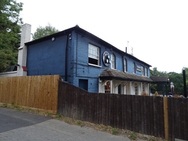
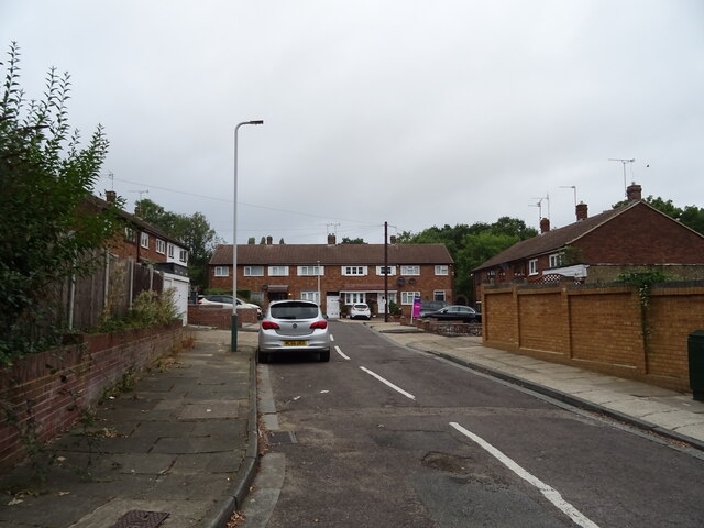
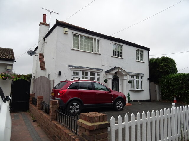
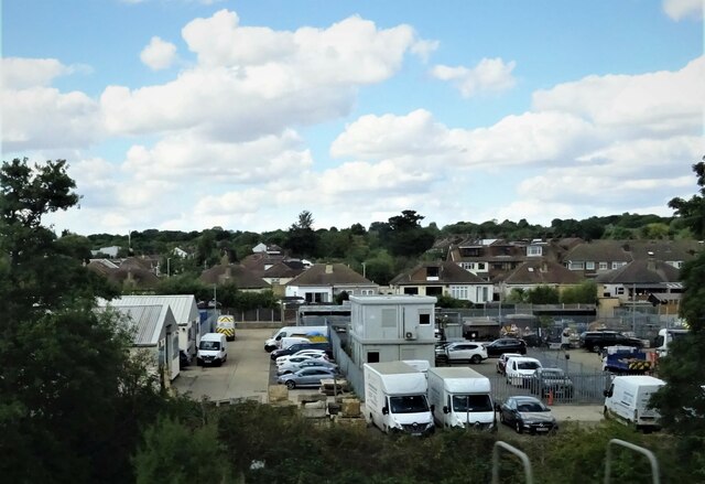
Shoulder of Mutton Wood Images

Images are sourced within 2km of 51.605178/0.23859026 or Grid Reference TQ5591. Thanks to Geograph Open Source API. All images are credited.

Harold Wood Station - Elizabeth Line Platform 3 with a westbound train about to depart.
Harold Wood Station - Elizabeth Line
Platform 3 with a westbound train about to depart.
Houses on Straight Road, Romford
McDonald's on Straight Road, Romford
The Deers Rest On Noak Hill Road.
See <a href="https://www.geograph.org.uk/photo/7266307">TQ5393 : Sign for the Deers Rest</a> for sign.
The Deers Rest
On Noak Hill Road. See TQ5393 : Sign for the Deers Rest for sign.
Sign for the Deers Rest See <a href="https://www.geograph.org.uk/photo/7266306">TQ5393 : The Deers Rest</a> and for <a href="https://www.geograph.org.uk/photo/7266311">TQ5393 : The Deers Rest</a>
 context.
Sign for the Deers Rest
Greenbank Close, Noak Hill, Romford
The Deers Rest On Noak Hill Road.
See <a href="https://www.geograph.org.uk/photo/7266307">TQ5393 : Sign for the Deers Rest</a> for sign.
The Deers Rest
On Noak Hill Road. See TQ5393 : Sign for the Deers Rest for sign.
Noak Hill Road
Noak Hill Road
White house on Noak Hill Road
Track off Noak Hill Road
Road junction, Noak Hill
Elms Industrial Estate, Harold Park
Harold Wood, Railway Station
Houses on Rosslyn Avenue, Romford
Squirrels Heath Road, Romford
The Array Essex On Shepherds Hill.
See <a href="https://www.geograph.org.uk/photo/7275286">TQ5590 : Sign for the Array Essex</a> for sign.
The Array Essex
On Shepherds Hill. See TQ5590 : Sign for the Array Essex for sign.
Sign for the Array Essex See <a href="https://www.geograph.org.uk/photo/7275283">TQ5590 : The Array Essex</a> for public house.
Sign for the Array Essex
See TQ5590 : The Array Essex for public house.
Houses on Shepherds Hill
Show me another place!

Shoulder of Mutton Wood is located at Grid Ref: TQ5591 (Lat: 51.605178, Lng: 0.23859026)

Unitary Authority: Havering

Police Authority: Metropolitan

What 3 Words

///ranks.splash.bonds. Near Harold Wood, London

Related Wikis

King's Wood School

King's Wood School was a secondary school in Harold Hill near Romford, London Borough of Havering, England. It was a mixed school of non-denominational...

Drapers' Academy

Drapers' Academy is a secondary school for girls and boys, from years 7 to 13 sixth form with academy status, located in Harold Hill near Romford, Greater...

Harold Park

Harold Park is a place in the London Borough of Havering. == History == Harold Park is north-eastern part of Harold Wood, occupying an isthmus of land...

Harold Hill

Harold Hill is a suburban area in the London Borough of Havering, East London. 16.6 miles (26.7 km) northeast of Charing Cross. It is a district centre...

Nearby Amenities

Located within 500m of 51.605178,0.23859026
Stratton Road
Bus: yes
Local Ref: DH
Public Transport: stop_position
Lat/Long: 51.6061744/0.2432321
Crossing
Crossing: unmarked
Crossing Island: yes
Tactile Paving: yes
Lat/Long: 51.6042375/0.2365003
Ref GB Tflcid: RWG121749
Traffic Calming: cushion
Lat/Long: 51.6017991/0.2356012
Ref GB Tflcid: RWG121750
Traffic Calming: cushion
Lat/Long: 51.6032201/0.2371777
Ref GB Tflcid: RWG122413
Traffic Calming: table
Lat/Long: 51.6092006/0.2395949
Fast Food
The Good Year
Addr City: Romford
Addr Housenumber: 112
Addr Postcode: RM3 9PH
Addr Street: Petersfield Avenue
Cuisine: chinese
Fhrs Id: 373155
Fhrs Local Authority Id: 13329
Source Addr: FHRS Open Data
Lat/Long: 51.6050239/0.2349029
Post Box
Lat/Long: 51.6021/0.2350707
Bus Stop
Dagnam Park Square
Local Ref: DJ
Naptan AtcoCode: 490005929N
Naptan Bearing: N
Naptan CommonName: Harold HillDagnam Park Square
Naptan Indicator: Stop DJ
Naptan Street: DAGNAM PARK DRIVE
Public Transport: platform
Ref: 50913
Lat/Long: 51.6050586/0.2436479
Bus Stop
Court Avenue
Local Ref: CG
Naptan AtcoCode: 490005648N
Naptan Bearing: N
Naptan CommonName: Court Avenue Colchester Road
Naptan Indicator: Stop CG
Naptan Street: COLCHESTER ROAD
Naptan Verified: no
Public Transport: platform
Lat/Long: 51.6008058/0.2389907
Bus Stop
Fairford Way
Local Ref: PA
Naptan AtcoCode: 490006711N
Naptan Bearing: N
Naptan CommonName: Harold HillPetersfield Avenue
Naptan Indicator: Stop PA
Naptan Street: PETERSFIELD AVENUE
Naptan Verified: no
Public Transport: platform
Lat/Long: 51.6031965/0.2443855
Bus Stop
Fairford Way
Local Ref: PP
Naptan AtcoCode: 490006711S
Naptan Bearing: S
Naptan CommonName: Harold HillPetersfield Avenue
Naptan Indicator: Stop PP
Naptan Street: PETERSFIELD AVENUE
Naptan Verified: no
Public Transport: platform
Lat/Long: 51.603415/0.2444418
Bus Stop
Paines Brook Way
Local Ref: PE
Naptan AtcoCode: 490010726W
Naptan Bearing: W
Naptan CommonName: Paines Brook Way
Naptan Indicator: Stop PE
Naptan Street: PETERSFIELD AVENUE
Naptan Verified: no
Public Transport: platform
Lat/Long: 51.6056594/0.2321875
Bus Stop
Petersfield Avenue Colchester Road
Bench: yes
Bin: yes
Local Ref: CC
Naptan AtcoCode: 490010966N
Naptan Bearing: N
Naptan CommonName: Petersfield Ave Colchester Rd
Naptan Indicator: Stop CC
Naptan Street: COLCHESTER ROAD
Naptan Verified: no
Public Transport: platform
Shelter: yes
Lat/Long: 51.6023168/0.2438753
Bus Stop
Tarnworth Road
Local Ref: PB
Naptan AtcoCode: 490011536W
Naptan Bearing: W
Naptan CommonName: Tarnworth Road Retford Path
Naptan Indicator: Stop PB
Naptan Street: PETERSFIELD AVENUE
Naptan Verified: no
Public Transport: platform
Lat/Long: 51.6035017/0.2399091
Bus Stop
Paines Brook Way
Local Ref: PJ
Naptan AtcoCode: 490011852E
Naptan Bearing: E
Naptan CommonName: Paines Brook Way Sage Wood
Naptan Indicator: Stop PJ
Naptan Street: PETERSFIELD AVENUE
Naptan Verified: no
Public Transport: platform
Lat/Long: 51.606049/0.2330656
Bus Stop
Redruth Road
Local Ref: LS
Naptan AtcoCode: 490011492N
Naptan Bearing: N
Naptan CommonName: Redruth Road
Naptan Indicator: Stop LS
Naptan Street: LEAMINGTON ROAD
Naptan Verified: no
Public Transport: platform
Lat/Long: 51.6066898/0.2375336
Bus Stop
Redruth Road
Local Ref: LP
Naptan AtcoCode: 490011492S
Naptan Bearing: S
Naptan CommonName: Redruth Road
Naptan Indicator: Stop LP
Naptan Verified: no
Public Transport: platform
Lat/Long: 51.6066933/0.23771
Bus Stop
Settle Road
Local Ref: DE
Naptan AtcoCode: 490011997E
Naptan Bearing: E
Naptan CommonName: Settle Road
Naptan Indicator: Stop DE
Naptan Street: DAGNAM PARK DRIVE
Naptan Verified: no
Public Transport: platform
Lat/Long: 51.6088846/0.2385184
Bus Stop
Settle Road
Local Ref: DL
Naptan AtcoCode: 490011997W
Naptan Bearing: W
Naptan CommonName: Settle Road
Naptan Indicator: Stop DL
Naptan Street: DAGNAM PARK DRIVE
Naptan Verified: no
Public Transport: platform
Lat/Long: 51.6083004/0.2401337
Bus Stop
Sheffield Drive
Local Ref: DK
Naptan AtcoCode: 490012054N
Naptan Bearing: N
Naptan CommonName: Sheffield Drive
Naptan Indicator: Stop DK
Naptan Street: DAGNAM PARK DRIVE
Naptan Verified: no
Public Transport: platform
Lat/Long: 51.6066625/0.2426598
Bus Stop
Sheffield Drive
Local Ref: DF
Naptan AtcoCode: 490012054S
Naptan Bearing: S
Naptan CommonName: Sheffield Drive
Naptan Indicator: Stop DF
Naptan Street: DAGNAM PARK DRIVE
Naptan Verified: no
Public Transport: platform
Lat/Long: 51.6075839/0.2417462
Bus Stop
Tarnworth Road
Local Ref: PN
Naptan AtcoCode: 490013159E
Naptan Bearing: E
Naptan CommonName: Tarnworth RoadPetersfield Ave
Naptan Indicator: Stop PN
Naptan Street: PETERSFIELD AVENUE
Naptan Verified: no
Public Transport: platform
Lat/Long: 51.6036549/0.2425645
Bus Stop
St Neot's Road
Local Ref: PL
Naptan AtcoCode: 490012819E
Naptan Bearing: E
Naptan CommonName: Petersfield AvenueSt Neots Rd
Naptan Indicator: Stop PL
Naptan Street: PETERSFIELD AVENUE
Naptan Verified: no
Public Transport: platform
Lat/Long: 51.6036417/0.2391203
Bus Stop
St Neot's Road
Local Ref: PC
Naptan AtcoCode: 490012819N1
Naptan Bearing: N
Naptan CommonName: Petersfield AvenueSt Neots Rd
Naptan Indicator: Stop PC
Naptan Street: PETERSFIELD AVENUE
Naptan Verified: no
Public Transport: platform
Lat/Long: 51.6038482/0.2370552
Bus Stop
Leamington Close
Local Ref: LQ
Naptan AtcoCode: 490012819N2
Naptan Bearing: N
Naptan CommonName: Petersfield AvenueSt Neots Rd
Naptan Indicator: Stop LQ
Naptan Street: LEAMINGTON ROAD
Naptan Verified: no
Public Transport: platform
Lat/Long: 51.6041645/0.2380827
Bus Stop
Stratton Road
Local Ref: DH
Naptan AtcoCode: 490012912S
Naptan Bearing: S
Naptan CommonName: Stratton Road
Naptan Indicator: Stop DH
Naptan Street: DAGNAM PARK DRIVE
Public Transport: platform
Ref: 55983
Lat/Long: 51.6061593/0.2432874
Bus Stop
The Petersfield Centre
Local Ref: PD
Naptan AtcoCode: 490013497N
Naptan Bearing: N
Naptan CommonName: The Petersfield Centre
Naptan Indicator: Stop PD
Naptan Street: PETERSFIELD AVENUE
Naptan Verified: no
Public Transport: platform
Lat/Long: 51.6051858/0.234865
Bus Stop
The Petersfield Centre
Local Ref: PK
Naptan AtcoCode: 490013497S
Naptan Bearing: S
Naptan CommonName: The Petersfield Centre
Naptan Indicator: Stop PK
Naptan Street: PETERSFIELD AVENUE
Naptan Verified: no
Public Transport: platform
Lat/Long: 51.6053246/0.234905
Bus Stop
Wickford Drive
Local Ref: LN
Naptan AtcoCode: 490014650S
Naptan Bearing: S
Naptan CommonName: Wickford Drive
Naptan Indicator: Stop LN
Naptan Street: LEAMINGTON ROAD
Naptan Verified: no
Public Transport: platform
Lat/Long: 51.608426/0.237646
Colne Drive
Naptan AtcoCode: 490016431S
Naptan Bearing: S
Naptan CommonName: Colne Drive
Naptan Indicator: Stop
Naptan Verified: no
Lat/Long: 51.6039154/0.2349903
Bus Stop
Petersfield Avenue
Local Ref: LR
Naptan AtcoCode: 490018347S
Naptan Bearing: S
Naptan CommonName: Petersfield Avenue
Naptan Indicator: Stop
Naptan Verified: no
Public Transport: platform
Lat/Long: 51.604398/0.2381815
Pub
The Saxon King
Addr City: Romford
Addr Postcode: RM3 9PP
Addr Street: Petersfield Avenue
Fhrs Id: 373173
Fhrs Local Authority Id: 13450
Source Addr: FHRS Open Data
Lat/Long: 51.6036641/0.2370599
Pub
William The Conqueror
Fixme: name changed?
Lat/Long: 51.6057708/0.2335988
Crossing
Bicycle: yes
Crossing: unmarked
Crossing Markings: no
Tactile Paving: yes
Lat/Long: 51.6014177/0.2348964
Pharmacy
Boots
Addr City: Romford
Addr Housenumber: 122
Addr Postcode: RM3 9PH
Addr Street: Petersfield Avenue
Branch: Romford Harold Hill Petersfield Avenue
Brand Wikidata: Q6123139
Contact Phone: +44 1708 343834
Contact Website: http://www.boots.com/stores/6234-romfd-harold-hill-rm3-9ph
Dispensing: yes
Fhrs Id: 373587
Fhrs Local Authority Id: 51420
Level: 0
Operator: Boots UK Limited
Ref: 6234
Shop: chemist
Source: gps;photograph;local knowledge
Source Addr: FHRS Open Data
Lat/Long: 51.6050293/0.234989
Dagnam Park Square
Bus: yes
Local Ref: DJ
Public Transport: stop_position
Lat/Long: 51.6050699/0.2437635
Barrier: bollard
Material: metal
Lat/Long: 51.6013716/0.2349756
Generator Method: photovoltaic
Generator Output Electricity: yes
Generator Source: solar
Generator Type: solar_photovoltaic_panel
Location: roof
Power: generator
Lat/Long: 51.6047256/0.2369195
Generator Method: photovoltaic
Generator Output Electricity: yes
Generator Source: solar
Generator Type: solar_photovoltaic_panel
Location: roof
Power: generator
Lat/Long: 51.6058393/0.233037
Generator Method: photovoltaic
Generator Output Electricity: yes
Generator Source: solar
Generator Type: solar_photovoltaic_panel
Location: roof
Power: generator
Lat/Long: 51.6058068/0.2330585
Generator Method: photovoltaic
Generator Output Electricity: yes
Generator Source: solar
Generator Type: solar_photovoltaic_panel
Location: roof
Power: generator
Lat/Long: 51.6043708/0.2350366
Generator Method: photovoltaic
Generator Output Electricity: yes
Generator Source: solar
Generator Type: solar_photovoltaic_panel
Location: roof
Power: generator
Lat/Long: 51.6043975/0.2349924
Generator Method: photovoltaic
Generator Output Electricity: yes
Generator Source: solar
Generator Type: solar_photovoltaic_panel
Location: roof
Power: generator
Lat/Long: 51.6044258/0.2349642
Generator Method: photovoltaic
Generator Output Electricity: yes
Generator Source: solar
Generator Type: solar_photovoltaic_panel
Location: roof
Power: generator
Lat/Long: 51.6036436/0.234822
Generator Method: photovoltaic
Generator Output Electricity: yes
Generator Source: solar
Generator Type: solar_photovoltaic_panel
Location: roof
Power: generator
Lat/Long: 51.6036803/0.2347711
Generator Method: photovoltaic
Generator Output Electricity: yes
Generator Source: solar
Generator Type: solar_photovoltaic_panel
Location: roof
Power: generator
Lat/Long: 51.6037219/0.2347335
Generator Method: photovoltaic
Generator Output Electricity: yes
Generator Source: solar
Generator Type: solar_photovoltaic_panel
Location: roof
Power: generator
Lat/Long: 51.6037703/0.2346624
Generator Method: photovoltaic
Generator Output Electricity: yes
Generator Source: solar
Generator Type: solar_photovoltaic_panel
Location: roof
Power: generator
Lat/Long: 51.603891/0.234582
Generator Method: photovoltaic
Generator Output Electricity: yes
Generator Source: solar
Generator Type: solar_photovoltaic_panel
Location: roof
Power: generator
Lat/Long: 51.603866/0.2345498
Generator Method: photovoltaic
Generator Output Electricity: yes
Generator Source: solar
Generator Type: solar_photovoltaic_panel
Location: roof
Power: generator
Lat/Long: 51.6038261/0.2344519
Generator Method: photovoltaic
Generator Output Electricity: yes
Generator Source: solar
Generator Type: solar_photovoltaic_panel
Location: roof
Power: generator
Lat/Long: 51.6037744/0.2344009
Generator Method: photovoltaic
Generator Output Electricity: yes
Generator Source: solar
Generator Type: solar_photovoltaic_panel
Location: roof
Power: generator
Lat/Long: 51.6037428/0.2343446
Generator Method: photovoltaic
Generator Output Electricity: yes
Generator Source: solar
Generator Type: solar_photovoltaic_panel
Location: roof
Power: generator
Lat/Long: 51.6037053/0.2342789
Generator Method: photovoltaic
Generator Output Electricity: yes
Generator Source: solar
Generator Type: solar_photovoltaic_panel
Location: roof
Power: generator
Lat/Long: 51.603682/0.2342319
Generator Method: photovoltaic
Generator Output Electricity: yes
Generator Source: solar
Generator Type: solar_photovoltaic_panel
Location: roof
Power: generator
Lat/Long: 51.6036453/0.2341609
Generator Method: photovoltaic
Generator Output Electricity: yes
Generator Source: solar
Generator Type: solar_photovoltaic_panel
Location: roof
Power: generator
Lat/Long: 51.603522/0.2343191
Generator Method: photovoltaic
Generator Output Electricity: yes
Generator Source: solar
Generator Type: solar_photovoltaic_panel
Location: roof
Power: generator
Lat/Long: 51.6034979/0.2343594
Generator Method: photovoltaic
Generator Output Electricity: yes
Generator Source: solar
Generator Type: solar_photovoltaic_panel
Location: roof
Power: generator
Lat/Long: 51.6034471/0.2344237
Access: no
Barrier: bollard
Bicycle: yes
Bollard: fixed
Check Date: 2017-09-12
Foot: yes
Ref GB Tflcid: RWG122528
Lat/Long: 51.6035508/0.237284
Bicycle Parking
Bicycle Lock: provided
Bicycle Parking: stands
Capacity: 10
Covered: yes
Ref GB Tflcid: RWG122638
Lat/Long: 51.6048808/0.2367991
Bicycle Parking
Bicycle Parking: stands
Capacity: 10
Ref GB Tflcid: RWG122679
Lat/Long: 51.6014923/0.235549
Bicycle Parking
Bicycle Parking: stands
Capacity: 4
Ref GB Tflcid: RWG122637
Lat/Long: 51.6051075/0.2350684
Bicycle Parking
Bicycle Parking: stands
Capacity: 4
Ref GB Tflcid: RWG122636
Lat/Long: 51.6055735/0.2343653
Bicycle Parking
Bicycle Parking: stands
Capacity: 8
Ref GB Tflcid: RWG122676
Lat/Long: 51.6030963/0.234518
Ref GB Tflcid: RWG121751
Traffic Calming: cushion
Lat/Long: 51.6025291/0.2365449
Ref GB Tflcid: RWG121716
Traffic Calming: cushion
Lat/Long: 51.6087304/0.2389948
Ref GB Tflcid: RWG121717
Traffic Calming: cushion
Lat/Long: 51.6087162/0.2390522
Ref GB Tflcid: RWG121723
Traffic Calming: cushion
Lat/Long: 51.6048942/0.2438366
Ref GB Tflcid: RWG121714
Traffic Calming: cushion
Lat/Long: 51.6091798/0.2369282
Crossing
Crossing: uncontrolled
Crossing Island: yes
Lat/Long: 51.6055151/0.2345761
Cafe
Cafe 90
Lat/Long: 51.605619/0.2340879
Crossing
Crossing: unmarked
Crossing Island: yes
Tactile Paving: yes
Lat/Long: 51.6051311/0.2351628
Post Box
Operator: Royal Mail
Operator Wikidata: Q638098
Post Box Type: pillar
Source: streetside
Lat/Long: 51.6050753/0.235116
Place Of Worship
The Salvation Army - Harold Hill
Addr City: Harold Hill
Addr Country: GB
Addr Postcode: RM3 9PP
Addr Street: Petersfield Avenue
Denomination: salvation_army
Religion: christian
Website: https://www.salvationarmy.org.uk/harold-hill
Lat/Long: 51.6041401/0.2363214
The data included in this document is from www.openstreetmap.org. The data is made available under ODbL.

Have you been to Shoulder of Mutton Wood?

Leave your review of Shoulder of Mutton Wood below (or comments, questions and feedback).