Birchett's Wood

Wood, Forest in Sussex Wealden

England

Birchett's Wood

Groombridge Water Treatment Works Located on Corseley Road to the north of Erdige Stream.
Groombridge Water Treatment Works Credit: Simon Carey

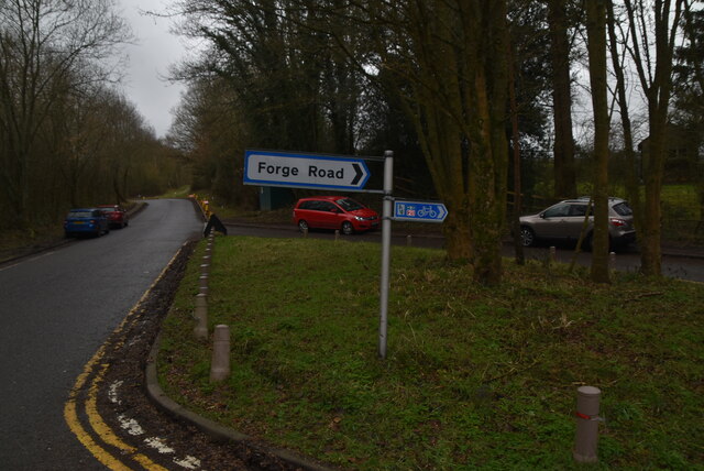
Birchett's Wood is a picturesque forest located in Sussex, England. Covering an area of approximately 100 acres, it is a popular destination for nature enthusiasts and outdoor lovers. The wood is characterized by its dense growth of birch trees, which give it its name and create a stunning natural landscape.

The forest is home to a diverse range of flora and fauna, making it an ideal habitat for various species. Visitors can expect to see an array of woodland creatures such as deer, squirrels, and a wide variety of bird species. The tranquil atmosphere and abundance of wildlife make Birchett's Wood a haven for nature photography and birdwatching.

Walking and hiking trails crisscross the forest, allowing visitors to explore its beauty at their own pace. The paths wind through the trees, offering glimpses of sunlight filtering through the foliage and creating a magical atmosphere. In spring, the forest floor is carpeted with bluebells, creating a breathtaking display of colors.

Birchett's Wood also has a rich history, with evidence of human settlement dating back centuries. Archaeological finds in the area indicate that the forest was inhabited during the Iron Age and Roman times. Remnants of ancient structures and artifacts add an extra layer of intrigue to the woodland experience.

Overall, Birchett's Wood is a captivating destination that offers a serene escape from the hustle and bustle of everyday life. With its stunning natural beauty and rich history, it is a must-visit location for anyone seeking to immerse themselves in the beauty of the Sussex countryside.

If you have any feedback on the listing, please let us know in the comments section below.

Birchett's Wood Images

Images are sourced within 2km of 51.098248/0.20607197 or Grid Reference TQ5435. Thanks to Geograph Open Source API. All images are credited.

Groombridge Water Treatment Works Located on Corseley Road to the north of Erdige Stream.
Groombridge Water Treatment Works
Located on Corseley Road to the north of Erdige Stream.
Eridge Stream A tributary of Mottsmill Stream that rises in Eridge Park. Viewed from Corseley Road bridge.
Eridge Stream
A tributary of Mottsmill Stream that rises in Eridge Park. Viewed from Corseley Road bridge.
Corseley Road Heading south from Groombridge towards Mott's Mill and Eridge.
Corseley Road
Heading south from Groombridge towards Mott's Mill and Eridge.
Great Mead The name of the field according to Withyham's 1842 tithe map bounded by Corseley Road to the east and Eridge Stream to the north.
Great Mead
The name of the field according to Withyham's 1842 tithe map bounded by Corseley Road to the east and Eridge Stream to the north.
Five Acres/Clays Land The name of the fields according to Withyham's 1842 tithe map that have been merged to form a larger unit. Five Acres was to the right where the footpath to Mott's Mill is, whilst Clays Land was to the east.
Five Acres/Clays Land
The name of the fields according to Withyham's 1842 tithe map that have been merged to form a larger unit. Five Acres was to the right where the footpath to Mott's Mill is, whilst Clays Land was to the east.
Type 24 Pillboxes Two in close proximity to the south of Groombridge, an important railway junction during World War Two.
Type 24 Pillboxes
Two in close proximity to the south of Groombridge, an important railway junction during World War Two.
Wet Field The name of the field according to Withyham's 1842 tithe map bounded by Long Shaw to the east and the public footpath to Sherlock's Farm to the west.
Wet Field
The name of the field according to Withyham's 1842 tithe map bounded by Long Shaw to the east and the public footpath to Sherlock's Farm to the west.
Eridge Rocks Eridge Rocks are owned and managed by the Sussex Wildlife Trust and extend for a considerable distance with a footpath running along the foot of them. They are 135 million years old and are described in the British Geological Survey: "Ashdown Formation - Sandstone And Siltstone, Interbedded. Sedimentary Bedrock formed approximately 134 to 145 million years ago in the Cretaceous Period. Local environment previously dominated by swamps, estuaries and deltas." The dinosaurs were wiped out 65 million years ago.

One of the information boards can be seen at <a title="https://www.geograph.org.uk/photo/6723121" href="https://www.geograph.org.uk/photo/6723121">Link</a>  I always think that this rock looks like a sphinx.
Eridge Rocks
Eridge Rocks are owned and managed by the Sussex Wildlife Trust and extend for a considerable distance with a footpath running along the foot of them. They are 135 million years old and are described in the British Geological Survey: "Ashdown Formation - Sandstone And Siltstone, Interbedded. Sedimentary Bedrock formed approximately 134 to 145 million years ago in the Cretaceous Period. Local environment previously dominated by swamps, estuaries and deltas." The dinosaurs were wiped out 65 million years ago. One of the information boards can be seen at Link I always think that this rock looks like a sphinx.
Eridge Rocks Eridge Rocks are owned and managed by the Sussex Wildlife Trust and extend for a considerable distance with a footpath running along the foot of them. They are 135 million years old and are described in the British Geological Survey: "Ashdown Formation - Sandstone And Siltstone, Interbedded. Sedimentary Bedrock formed approximately 134 to 145 million years ago in the Cretaceous Period. Local environment previously dominated by swamps, estuaries and deltas." The dinosaurs were wiped out 65 million years ago.

One of the information boards can be seen at <a title="https://www.geograph.org.uk/photo/6723121" href="https://www.geograph.org.uk/photo/6723121">Link</a>
Eridge Rocks
Eridge Rocks are owned and managed by the Sussex Wildlife Trust and extend for a considerable distance with a footpath running along the foot of them. They are 135 million years old and are described in the British Geological Survey: "Ashdown Formation - Sandstone And Siltstone, Interbedded. Sedimentary Bedrock formed approximately 134 to 145 million years ago in the Cretaceous Period. Local environment previously dominated by swamps, estuaries and deltas." The dinosaurs were wiped out 65 million years ago. One of the information boards can be seen at Link
Sham Farm Road This looks downhill to Steel Bridge where Sham Farm Road crosses a stream.
Sham Farm Road
This looks downhill to Steel Bridge where Sham Farm Road crosses a stream.
Stream near Forge Wood House This stream flows from the main lake in Eridge Park.
Stream near Forge Wood House
This stream flows from the main lake in Eridge Park.
The Tunbridge Wells Circular Walk passes through Eridge Park The current Georgian-style house of Eridge Park was built in the late 1930s to replace the neo-Gothic Eridge Castle that had been inspired by Strawberry Hill House in Twickenham. The Castle had been begun in 1787. Eridge Park is said to be the oldest enclosed deer park in the country. The lakes were created in the 16th century to hold water to power iron works on the estate.
The Tunbridge Wells Circular Walk passes through Eridge Park
The current Georgian-style house of Eridge Park was built in the late 1930s to replace the neo-Gothic Eridge Castle that had been inspired by Strawberry Hill House in Twickenham. The Castle had been begun in 1787. Eridge Park is said to be the oldest enclosed deer park in the country. The lakes were created in the 16th century to hold water to power iron works on the estate.
Eridge Rocks Eridge Rocks are owned and managed by the Sussex Wildlife Trust and extend for a considerable distance with a footpath running along the foot of them. They are 135 million years old and are described in the British Geological Survey: "Ashdown Formation - Sandstone And Siltstone, Interbedded. Sedimentary Bedrock formed approximately 134 to 145 million years ago in the Cretaceous Period. Local environment previously dominated by swamps, estuaries and deltas." The dinosaurs were wiped out 65 million years ago.

One of the information boards can be seen at <a title="https://www.geograph.org.uk/photo/6723121" href="https://www.geograph.org.uk/photo/6723121">Link</a>  this formation is next to the car park.
Eridge Rocks
Eridge Rocks are owned and managed by the Sussex Wildlife Trust and extend for a considerable distance with a footpath running along the foot of them. They are 135 million years old and are described in the British Geological Survey: "Ashdown Formation - Sandstone And Siltstone, Interbedded. Sedimentary Bedrock formed approximately 134 to 145 million years ago in the Cretaceous Period. Local environment previously dominated by swamps, estuaries and deltas." The dinosaurs were wiped out 65 million years ago. One of the information boards can be seen at Link this formation is next to the car park.
Sham Farm Road The Deer Park Cafe and Camp Site is just ahead.
Sham Farm Road
The Deer Park Cafe and Camp Site is just ahead.
Sheep rounded up on the Tunbridge Wells Circular Walk These sheep had been expertly rounded up by two sheepdogs.
Sheep rounded up on the Tunbridge Wells Circular Walk
These sheep had been expertly rounded up by two sheepdogs.
Sphinx at Eridge Rocks Eridge Rocks are owned and managed by the Sussex Wildlife Trust and extend for a considerable distance with a footpath running along the foot of them. They are 135 million years old and are described in the British Geological Survey: "Ashdown Formation - Sandstone And Siltstone, Interbedded. Sedimentary Bedrock formed approximately 134 to 145 million years ago in the Cretaceous Period. Local environment previously dominated by swamps, estuaries and deltas." The dinosaurs were wiped out 65 million years ago.

One of the information boards can be seen at <a title="https://www.geograph.org.uk/photo/6723121" href="https://www.geograph.org.uk/photo/6723121">Link</a>  I always think that this rock looks like a sphinx.
Sphinx at Eridge Rocks
Eridge Rocks are owned and managed by the Sussex Wildlife Trust and extend for a considerable distance with a footpath running along the foot of them. They are 135 million years old and are described in the British Geological Survey: "Ashdown Formation - Sandstone And Siltstone, Interbedded. Sedimentary Bedrock formed approximately 134 to 145 million years ago in the Cretaceous Period. Local environment previously dominated by swamps, estuaries and deltas." The dinosaurs were wiped out 65 million years ago. One of the information boards can be seen at Link I always think that this rock looks like a sphinx.
Eridge Station Eridge station is on the Uckfield branch of the Oxted line in southern England and serves a rural district around Eridge in East Sussex. It is 57 km from London Bridge. The station is managed by Southern. It opened in 1868.
Train services from the station are provided by Southern. Also, heritage services connecting to Groombridge, High Rocks and Tunbridge Wells West are run by the Spa Valley Railway.
Eridge Station
Eridge station is on the Uckfield branch of the Oxted line in southern England and serves a rural district around Eridge in East Sussex. It is 57 km from London Bridge. The station is managed by Southern. It opened in 1868. Train services from the station are provided by Southern. Also, heritage services connecting to Groombridge, High Rocks and Tunbridge Wells West are run by the Spa Valley Railway.
Roadsign, Eridge Station
Show me another place!

Birchett's Wood is located at Grid Ref: TQ5435 (Lat: 51.098248, Lng: 0.20607197)

Administrative County: East Sussex

District: Wealden

Police Authority: Sussex

What 3 Words

///insurance.nerves.taking. Near Groombridge, East Sussex

Nearby Locations

Birchett's Wood

Related Wikis

Eridge Green

Eridge Green is a 8.4-hectare (21-acre) biological Site of Special Scientific Interest north-east of Crowborough in East Sussex. It is part of the 44 hectares...

Eridge railway station

Eridge railway station is on the Uckfield branch of the Oxted line in southern England and serves a rural district around Eridge in East Sussex. It is...
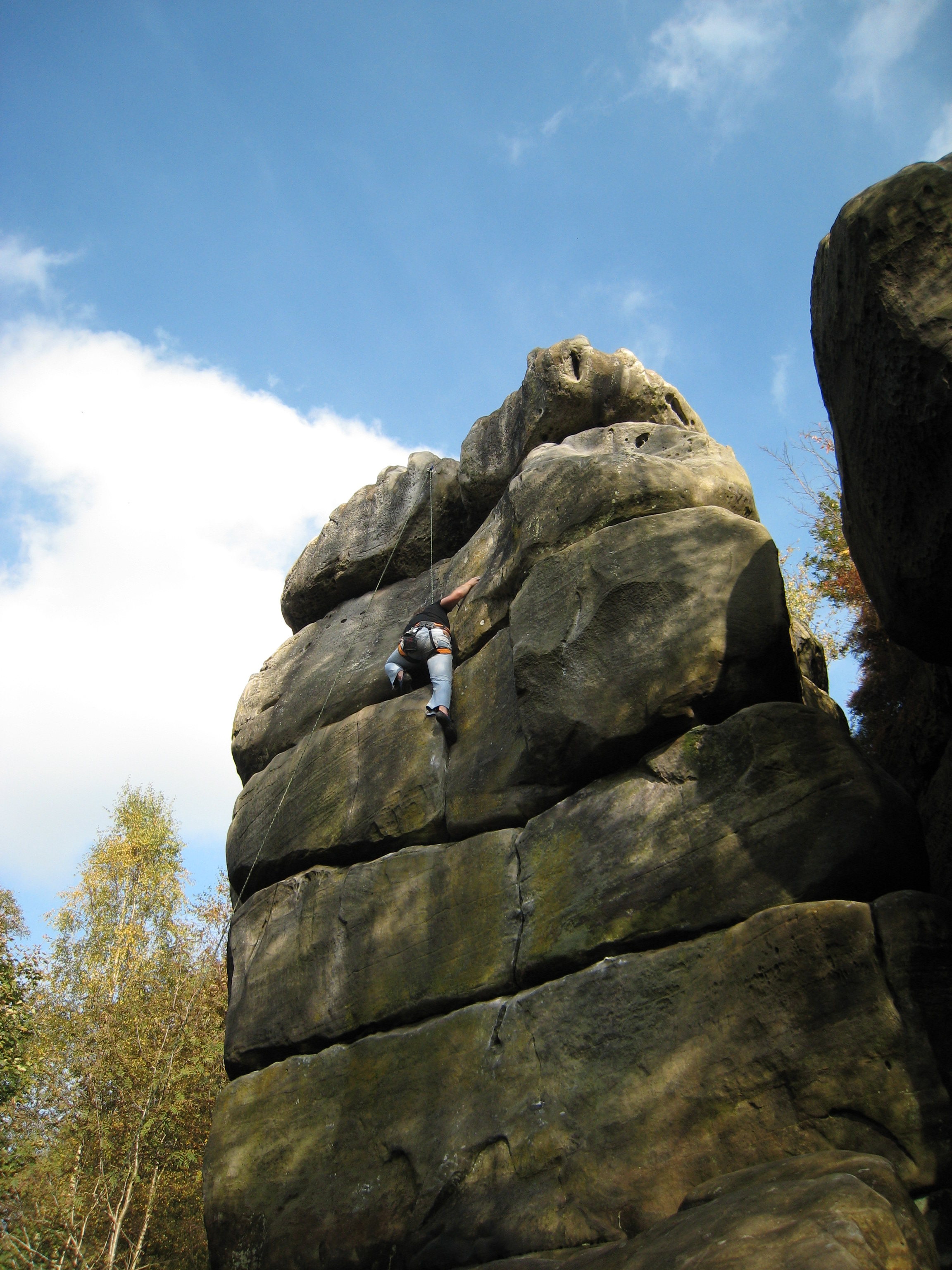
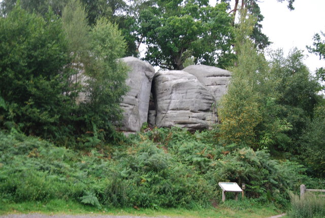
Harrison's Rocks

Harrison's Rocks is a series of sandstone crags approximately 1.5 kilometres (1 mi) south of the village of Groombridge in the county of East Sussex. The...

Groombridge railway station

Groombridge railway station is a station on the Spa Valley Railway (SVR) in Groombridge, East Sussex, England. Once a busy station serving four directions...
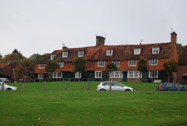
Groombridge

Groombridge is a village of about 1,600 people. It straddles the border between Kent and East Sussex, in England. The nearest large town is Royal Tunbridge...

High Rocks

High Rocks is a 3.2-hectare (7.9-acre) geological Site of Special Scientific Interest west of Tunbridge Wells in East Sussex and Kent. It is a Geological...

Groombridge Place

Groombridge Place is a moated manor house in the village of Groombridge near Tunbridge Wells, Kent, England. It has become a tourist attraction, noted...

Penn's Rocks

Penn's Rocks is a 10.2-hectare (25-acre) biological Site of Special Scientific Interest north of Crowborough in East Sussex.This site is a steep sided...

Nearby Amenities

Located within 500m of 51.098248,0.20607197
Rolling Stock
Addr City: The Forstal
Addr Housename: T/A Rolling Stock, Loco49 Ltd
Addr Postcode: TN3 9JY
Addr Street: Hamsell, Eridge
Office: trailer_dealer
Phone: +44 808 145 8488
Website: https://rollingstock.uk/
Lat/Long: 51.0941733/0.2077502
The data included in this document is from www.openstreetmap.org. The data is made available under ODbL.

Have you been to Birchett's Wood?

Leave your review of Birchett's Wood below (or comments, questions and feedback).