Street Coppice

Wood, Forest in Essex Uttlesford

England

Street Coppice

Little Barrington Hall Farm
Little Barrington Hall Farm Credit: Trevor Harris

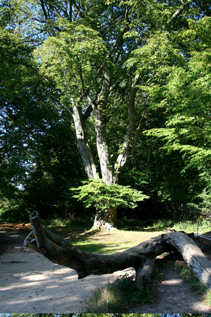
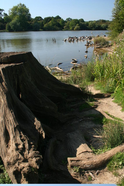
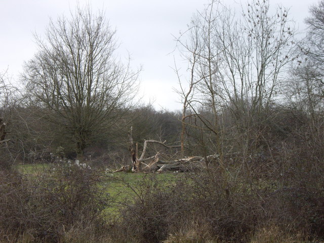
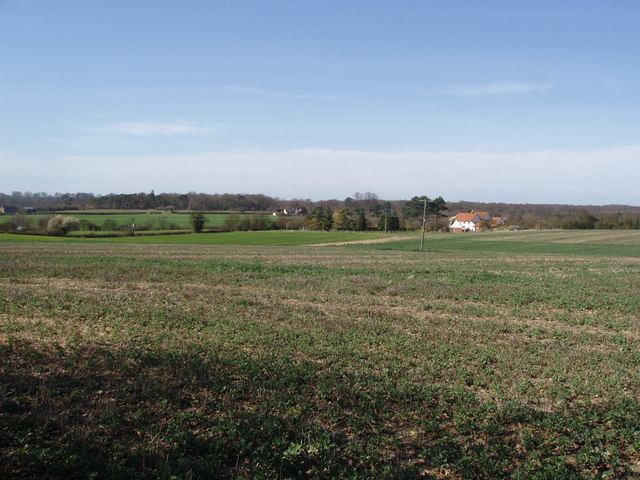
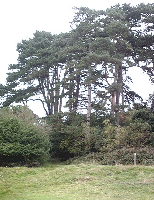
Street Coppice is a dense woodland located in the county of Essex, England. Situated near the village of Matching Tye, it covers an expansive area and is renowned for its natural beauty and rich biodiversity. The coppice is a designated Site of Special Scientific Interest (SSSI) due to its exceptional ecological value.

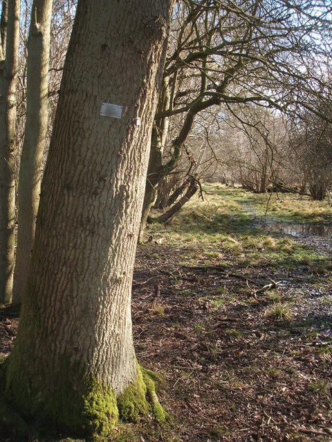
The woodland is primarily made up of deciduous trees, such as oak, beech, and birch, which create a vibrant and diverse canopy. The forest floor is adorned with a variety of wildflowers, ferns, and mosses, adding to its enchanting ambiance.

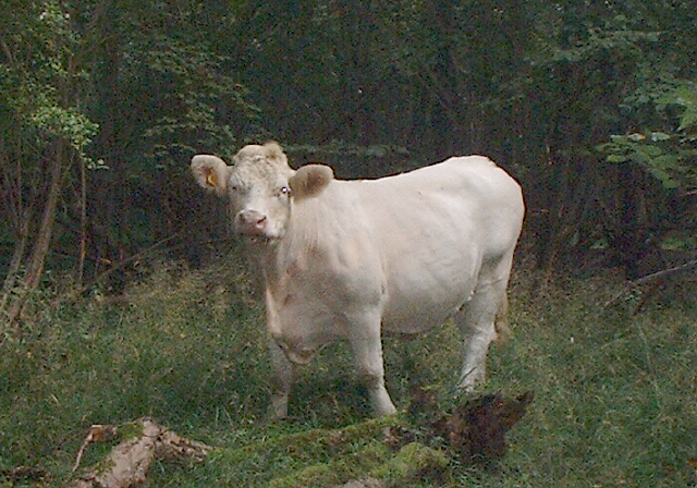
Street Coppice is a haven for numerous species of wildlife, including several rare and protected species. It is home to a thriving population of birds, including woodpeckers, owls, and various songbirds. Mammals such as badgers, foxes, and deer can also be spotted within the woodland, adding to its allure for nature enthusiasts and wildlife photographers.

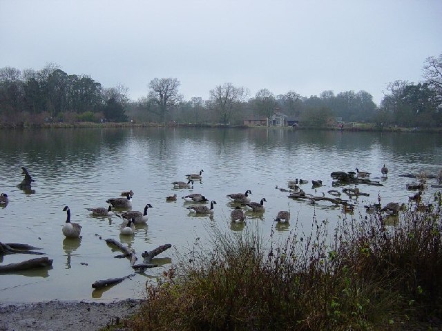
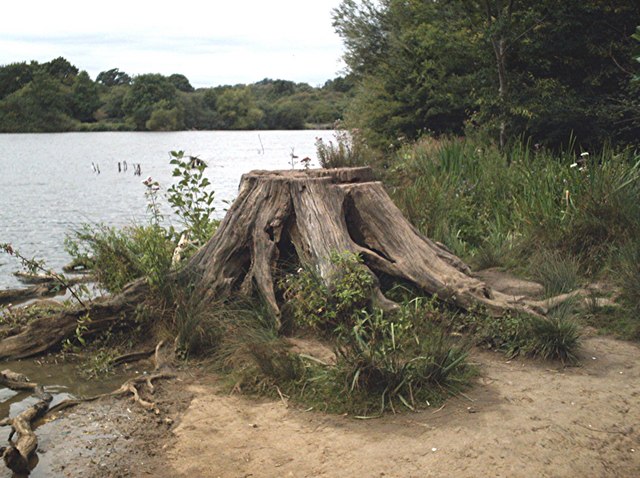
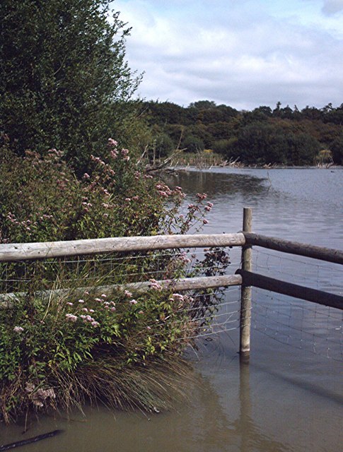
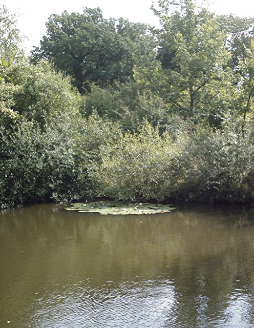
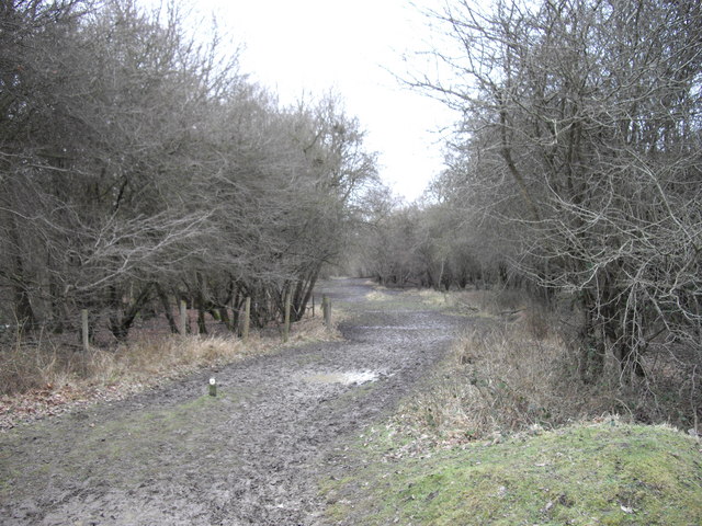
The coppice is crisscrossed by a network of well-maintained footpaths and trails, providing visitors with the opportunity to explore its enchanting surroundings. These paths lead to picturesque clearings and tranquil ponds, offering a peaceful retreat for those seeking solace in nature.

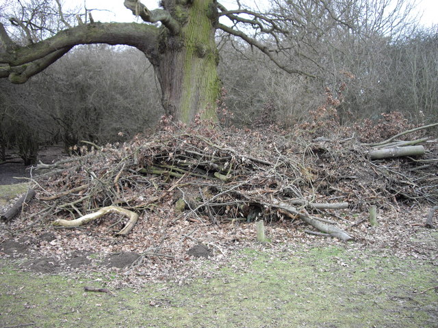
In addition to its natural appeal, Street Coppice holds historical significance. It is believed to have been an important source of timber during medieval times, supplying the local community with wood for construction and fuel.

Overall, Street Coppice is a captivating woodland that showcases the beauty of Essex's natural landscape. Its diverse flora and fauna, coupled with its historical importance, make it a must-visit destination for nature lovers and history enthusiasts alike.

If you have any feedback on the listing, please let us know in the comments section below.

Street Coppice Images

Images are sourced within 2km of 51.86685/0.24084159 or Grid Reference TL5421. Thanks to Geograph Open Source API. All images are credited.

Little Barrington Hall Farm
Hatfield Forest. Now a popular park cared for by the National Trust.
Hatfield Forest.
Now a popular park cared for by the National Trust.
The Shell House, Hatfield Forest Jacob Houblon III built The Shell House in about 1754. It was attached to a cottage by his new lake and was occupied by a housekeeper who kept poultry and peacocks. The cottage was later demolished. The Shell House has recently been restored by The National Trust.
The Shell House, Hatfield Forest
Jacob Houblon III built The Shell House in about 1754. It was attached to a cottage by his new lake and was occupied by a housekeeper who kept poultry and peacocks. The cottage was later demolished. The Shell House has recently been restored by The National Trust.
The Lake, Hatfield Forest Looking SW across to the Shell House. This lake was created by Jacob Houblon III in circa 1750 from marshland fed by the Shermore Brook.
The Lake, Hatfield Forest
Looking SW across to the Shell House. This lake was created by Jacob Houblon III in circa 1750 from marshland fed by the Shermore Brook.
House at Bush End, near Hatfield Forest, Essex
Heifer, Lodge Coppice, Hatfield Forest
High House Farm, Bush End
Hatfield Forest In Gravelpit Coppice near the lake.
Hatfield Forest
In Gravelpit Coppice near the lake.
The Lake, Hatfield Forest
Damaged trees in Hatfield Park Some unfortunate casualties from the storms in January 2007. Be sure to bring some wellies if you're venturing here too, it's a bit muddy!!
Damaged trees in Hatfield Park
Some unfortunate casualties from the storms in January 2007. Be sure to bring some wellies if you're venturing here too, it's a bit muddy!!
A ride (track) in Round Coppice, Hatfield Forest Hatfield Forest National Nature Reserve is owned and managed by the National Trust.
A ride (track) in Round Coppice, Hatfield Forest
Hatfield Forest National Nature Reserve is owned and managed by the National Trust.
Watch out- there's an airport about! Looking across this Essex farming landscape, it's difficult to believe that on the horizon is one of the busiest airports in Britain.  This is a view towards Little Barrington Hall and beyond that Hatfield Forest which is a National Trust countryside park.  If BAA get their way and Stansted Airport is tripled in size over the next 15 years, then areas like this will disappear under concrete and sprawling buildings disfigure the landscape.
Watch out- there's an airport about!
Looking across this Essex farming landscape, it's difficult to believe that on the horizon is one of the busiest airports in Britain. This is a view towards Little Barrington Hall and beyond that Hatfield Forest which is a National Trust countryside park. If BAA get their way and Stansted Airport is tripled in size over the next 15 years, then areas like this will disappear under concrete and sprawling buildings disfigure the landscape.
Lakeside stump Hatfield Forest.
Lakeside stump
Hatfield Forest.
Watering place A shallow,muddy,fenced area of the lake much used by thirsty cattle.
Watering place
A shallow,muddy,fenced area of the lake much used by thirsty cattle.
Pond in Collin's Coppice Hatfield Forest pond.
Pond in Collin's Coppice
Hatfield Forest pond.
Pines, Hatfield Forest A small stand of pine trees in Gravelpit Coppice.
Pines, Hatfield Forest
A small stand of pine trees in Gravelpit Coppice.
Muddy Path in Collin's Coppice Collin's Coppice is part of Hatfield Forest.
Muddy Path in Collin's Coppice
Collin's Coppice is part of Hatfield Forest.
Pruning waste under old oak at edge of Collin's Coppice
Show me another place!

Street Coppice is located at Grid Ref: TL5421 (Lat: 51.86685, Lng: 0.24084159)

Administrative County: Essex

District: Uttlesford

Police Authority: Essex

What 3 Words

///intruded.pine.rely. Near Takeley, Essex

Related Wikis

Stane Street Halt railway station

Stane Street Halt railway station was a station serving the community of Takeley Street to the west of the village of Takeley near Bishop's Stortford,...

Portingbury Hills

Portingbury Hills (grid reference TL5320) or Portingbury Rings is a hill in Hatfield Forest, Hatfield Broad Oak, Essex, United Kingdom. == Artefacts... ==

Hatfield Forest

Hatfield Forest is a 403.2-hectare (996-acre) biological Site of Special Scientific Interest in Essex, three miles east of Bishop's Stortford. It is also...

The Christian School, Takeley

The Christian School (Takeley) is an independent Christian school located in Takeley, Bishop's Stortford, Essex. The school caters for children of 7 through...

Takeley

Takeley is a village and civil parish in the Uttlesford district of Essex, England. == History == A number of theories have arisen over the origin of the...

Takeley railway station

Takeley railway station was a station serving the Hockerill area of Takeley in Bishop's Stortford, England. The station was 5 miles 11 chains (8.27 km...

Takeley Priory

Takeley Priory, dedicated to Saint Valery, was a Benedictine monastery in Takeley, Essex, England, founded by William the Conqueror between 1066 and 1086...

Takeley F.C.

Takeley Football Club is an English football club based in Takeley, Essex. The club are currently members of the Essex Senior League and play at Station...

Nearby Amenities

Located within 500m of 51.86685,0.24084159
Takeley Street
Place: village
Lat/Long: 51.8681429/0.2473882
Bus Stop
Rayleigh Cottage
Bus: yes
Naptan AtcoCode: 150020015009
Naptan Bearing: E
Naptan CommonName: Rayleigh Cottage
Naptan Indicator: Opp
Naptan Landmark: Rayleigh Cottage
Naptan NaptanCode: esxdgjmp
Naptan Street: Dunmow Road
Naptan Verified: no
Public Transport: platform
Source: naptan_import
Lat/Long: 51.8687166/0.2409217
Bus Stop
Rayleigh Cottage
Bus: yes
Naptan AtcoCode: 150020015010
Naptan Bearing: W
Naptan CommonName: Rayleigh Cottage
Naptan Indicator: o/s
Naptan Landmark: Rayleigh Cottage
Naptan NaptanCode: esxdgjmj
Naptan Street: Dunmow Road
Naptan Verified: no
Public Transport: platform
Source: naptan_import
Lat/Long: 51.8686716/0.2404546
Bus Stop
The Old Mill
Bus: yes
Naptan AtcoCode: 150020015011
Naptan Bearing: E
Naptan CommonName: The Old Mill
Naptan Indicator: o/s
Naptan Landmark: The Old Mill
Naptan NaptanCode: esxdgjmg
Naptan Street: Dunmow Road
Naptan Verified: no
Public Transport: platform
Source: naptan_import
Lat/Long: 51.8690302/0.2353154
Bus Stop
The Old Mill
Bus: yes
Naptan AtcoCode: 1500DGK002
Naptan Bearing: W
Naptan CommonName: The Old Mill
Naptan Indicator: Opp
Naptan Landmark: The Old Mill
Naptan NaptanCode: esxgmdjw
Naptan Street: Dunmow Road
Naptan Verified: no
Public Transport: platform
Source: naptan_import
Lat/Long: 51.869042/0.2346914
Bus Stop
The Green Man
Bus: yes
Naptan AtcoCode: 1500IM186
Naptan Bearing: W
Naptan CommonName: The Green Man
Naptan Indicator: Adj
Naptan Landmark: The Green Man
Naptan NaptanCode: esxdgjmt
Naptan Street: Dunmow Road
Naptan Verified: no
Public Transport: platform
Source: naptan_import
Lat/Long: 51.8682801/0.246362
The Green Man
Naptan AtcoCode: 1500IM186Y
Naptan Bearing: E
Naptan BusStopType: CUS
Naptan CommonName: The Green Man
Naptan Indicator: Opp
Naptan Landmark: The Green Man
Naptan NaptanCode: esxjdgwt
Naptan Street: Dunmow Road
Naptan Verified: no
Public Transport: platform
Source: naptan_import
Lat/Long: 51.8683624/0.2462935
Stane Street
Historic Railway: halt
Railway: site
Wikidata: Q7598686
Wikipedia: en:Stane Street Halt railway station
Lat/Long: 51.8675389/0.2458089
Street Coppice
Place: locality
Lat/Long: 51.8673433/0.240873
Spittlemore Coppice
Place: locality
Lat/Long: 51.8644813/0.2384053
Information: board
Tourism: information
Lat/Long: 51.8674476/0.2452583
Bench
Backrest: no
Lat/Long: 51.867576/0.2453108
Crossing
Crossing: unmarked
Crossing Markings: no
Lat/Long: 51.8682357/0.2474657
Speed Camera
Direction: backward
Lat/Long: 51.8690178/0.2352202
Information: board
Tourism: information
Lat/Long: 51.8675193/0.2458521
Bench
Lat/Long: 51.8675301/0.245832
Information: board
Tourism: information
Lat/Long: 51.8675756/0.2457033
Noexit: yes
Lat/Long: 51.8688429/0.2394116
Takeley Hill
Place: locality
Lat/Long: 51.8660377/0.2453313
The data included in this document is from www.openstreetmap.org. The data is made available under ODbL.

Have you been to Street Coppice?

Leave your review of Street Coppice below (or comments, questions and feedback).