Burnt House Wood

Wood, Forest in Sussex Wealden

England

Burnt House Wood

View from Redgate Mill Lane to an old railway line This was the Cuckoo Line. It became known as the Cuckoo Line because traditionally, the first cuckoo of spring was released from a cage at Heathfield Fair. The line was opened in two stages - between Polegate and Hailsham opened on 14th May 1849 and northwards from Hailsham to Eridge in 1880, the section here being opened on 1st September 1880. The Cuckoo Line was closed to passengers north of Hailsham on 14th June 1965 and the final stretch of line on 9th September 1968.

See <span class="nowrap"><a title="http://disused-stations.org.uk/r/rotherfield_and_mark_cross/index.shtml" rel="nofollow ugc noopener" href="http://disused-stations.org.uk/r/rotherfield_and_mark_cross/index.shtml">Link</a><img style="margin-left:2px;" alt="External link" title="External link - shift click to open in new window" src="https://s1.geograph.org.uk/img/external.png" width="10" height="10"/></span>  and <span class="nowrap"><a title="https://www.eastsussex.gov.uk/leisureandtourism/discover-east-sussex/countryside-sites/cuckootrail/" rel="nofollow ugc noopener" href="https://www.eastsussex.gov.uk/leisureandtourism/discover-east-sussex/countryside-sites/cuckootrail/">Link</a><img style="margin-left:2px;" alt="External link" title="External link - shift click to open in new window" src="https://s1.geograph.org.uk/img/external.png" width="10" height="10"/></span>  for more information.  This part of the old line is not accessible but can be seen here, just on this side of the woodland.
View from Redgate Mill Lane to an old railway line Credit: Marathon

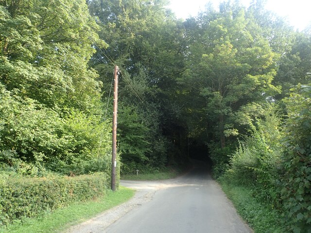
Burnt House Wood is a picturesque woodland located in Sussex, England. Covering an area of approximately 50 acres, it is a popular destination for nature enthusiasts and walkers alike. The woodland is characterized by its diverse range of flora and fauna, offering visitors a unique and tranquil experience.

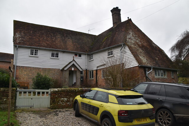
The name "Burnt House Wood" is derived from the remnants of a burnt down cottage that once stood within the woodland. Although the history of the cottage remains somewhat mysterious, its ruins add an eerie charm to the area. It is believed that the cottage was destroyed by a fire several decades ago, leaving only the stone foundations and a few walls behind.

The woodland itself is primarily composed of oak and beech trees, providing a dense canopy that filters sunlight and creates a cool, shaded atmosphere. Beneath the towering trees, the forest floor is covered with a carpet of ferns, bluebells, and wildflowers, adding bursts of color during the spring and summer months.

Wildlife thrives in Burnt House Wood, with various species making their home within its boundaries. Deer, foxes, badgers, and a wide variety of bird species can often be spotted among the trees. Visitors may also catch sight of butterflies, dragonflies, and other insects fluttering through the undergrowth.

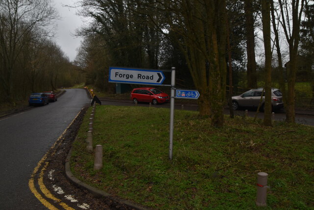
For those looking to explore the woodland, well-maintained footpaths and trails provide easy access to the different areas of interest. The peaceful ambiance and natural beauty of Burnt House Wood make it an ideal spot for a leisurely stroll, birdwatching, or simply escaping the hustle and bustle of everyday life.

If you have any feedback on the listing, please let us know in the comments section below.

Burnt House Wood Images

Images are sourced within 2km of 51.071552/0.19428146 or Grid Reference TQ5332. Thanks to Geograph Open Source API. All images are credited.

View from Redgate Mill Lane to an old railway line This was the Cuckoo Line. It became known as the Cuckoo Line because traditionally, the first cuckoo of spring was released from a cage at Heathfield Fair. The line was opened in two stages - between Polegate and Hailsham opened on 14th May 1849 and northwards from Hailsham to Eridge in 1880, the section here being opened on 1st September 1880. The Cuckoo Line was closed to passengers north of Hailsham on 14th June 1965 and the final stretch of line on 9th September 1968.

See <span class="nowrap"><a title="http://disused-stations.org.uk/r/rotherfield_and_mark_cross/index.shtml" rel="nofollow ugc noopener" href="http://disused-stations.org.uk/r/rotherfield_and_mark_cross/index.shtml">Link</a><img style="margin-left:2px;" alt="External link" title="External link - shift click to open in new window" src="https://s1.geograph.org.uk/img/external.png" width="10" height="10"/></span>  and <span class="nowrap"><a title="https://www.eastsussex.gov.uk/leisureandtourism/discover-east-sussex/countryside-sites/cuckootrail/" rel="nofollow ugc noopener" href="https://www.eastsussex.gov.uk/leisureandtourism/discover-east-sussex/countryside-sites/cuckootrail/">Link</a><img style="margin-left:2px;" alt="External link" title="External link - shift click to open in new window" src="https://s1.geograph.org.uk/img/external.png" width="10" height="10"/></span>  for more information.  This part of the old line is not accessible but can be seen here, just on this side of the woodland.
View from Redgate Mill Lane to an old railway line
This was the Cuckoo Line. It became known as the Cuckoo Line because traditionally, the first cuckoo of spring was released from a cage at Heathfield Fair. The line was opened in two stages - between Polegate and Hailsham opened on 14th May 1849 and northwards from Hailsham to Eridge in 1880, the section here being opened on 1st September 1880. The Cuckoo Line was closed to passengers north of Hailsham on 14th June 1965 and the final stretch of line on 9th September 1968. See LinkExternal link and LinkExternal link for more information. This part of the old line is not accessible but can be seen here, just on this side of the woodland.
The Sussex Border Path near Stitches Farm The Sussex Border Path drops down ahead to the valley of the Eridge Brook which also carries the Uckfield Line between Eridge and Crowborough. See <span class="nowrap"><a title="https://www.walkingenglishman.com/ldp/sussexborderpath.html" rel="nofollow ugc noopener" href="https://www.walkingenglishman.com/ldp/sussexborderpath.html">Link</a><img style="margin-left:2px;" alt="External link" title="External link - shift click to open in new window" src="https://s1.geograph.org.uk/img/external.png" width="10" height="10"/></span>
The Sussex Border Path near Stitches Farm
The Sussex Border Path drops down ahead to the valley of the Eridge Brook which also carries the Uckfield Line between Eridge and Crowborough. See LinkExternal link
Looking down to the former Cuckoo Line This was the Cuckoo Line. It became known as the Cuckoo Line because traditionally, the first cuckoo of spring was released from a cage at Heathfield Fair. The line was opened in two stages - between Polegate and Hailsham opened on 14th May 1849 and northwards from Hailsham to Eridge in 1880, the section here being opened on 1st September 1880. The Cuckoo Line was closed to passengers north of Hailsham on 14th June 1965 and the final stretch of line on 9th September 1968.

See <span class="nowrap"><a title="http://disused-stations.org.uk/r/rotherfield_and_mark_cross/index.shtml" rel="nofollow ugc noopener" href="http://disused-stations.org.uk/r/rotherfield_and_mark_cross/index.shtml">Link</a><img style="margin-left:2px;" alt="External link" title="External link - shift click to open in new window" src="https://s1.geograph.org.uk/img/external.png" width="10" height="10"/></span>  and <span class="nowrap"><a title="https://www.eastsussex.gov.uk/leisureandtourism/discover-east-sussex/countryside-sites/cuckootrail/" rel="nofollow ugc noopener" href="https://www.eastsussex.gov.uk/leisureandtourism/discover-east-sussex/countryside-sites/cuckootrail/">Link</a><img style="margin-left:2px;" alt="External link" title="External link - shift click to open in new window" src="https://s1.geograph.org.uk/img/external.png" width="10" height="10"/></span>  for more information.  This part of the old line is not accessible but can be seen here, just on this side of the woodland.
Looking down to the former Cuckoo Line
This was the Cuckoo Line. It became known as the Cuckoo Line because traditionally, the first cuckoo of spring was released from a cage at Heathfield Fair. The line was opened in two stages - between Polegate and Hailsham opened on 14th May 1849 and northwards from Hailsham to Eridge in 1880, the section here being opened on 1st September 1880. The Cuckoo Line was closed to passengers north of Hailsham on 14th June 1965 and the final stretch of line on 9th September 1968. See LinkExternal link and LinkExternal link for more information. This part of the old line is not accessible but can be seen here, just on this side of the woodland.
Looking towards the former Cuckoo Line This was the Cuckoo Line. It became known as the Cuckoo Line because traditionally, the first cuckoo of spring was released from a cage at Heathfield Fair. The line was opened in two stages - between Polegate and Hailsham opened on 14th May 1849 and northwards from Hailsham to Eridge in 1880, the section here being opened on 1st September 1880. The Cuckoo Line was closed to passengers north of Hailsham on 14th June 1965 and the final stretch of line on 9th September 1968.

See <span class="nowrap"><a title="http://disused-stations.org.uk/r/rotherfield_and_mark_cross/index.shtml" rel="nofollow ugc noopener" href="http://disused-stations.org.uk/r/rotherfield_and_mark_cross/index.shtml">Link</a><img style="margin-left:2px;" alt="External link" title="External link - shift click to open in new window" src="https://s1.geograph.org.uk/img/external.png" width="10" height="10"/></span>  and <span class="nowrap"><a title="https://www.eastsussex.gov.uk/leisureandtourism/discover-east-sussex/countryside-sites/cuckootrail/" rel="nofollow ugc noopener" href="https://www.eastsussex.gov.uk/leisureandtourism/discover-east-sussex/countryside-sites/cuckootrail/">Link</a><img style="margin-left:2px;" alt="External link" title="External link - shift click to open in new window" src="https://s1.geograph.org.uk/img/external.png" width="10" height="10"/></span>  for more information.  This part of the old line is not accessible but can be seen here, between the further hedge and the woodland.
Looking towards the former Cuckoo Line
This was the Cuckoo Line. It became known as the Cuckoo Line because traditionally, the first cuckoo of spring was released from a cage at Heathfield Fair. The line was opened in two stages - between Polegate and Hailsham opened on 14th May 1849 and northwards from Hailsham to Eridge in 1880, the section here being opened on 1st September 1880. The Cuckoo Line was closed to passengers north of Hailsham on 14th June 1965 and the final stretch of line on 9th September 1968. See LinkExternal link and LinkExternal link for more information. This part of the old line is not accessible but can be seen here, between the further hedge and the woodland.
Stitches Farm from the Sussex Border Path Beyond the farm, the Sussex Border Path drops down to the valley of the Eridge Brook which also carries the Uckfield Line between Eridge and Crowborough. See <span class="nowrap"><a title="https://www.walkingenglishman.com/ldp/sussexborderpath.html" rel="nofollow ugc noopener" href="https://www.walkingenglishman.com/ldp/sussexborderpath.html">Link</a><img style="margin-left:2px;" alt="External link" title="External link - shift click to open in new window" src="https://s1.geograph.org.uk/img/external.png" width="10" height="10"/></span>
Stitches Farm from the Sussex Border Path
Beyond the farm, the Sussex Border Path drops down to the valley of the Eridge Brook which also carries the Uckfield Line between Eridge and Crowborough. See LinkExternal link
The Sussex Border Path heading towards Stitches Farm Beyond the farm, the Sussex Border Path drops down to the valley of the Eridge Brook which also carries the Uckfield Line between Eridge and Crowborough. See <span class="nowrap"><a title="https://www.walkingenglishman.com/ldp/sussexborderpath.html" rel="nofollow ugc noopener" href="https://www.walkingenglishman.com/ldp/sussexborderpath.html">Link</a><img style="margin-left:2px;" alt="External link" title="External link - shift click to open in new window" src="https://s1.geograph.org.uk/img/external.png" width="10" height="10"/></span>
The Sussex Border Path heading towards Stitches Farm
Beyond the farm, the Sussex Border Path drops down to the valley of the Eridge Brook which also carries the Uckfield Line between Eridge and Crowborough. See LinkExternal link
The Sussex Border Path on the way to Stitches Farm Beyond the farm, the Sussex Border Path drops down to the valley of the Eridge Brook which also carries the Uckfield Line between Eridge and Crowborough. See <span class="nowrap"><a title="https://www.walkingenglishman.com/ldp/sussexborderpath.html" rel="nofollow ugc noopener" href="https://www.walkingenglishman.com/ldp/sussexborderpath.html">Link</a><img style="margin-left:2px;" alt="External link" title="External link - shift click to open in new window" src="https://s1.geograph.org.uk/img/external.png" width="10" height="10"/></span>
The Sussex Border Path on the way to Stitches Farm
Beyond the farm, the Sussex Border Path drops down to the valley of the Eridge Brook which also carries the Uckfield Line between Eridge and Crowborough. See LinkExternal link
View from Sandhill Lane This is close to and within the sound of the A26.
View from Sandhill Lane
This is close to and within the sound of the A26.
View from Sandhill Lane This is close to Sandhill Cottages and looks across the valley through which the Uckfield line runs.
View from Sandhill Lane
This is close to Sandhill Cottages and looks across the valley through which the Uckfield line runs.
Sandhill Lane Sandhill Lane here passes through Roughets Wood but keeps along the south side of the wood.
Sandhill Lane
Sandhill Lane here passes through Roughets Wood but keeps along the south side of the wood.
View from Sandhill Lane This view is close to Sandhill Cottages, which are on the right, and looks across the valley through which the Uckfield line runs.
View from Sandhill Lane
This view is close to Sandhill Cottages, which are on the right, and looks across the valley through which the Uckfield line runs.
Sandhill Lane Sandhill Lane enters Slab Wood just ahead. This is close to and within the sound of the A26.
Sandhill Lane
Sandhill Lane enters Slab Wood just ahead. This is close to and within the sound of the A26.
Eridge Station Eridge station is on the Uckfield branch of the Oxted line in southern England and serves a rural district around Eridge in East Sussex. It is 57 km from London Bridge. The station is managed by Southern. It opened in 1868.
Train services from the station are provided by Southern. Also, heritage services connecting to Groombridge, High Rocks and Tunbridge Wells West are run by the Spa Valley Railway.
Eridge Station
Eridge station is on the Uckfield branch of the Oxted line in southern England and serves a rural district around Eridge in East Sussex. It is 57 km from London Bridge. The station is managed by Southern. It opened in 1868. Train services from the station are provided by Southern. Also, heritage services connecting to Groombridge, High Rocks and Tunbridge Wells West are run by the Spa Valley Railway.
Roadsign, Eridge Station
Renby Farm Cottages
Renby Farm Cottages
Renby Farmhouse Listed buildings and structures are officially designated as being of special architectural, historical or cultural significance. There are over half a million listed structures in the United Kingdom, covered by around 375,000 listings.
Listed status is more commonly associated with buildings or groups of buildings, however it can cover many other structures, including bridges, headstones, steps, ponds, monuments, walls, phone boxes, wrecks, parks, and heritage sites, and in more recent times a road crossing (Abbey Road) and graffiti art (Banksy 'Spy-booth') have been included.

In England and Wales there are three main listing designations;
Grade I (2.5%) - exceptional interest, sometimes considered to be internationally important.
Grade II* (5.5%) - particularly important buildings of more than special interest. 
Grade II (92%) - nationally important and of special interest. 

There are also locally listed structures (at the discretion of local authorities) using A, B and C designations.

In Scotland three classifications are also used but the criteria are different. There are around 47,500 Listed buildings.
Category A (8%)- generally equivalent to Grade I and II* in England and Wales
Category B (51%)- this appears generally to cover the ground of Grade II, recognising national importance.
Category C (41%)- buildings of local importance, probably with some overlap with English Grade II.

In Northern Ireland the criteria are similar to Scotland, but the classifications are:
Grade A (2.3%)
Grade B+ (4.7%)
Grade B (93%)

Read more at Wikipedia <span class="nowrap"><a title="http://en.wikipedia.org/wiki/Listed_building" rel="nofollow ugc noopener" href="http://en.wikipedia.org/wiki/Listed_building">Link</a><img style="margin-left:2px;" alt="External link" title="External link - shift click to open in new window" src="https://s1.geograph.org.uk/img/external.png" width="10" height="10"/></span>
Renby Farmhouse
Listed buildings and structures are officially designated as being of special architectural, historical or cultural significance. There are over half a million listed structures in the United Kingdom, covered by around 375,000 listings. Listed status is more commonly associated with buildings or groups of buildings, however it can cover many other structures, including bridges, headstones, steps, ponds, monuments, walls, phone boxes, wrecks, parks, and heritage sites, and in more recent times a road crossing (Abbey Road) and graffiti art (Banksy 'Spy-booth') have been included. In England and Wales there are three main listing designations; Grade I (2.5%) - exceptional interest, sometimes considered to be internationally important. Grade II* (5.5%) - particularly important buildings of more than special interest. Grade II (92%) - nationally important and of special interest. There are also locally listed structures (at the discretion of local authorities) using A, B and C designations. In Scotland three classifications are also used but the criteria are different. There are around 47,500 Listed buildings. Category A (8%)- generally equivalent to Grade I and II* in England and Wales Category B (51%)- this appears generally to cover the ground of Grade II, recognising national importance. Category C (41%)- buildings of local importance, probably with some overlap with English Grade II. In Northern Ireland the criteria are similar to Scotland, but the classifications are: Grade A (2.3%) Grade B+ (4.7%) Grade B (93%) Read more at Wikipedia LinkExternal link
Renby Farmhouse Grade II listed.
Renby Farmhouse
Grade II listed.
Renby Oast
Renby Oast
Show me another place!

Burnt House Wood is located at Grid Ref: TQ5332 (Lat: 51.071552, Lng: 0.19428146)

Administrative County: East Sussex

District: Wealden

Police Authority: Sussex

What 3 Words

///juicy.welcome.marketing. Near Crowborough, East Sussex

Related Wikis

Bowles Rocks

Bowles Rocks is a sandstone crag in the county of East Sussex, on the border with Kent, approximately 8 kilometres (5 mi) south of the town of Royal Tunbridge...

Bowles Outdoor Centre

Bowles Outdoor Centre is an outdoor education/outdoor learning centre in southeast England, located between Royal Tunbridge Wells and Crowborough at Bowles...

Bream Wood

Bream Wood is a 7.8-hectare (19-acre) biological Site of Special Scientific Interest north of Crowborough in East Sussex.This steep sided valley wood has...

Eridge railway station

Eridge railway station is on the Uckfield branch of the Oxted line in southern England and serves a rural district around Eridge in East Sussex. It is...

Beacon Academy

Beacon Academy (formerly Beacon Community College) is a coeducational secondary school and sixth form located in Crowborough in the English county of East...

Pratt's Mill, Crowborough

Pratt's Mill is a tower mill at Crowborough, Sussex, England which has been truncated and converted to residential accommodation. == History == Pratt...

Jarvis Brook

Jarvis Brook is a village between Crowborough and Rotherfield in the Borough of Wealden East Sussex. Crowborough Railway Station, on the Uckfield branch...

Crowborough Community Church

Crowborough Community Church (also known as Community Church, Crowborough) is an Evangelical church in the town of Crowborough in East Sussex, England...

Nearby Amenities

Located within 500m of 51.071552,0.19428146
Pub
The Boars Head Inn
Addr City: Crowborough
Addr Housename: The Boars Head Inn
Addr Postcode: TN6 3GR
Addr Street: Boars Head Road
Brewery: Harveys_&_other_guest_Ales
Description: Unspoilt 17th. Century Inn.
Email: boars.head@mail.com
Internet Access: yes
Opening Hours: Mo-Su 12:00-23:00
Outdoor Seating: yes
Payment Cash: yes
Payment Maestro: yes
Payment Mastercard: yes
Payment Visa: yes
Phone: +44 1892 660447
Smoking: outside
Wikidata: Q26279196
Lat/Long: 51.0715416/0.1886372
Bus Stop
The Boars Head Inn
Naptan AtcoCode: 1400WE0021
Naptan NaptanCode: esuatwpt
Public Transport: platform
Lat/Long: 51.0721768/0.1883027
Post Box
Operator: Royal Mail
Post Box Type: lamp
Ref: TN6 222
Royal Cypher: EIIR
Royal Cypher Wikidata: Q33102113
Lat/Long: 51.0717439/0.1881957
Bus Stop
The Boars Head Inn
Public Transport: platform
Lat/Long: 51.0718248/0.1882639
Golf: pin
Lat/Long: 51.0695018/0.1934527
Golf: pin
Lat/Long: 51.0695251/0.1897626
Golf: pin
Lat/Long: 51.0706127/0.1875385
Golf: pin
Lat/Long: 51.0696716/0.1913864
Golf: pin
Lat/Long: 51.0683632/0.1909327
Man Made: mast
Lat/Long: 51.0731641/0.1890648
The data included in this document is from www.openstreetmap.org. The data is made available under ODbL.

Have you been to Burnt House Wood?

Leave your review of Burnt House Wood below (or comments, questions and feedback).