Deanland Wood

Wood, Forest in Sussex Wealden

England

Deanland Wood

Old lane near Chalvington Many lanes and roads in this area of Sussex lead south to the pastures on the South Downs. With the arrival of the car many lanes were made up but some did not, lost their importance and now are bridleways or footpaths. This route begins deep in the Weald then heads south but stops at the A22, becoming a track until it reaches Chalvington Stud Farm before becoming a made up road again. What initially looks like a lane from the period of enclosures actually dates back to the Roman times. This view looks south and is taken the crossroads of tracks just south of the A22. See <a href="https://www.geograph.org.uk/gridref/TQ5311">TQ5311</a> for where the west track ends.
Old lane near Chalvington Credit: Simon Carey

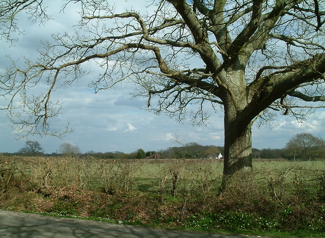
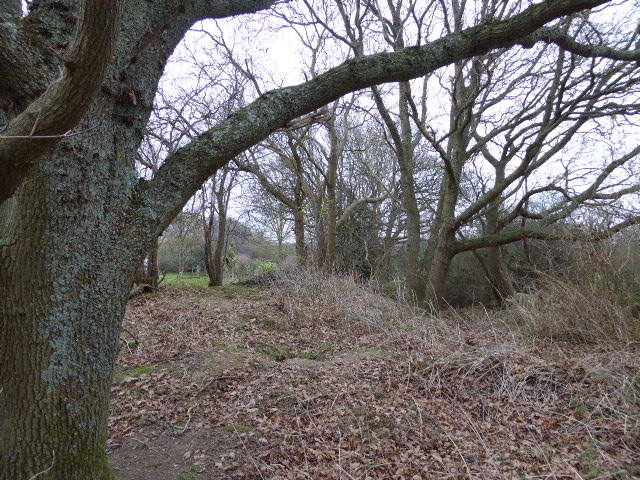
Deanland Wood is a picturesque woodland located in the county of Sussex, England. Spanning an area of approximately 50 hectares, it is nestled within the South Downs National Park, showcasing the region's natural beauty. The woodland is situated near the village of Golden Cross, just a short distance from the town of Hailsham.

Deanland Wood boasts a diverse range of tree species, including oak, ash, beech, and birch, which create a rich and vibrant canopy. The forest floor is adorned with an array of wildflowers, such as bluebells, primroses, and wood anemones, adding a splash of color to the surroundings during the spring season.

As a designated Site of Special Scientific Interest (SSSI), the wood is recognized for its ecological importance. It provides a habitat for a variety of wildlife, including deer, badgers, foxes, and a multitude of bird species. Nature enthusiasts and birdwatchers frequent the area to observe and appreciate the diverse fauna that calls Deanland Wood home.

The wood features several walking trails and paths, inviting visitors to explore its enchanting surroundings. These routes offer glimpses of the mesmerizing landscape, allowing hikers and walkers to immerse themselves in the tranquility of the woodland. The wood is maintained by the Forestry Commission, ensuring the preservation of its natural ecosystem and its accessibility to the public.

Overall, Deanland Wood is a cherished natural gem in Sussex, offering visitors an opportunity to connect with nature and experience the serenity of a traditional English woodland.

If you have any feedback on the listing, please let us know in the comments section below.

Deanland Wood Images

Images are sourced within 2km of 50.884249/0.17659666 or Grid Reference TQ5311. Thanks to Geograph Open Source API. All images are credited.

Old lane near Chalvington Many lanes and roads in this area of Sussex lead south to the pastures on the South Downs. With the arrival of the car many lanes were made up but some did not, lost their importance and now are bridleways or footpaths. This route begins deep in the Weald then heads south but stops at the A22, becoming a track until it reaches Chalvington Stud Farm before becoming a made up road again. What initially looks like a lane from the period of enclosures actually dates back to the Roman times. This view looks south and is taken the crossroads of tracks just south of the A22. See <a href="https://www.geograph.org.uk/gridref/TQ5311">TQ5311</a> for where the west track ends.
Old lane near Chalvington
Many lanes and roads in this area of Sussex lead south to the pastures on the South Downs. With the arrival of the car many lanes were made up but some did not, lost their importance and now are bridleways or footpaths. This route begins deep in the Weald then heads south but stops at the A22, becoming a track until it reaches Chalvington Stud Farm before becoming a made up road again. What initially looks like a lane from the period of enclosures actually dates back to the Roman times. This view looks south and is taken the crossroads of tracks just south of the A22. See TQ5311 for where the west track ends.
Crossroads near Golden Cross Looking north where the road from Chalvington turns left and heads for Golden Cross. Sheepcote Lane which turns right is a dead end but follows the route of the track from <a href="https://www.geograph.org.uk/gridref/TQ5411">TQ5411</a> before ending at Semeston Croft <a href="https://www.geograph.org.uk/gridref/TQ5309">TQ5309</a> and becoming a track again until reaching Chalvington. The northern route has not become a road and meets up with the track seen in TQ5411 a mile or so east.
Crossroads near Golden Cross
Looking north where the road from Chalvington turns left and heads for Golden Cross. Sheepcote Lane which turns right is a dead end but follows the route of the track from TQ5411 before ending at Semeston Croft TQ5309 and becoming a track again until reaching Chalvington. The northern route has not become a road and meets up with the track seen in TQ5411 a mile or so east.
Sheepcote Lane, near Chalvington Looking south just beyond Mount Pleasant Farm. This is the same lane from <a href="https://www.geograph.org.uk/gridref/TQ5411">TQ5411</a>.
Sheepcote Lane, near Chalvington
Looking south just beyond Mount Pleasant Farm. This is the same lane from TQ5411.
Hedgerow Oak at Whitesmith Low Weald landscape looking towards Randall's Farm, with Chiddingly Church in the distance.
Hedgerow Oak at Whitesmith
Low Weald landscape looking towards Randall's Farm, with Chiddingly Church in the distance.
Pollards Farm Cottage On the road that links Chalvington and Golden Cross.
Pollards Farm Cottage
On the road that links Chalvington and Golden Cross.
Golden Cross Inn, Golden Cross The road in front is the A22. The village itself has grown up around a crossroad junction of routes.
Golden Cross Inn, Golden Cross
The road in front is the A22. The village itself has grown up around a crossroad junction of routes.
The Old Mill, Golden Cross Built sometime in the early 19th century and known as either Wickens Mill or Dicker Mill. It remained operational until the eve of the First World War though only the roundhouse survives of the former post mill which has now been converted into a holiday home known as Jasmine Mill. See also <a href="https://www.geograph.org.uk/photo/2802150">TQ5312 : The Old Mill, Golden Cross</a> for a similar view.
The Old Mill, Golden Cross
Built sometime in the early 19th century and known as either Wickens Mill or Dicker Mill. It remained operational until the eve of the First World War though only the roundhouse survives of the former post mill which has now been converted into a holiday home known as Jasmine Mill. See also TQ5312 : The Old Mill, Golden Cross for a similar view.
Deanland Airfield Constructed in the spring of 1943 as an advanced airfield landing ground to help the D Day landings. It closed down after the war and was reactivated in 1963 by a local farmer as a landing strip for his own planes. From that point it grew as more people wished to have a base for their planes.
Deanland Airfield
Constructed in the spring of 1943 as an advanced airfield landing ground to help the D Day landings. It closed down after the war and was reactivated in 1963 by a local farmer as a landing strip for his own planes. From that point it grew as more people wished to have a base for their planes.
Pond, near Veals Farm A private angling pond next to the bridleway that links Ripe Lane with Broomhams. The building belongs to Deanland Airfield.
Pond, near Veals Farm
A private angling pond next to the bridleway that links Ripe Lane with Broomhams. The building belongs to Deanland Airfield.
Entrance to Green Lane Cottage The drive is in fact a bridleway that links Ripe with Deanland Road.
Entrance to Green Lane Cottage
The drive is in fact a bridleway that links Ripe with Deanland Road.
Brickfields Farm Can you spot the cunningly disguised mobile phone mast?
Brickfields Farm
Can you spot the cunningly disguised mobile phone mast?
Bridleway, Eleven Acre Wood This narrow and muddy path links Ripe Lane with Broomham.
Bridleway, Eleven Acre Wood
This narrow and muddy path links Ripe Lane with Broomham.
Eight Acre Wood Taken from Nash Street.
Eight Acre Wood
Taken from Nash Street.
Nash Street Wood Following the footpath that leads to Thunder Hill
Nash Street Wood
Following the footpath that leads to Thunder Hill
Green Lane A surviving track from the former Dicker Common which failed to become macadamised. The bridge to the left marks the start of the footpath to Chalvington Stud Farm. The former lane runs from Camberlot Road to Sheepcote Lane. Despite it being designated as a footpath it seems to be used by motor vehicles and horses.
Green Lane
A surviving track from the former Dicker Common which failed to become macadamised. The bridge to the left marks the start of the footpath to Chalvington Stud Farm. The former lane runs from Camberlot Road to Sheepcote Lane. Despite it being designated as a footpath it seems to be used by motor vehicles and horses.
Camberlot Wood The footpath from Clover Farm to Chalvington Stud Farm follows its southern border.
Camberlot Wood
The footpath from Clover Farm to Chalvington Stud Farm follows its southern border.
Low Weald Landscape This part of the Weald has been farmed since the Romans. Looking south west from Camberlot Wood.
Low Weald Landscape
This part of the Weald has been farmed since the Romans. Looking south west from Camberlot Wood.
Chalvington Road Looking towards Golden Cross. The round building to the left is this, <a href="https://www.geograph.org.uk/photo/177461">TQ5312 : The Old Mill, Golden Cross</a> whilst the big white building to the right is a caravan showroom. The straightness of the road indicates that it was made after the enclosure of the former common.
Chalvington Road
Looking towards Golden Cross. The round building to the left is this, TQ5312 : The Old Mill, Golden Cross whilst the big white building to the right is a caravan showroom. The straightness of the road indicates that it was made after the enclosure of the former common.
Show me another place!

Deanland Wood is located at Grid Ref: TQ5311 (Lat: 50.884249, Lng: 0.17659666)

Administrative County: East Sussex

District: Wealden

Police Authority: Sussex

What 3 Words

///grief.suspect.dispenser. Near Hailsham, East Sussex

Nearby Locations

Deanland Wood

Related Wikis

Golden Cross, East Sussex

Golden Cross is a small village in the Wealden district of East Sussex, England. Its nearest town is Hailsham, which lies approximately 3+1⁄2 miles (6...

Burgh Hill Farm Meadow

Burgh Hill Farm Meadow is a 0.9-hectare (2.2-acre) biological Site of Special Scientific Interest west of Hailsham in East Sussex.This meadow is managed...

RAF Deanland

RAF Deanland is a former Royal Air Force advanced landing ground located 4 miles (6.4 km) west of Hailsham, East Sussex and 13.4 miles (21.6 km) north...

Farleys House

Farleys House near Chiddingly, East Sussex, has been converted into a museum and archive featuring the lives and work of its former residents, the photographer...

Whitesmith maze

A plantation of willows near Whitesmith, East Sussex, in England forms a maze in the shape of a quotation from the Bible. The maze was planted by local...

Lower Dicker

Lower Dicker is a 0.1-hectare (0.25-acre) geological Site of Special Scientific Interest west of Hailsham in East Sussex. It is a Geological Conservation...

Chalvington with Ripe

The civil parish of Chalvington with Ripe, in the Wealden District of East Sussex, England, is made up of the two villages, Chalvington and Ripe. They...

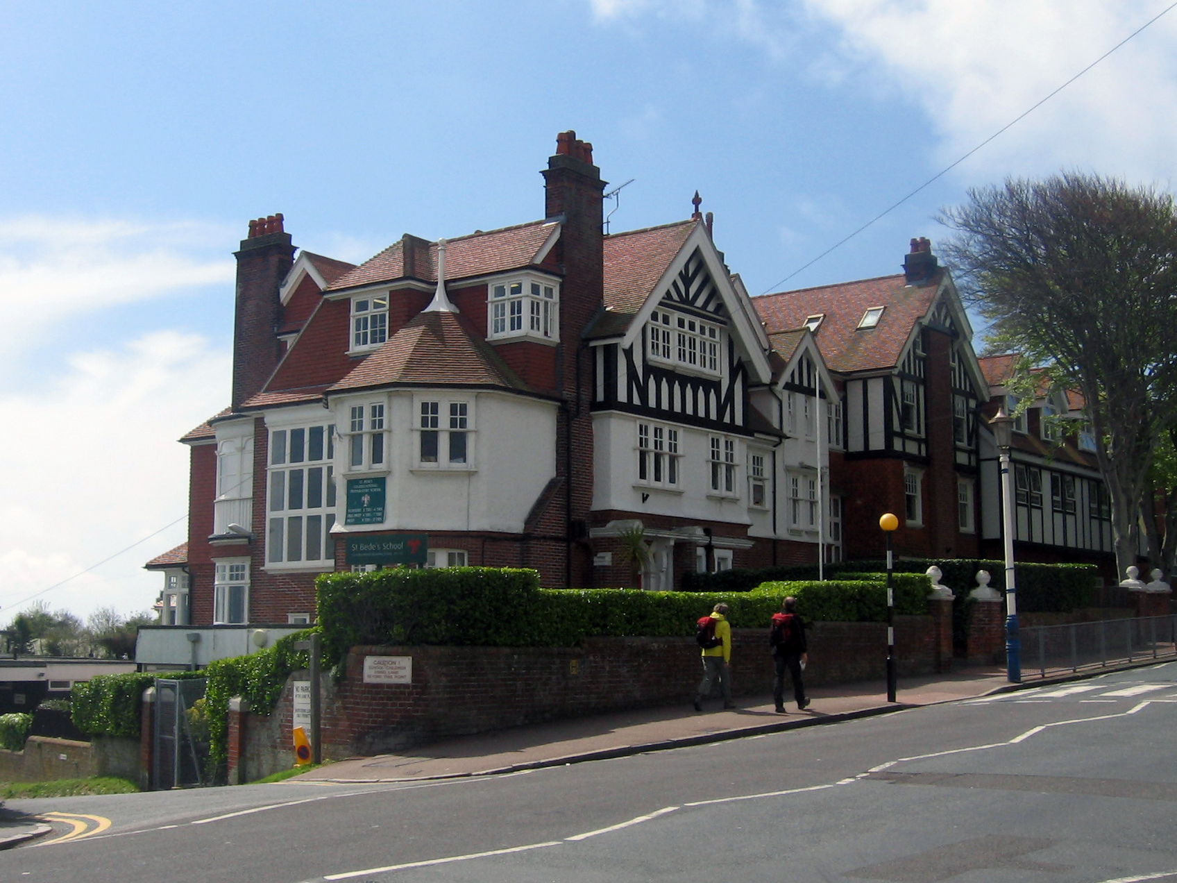
Bede's School, Eastbourne

Bede's School (until 2012, known as St Bede's School), consists of a preparatory school and pre-preparatory nursery in Holywell, Meads, Eastbourne, East...

Nearby Amenities

Located within 500m of 50.884249,0.17659666
Material: wood
Power: pole
Source: bing
Lat/Long: 50.8803294/0.1785578
Material: wood
Power: pole
Source: bing
Lat/Long: 50.880342/0.1765872
Material: wood
Power: pole
Source: bing
Lat/Long: 50.8810763/0.1796014
Material: wood
Power: portal
Source: bing
Lat/Long: 50.8817072/0.1805246
Material: wood
Power: portal
Source: bing
Lat/Long: 50.8820063/0.18241
Material: wood
Power: pole
Source: bing
Lat/Long: 50.8829553/0.1825244
Material: wood
Power: pole
Source: bing
Lat/Long: 50.8837549/0.1825999
Material: wood
Power: pole
Source: bing
Lat/Long: 50.8846026/0.1827057
Material: wood
Power: pole
Source: bing
Lat/Long: 50.8850855/0.1807222
Material: wood
Power: pole
Source: bing
Lat/Long: 50.8857463/0.183279
Turning Loop
Lat/Long: 50.8853001/0.1755858
Barrier: yes
Lat/Long: 50.8848375/0.179875
The data included in this document is from www.openstreetmap.org. The data is made available under ODbL.

Have you been to Deanland Wood?

Leave your review of Deanland Wood below (or comments, questions and feedback).