Boar's Head Wood

Wood, Forest in Sussex Wealden

England

Boar's Head Wood

Foxy Field/Round Field The name of the fields according to Withyham's 1842 tithe map that have been merged to form a larger unit. Foxy Field is in the foreground whilst Round Field is beyond the hedgerow in the distance adjacent to Badbrook Wood. Now part of Park Grove Deer Farm.
Foxy Field/Round Field Credit: Simon Carey

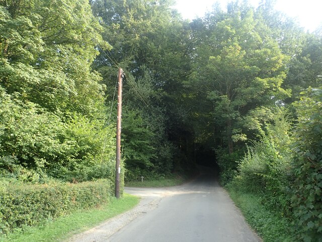
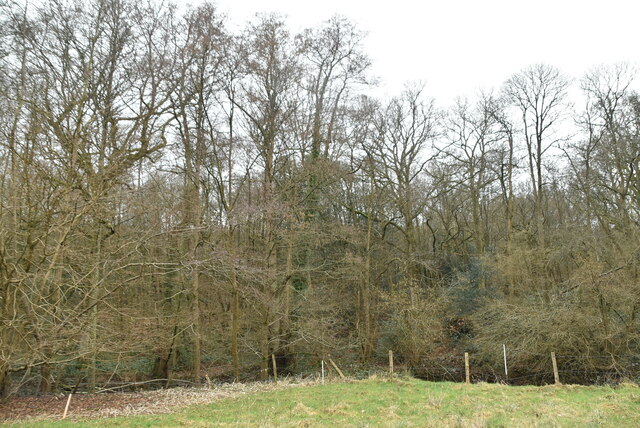
Boar's Head Wood is a breathtaking woodland located in Sussex, England. Stretching across an area of approximately 100 acres, this forest is renowned for its natural beauty and rich biodiversity. The wood is predominantly made up of a variety of broadleaf trees, including oak, beech, and chestnut, which create a dense and lush canopy overhead.

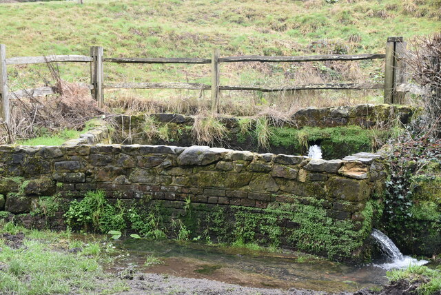
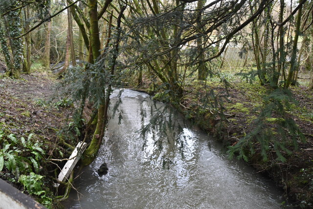
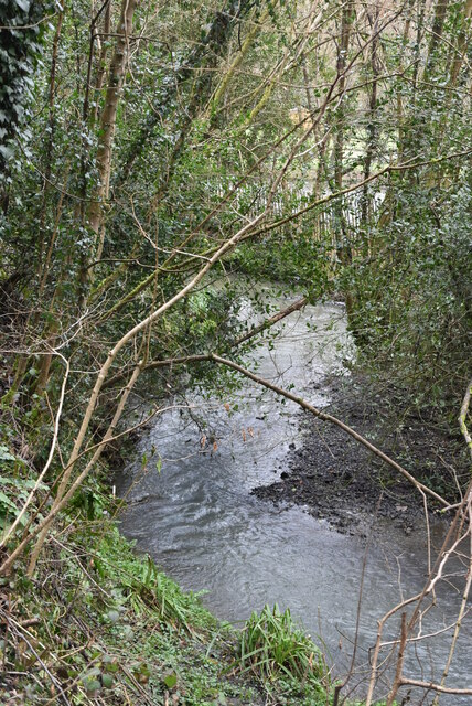
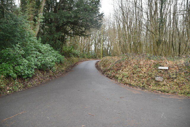
The forest floor of Boar's Head Wood is covered with a thick carpet of moss, ferns, and wildflowers, adding to its enchanting atmosphere. The wood is crisscrossed with a network of well-maintained footpaths, allowing visitors to explore the area and immerse themselves in its tranquil surroundings. These paths lead to various points of interest, such as a small stream that meanders through the wood, creating a soothing soundtrack of flowing water.

Boar's Head Wood is not only a haven for nature enthusiasts but also a sanctuary for a diverse range of wildlife. The forest is home to numerous species of birds, including woodpeckers, owls, and warblers, which fill the air with their melodic songs. Squirrels can be seen scampering through the treetops, while rabbits and deer occasionally make an appearance, adding to the sense of wilderness and untamed beauty.

The wood has been carefully preserved by local conservation efforts, ensuring that its natural ecosystem remains intact. It serves as an important habitat for rare and endangered species, making it a site of ecological significance. Visitors to Boar's Head Wood can revel in its peaceful atmosphere, reconnect with nature, and witness the wonders of a truly remarkable woodland.

If you have any feedback on the listing, please let us know in the comments section below.

Boar's Head Wood Images

Images are sourced within 2km of 51.073871/0.1818857 or Grid Reference TQ5232. Thanks to Geograph Open Source API. All images are credited.

Foxy Field/Round Field The name of the fields according to Withyham's 1842 tithe map that have been merged to form a larger unit. Foxy Field is in the foreground whilst Round Field is beyond the hedgerow in the distance adjacent to Badbrook Wood. Now part of Park Grove Deer Farm.
Foxy Field/Round Field
The name of the fields according to Withyham's 1842 tithe map that have been merged to form a larger unit. Foxy Field is in the foreground whilst Round Field is beyond the hedgerow in the distance adjacent to Badbrook Wood. Now part of Park Grove Deer Farm.
Park Grove/Long Field The name of the fields according to Withyham's 1842 tithe map that have been merged to form a larger unit. Park Grove is in the foreground whilst Long field was to the east adjacent to Badbrook Wood. Both are bounded to the south by Parkgrove Wood.
Park Grove/Long Field
The name of the fields according to Withyham's 1842 tithe map that have been merged to form a larger unit. Park Grove is in the foreground whilst Long field was to the east adjacent to Badbrook Wood. Both are bounded to the south by Parkgrove Wood.
Barn Mead The name of the field according to Withyham's 1842 tithe map located to the south of Park Grove.
Barn Mead
The name of the field according to Withyham's 1842 tithe map located to the south of Park Grove.
Park Grove Cottage Former farm outbuilding belonging to Parkgrove Farm whose original farmhouse, now called Home Place, can be seen in the distance.
Park Grove Cottage
Former farm outbuilding belonging to Parkgrove Farm whose original farmhouse, now called Home Place, can be seen in the distance.
Home Place Originally a farmhouse for Wiggs Farm later known as Parkgrove Farm. Now converted into a residence.
Home Place
Originally a farmhouse for Wiggs Farm later known as Parkgrove Farm. Now converted into a residence.
View from Sandhill Lane This is close to and within the sound of the A26.
View from Sandhill Lane
This is close to and within the sound of the A26.
View from Sandhill Lane This is close to Sandhill Cottages and looks across the valley through which the Uckfield line runs.
View from Sandhill Lane
This is close to Sandhill Cottages and looks across the valley through which the Uckfield line runs.
Sandhill Lane Sandhill Lane here passes through Roughets Wood but keeps along the south side of the wood.
Sandhill Lane
Sandhill Lane here passes through Roughets Wood but keeps along the south side of the wood.
View from Sandhill Lane This view is close to Sandhill Cottages, which are on the right, and looks across the valley through which the Uckfield line runs.
View from Sandhill Lane
This view is close to Sandhill Cottages, which are on the right, and looks across the valley through which the Uckfield line runs.
Sandhill Lane Sandhill Lane enters Slab Wood just ahead. This is close to and within the sound of the A26.
Sandhill Lane
Sandhill Lane enters Slab Wood just ahead. This is close to and within the sound of the A26.
Forge Rd
Forge Rd
Hamilton House
Hamilton House
Roadside spring, Forge Lane
Stream by Forge Rd
Stream by Forge Rd
Stream out of Hamsell Lake The iron industry thrived in the Weald of Kent, Sussex & Surrey from Pre-Roman times until the Industrial revolution. The industry was based on Iron ore from the Cretaceous rocks of the area and charcoal from the woodlands. The remains of the industry can still be seen in the many Hammer ponds in the area and woodland names such as Furnace, Minepit etc. The use of coal not charcoal saw the demise of the industry.
Wikipedia: <span class="nowrap"><a title="http://en.wikipedia.org/wiki/Wealden_iron_industry" rel="nofollow ugc noopener" href="http://en.wikipedia.org/wiki/Wealden_iron_industry">Link</a><img style="margin-left:2px;" alt="External link" title="External link - shift click to open in new window" src="https://s1.geograph.org.uk/img/external.png" width="10" height="10"/></span>
Stream out of Hamsell Lake
The iron industry thrived in the Weald of Kent, Sussex & Surrey from Pre-Roman times until the Industrial revolution. The industry was based on Iron ore from the Cretaceous rocks of the area and charcoal from the woodlands. The remains of the industry can still be seen in the many Hammer ponds in the area and woodland names such as Furnace, Minepit etc. The use of coal not charcoal saw the demise of the industry. Wikipedia: LinkExternal link
Track of Forge Rd
Track of Forge Rd
Roughets Wood
Roughets Wood
Jarvis Brook Jarvis Brook rises in Crowborough and flows se through Jarvis Brook. It then turns north and joins Eridge Stream near Eridge. A distance of about 8km.
Jarvis Brook
Jarvis Brook rises in Crowborough and flows se through Jarvis Brook. It then turns north and joins Eridge Stream near Eridge. A distance of about 8km.
Show me another place!

Boar's Head Wood is located at Grid Ref: TQ5232 (Lat: 51.073871, Lng: 0.1818857)

Administrative County: East Sussex

District: Wealden

Police Authority: Sussex

What 3 Words

///salad.happier.approvals. Near Crowborough, East Sussex

Related Wikis

Bream Wood

Bream Wood is a 7.8-hectare (19-acre) biological Site of Special Scientific Interest north of Crowborough in East Sussex.This steep sided valley wood has...

Bowles Rocks

Bowles Rocks is a sandstone crag in the county of East Sussex, on the border with Kent, approximately 8 kilometres (5 mi) south of the town of Royal Tunbridge...

Bowles Outdoor Centre

Bowles Outdoor Centre is an outdoor education/outdoor learning centre in southeast England, located between Royal Tunbridge Wells and Crowborough at Bowles...

Pratt's Mill, Crowborough

Pratt's Mill is a tower mill at Crowborough, Sussex, England which has been truncated and converted to residential accommodation. == History == Pratt...

Crowborough Community Church

Crowborough Community Church (also known as Community Church, Crowborough) is an Evangelical church in the town of Crowborough in East Sussex, England...

Eridge railway station

Eridge railway station is on the Uckfield branch of the Oxted line in southern England and serves a rural district around Eridge in East Sussex. It is...

Penn's Rocks

Penn's Rocks is a 10.2-hectare (25-acre) biological Site of Special Scientific Interest north of Crowborough in East Sussex.This site is a steep sided...

Beacon Academy

Beacon Academy (formerly Beacon Community College) is a coeducational secondary school and sixth form located in Crowborough in the English county of East...

Nearby Amenities

Located within 500m of 51.073871,0.1818857
Barrier: kissing_gate
Source: GPS
Lat/Long: 51.0768041/0.1843131
Bus Stop
The Boars Head Inn
Naptan AtcoCode: 1400WE0021
Naptan NaptanCode: esuatwpt
Public Transport: platform
Lat/Long: 51.0721768/0.1883027
Post Box
Operator: Royal Mail
Post Box Type: lamp
Ref: TN6 222
Royal Cypher: EIIR
Royal Cypher Wikidata: Q33102113
Lat/Long: 51.0717439/0.1881957
Bus Stop
The Boars Head Inn
Public Transport: platform
Lat/Long: 51.0718248/0.1882639
Barrier: stile
Bicycle: no
Foot: yes
Material: wood
Stile: stepover
Lat/Long: 51.0767383/0.179217
Bench
Backrest: no
Material: wood
Lat/Long: 51.0776623/0.1806444
Boarshead
Place: hamlet
Source Name: OS_OpenData_Streetview
Lat/Long: 51.0752255/0.1882911
Barrier: kissing_gate
Bicycle: no
Foot: yes
Lat/Long: 51.0757309/0.1877353
Barrier: kissing_gate
Bicycle: no
Foot: yes
Lat/Long: 51.0758284/0.1878295
The data included in this document is from www.openstreetmap.org. The data is made available under ODbL.

Have you been to Boar's Head Wood?

Leave your review of Boar's Head Wood below (or comments, questions and feedback).