The Rookery

Wood, Forest in Kent Sevenoaks

England

The Rookery

Lullingstone Castle, near Shoreham, Kent
Lullingstone Castle, near Shoreham, Kent Credit: Becky Williamson

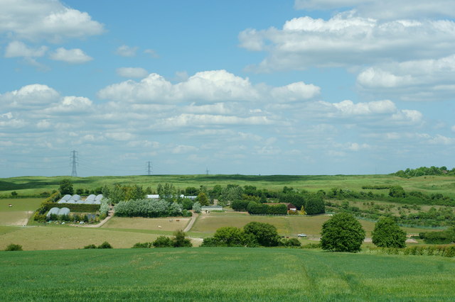
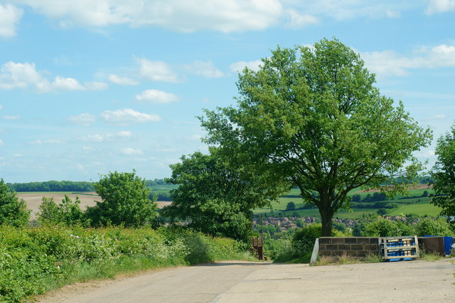
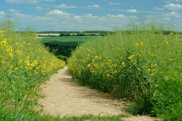
The Rookery is a picturesque woodland located in Kent, England. Situated within a dense forest, it is a popular destination for nature enthusiasts and hikers alike. Spanning over an area of several acres, The Rookery is home to a diverse range of flora and fauna, making it an ideal spot for wildlife observation.

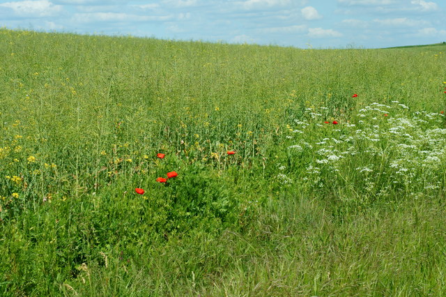
The woodland is characterized by its dense canopy of trees, predominantly consisting of oak, beech, and birch. The lush greenery provides a serene and peaceful ambiance, offering a perfect escape from the hustle and bustle of everyday life. The forest floor is adorned with a carpet of moss, ferns, and wildflowers, creating a vibrant tapestry of colors and textures.

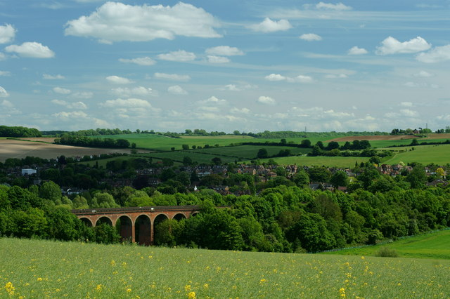
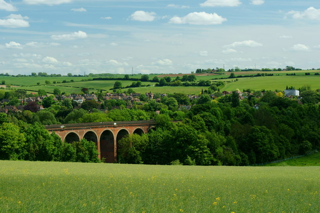
Visitors to The Rookery can enjoy a network of well-maintained trails that wind their way through the woodland. These trails offer varying levels of difficulty, catering to both casual walkers and more experienced hikers. Along the way, there are several designated viewpoints that provide breathtaking vistas of the surrounding countryside.

The Rookery is also home to a rich array of wildlife. Birdwatchers can spot a variety of avian species, including woodpeckers, owls, and various songbirds. The woodland is also inhabited by small mammals such as squirrels, rabbits, and foxes. Lucky visitors may even catch a glimpse of elusive creatures like badgers and deer.

Overall, The Rookery in Kent is a haven for nature lovers, offering a tranquil setting and opportunities for exploration and wildlife observation. Its lush woodland and diverse ecosystem make it a must-visit destination for those seeking to reconnect with nature.

If you have any feedback on the listing, please let us know in the comments section below.

The Rookery Images

Images are sourced within 2km of 51.352676/0.1927659 or Grid Reference TQ5263. Thanks to Geograph Open Source API. All images are credited.

Lullingstone Castle, near Shoreham, Kent
Bridge over River Darent at Castle Farm
Cottages on Darent River,  north of Shoreham Village, Kent
Cottages on Darent River, north of Shoreham Village, Kent
Bald Eagle at Eagle Heights, Eynsford, Kent Bald eagle (Haliaeetus leucocephalus). Seen during the lunchtime flying display.
<span class="nowrap"><a title="http://www.eagleheights.co.uk/" rel="nofollow ugc noopener" href="http://www.eagleheights.co.uk/">Link</a><img style="margin-left:2px;" alt="External link" title="External link - shift click to open in new window" src="https://s1.geograph.org.uk/img/external.png" width="10" height="10"/></span>
Bald Eagle at Eagle Heights, Eynsford, Kent
Bald eagle (Haliaeetus leucocephalus). Seen during the lunchtime flying display. LinkExternal link
Cheetah at Eagle Heights, Eynsford, Kent One of three cheetahs (Acinonyx jubatus) in the enclosure.
<span class="nowrap"><a title="http://www.eagleheights.co.uk/" rel="nofollow ugc noopener" href="http://www.eagleheights.co.uk/">Link</a><img style="margin-left:2px;" alt="External link" title="External link - shift click to open in new window" src="https://s1.geograph.org.uk/img/external.png" width="10" height="10"/></span>
Cheetah at Eagle Heights, Eynsford, Kent
One of three cheetahs (Acinonyx jubatus) in the enclosure. LinkExternal link
View From Eagle Heights, Eynsford, Kent Looking in the direction of Capricorn Farm. The railway line runs between the double row of diagonal hedges, to the right of picture
View From Eagle Heights, Eynsford, Kent
Looking in the direction of Capricorn Farm. The railway line runs between the double row of diagonal hedges, to the right of picture
View From Eagle Heights, Eynsford, Kent Looking across the valley, in the direction of Eynsford.
View From Eagle Heights, Eynsford, Kent
Looking across the valley, in the direction of Eynsford.
Footpath to Eynsford, Kent Leaving the road, just below Eagle Heights; the footpath heads towards Eynsford, crossing the railway line en route. Photographed through the fading yellow of the rape crop.
Footpath to Eynsford, Kent
Leaving the road, just below Eagle Heights; the footpath heads towards Eynsford, crossing the railway line en route. Photographed through the fading yellow of the rape crop.
Crop Meets Wild Flowers At the field edge; the crop of rape finishes, and is met by poppies and cow parsley. A hedge is out of picture, to the right. Photograph taken from the footpath between Eagle Heights and Eynsford, Kent.
Crop Meets Wild Flowers
At the field edge; the crop of rape finishes, and is met by poppies and cow parsley. A hedge is out of picture, to the right. Photograph taken from the footpath between Eagle Heights and Eynsford, Kent.
View Towards Eynsford, Kent Looking across the railway viaduct, towards the village of Eynsford.
View Towards Eynsford, Kent
Looking across the railway viaduct, towards the village of Eynsford.
Eynsford Railway Viaduct, Kent Looking towards the viaduct, and village of Eynsford, from the footpath.
Eynsford Railway Viaduct, Kent
Looking towards the viaduct, and village of Eynsford, from the footpath.
Station Road, Eynsford, Kent Looking towards the village centre.
Station Road, Eynsford, Kent
Looking towards the village centre.
Eynsford Railway Station, Kent Looking towards the village centre, from the footbridge.
Eynsford Railway Station, Kent
Looking towards the village centre, from the footbridge.
View From Eagle Heights, Eynsford, Kent Edge of the field, with a house just out of picture, to the right. On the skyline, Farningham Woods can be seen.
View From Eagle Heights, Eynsford, Kent
Edge of the field, with a house just out of picture, to the right. On the skyline, Farningham Woods can be seen.
Footpath to Eynsford, Kent Photograph taken from the road, near Eagle Heights.
Footpath to Eynsford, Kent
Photograph taken from the road, near Eagle Heights.
Footpath to Lullingstone, Kent Photograph taken from the road, close to Eagle Heights.
Footpath to Lullingstone, Kent
Photograph taken from the road, close to Eagle Heights.
Junction on Lullingstone Lane, Kent Looking in the direction of Eynsford. The road, to the left, climbs the hill to Eagle Heights.
Junction on Lullingstone Lane, Kent
Looking in the direction of Eynsford. The road, to the left, climbs the hill to Eagle Heights.
Railway Viaduct, Eynsford, Kent View from Lullingstone Lane. Lucky timing; with a train approaching, as I considered the composition.
Railway Viaduct, Eynsford, Kent
View from Lullingstone Lane. Lucky timing; with a train approaching, as I considered the composition.
Show me another place!

The Rookery is located at Grid Ref: TQ5263 (Lat: 51.352676, Lng: 0.1927659)

Administrative County: Kent

District: Sevenoaks

Police Authority: Kent

What 3 Words

///trades.priced.less. Near Eynsford, Kent

Nearby Locations

The Rookery

Related Wikis

Preston Hill Country Park

Preston Hill Country Park is in Eynsford, in Kent, England. It is a woodland and former military firing range. Within the site of the park and woodland...

Lullingstone

Lullingstone is a village in the county of Kent, England. It is best known for its castle, Roman villa and its public golf course. Lullingstone was a civil...

St Botolph's Church, Lullingstone

St Botolph's Church is an Anglican church in the village of Lullingstone, in Kent, England, situated on the lawn of Lullingstone Castle. It dates from...
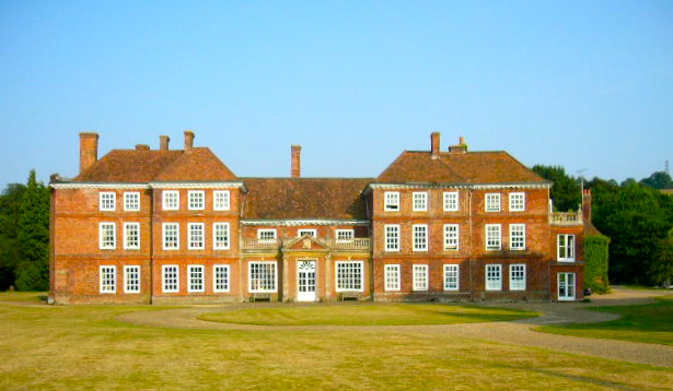
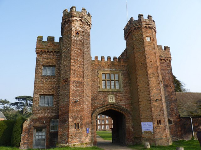
Lullingstone Castle

Lullingstone Castle is a historic manor house, set in an estate in the village of Lullingstone and the civil parish of Eynsford in the English county of...

Lullingstone Roman Villa

Lullingstone Roman Villa is a villa built during the Roman occupation of Britain, situated in Lullingstone near the village of Eynsford in Kent, south...

Eynsford railway station

Eynsford railway station serves Eynsford in Kent, England. It is 20 miles 32 chains (32.8 km) down the line from London Victoria and is situated between...

1934 London, Scottish & Provincial Airways Airspeed Courier crash

On 29 September 1934, an Airspeed Courier of London, Scottish & Provincial Airways Ltd crashed just north of Shoreham, Kent. The aircraft was on a scheduled...

Eynsford

Eynsford ( or ) is a village and civil parish in the Sevenoaks District of Kent, England. It is located 3.3 miles (5 km) south east of Swanley, 7 miles...

Nearby Amenities

Located within 500m of 51.352676,0.1927659
Created By: YahooApplet 1.0
Lat/Long: 51.355419/0.1949041
Created By: YahooApplet 1.0
Lat/Long: 51.3549098/0.1943676
Power: tower
Lat/Long: 51.352531/0.1950854
Power: tower
Lat/Long: 51.3518878/0.1886996
Lullingstone Country Park
Created By: Potlatch 0.8a
Tourism: attraction
Lat/Long: 51.3530752/0.1902348
Barrier: kissing_gate
Foot: yes
Lat/Long: 51.3526441/0.1908275
Barrier: kissing_gate
Material: wood
Maxwidth Physical: 1
Lat/Long: 51.3525063/0.1905592
Lullingstone Country Park
Check Date: 2022-11-12
Information: board
Tourism: information
Lat/Long: 51.3528471/0.1905341
Tourism: picnic_site
Lat/Long: 51.3525754/0.1899505
Bench
Colour: brown
Material: wood
Seats: 3
Lat/Long: 51.3530807/0.1912158
Bench
Colour: brown
Material: wood
Seats: 3
Lat/Long: 51.3532491/0.1913716
Bench
Backrest: yes
Colour: brown
Material: wood
Seats: 3
Lat/Long: 51.3537805/0.1913187
Bench
Colour: brown
Material: wood
Seats: 3
Lat/Long: 51.3567343/0.1931941
Entrance: yes
Lat/Long: 51.3528787/0.1906441
Bicycle Parking
Bicycle Parking: stands
Capacity: 12
Covered: no
Source: survey;Bing
Lat/Long: 51.3528399/0.1905646
Waste Basket
Waste: dog_excrement
Lat/Long: 51.3527499/0.189737
Waste Basket
Waste: dog_excrement
Lat/Long: 51.3528756/0.1866622
Waste Basket
Waste: dog_excrement
Lat/Long: 51.3537012/0.1872004
Bench
Backrest: yes
Colour: brown
Material: wood
Seats: 3
Lat/Long: 51.3537718/0.186613
Leisure: picnic_table
Lat/Long: 51.3547577/0.1870195
Leisure: picnic_table
Lat/Long: 51.3548903/0.1869676
Preston Hill Nature Reserve
Leisure: nature_reserve
Lat/Long: 51.3489283/0.1961292
Toilets
Lat/Long: 51.3530095/0.1909219
Bus Stop
The Hop Shop
Local Ref: opp
Naptan AtcoCode: 2400A074640A
Naptan Bearing: SW
Naptan BusStopType: MKD
Naptan CommonName: The Hop Shop
Naptan Indicator: opp
Naptan Landmark: The Hop Shop
Naptan NaptanCode: kntjmgdp
Naptan RevisionNumber: 2
Naptan Status: act
Naptan Street: A225 Shoreham Road
Naptan Verified: no
Public Transport: platform
Ref: kntjmgdp
Source: naptan_import
Source Date: 2018-04-24
Lat/Long: 51.3490766/0.1948775
Bus Stop
The Hop Shop
Local Ref: adj
Naptan AtcoCode: 2400A074630A
Naptan Bearing: N
Naptan BusStopType: MKD
Naptan CommonName: The Hop Shop
Naptan Indicator: adj
Naptan Landmark: The Hop Shop
Naptan NaptanCode: kntjmgdt
Naptan RevisionNumber: 2
Naptan Status: act
Naptan Street: A225 Shoreham Road
Naptan Verified: no
Public Transport: platform
Ref: kntjmgdt
Source: naptan_import
Source Date: 2018-04-24
Lat/Long: 51.3494126/0.1947068
Entrance: yes
Lat/Long: 51.3530046/0.1908748
Recycling
Recycling Cans: yes
Recycling Glass: yes
Recycling Glass Bottles: yes
Recycling Plastic: yes
Recycling Type: container
Lat/Long: 51.3530114/0.1906923
Waste Basket
Lat/Long: 51.3530219/0.190699
Man Made: surveillance
Surveillance Type: camera
Lat/Long: 51.3528724/0.1902524
Bench
Colour: brown
Material: wood
Seats: 3
Lat/Long: 51.3552116/0.1870733
Bench
Colour: brown
Material: wood
Seats: 3
Lat/Long: 51.3551614/0.1871324
Playground: structure
Lat/Long: 51.3551781/0.1872678
Leisure: picnic_table
Lat/Long: 51.3548297/0.1870264
Leisure: picnic_table
Lat/Long: 51.354777/0.1869151
Leisure: picnic_table
Lat/Long: 51.3547954/0.1871015
Playground: structure
Lat/Long: 51.3536901/0.1869594
Playground: structure
Lat/Long: 51.3534189/0.1891011
Bench
Backrest: yes
Colour: gray
Material: wood
Seats: 3
Lat/Long: 51.3564235/0.1893881
Bench
Backrest: yes
Colour: brown
Material: wood
Seats: 3
Lat/Long: 51.3568514/0.1933658
Covered: yes
Leisure: picnic_table
Lat/Long: 51.352962/0.1906796
Covered: yes
Leisure: picnic_table
Lat/Long: 51.3529922/0.190691
Covered: yes
Leisure: picnic_table
Lat/Long: 51.3529411/0.1906642
Covered: yes
Leisure: picnic_table
Lat/Long: 51.3530942/0.1907604
Covered: yes
Leisure: picnic_table
Lat/Long: 51.3530657/0.1907453
Covered: yes
Leisure: picnic_table
Lat/Long: 51.3530862/0.1908077
Covered: yes
Leisure: picnic_table
Lat/Long: 51.3530537/0.1907939
The data included in this document is from www.openstreetmap.org. The data is made available under ODbL.

Have you been to The Rookery?

Leave your review of The Rookery below (or comments, questions and feedback).