Bream Wood

Wood, Forest in Sussex Wealden

England

Bream Wood

Bad Brook, Jockey's Wood Rising in Badbrook Wood and becoming Mottsmill Stream above Motts Mill before eventually joining the River Medway west of Groombridge.
Bad Brook, Jockey's Wood Credit: Simon Carey

Bream Wood, located in the county of Sussex, England, is a beautiful and diverse forest encompassing an area of approximately 200 acres. The wood is situated near the village of Bream, hence its name, and is surrounded by picturesque countryside and rolling hills.

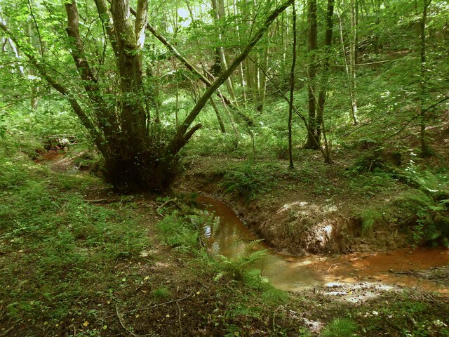
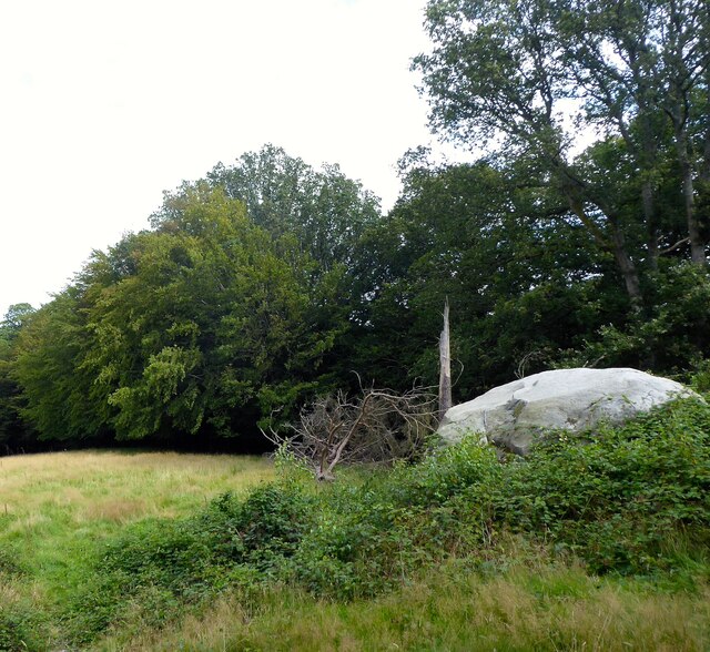
Bream Wood is predominantly made up of a mix of broadleaf trees, including oak, beech, ash, and birch, creating a rich and vibrant woodland environment. These trees provide a habitat for a variety of wildlife, from birds and small mammals to insects and reptiles.

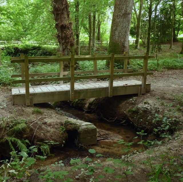
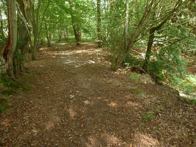
The forest is crisscrossed by a network of well-maintained footpaths and trails, making it a popular destination for walkers, nature enthusiasts, and families seeking outdoor recreation. The paths wind their way through the wood, offering visitors the opportunity to explore the diverse flora and fauna that call Bream Wood home.

In addition to its natural beauty, Bream Wood also has historical significance. The forest has been in existence for centuries, and remnants of ancient earthworks and boundary banks can still be found within its boundaries, hinting at its long-standing presence in the area.

Bream Wood is open to the public year-round, and visitors are encouraged to respect and preserve its natural beauty. The forest offers a tranquil retreat from the hustle and bustle of everyday life, inviting individuals to immerse themselves in the serenity and wonder of nature.

If you have any feedback on the listing, please let us know in the comments section below.

Bream Wood Images

Images are sourced within 2km of 51.074622/0.17245616 or Grid Reference TQ5232. Thanks to Geograph Open Source API. All images are credited.

Bad Brook, Jockey's Wood Rising in Badbrook Wood and becoming Mottsmill Stream above Motts Mill before eventually joining the River Medway west of Groombridge.
Bad Brook, Jockey's Wood
Rising in Badbrook Wood and becoming Mottsmill Stream above Motts Mill before eventually joining the River Medway west of Groombridge.
Footbridge, Jockey's Wood Taking the High Weald Landscape Trail over Bad Brook at the southern end of the wood.
Footbridge, Jockey's Wood
Taking the High Weald Landscape Trail over Bad Brook at the southern end of the wood.
Jockys Field The name of the field according to Withyham's 1842 tithe map located to the south of Jockey's Wood and north of Fox Hole Wood.
Jockys Field
The name of the field according to Withyham's 1842 tithe map located to the south of Jockey's Wood and north of Fox Hole Wood.
Fox Hole Wood The name of the wood according to Withyham's 1842 tithe map that now appears on maps as a northern extension of Badbrook Wood.
Fox Hole Wood
The name of the wood according to Withyham's 1842 tithe map that now appears on maps as a northern extension of Badbrook Wood.
Fox Hole Field The name of the field according to Withyham's 1842 tithe map located to the north of Coalhouse Wood.
Fox Hole Field
The name of the field according to Withyham's 1842 tithe map located to the north of Coalhouse Wood.
Sandstone Outcrop near Badbrook Wood Part of a small band located on the western side of the High Weald Landscape Trail. This one in particular has plenty of graffitied carvings on it.
Sandstone Outcrop near Badbrook Wood
Part of a small band located on the western side of the High Weald Landscape Trail. This one in particular has plenty of graffitied carvings on it.
Foxy Field/Round Field The name of the fields according to Withyham's 1842 tithe map that have been merged to form a larger unit. Foxy Field is in the foreground whilst Round Field is beyond the hedgerow in the distance adjacent to Badbrook Wood. Now part of Park Grove Deer Farm.
Foxy Field/Round Field
The name of the fields according to Withyham's 1842 tithe map that have been merged to form a larger unit. Foxy Field is in the foreground whilst Round Field is beyond the hedgerow in the distance adjacent to Badbrook Wood. Now part of Park Grove Deer Farm.
Park Grove/Long Field The name of the fields according to Withyham's 1842 tithe map that have been merged to form a larger unit. Park Grove is in the foreground whilst Long field was to the east adjacent to Badbrook Wood. Both are bounded to the south by Parkgrove Wood.
Park Grove/Long Field
The name of the fields according to Withyham's 1842 tithe map that have been merged to form a larger unit. Park Grove is in the foreground whilst Long field was to the east adjacent to Badbrook Wood. Both are bounded to the south by Parkgrove Wood.
Barn Mead The name of the field according to Withyham's 1842 tithe map located to the south of Park Grove.
Barn Mead
The name of the field according to Withyham's 1842 tithe map located to the south of Park Grove.
Park Grove Cottage Former farm outbuilding belonging to Parkgrove Farm whose original farmhouse, now called Home Place, can be seen in the distance.
Park Grove Cottage
Former farm outbuilding belonging to Parkgrove Farm whose original farmhouse, now called Home Place, can be seen in the distance.
Home Place Originally a farmhouse for Wiggs Farm later known as Parkgrove Farm. Now converted into a residence.
Home Place
Originally a farmhouse for Wiggs Farm later known as Parkgrove Farm. Now converted into a residence.
Park Lodge, Lye Green Built as a lodge for Park House around 1874.
Park Lodge, Lye Green
Built as a lodge for Park House around 1874.
Gate Field/Hollands Field The name of the fields according to Withyham's 1842 tithe map that have been merged to form a larger unit. Gate field was in the foreground whilst Hollands Field was on the slope in the distance.
Gate Field/Hollands Field
The name of the fields according to Withyham's 1842 tithe map that have been merged to form a larger unit. Gate field was in the foreground whilst Hollands Field was on the slope in the distance.
Gate Field The name of the field according to Withyham's 1842 tithe map located to the north of the High Weald Landscape Trail.
Gate Field
The name of the field according to Withyham's 1842 tithe map located to the north of the High Weald Landscape Trail.
Kiln Field The name of the field according to Withyham's 1842 tithe map located to the west of Littlebrook.
Kiln Field
The name of the field according to Withyham's 1842 tithe map located to the west of Littlebrook.
Four Acre Mead The name of the field according to Withyham's 1842 tithe map that is now part of Park Grove Deer Farm. The herd was lying against the fence as I approached and didn't take off as wild deer are prone to do but slowly rose and gradually moved further up the hill. A brave younger stag even decided to have a sniff at my hand when I put it through the fence. What was interesting was observing the herd's leader stag, clearly visible on the left, gently shift the herd away from the fence as I walked past them.
Four Acre Mead
The name of the field according to Withyham's 1842 tithe map that is now part of Park Grove Deer Farm. The herd was lying against the fence as I approached and didn't take off as wild deer are prone to do but slowly rose and gradually moved further up the hill. A brave younger stag even decided to have a sniff at my hand when I put it through the fence. What was interesting was observing the herd's leader stag, clearly visible on the left, gently shift the herd away from the fence as I walked past them.
View from Sandhill Lane This is close to and within the sound of the A26.
View from Sandhill Lane
This is close to and within the sound of the A26.
View from Sandhill Lane This is close to Sandhill Cottages and looks across the valley through which the Uckfield line runs.
View from Sandhill Lane
This is close to Sandhill Cottages and looks across the valley through which the Uckfield line runs.
Show me another place!

Bream Wood is located at Grid Ref: TQ5232 (Lat: 51.074622, Lng: 0.17245616)

Administrative County: East Sussex

District: Wealden

Police Authority: Sussex

What 3 Words

///soup.lied.enjoys. Near Crowborough, East Sussex

Related Wikis

Bream Wood

Bream Wood is a 7.8-hectare (19-acre) biological Site of Special Scientific Interest north of Crowborough in East Sussex.This steep sided valley wood has...

Crowborough Community Church

Crowborough Community Church (also known as Community Church, Crowborough) is an Evangelical church in the town of Crowborough in East Sussex, England...

Pratt's Mill, Crowborough

Pratt's Mill is a tower mill at Crowborough, Sussex, England which has been truncated and converted to residential accommodation. == History == Pratt...

Crowborough

Crowborough is a town and civil parish in East Sussex, England, in the Weald at the edge of Ashdown Forest in the High Weald Area of Outstanding Natural...

Penn's Rocks

Penn's Rocks is a 10.2-hectare (25-acre) biological Site of Special Scientific Interest north of Crowborough in East Sussex.This site is a steep sided...

Bowles Rocks

Bowles Rocks is a sandstone crag in the county of East Sussex, on the border with Kent, approximately 8 kilometres (5 mi) south of the town of Royal Tunbridge...

Bowles Outdoor Centre

Bowles Outdoor Centre is an outdoor education/outdoor learning centre in southeast England, located between Royal Tunbridge Wells and Crowborough at Bowles...

Beacon Academy

Beacon Academy (formerly Beacon Community College) is a coeducational secondary school and sixth form located in Crowborough in the English county of East...

Nearby Amenities

Located within 500m of 51.074622,0.17245616
The data included in this document is from www.openstreetmap.org. The data is made available under ODbL.

Have you been to Bream Wood?

Leave your review of Bream Wood below (or comments, questions and feedback).