Mildridge Wood

Wood, Forest in Kent Sevenoaks

England

Mildridge Wood

Dryhill Lane, a public bridleway Thankfully, the southern portion of Dryhill Lane only has bridleway status, so those nasty gas-guzzling 4x4s (or other motor cars) cannot be brought here to disturb its peace.
Dryhill Lane, a public bridleway Credit: Dr Neil Clifton

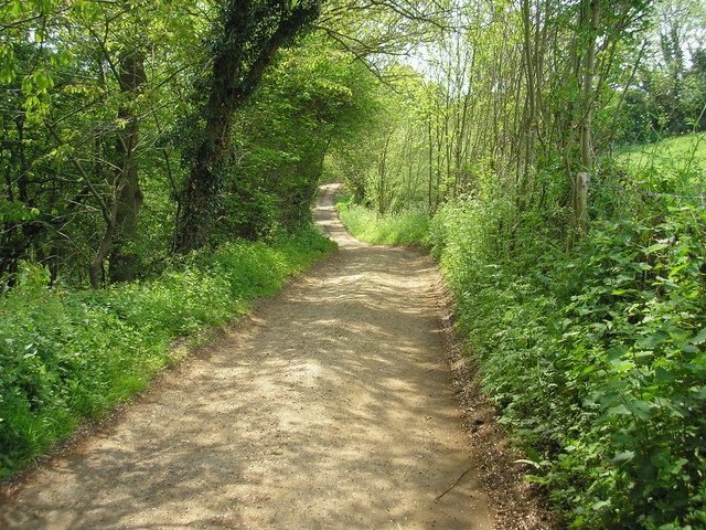
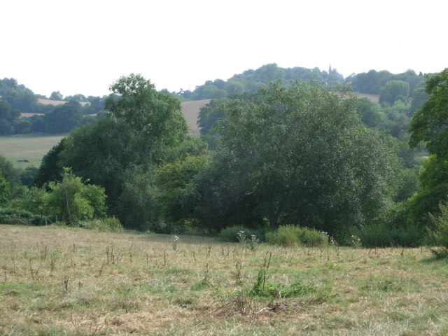
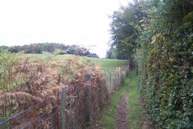
Mildridge Wood, located in the county of Kent, is a picturesque forest that spans an area of approximately 500 acres. Situated near the village of Mildridge, this woodland offers a tranquil escape from the hustle and bustle of everyday life. The wood is characterized by its diverse range of tree species, including oak, beech, and ash, which create a rich and vibrant canopy overhead.

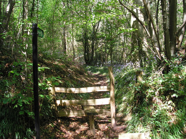
As visitors explore Mildridge Wood, they will be greeted by a network of well-maintained footpaths that wind their way through the forest. These paths provide an opportunity for nature enthusiasts to immerse themselves in the natural beauty of the area, while also offering a chance to spot local wildlife such as deer, squirrels, and a variety of bird species.

In addition to its natural wonders, Mildridge Wood boasts several amenities to enhance visitors' experience. Picnic areas are scattered throughout the forest, providing a perfect spot to enjoy a leisurely lunch surrounded by nature. There are also designated areas for barbecues, making it an ideal location for a family outing or a social gathering with friends.

For those seeking a more active day out, Mildridge Wood offers several recreational activities. The forest features a well-maintained cycle path, allowing cyclists to explore the area at their own pace. There are also designated areas for horse riding, providing an opportunity for equestrian enthusiasts to enjoy the wood from a different perspective.

Overall, Mildridge Wood in Kent offers a peaceful and scenic escape for individuals and families alike. Its diverse range of flora and fauna, coupled with its well-maintained facilities, make it a popular destination for nature lovers and outdoor enthusiasts.

If you have any feedback on the listing, please let us know in the comments section below.

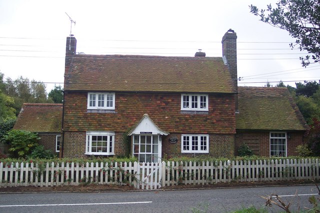
Mildridge Wood Images

Images are sourced within 2km of 51.262719/0.16510252 or Grid Reference TQ5153. Thanks to Geograph Open Source API. All images are credited.

Dryhill Lane, a public bridleway Thankfully, the southern portion of Dryhill Lane only has bridleway status, so those nasty gas-guzzling 4x4s (or other motor cars) cannot be brought here to disturb its peace.
Dryhill Lane, a public bridleway
Thankfully, the southern portion of Dryhill Lane only has bridleway status, so those nasty gas-guzzling 4x4s (or other motor cars) cannot be brought here to disturb its peace.
Footpath into Hawks Wood This path leads westward from the little-used Back Lane into Hawks Wood, near Sevenoaks, Kent.  It's late May and there are still plenty of bluebells about.
Footpath into Hawks Wood
This path leads westward from the little-used Back Lane into Hawks Wood, near Sevenoaks, Kent. It's late May and there are still plenty of bluebells about.
Farmland suffering from a summer of drought This photograph was taken from Back Lane. Part of Hawks Wood is in the near distance whilst in the far distance can just be seen the shingled spire of Ide Hill Church.
Farmland suffering from a summer of drought
This photograph was taken from Back Lane. Part of Hawks Wood is in the near distance whilst in the far distance can just be seen the shingled spire of Ide Hill Church.
The Woodman - Goathurst Common
Pubsign "The Woodman" - Goathurst Common
Whitley Cottage On the B2042 Cold Harbour Road near Goathurst Common.
Whitley Cottage
On the B2042 Cold Harbour Road near Goathurst Common.
Footpath to Cold Arbour Road This path leads from Back Lane, Whitley Row to the B2042. The Woodman Pub (roof) is seen in the background.
Footpath to Cold Arbour Road
This path leads from Back Lane, Whitley Row to the B2042. The Woodman Pub (roof) is seen in the background.
Triangle of Green at Whitley Road Back Lane is on the right leading straight on to Sevenoaks. Penn Lane leads left towards Sundridge.
Triangle of Green at Whitley Road
Back Lane is on the right leading straight on to Sevenoaks. Penn Lane leads left towards Sundridge.
Footpath to Willow Wood This path leads from Penn Lane to Church Road. This path follows a track to Hawks Wood.
Footpath to Willow Wood
This path leads from Penn Lane to Church Road. This path follows a track to Hawks Wood.
Woodland track junction near Hawks Wood A footpath from Willow Wood leads right towards Penn Lane, Whitley Row. The track on the left is an access track into the wood.
Woodland track junction near Hawks Wood
A footpath from Willow Wood leads right towards Penn Lane, Whitley Row. The track on the left is an access track into the wood.
Track in Willow Wood This is an access track in the wood, from a footpath/track towards Penn Lane.
Track in Willow Wood
This is an access track in the wood, from a footpath/track towards Penn Lane.
Picnic Area in Dryhill Local Nature Reserve These two tables are close to the car park in the nature reserve.
Note; the chain at the base of the table.
Picnic Area in Dryhill Local Nature Reserve
These two tables are close to the car park in the nature reserve. Note; the chain at the base of the table.
Access road to Dryhill Local Nature Reserve car park This track leads from Dryhill Lane to the small car park.
Access road to Dryhill Local Nature Reserve car park
This track leads from Dryhill Lane to the small car park.
Hawks Wood Track and footpath off Penn Lane.
Hawks Wood
Track and footpath off Penn Lane.
Footpath south of Manor Farm The path is a sunken track from the farm to the start of the woods, at about where posts may be seen here.
Footpath south of Manor Farm
The path is a sunken track from the farm to the start of the woods, at about where posts may be seen here.
Manor Farm Apart from the houses, the main house to the left of the track and one beyond the barns to the right, all the farm buildings appear disused. There is a small ford on the track, with a stone slab bridge for pedestrians.
Manor Farm
Apart from the houses, the main house to the left of the track and one beyond the barns to the right, all the farm buildings appear disused. There is a small ford on the track, with a stone slab bridge for pedestrians.
Manor Farm and Hill Water This stream is called Hill Water. It is seen here at Manor Farm where it is forded but also has a stone bridge, just out of the picture to the left. Hill Water is a tributary of the River Darent and forms a wooded valley upriver of here - see <a title="https://www.geograph.org.uk/photo/4022595" href="https://www.geograph.org.uk/photo/4022595">Link</a>
Manor Farm and Hill Water
This stream is called Hill Water. It is seen here at Manor Farm where it is forded but also has a stone bridge, just out of the picture to the left. Hill Water is a tributary of the River Darent and forms a wooded valley upriver of here - see Link
Old barn at Manor Farm This barn is clearly on its last legs.
Old barn at Manor Farm
This barn is clearly on its last legs.
Show me another place!

Mildridge Wood is located at Grid Ref: TQ5153 (Lat: 51.262719, Lng: 0.16510252)

Administrative County: Kent

District: Sevenoaks

Police Authority: Kent

What 3 Words

///belt.item.slide. Near Sevenoaks, Kent

Related Wikis

New Beacon School

The New Beacon Preparatory School is an independent all-boys preparatory school, located at Sevenoaks in the English county of Kent. It admits both day...
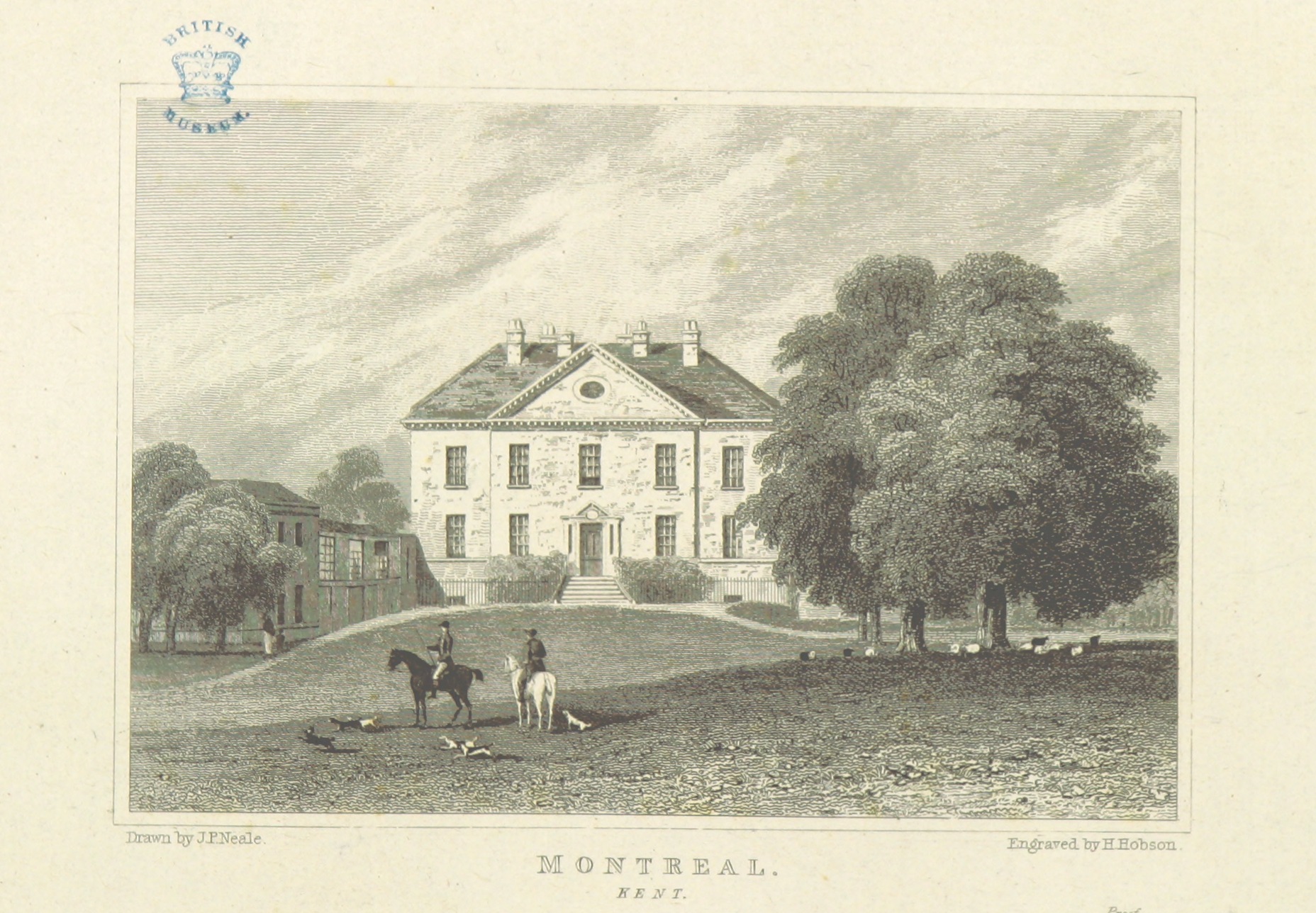
Montreal Park

Montreal Park is a development in Sevenoaks in Kent which was formerly the home of Lord Amherst, Commander-in-Chief of the Forces. It was named after his...

West Heath School (special school)

West Heath School is an independent school in Sevenoaks, Kent. It caters for children for whom mainstream schooling has become insufficient, for varying...

Dryhill Nature Reserve

Dryhill is an 11.7-hectare (29-acre) geological Site of Special Scientific Interest on the western outskirts of Sevenoaks in Kent. It is a Geological Conservation...

Sevenoaks railway station

Sevenoaks railway station is a railway station on the South Eastern Main Line in England, serving the town of Sevenoaks, Kent. It is 22 miles 9 chains...

Bessels Green

Bessels Green is a village now incorporated into the built-up area of Sevenoaks in Kent, England. It is on the north-western outskirts of Sevenoaks, in...

Dryhill

Dryhill is a small hamlet in the Sevenoaks district, in the county of Kent, England. == Location == It is about two miles away from the large town of Sevenoaks...

Sevenoaks School

Sevenoaks School is a highly selective coeducational private school in Sevenoaks, Kent, England. It is the second oldest non-denominational school in the...

Nearby Amenities

Located within 500m of 51.262719,0.16510252
The data included in this document is from www.openstreetmap.org. The data is made available under ODbL.

Have you been to Mildridge Wood?

Leave your review of Mildridge Wood below (or comments, questions and feedback).