Roseland Shaw

Wood, Forest in Sussex Wealden

England

Roseland Shaw

Postbox, The Street, Selmasson
Postbox, The Street, Selmasson Credit: PAUL FARMER

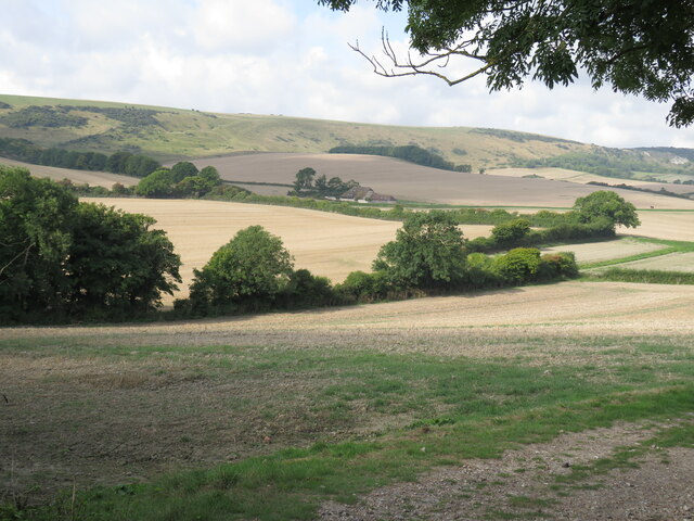
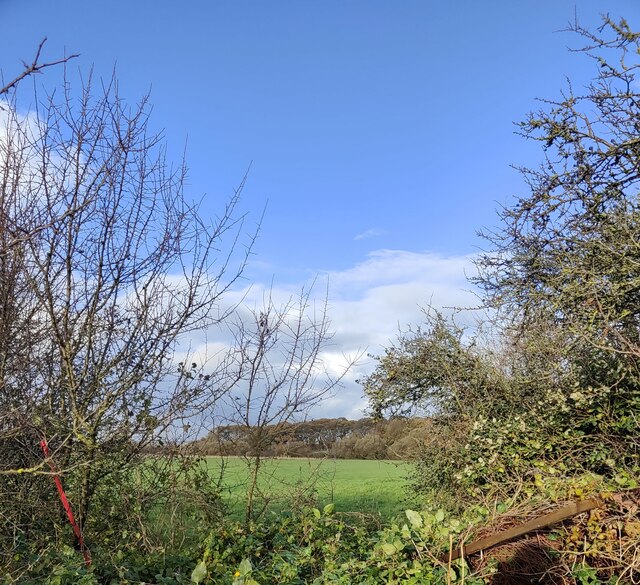
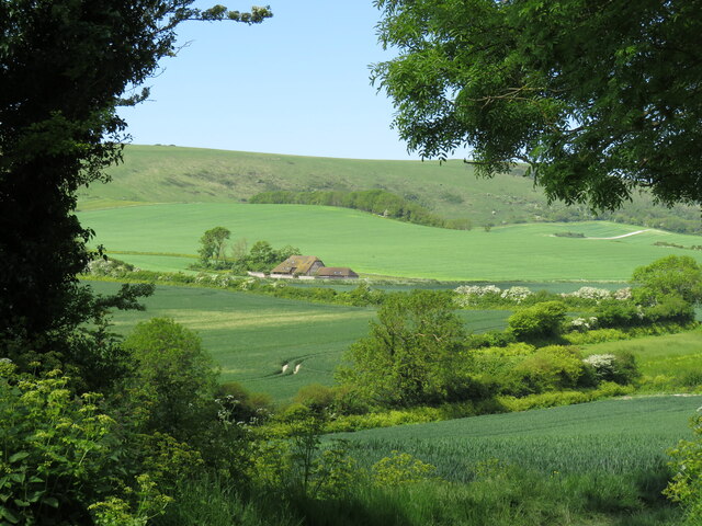
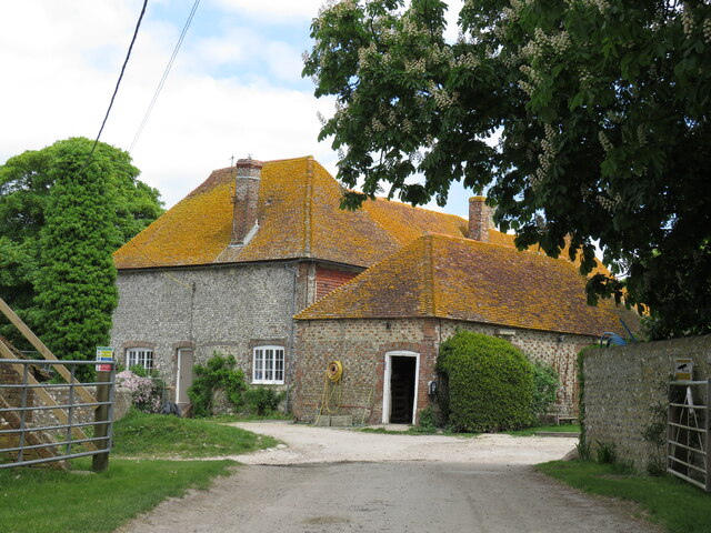
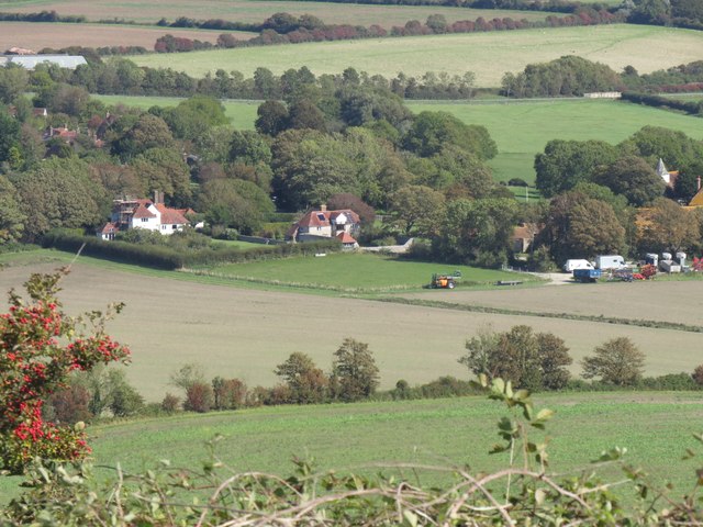
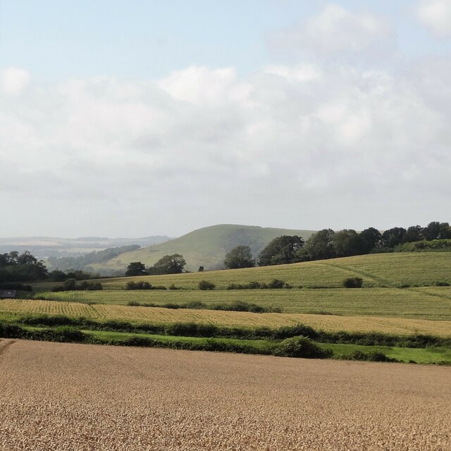
Roseland Shaw is a quaint and picturesque woodland area located in the county of Sussex, England. Nestled amidst the rolling hills and lush countryside, this enchanting woodland is a nature lover's paradise. Covering an area of approximately 100 acres, Roseland Shaw is known for its dense forest and serene atmosphere.

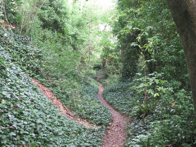
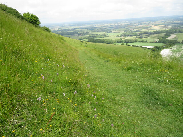
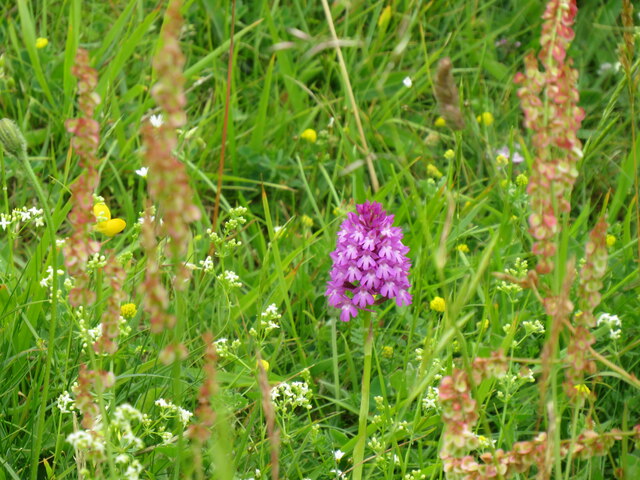
The woodland is characterized by its diverse range of tree species, including oak, beech, and birch, which create a vibrant and colorful canopy throughout the year. The forest floor is adorned with a carpet of wildflowers, adding to the area's natural beauty. Walking trails wind their way through the wood, providing visitors with the opportunity to explore and immerse themselves in the tranquil surroundings.

Roseland Shaw is also home to a rich variety of wildlife. Birdwatchers will delight in the chance to spot species such as woodpeckers, owls, and thrushes, while nature enthusiasts may encounter deer, foxes, and squirrels roaming freely in their natural habitat.

The woodland is well-maintained, with designated picnic areas and benches for visitors to relax and enjoy a peaceful break amidst the stunning scenery. Additionally, educational signs are strategically placed along the trails, providing information about the flora and fauna found within Roseland Shaw.

Whether it's a leisurely stroll, a family picnic, or a birdwatching adventure, Roseland Shaw offers a serene escape from the hustle and bustle of everyday life. Its natural beauty and tranquil ambience make it a must-visit destination for nature enthusiasts and those seeking a peaceful retreat in the heart of Sussex.

If you have any feedback on the listing, please let us know in the comments section below.

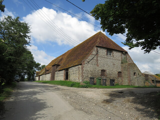
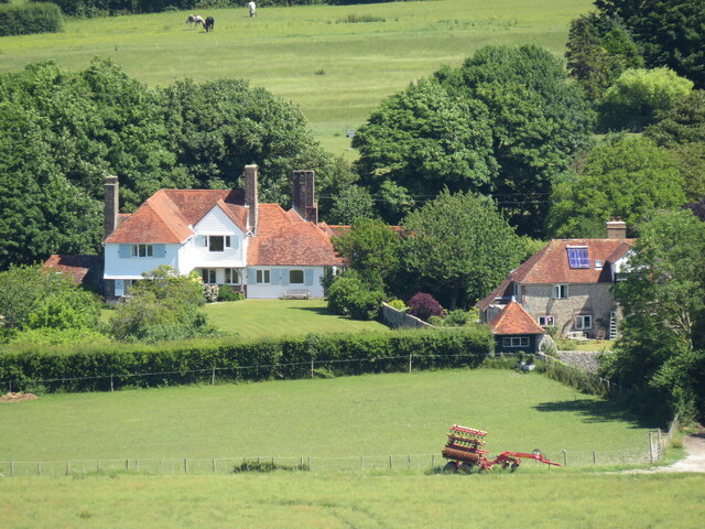
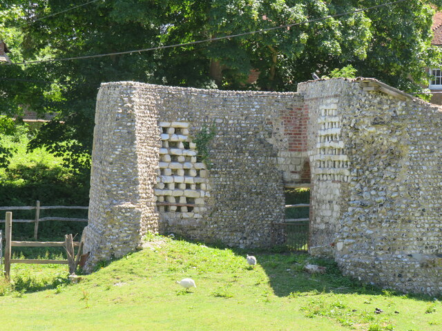
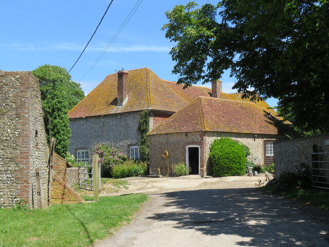
Roseland Shaw Images

Images are sourced within 2km of 50.836194/0.13234786 or Grid Reference TQ5006. Thanks to Geograph Open Source API. All images are credited.

Postbox, The Street, Selmasson
View south from Berwick Church New Barn on the coach road in centre, Bopeep chalk pits top right.
View south from Berwick Church
New Barn on the coach road in centre, Bopeep chalk pits top right.
Sunken lane above Alciston This is only recorded on the Explorer map as a public footpath crossing what appears to be a large field. In fact it is an old cartway which, with the erosive power of rainwater, has become a deep sunken lane, and is clearly still used by horse-riders.
Sunken lane above Alciston
This is only recorded on the Explorer map as a public footpath crossing what appears to be a large field. In fact it is an old cartway which, with the erosive power of rainwater, has become a deep sunken lane, and is clearly still used by horse-riders.
Horse and carriage on the old coach road The old coach road from Firle to Alfriston provides an all-weather route for horse-riders, cyclists and walkers. It is classed as a byway - and is enjoying an upgrade.
Horse and carriage on the old coach road
The old coach road from Firle to Alfriston provides an all-weather route for horse-riders, cyclists and walkers. It is classed as a byway - and is enjoying an upgrade.
Alciston's tithe barn The 16th-century barn is more than 50 metres long, and is part of the Alciston Court House farm complex.
Alciston's tithe barn
The 16th-century barn is more than 50 metres long, and is part of the Alciston Court House farm complex.
Alciston from Bostal path Village in the trees - seen here from one of two paths that drop down to the village from the South Downs Way.
Alciston from Bostal path
Village in the trees - seen here from one of two paths that drop down to the village from the South Downs Way.
Dovecots at Alciston Court Farm The map claims them as ruins, but they look pretty convincing.
Dovecots at Alciston Court Farm
The map claims them as ruins, but they look pretty convincing.
Alciston Court Farm Farming much of Alciston as tenants of the Gage family of Firle.
Alciston Court Farm
Farming much of Alciston as tenants of the Gage family of Firle.
Field near A27 Lewes Road
New Barn from Berwick Church New Barn, now converted into a home, sits alongside the Old Coach Road that runs from Firle to Alfriston.
New Barn from Berwick Church
New Barn, now converted into a home, sits alongside the Old Coach Road that runs from Firle to Alfriston.
Alciston Court Farm Much of the land in Alciston  forms part of the Court Farm.
Alciston Court Farm
Much of the land in Alciston forms part of the Court Farm.
Alciston from Bopeep Bostal Alciston village, part of the Firle estate, seen from the car park on Bopeep Bostal.
Alciston from Bopeep Bostal
Alciston village, part of the Firle estate, seen from the car park on Bopeep Bostal.
View WNW towards Mount Caburn This was taken from the permissive path that links the Old Coach Road to Charleston Farmhouse.
View WNW towards Mount Caburn
This was taken from the permissive path that links the Old Coach Road to Charleston Farmhouse.
Barn and tank at Charleston Farm
Tilton Bostal Bridleway that leads off South Downs Way to provide flowery and gradual descent to Tilton, one-time home of the economist Maynard Keynes, and his associates in the Bloomsbury set at nearby Charleston
Tilton Bostal
Bridleway that leads off South Downs Way to provide flowery and gradual descent to Tilton, one-time home of the economist Maynard Keynes, and his associates in the Bloomsbury set at nearby Charleston
Pyramid orchid at Tilton Bostal Thin chalk soils on steep north-facing scarp slopes of the South Downs provide rich array of cowslips, followed here by orchids
Pyramid orchid at Tilton Bostal
Thin chalk soils on steep north-facing scarp slopes of the South Downs provide rich array of cowslips, followed here by orchids
Bostal path above Alciston Now classed simply as a footpath but signs are that this has been worn down over the centuries by cart traffic. One of several bostal paths that cross 'access land' on the scarp slopes of the Downs.
Bostal path above Alciston
Now classed simply as a footpath but signs are that this has been worn down over the centuries by cart traffic. One of several bostal paths that cross 'access land' on the scarp slopes of the Downs.
Bopeep  Farmhouse The farmhouse sits astride the old coach road, seen here from the top of the old chalkpit at Bopeep Bostal.
Bopeep Farmhouse
The farmhouse sits astride the old coach road, seen here from the top of the old chalkpit at Bopeep Bostal.
Show me another place!

Roseland Shaw is located at Grid Ref: TQ5006 (Lat: 50.836194, Lng: 0.13234786)

Administrative County: East Sussex

District: Wealden

Police Authority: Sussex

What 3 Words

///marzipan.jars.dispenser. Near Newhaven, East Sussex

Related Wikis

Selmeston

Selmeston is a village and civil parish in the Wealden District of East Sussex, England. It is located eight miles (13 km) east of Lewes, to the north...

Alciston

Alciston is a village and civil parish in the Wealden district of East Sussex, England. It is inland, just off the A27 road, about ten miles (16 km) north...

Firle

Firle (; Sussex dialect: Furrel ) is a village and civil parish in the Lewes district of East Sussex, England. Firle refers to an old-English/Anglo-Saxon...

Firle Hill Climb

Firle Hill Climb is a disused hillclimbing course near Lewes, East Sussex, England, sometimes referred to as Bo Peep Hill Climb. The event was celebrated...

Charleston Farmhouse

Charleston, in East Sussex, is a property associated with the Bloomsbury group, that is open to the public. It was the country home of Vanessa Bell and...

Berwick, East Sussex

Berwick (pronounced BUR-wik or, more recently, BERR-ik) is a village and civil parish in the Wealden district of East Sussex in England. The village...

Firle Beacon

Firle Beacon is a hill in the South Downs of southern England. It is 217 metres high and is a Marilyn. It commands a far-reaching view. When the prevailing...

Berwick railway station (East Sussex)

Berwick railway station is located in Berwick, East Sussex, England. Berwick village is located nearby to the south of the A27 road. The station is on...

Related Videos

Day Six - South Downs Way - Rodmell to Alfriston | Cool Dudes Walking Club | 100 mile walk

Day Six of the South Downs Way. Rodmell to Alfriston. Scroll down for full kit list and links. Here is the amazing massage thing: ...

Walking the South Downs Way | Part 2 - Downhill, Upriver

Join me on a beautiful hike near the south coast of England, with a lovely mix of wetlands, nesting birds and chalk figures!

Walking the South Downs Way: Day 6

Thursday 30th May 2019 I awoke in my tent at Alfriston Camping and soon packed up after breakfast, ready for my final day and ...

Alfriston

The first of our 3 part series where we arrive in the ancient village of Alfriston on the East side of Sussex.

Nearby Amenities

Located within 500m of 50.836194,0.13234786
Barrier: stile
Lat/Long: 50.8383407/0.1375595
Barrier: stile
Lat/Long: 50.8359282/0.1361341
Barrier: stile
Lat/Long: 50.8375877/0.137065
The data included in this document is from www.openstreetmap.org. The data is made available under ODbL.

Have you been to Roseland Shaw?

Leave your review of Roseland Shaw below (or comments, questions and feedback).