Cow Hollow Wood

Wood, Forest in Cambridgeshire South Cambridgeshire

England

Cow Hollow Wood

Clayhithe: Cam Sailing Club Blue sky and blue water on a bright and blowy July morning. The notice on the left prohibits fishing beyond it.
Clayhithe: Cam Sailing Club Credit: John Sutton

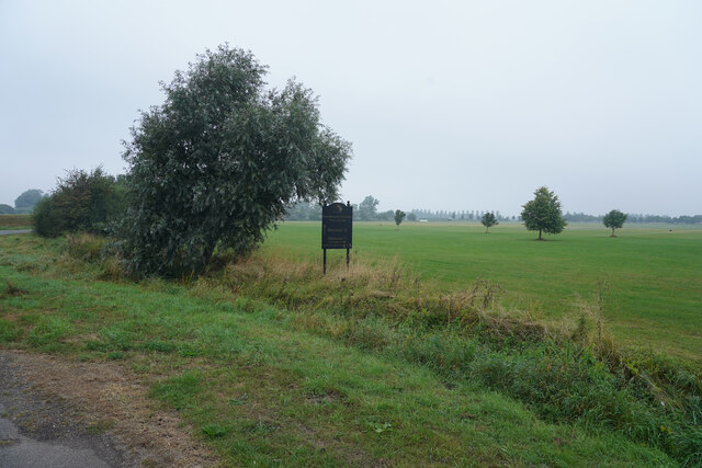
Cow Hollow Wood is a picturesque woodland located in the heart of Cambridgeshire, England. Covering an area of approximately 50 acres, it is known for its diverse range of flora and fauna, making it a haven for nature enthusiasts and wildlife lovers alike.

The wood is predominantly composed of a mix of deciduous and coniferous trees, including oak, beech, pine, and birch. These trees provide a lush canopy, creating a peaceful and tranquil atmosphere for visitors to enjoy. The woodland floor is adorned with a carpet of wildflowers during the spring and summer months, adding bursts of color to the landscape.

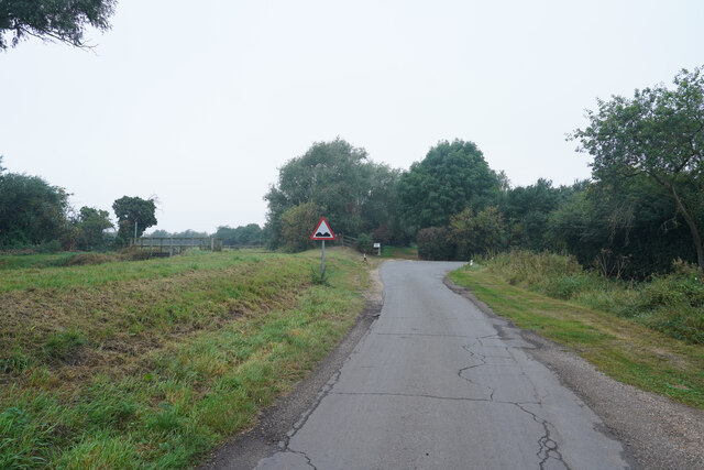
Numerous walking trails wind their way through the wood, offering visitors the opportunity to explore its hidden gems. These well-maintained paths are perfect for leisurely strolls or more adventurous hikes, catering to all fitness levels. In addition to the walking trails, Cow Hollow Wood also features designated picnic areas, allowing visitors to relax and unwind amidst the beauty of nature.

The wood is home to a rich variety of wildlife, including deer, foxes, badgers, and a wide array of bird species. Nature enthusiasts will delight in the opportunity to observe and photograph these creatures in their natural habitat.

Cow Hollow Wood is easily accessible by car, with ample parking available nearby. Entrance to the wood is free of charge, making it an ideal destination for families, nature lovers, and individuals seeking a peaceful retreat from the hustle and bustle of daily life.

If you have any feedback on the listing, please let us know in the comments section below.

Cow Hollow Wood Images

Images are sourced within 2km of 52.260115/0.19652111 or Grid Reference TL5064. Thanks to Geograph Open Source API. All images are credited.

Clayhithe: Cam Sailing Club Blue sky and blue water on a bright and blowy July morning. The notice on the left prohibits fishing beyond it.
Clayhithe: Cam Sailing Club
Blue sky and blue water on a bright and blowy July morning. The notice on the left prohibits fishing beyond it.
Clayhithe: the Cam Conservancy quay and slipway Looking downstream on a fine morning in late July. The Conservancy's weed harvester is moored at the north end of the quay, in the centre of the picture. The fence and gates at the quay are recent - <a href="https://www.geograph.org.uk/photo/6407902">TL5064 : Clayhithe: downstream in early March</a> shows how things were in 2020.
Clayhithe: the Cam Conservancy quay and slipway
Looking downstream on a fine morning in late July. The Conservancy's weed harvester is moored at the north end of the quay, in the centre of the picture. The fence and gates at the quay are recent - TL5064 : Clayhithe: downstream in early March shows how things were in 2020.
Looking across the C.C polo ground It was most unexpected to find a Polo ground out in the country beyond the village of Lode.
Looking across the C.C polo ground
It was most unexpected to find a Polo ground out in the country beyond the village of Lode.
Lug Fen Drove This is almost the end of Lug Fen Drove. The road takes a right angle turn just ahead and the surface gets even worse.
Lug Fen Drove
This is almost the end of Lug Fen Drove. The road takes a right angle turn just ahead and the surface gets even worse.
Clayhithe: the sun breaking through Looking towards Clayhithe bridge and against the light at 12.30 on an October day whose morning had been cloudy, with persistent mist. In a few minutes the sky was blue and remained clear for the rest of a warm day.
Clayhithe: the sun breaking through
Looking towards Clayhithe bridge and against the light at 12.30 on an October day whose morning had been cloudy, with persistent mist. In a few minutes the sky was blue and remained clear for the rest of a warm day.
Clayhithe: Cambridge Motor Boat Club Cruisers, reflections and two busy men, with chalets and caravans in the background. The sun was just breaking through after a cloudy October morning with persistent mist.
Clayhithe: Cambridge Motor Boat Club
Cruisers, reflections and two busy men, with chalets and caravans in the background. The sun was just breaking through after a cloudy October morning with persistent mist.
Clayhithe: Cam Sailing Club This October morning had been cloudy, with persistent mist, but after midday the sun showed signs of breaking through - and not long after this picture was taken the sky cleared and was blue for the rest of the day (see, for instance, <a href="https://www.geograph.org.uk/photo/6986179">TL4963 : Cruising down the Cam</a>, taken half an hour later).
Clayhithe: Cam Sailing Club
This October morning had been cloudy, with persistent mist, but after midday the sun showed signs of breaking through - and not long after this picture was taken the sky cleared and was blue for the rest of the day (see, for instance, TL4963 : Cruising down the Cam, taken half an hour later).
Clayhithe: moorings at Cambridge Motor Boat Club Still waters and cloud about to clear after an overcast and misty early-autumn morning.
Clayhithe: moorings at Cambridge Motor Boat Club
Still waters and cloud about to clear after an overcast and misty early-autumn morning.
Oak leaves on the way to Horningsea This bridle way is part of a network of paths and tracks linking Lode, Stow-cum-Quy and Horningsea (ahead) in The Fens north-east of Cambridge.
Oak leaves on the way to Horningsea
This bridle way is part of a network of paths and tracks linking Lode, Stow-cum-Quy and Horningsea (ahead) in The Fens north-east of Cambridge.
Moored near Clayhithe Bridge A band of thick cloud which had obscured the sun for the previous quarter of an hour was moving south-eastwards on a very cold morning in early December.
Moored near Clayhithe Bridge
A band of thick cloud which had obscured the sun for the previous quarter of an hour was moving south-eastwards on a very cold morning in early December.
Moored near Clayhithe Reflections in still waters on a lovely January morning. Clayhithe Bridge is in the distance on the left.
Moored near Clayhithe
Reflections in still waters on a lovely January morning. Clayhithe Bridge is in the distance on the left.
Waterbeach: a King's Cross train at Bannold Road A Sunday-morning train from King's Lynn approaching Bannold Road, which runs east from Waterbeach to Long Drove and Bottisham Lock. <a href="https://www.geograph.org.uk/photo/7083459">TL5065 : Waterbeach: Birmingham-bound at Bannold Road</a>, taken less than a minute before, shows a northbound train.

For more about the automatic half-barrier crossing, known as Bottisham Road by the railway, see <span class="nowrap"><a title="https://abcrailwayguide.uk/bottisham-road-public-level-crossing-cambridgeshire#.YfadzGCnx8w" rel="nofollow ugc noopener" href="https://abcrailwayguide.uk/bottisham-road-public-level-crossing-cambridgeshire#.YfadzGCnx8w">Link</a><img style="margin-left:2px;" alt="External link" title="External link - shift click to open in new window" src="https://s1.geograph.org.uk/img/external.png" width="10" height="10"/></span> .
Waterbeach: a King's Cross train at Bannold Road
A Sunday-morning train from King's Lynn approaching Bannold Road, which runs east from Waterbeach to Long Drove and Bottisham Lock. TL5065 : Waterbeach: Birmingham-bound at Bannold Road, taken less than a minute before, shows a northbound train. For more about the automatic half-barrier crossing, known as Bottisham Road by the railway, see LinkExternal link .
Waterbeach: Birmingham-bound at Bannold Road A Sunday-morning train from Stansted Airport passing Bannold Road, which runs east from Waterbeach to Long Drove and Bottisham Lock. <a href="https://www.geograph.org.uk/photo/7083451">TL5065 : Waterbeach: a King's Cross train at Bannold Road</a>, taken less than a minute later, shows a southbound train.

For more about the automatic half-barrier crossing, known as Bottisham Road by the railway, see <span class="nowrap"><a title="https://abcrailwayguide.uk/bottisham-road-public-level-crossing-cambridgeshire#.YfadzGCnx8w" rel="nofollow ugc noopener" href="https://abcrailwayguide.uk/bottisham-road-public-level-crossing-cambridgeshire#.YfadzGCnx8w">Link</a><img style="margin-left:2px;" alt="External link" title="External link - shift click to open in new window" src="https://s1.geograph.org.uk/img/external.png" width="10" height="10"/></span> .
Waterbeach: Birmingham-bound at Bannold Road
A Sunday-morning train from Stansted Airport passing Bannold Road, which runs east from Waterbeach to Long Drove and Bottisham Lock. TL5065 : Waterbeach: a King's Cross train at Bannold Road, taken less than a minute later, shows a southbound train. For more about the automatic half-barrier crossing, known as Bottisham Road by the railway, see LinkExternal link .
Bottisham Sluice on a January morning The notice advises foolish people not to climb, as the sluice's machinery can move without warning, or swim as there are strong currents.
Bottisham Sluice on a January morning
The notice advises foolish people not to climb, as the sluice's machinery can move without warning, or swim as there are strong currents.
Fishing at Bottisham Lock A brilliantly sunny Sunday morning at the end of January. The sluice is to the right of the lock's guillotine gate.
Fishing at Bottisham Lock
A brilliantly sunny Sunday morning at the end of January. The sluice is to the right of the lock's guillotine gate.
A cyclist at Bottisham Lock He was making for the right-bank path. I decided it looked as if it would be too claggy, so returned to Clayhithe by road, through Waterbeach.
A cyclist at Bottisham Lock
He was making for the right-bank path. I decided it looked as if it would be too claggy, so returned to Clayhithe by road, through Waterbeach.
Willow and calm water near Bottisham Lock Looking towards the pumping station at the end of Bottisham Lode on a still and sparkling Sunday morning at the end of January.
Willow and calm water near Bottisham Lock
Looking towards the pumping station at the end of Bottisham Lode on a still and sparkling Sunday morning at the end of January.
Downstream from Clayhithe Bridge The beer garden of The Bridge is on the left bank, the Cam Conservators' quay on the right. The picture was taken at about 10.30 on a brilliantly sunny Sunday morning at the end of January.
Downstream from Clayhithe Bridge
The beer garden of The Bridge is on the left bank, the Cam Conservators' quay on the right. The picture was taken at about 10.30 on a brilliantly sunny Sunday morning at the end of January.
Show me another place!

Cow Hollow Wood is located at Grid Ref: TL5064 (Lat: 52.260115, Lng: 0.19652111)

Administrative County: Cambridgeshire

District: South Cambridgeshire

Police Authority: Cambridgeshire

What 3 Words

///removals.speaker.envelope. Near Waterbeach, Cambridgeshire

Related Wikis

Waterbeach railway station

Waterbeach railway station is on the Fen line in the east of England, serving the village of Waterbeach, Cambridgeshire. It is 61 miles 1 chain (98.2 km...

Waterbeach Abbey

Waterbeach Abbey was an abbey at Waterbeach in Cambridgeshire, England. It was established in 1294 by nuns from the Second Order of St. Francis who had...

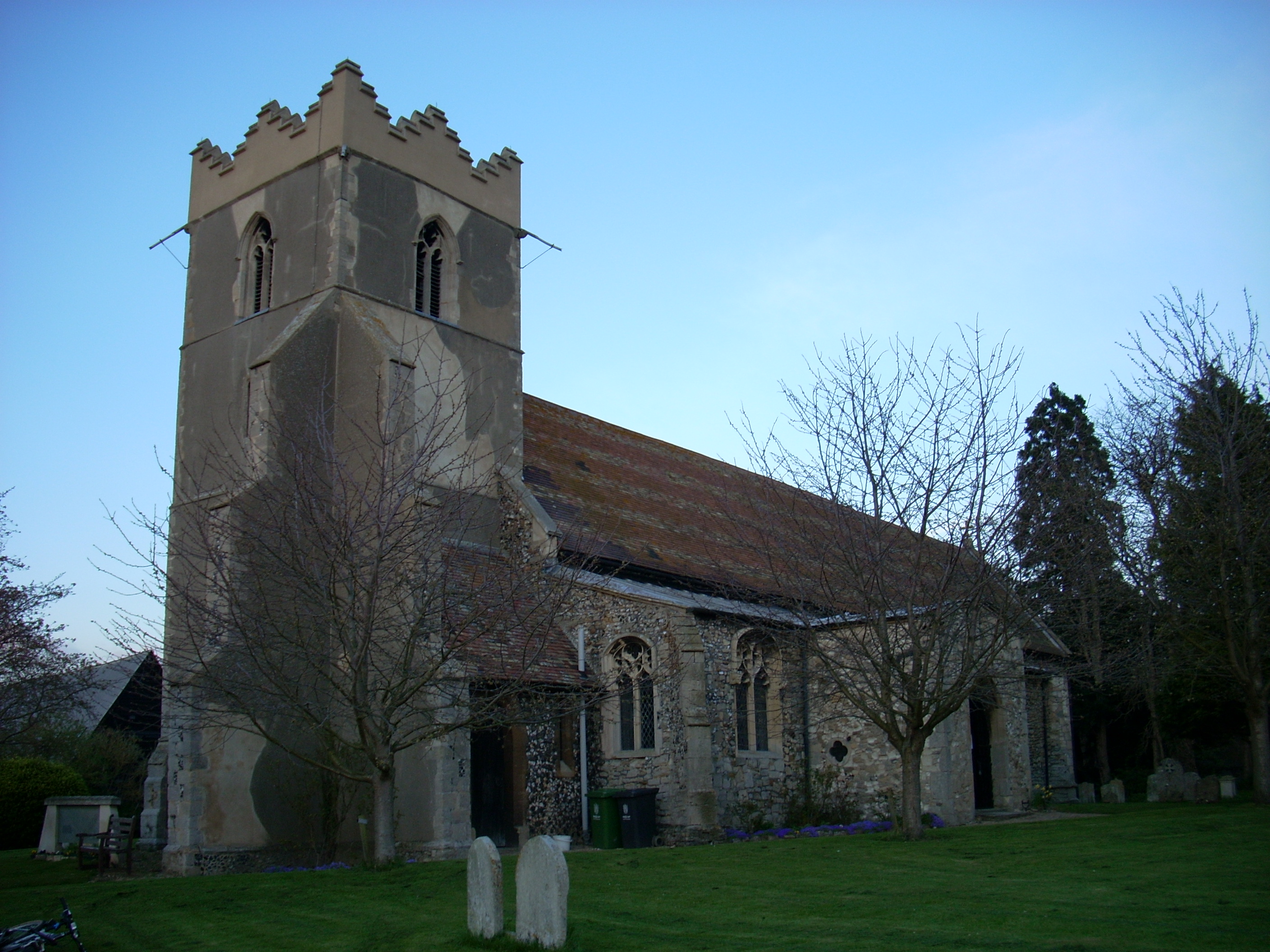
Church of St John the Evangelist, Waterbeach

The Anglican Church of St John the Evangelist (also known as St John's Church) is the parish church of the village of Waterbeach in Cambridgeshire, England...

Waterbeach

Waterbeach is an expanding village 6 miles (9.7 km) north of Cambridge on the edge of The Fens, in the South Cambridgeshire district of Cambridgeshire...

RAF Waterbeach

Royal Air Force Waterbeach or more simply RAF Waterbeach is a former Royal Air Force station located in Waterbeach, Cambridgeshire which is about 5.5 miles...

Waterbeach Barracks

Waterbeach Barracks is a former military installation in Waterbeach, Cambridgeshire. The site was an RAF Station, RAF Waterbeach and then used by the Royal...

Horningsea

Horningsea is a small village north of Cambridge in Cambridgeshire in England. The parish covers an area of 2.6 square miles (6.7 km2; 1,700 acres). It...

Landbeach

Landbeach is a small fen-edge English village about three miles (5 km) north of Cambridge. The parish covers an area of 9 km2 (3.5 sq mi). == History... ==

Nearby Amenities

Located within 500m of 52.260115,0.19652111
Clayhithe
Is In: Cambridgeshire, England, UK
Place: hamlet
Source Name: local knowledge
Lat/Long: 52.257639/0.1993411
Waterbeach
Public Transport: stop_position
Train: yes
Lat/Long: 52.262061/0.1965862
Post Box
Brand: Royal Mail
Brand Wikidata: Q638098
Collection Times: Mo-Fr 09:00; Sa 07:00
Operator: Royal Mail
Operator Wikidata: Q638098
Post Box Type: wall
Ref: CB25 264D
Royal Cypher: VR
Royal Cypher Wikidata: Q33102356
Lat/Long: 52.2566375/0.1986034
Post Box
Brand: Royal Mail
Brand Wikidata: Q638098
Collection Times: Mo-Fr 09:00; Sa 07:00
Operator: Royal Mail
Operator Wikidata: Q638098
Post Box Type: wall
Postal Code: CB25 9
Ref: CB25 512D
Royal Cypher: VR
Royal Cypher Wikidata: Q33102356
Lat/Long: 52.2635634/0.1945975
Pub
The Bridge
Addr City: Waterbeach
Addr Housename: The Bridge
Addr Postcode: CB25 9HZ
Addr Street: Clayhithe Road
Brand: Chef & Brewer
Brand Wikidata: Q5089491
Cuisine: british
Email: 6335unit@spiritpubcompany.com
Operator: Chef & Brewer Pub Co
Phone: +44 1223 860622
Website: https://www.chefandbrewer.com/pubs/cambridgeshire/bridge
Lat/Long: 52.2581197/0.1987522
The Bridge
Tourism: hotel
Lat/Long: 52.2583737/0.1989287
Barrier: kissing_gate
Kissing Gate: triangular_profile
Lat/Long: 52.258453/0.1975371
Barrier: sluice_gate
Source: survey
Lat/Long: 52.262752/0.2005132
Bus Stop
Clayhithe Farm
Naptan AtcoCode: 0500SHORN005
Naptan Bearing: N
Naptan BusStopType: CUS
Naptan CommonName: Clayhithe Farm
Naptan Indicator: near
Naptan Landmark: Clayhithe Farm
Naptan NaptanCode: cmbgadgt
Naptan Street: Clayhithe Road
Naptan Verified: no
Source: naptan_import
Lat/Long: 52.2568733/0.1991622
Bus Stop
Clayhithe Farm
Naptan AtcoCode: 0500SHORN006
Naptan Bearing: SW
Naptan BusStopType: CUS
Naptan CommonName: Clayhithe Farm
Naptan Indicator: opp
Naptan Landmark: Clayhithe Farm
Naptan NaptanCode: cmbgadgw
Naptan Street: Clayhithe Road
Naptan Verified: no
Source: naptan_import
Lat/Long: 52.2568529/0.199293
Bus Stop
Lode Avenue
Naptan AtcoCode: 0500SWATE011
Naptan Bearing: SE
Naptan CommonName: Lode Avenue
Naptan Indicator: near
Naptan Landmark: Lode Avenue
Naptan NaptanCode: cmbgdadg
Naptan Street: Station Road
Naptan Verified: no
Postal Code: CB25 9PX
Source: naptan_import
Lat/Long: 52.263008/0.1959746
Bus Stop
Lode Avenue
Naptan AtcoCode: 0500SWATE012
Naptan Bearing: NW
Naptan CommonName: Lode Avenue
Naptan Indicator: opp
Naptan Landmark: Lode Avenue
Naptan NaptanCode: cmbgdadj
Naptan Street: Station Road
Naptan Verified: no
Postal Code: CB25 9PX
Source: naptan_import
Lat/Long: 52.2631548/0.1955161
Bus Stop
Bridge Hotel
Naptan AtcoCode: 0500SWATE013
Naptan Bearing: S
Naptan BusStopType: CUS
Naptan CommonName: Bridge Hotel
Naptan Indicator: near
Naptan Landmark: Bridge Hotel
Naptan NaptanCode: cmbgdadm
Naptan Street: Clayhithe Road
Naptan Verified: no
Source: naptan_import
Lat/Long: 52.2582798/0.1982527
Bus Stop
Bridge Hotel
Naptan AtcoCode: 0500SWATE015
Naptan Bearing: N
Naptan BusStopType: CUS
Naptan CommonName: Bridge Hotel
Naptan Indicator: opp
Naptan Landmark: Bridge Hotel
Naptan NaptanCode: cmbgdadt
Naptan Street: Clayhithe Road
Naptan Verified: no
Source: naptan_import
Lat/Long: 52.2582355/0.1981374
Bus Stop
Railway Station
Naptan AtcoCode: 0500SWATE020
Naptan Bearing: SE
Naptan BusStopType: CUS
Naptan CommonName: Railway Station
Naptan Indicator: o/s
Naptan Landmark: Waterbeach Rail Station
Naptan NaptanCode: cmbgdagm
Naptan ShortCommonName: Railway Station
Naptan Street: Clayhithe Road
Naptan Verified: no
Source: naptan_import
Lat/Long: 52.2622183/0.1970379
Bus Stop
Railway Station
Naptan AtcoCode: 0500SWATE028
Naptan Bearing: NW
Naptan BusStopType: CUS
Naptan CommonName: Railway Station
Naptan Indicator: opp
Naptan Landmark: Waterbeach Rail Station
Naptan NaptanCode: cmbgdajp
Naptan ShortCommonName: Railway Station
Naptan Street: Clayhithe Road
Naptan Verified: no
Source: naptan_import
Lat/Long: 52.2621385/0.1969754
Railway: level_crossing
Lat/Long: 52.2623152/0.1968358
Turning Circle
Lat/Long: 52.2589158/0.1988357
Power: pole
Source: bing
Lat/Long: 52.2622139/0.1926327
Material: wood
Power: pole
Source: bing
Lat/Long: 52.2602887/0.1925828
Material: wood
Power: pole
Source: bing
Lat/Long: 52.2608546/0.1932899
Power: pole
Source: bing
Lat/Long: 52.258901/0.1908947
Material: wood
Power: pole
Source: bing
Lat/Long: 52.2595659/0.1917007
Power: pole
Source: bing
Lat/Long: 52.2582344/0.1900658
Power: pole
Source: bing
Lat/Long: 52.2628722/0.1923001
Power: pole
Source: bing
Lat/Long: 52.2615532/0.1929519
Waterbeach
Public Transport: stop_position
Train: yes
Lat/Long: 52.262556/0.1970417
Railway: level_crossing
Lat/Long: 52.2623414/0.1968063
Bicycle Parking
Waterbeach Railway Station
Bicycle Parking: stands
Capacity: 24
Covered: yes
Lat/Long: 52.2618613/0.1969942
Waterbeach
Naptan AtcoCode: 9100WATBECH
Network: National Rail
Network Website: https://www.nationalrail.co.uk/stations/wbc/
Network Wikidata: Q26334
Railway: station
Ref Crs: WBC
Wikidata: Q2620884
Wikipedia: en:Waterbeach railway station
Lat/Long: 52.2622818/0.1967655
Leisure: fitness_station
Sport: fitness
Lat/Long: 52.2623226/0.1914992
Barrier: lift_gate
Lat/Long: 52.2615263/0.197725
Building: bunker
Bunker Type: pillbox
Military: bunker
Lat/Long: 52.2611246/0.1959058
Bench
Backrest: yes
Material: wood
Lat/Long: 52.2637124/0.1930365
Bench
Backrest: yes
Material: wood
Seats: 4
Lat/Long: 52.2635948/0.1928848
Bench
Backrest: yes
Material: metal
Seats: 4
Lat/Long: 52.2569256/0.197555
Bench
Backrest: yes
Material: wood
Seats: 4
Lat/Long: 52.2637054/0.1925495
Bench
Backrest: yes
Colour: black
Material: concrete
Seats: 4
Lat/Long: 52.2580093/0.2000505
Bench
Backrest: yes
Material: wood
Lat/Long: 52.2564904/0.1969669
Barrier: height_restrictor
Maxheight: 2.1
Lat/Long: 52.2615237/0.1977198
Board Title: A quiet haven for people and wildlife
Information: map
Tourism: information
Lat/Long: 52.2584716/0.1975195
Bench
Backrest: yes
Material: wood
Lat/Long: 52.2595636/0.197442
Bench
Backrest: yes
Material: wood
Lat/Long: 52.2598971/0.1974911
The data included in this document is from www.openstreetmap.org. The data is made available under ODbL.

Have you been to Cow Hollow Wood?

Leave your review of Cow Hollow Wood below (or comments, questions and feedback).