Biggin Pin Plantation

Wood, Forest in Cambridgeshire South Cambridgeshire

England

Biggin Pin Plantation

Milton: at Fen Road Level Crossing A train heading for Ely and King's Lynn on a December morning. Moments later clouds covered the sun and most of the rest of the day was duller.
Milton: at Fen Road Level Crossing Credit: John Sutton

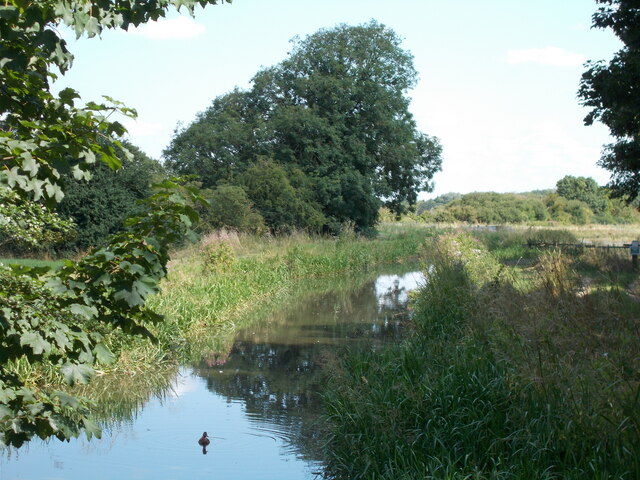
Biggin Pin Plantation is a picturesque woodland located in Cambridgeshire, England. Situated in the heart of the county, this plantation covers a vast area of land and offers a serene retreat for nature enthusiasts and hikers alike.

The plantation is predominantly made up of pine trees, which lend a distinct aroma to the air. These majestic trees create a dense canopy that provides shade and shelter to a variety of wildlife. Within the woodland, visitors can expect to encounter a diverse range of flora, including ferns, bluebells, and mosses, adding a splash of color to the landscape.

The well-maintained trails throughout the plantation enable visitors to explore the woodland at their leisure. These paths wind their way through the forest, offering stunning views of the surrounding countryside. The plantation also boasts several picnic areas, allowing visitors to relax and enjoy the tranquil atmosphere while indulging in a packed lunch.

Birdwatchers will find plenty to admire in Biggin Pin Plantation, with a myriad of avian species calling this woodland home. From woodpeckers to owls, the plantation provides an ideal habitat for these feathered creatures, making it a prime spot for birdwatching enthusiasts.

Biggin Pin Plantation is not only a haven for wildlife but also a popular destination for recreational activities. The plantation offers opportunities for horseback riding, cycling, and even camping, allowing visitors to fully immerse themselves in the natural beauty of the woodland.

Overall, Biggin Pin Plantation is a true gem in the Cambridgeshire countryside, offering a serene escape from the hustle and bustle of everyday life. With its stunning landscapes, diverse wildlife, and recreational activities, it is a must-visit destination for nature lovers of all ages.

If you have any feedback on the listing, please let us know in the comments section below.

Biggin Pin Plantation Images

Images are sourced within 2km of 52.234734/0.19438891 or Grid Reference TL4961. Thanks to Geograph Open Source API. All images are credited.

Milton: at Fen Road Level Crossing A train heading for Ely and King's Lynn on a December morning. Moments later clouds covered the sun and most of the rest of the day was duller.
Milton: at Fen Road Level Crossing
A train heading for Ely and King's Lynn on a December morning. Moments later clouds covered the sun and most of the rest of the day was duller.
Winter sunlight and an inky sky The River Cam just north of Fen Ditton during a bright spell on a December morning.
Winter sunlight and an inky sky
The River Cam just north of Fen Ditton during a bright spell on a December morning.
Quy Hall
Quy Hall
Quy Water near to Quy Hall
Quy Water from the bridge at Station Road
Public footpath signs at the Stone Bridge
Quy Water Looking along Quy water from Stone Bridge outside Stow-cum_Quy village.
Quy Water
Looking along Quy water from Stone Bridge outside Stow-cum_Quy village.
Low Fen Drove Way at Snout Corner In The Fens just north of Cambridge at the end of summer.
Low Fen Drove Way at Snout Corner
In The Fens just north of Cambridge at the end of summer.
On The Drove Way in late November The Drove Way is part of a roundabout network of paths and bridle ways linking Horningsea, Lode and Stow-cum-Quy (ahead), villages near the edge of The Fens north-east of Cambridge. <a href="https://www.geograph.org.uk/photo/6821053">TL5161 : Late April in the Cambridgeshire Fens</a> is a comparable picture taken seven months before.
On The Drove Way in late November
The Drove Way is part of a roundabout network of paths and bridle ways linking Horningsea, Lode and Stow-cum-Quy (ahead), villages near the edge of The Fens north-east of Cambridge. TL5161 : Late April in the Cambridgeshire Fens is a comparable picture taken seven months before.
A junction on The Drove Way The Drove Way is part of a roundabout network of paths and tracks on Quy Fen, linking Horningsea, Lode and Stow-cum-Quy. The track to the left leads to the Quy Fen common. The bridle way ahead takes you to Lode or Quy. <a href="https://www.geograph.org.uk/photo/3170931">TL5162 : Where three tracks meet</a> is a comparable picture taken earlier in autumn in 2012.
A junction on The Drove Way
The Drove Way is part of a roundabout network of paths and tracks on Quy Fen, linking Horningsea, Lode and Stow-cum-Quy. The track to the left leads to the Quy Fen common. The bridle way ahead takes you to Lode or Quy. TL5162 : Where three tracks meet is a comparable picture taken earlier in autumn in 2012.
The Drove Way: sunlight and shadows The Drove Way is part of a roundabout network of paths and tracks on Quy Fen, linking Horningsea, Lode and Stow-cum-Quy. The track ahead takes you to Lode or Quy.
The Drove Way: sunlight and shadows
The Drove Way is part of a roundabout network of paths and tracks on Quy Fen, linking Horningsea, Lode and Stow-cum-Quy. The track ahead takes you to Lode or Quy.
Straw stacks at Allicky Farm The farm is on The Drove Way, part of the roundabout network of paths and tracks linking Horningsea to Lode or Stow-cum-Quy (ahead) in The Fens north-east of Cambridge. The picture was taken on a bright Sunday morning at the end of November.
Straw stacks at Allicky Farm
The farm is on The Drove Way, part of the roundabout network of paths and tracks linking Horningsea to Lode or Stow-cum-Quy (ahead) in The Fens north-east of Cambridge. The picture was taken on a bright Sunday morning at the end of November.
Oak leaves on the way to Horningsea This bridle way is part of a network of paths and tracks linking Lode, Stow-cum-Quy and Horningsea (ahead) in The Fens north-east of Cambridge.
Oak leaves on the way to Horningsea
This bridle way is part of a network of paths and tracks linking Lode, Stow-cum-Quy and Horningsea (ahead) in The Fens north-east of Cambridge.
On Low Fen Drove Way in early spring Autumn-sown cereals looked to be doing well in these fields in The Fens just north-east of Cambridge.
On Low Fen Drove Way in early spring
Autumn-sown cereals looked to be doing well in these fields in The Fens just north-east of Cambridge.
Low Fen Drove Way at Honey Hill Honey Hill is 7 metres above sea level.
Low Fen Drove Way at Honey Hill
Honey Hill is 7 metres above sea level.
A May morning in the Cambridgeshire Fens Hawthorn in blossom and big arable fields south of the track linking Lode and Stow-cum-Quy to Horningsea, in The Fens north-east of Cambridge.
A May morning in the Cambridgeshire Fens
Hawthorn in blossom and big arable fields south of the track linking Lode and Stow-cum-Quy to Horningsea, in The Fens north-east of Cambridge.
Quy Fen: along the long pond A fine morning in early May.

Criss-crossed by paths, Quy Fen is an area of wetland, pasture and woodland maintained as common land for the benefit of neighbouring parishes. It is a site of special scientific interest.
Quy Fen: along the long pond
A fine morning in early May. Criss-crossed by paths, Quy Fen is an area of wetland, pasture and woodland maintained as common land for the benefit of neighbouring parishes. It is a site of special scientific interest.
Quy Fen long pond on a fine May morning Criss-crossed by paths, Quy Fen is an area of wetland, pasture and woodland maintained as common land for the benefit of neighbouring parishes. It is a site of special scientific interest.
Quy Fen long pond on a fine May morning
Criss-crossed by paths, Quy Fen is an area of wetland, pasture and woodland maintained as common land for the benefit of neighbouring parishes. It is a site of special scientific interest.
Show me another place!

Biggin Pin Plantation is located at Grid Ref: TL4961 (Lat: 52.234734, Lng: 0.19438891)

Administrative County: Cambridgeshire

District: South Cambridgeshire

Police Authority: Cambridgeshire

What 3 Words

///treaty.roadmap.skips. Near Waterbeach, Cambridgeshire

Nearby Locations

Biggin Pin Plantation

Related Wikis

Horningsea

Horningsea is a small village north of Cambridge in Cambridgeshire in England. The parish covers an area of 2.6 square miles (6.7 km2; 1,700 acres). It...

Quy railway station

Quy railway station served the parish of Stow cum Quy, Cambridgeshire, England from 1884 to 1964 on the Cambridge to Mildenhall railway. == History... ==

Stow-Cum-Quy Fen

Stow-Cum-Quy Fen is a 29.9-hectare (74-acre) biological Site of Special Scientific Interest west of Lode in Cambridgeshire. Most of it is common land.The...

Quy Hall

Quy Hall is a Grade II* listed English country house at Stow cum Quy, Cambridgeshire. Originally dating from the late 15th century, it was completely remodelled...

Fen Ditton

Fen Ditton is a village on the northeast edge of Cambridge in Cambridgeshire, England. The parish covers an area of 5.99 square kilometres (2 sq mi). Fen...

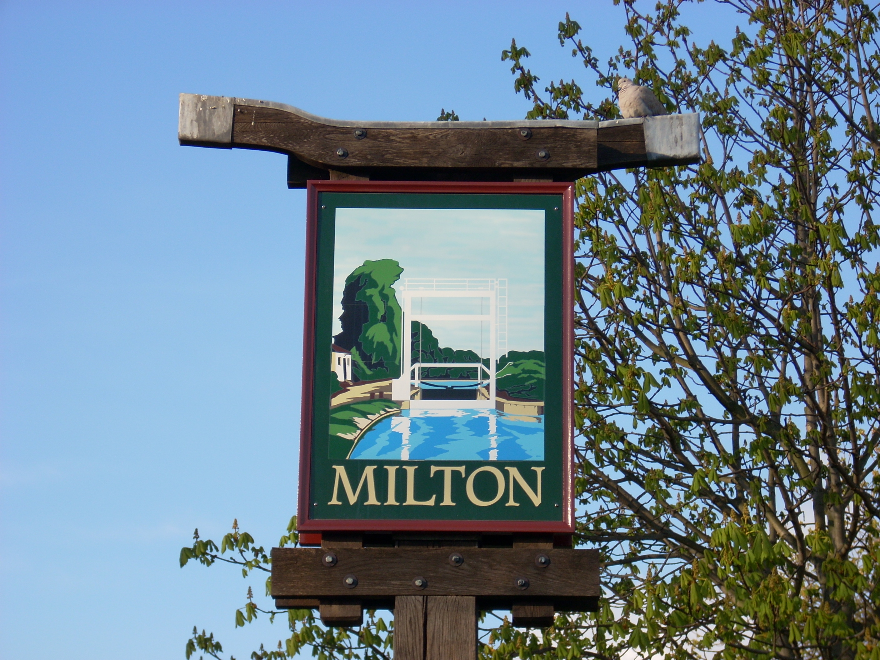
Milton, Cambridgeshire

Milton is a village just north of Cambridge, England, with a population of 4,679 at the 2011 census. == History == Milton grew from a small population...

Leightonstone

Leightonstone was a hundred of Huntingdonshire mentioned in the Domesday Book of 1086. It took its name from the stone at Leighton Bromswold where the...

Stow cum Quy

Stow cum Quy , commonly referred to as Quy, is a village and civil parish in Cambridgeshire, England. Situated around 4 miles (6.4 km) north east of Cambridge...

Nearby Amenities

Located within 500m of 52.234734,0.19438891
Design: barrel
Note: Position estimated from survey from nearby road.
Power: tower
Ref: PTK 36
Source: survey
Source Geometry: survey / estimate
Tower Type: anchor
Lat/Long: 52.2324585/0.1952508
Design: three-level
Power: tower
Ref: PTK 37
Source: survey
Source Geometry: bing
Source Ref: interpolation
Tower Type: anchor
Lat/Long: 52.2307071/0.1932308
Branch Type: split
Design: barrel
Power: tower
Source: survey
Source Geometry: yahoo
Tower Type: branch
Lat/Long: 52.2307359/0.193818
Branch Type: split
Design: barrel
Power: tower
Ref: PTC 34
Source: survey
Source Geometry: yahoo
Tower Type: branch
Lat/Long: 52.2313253/0.1947284
Design: barrel
Line Attachment: suspension
Power: tower
Ref: PTC 33
Source: survey
Source Geometry: yahoo
Lat/Long: 52.2334954/0.1979581
Design: barrel
Line Attachment: suspension
Note: Looking at the spacing of the towers, there should be one here. it's probably hidden from the aerial view by these trees.
Power: tower
Source: survey
Source Geometry: yahoo / extrapolation
Lat/Long: 52.2356221/0.201162
Snouts Corner
Place: locality
Source: npe
Lat/Long: 52.2316339/0.1946229
Design: delta
Power: tower
Source: survey
Source Geometry: yahoo
Tower Type: termination
Lat/Long: 52.2306531/0.194141
Design: barrel
Line Attachment: suspension
Power: tower
Ref: PTK 35
Source: survey
Lat/Long: 52.234625/0.1982808
Design: barrel
Line Attachment: suspension
Power: tower
Ref: PTK 34
Source: survey
Source Ref: interpolation
Lat/Long: 52.2365165/0.200999
The data included in this document is from www.openstreetmap.org. The data is made available under ODbL.

Have you been to Biggin Pin Plantation?

Leave your review of Biggin Pin Plantation below (or comments, questions and feedback).